Category:Brington and Molesworth
civil parish in Huntingdonshire, Cambridgeshire, England .jpg) | |||||
| Upload media | |||||
| Instance of | |||||
|---|---|---|---|---|---|
| Named after | |||||
| Location | Huntingdonshire, Cambridgeshire, East of England, England | ||||
| Population |
| ||||
 | |||||
Subcategories
This category has the following 2 subcategories, out of 2 total.
B
M
Media in category "Brington and Molesworth"
The following 93 files are in this category, out of 93 total.
-
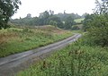
 A minor road, now a cul-de-sac, out of Molesworth - geograph.org.uk - 3019013.jpg 2,592 × 1,944; 1.79 MB
-
 A minor road, now a cul-de-sac, out of Molesworth - geograph.org.uk - 3019238.jpg 2,592 × 1,944; 1.81 MB
-
 A14 - sign for Chainbridge Lane - geograph.org.uk - 3580423.jpg 640 × 480; 45 KB
-
 A14 east of Chainbridge Lane - geograph.org.uk - 3580424.jpg 640 × 480; 40 KB
-
 A14 eastbound near The Acres - geograph.org.uk - 5082634.jpg 640 × 481; 44 KB
-
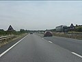
 A14 Westbound near Molesworth - geograph.org.uk - 3876146.jpg 640 × 433; 222 KB
-
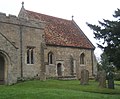
 All Saints church, Brington - geograph.org.uk - 3048017.jpg 1,944 × 2,592; 1.2 MB
-
 All Saints Church, Brington - geograph.org.uk - 962017.jpg 640 × 529; 90 KB
-
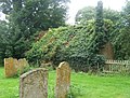
 All Saints, Brington - geograph.org.uk - 3867354.jpg 4,320 × 3,240; 5.56 MB
-
 Approaching Brington from the north - geograph.org.uk - 3018947.jpg 2,592 × 1,944; 1.97 MB
-
 B660 southbound - geograph.org.uk - 5576143.jpg 640 × 480; 54 KB
-
 B660 towards Old Weston - geograph.org.uk - 3365468.jpg 640 × 469; 46 KB
-
 Barley field - geograph.org.uk - 6541285.jpg 1,024 × 768; 176 KB
-
 Bend on Brington Road - geograph.org.uk - 6538465.jpg 1,920 × 1,280; 1.58 MB
-
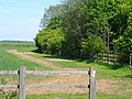
 Bridleway by Glebe Farm - geograph.org.uk - 2675189.jpg 640 × 480; 84 KB
-
 Bridleway crossing, A14 - geograph.org.uk - 3580439.jpg 640 × 480; 44 KB
-
 Bridleway divides near Molesworth Farm - geograph.org.uk - 6539132.jpg 1,024 × 768; 135 KB
-

-
 Bridleway near Old Weston - geograph.org.uk - 3484156.jpg 4,320 × 3,240; 3.41 MB
-
 Bridleway to Brington - geograph.org.uk - 6539176.jpg 1,024 × 768; 161 KB
-
 Bridleway to Molesworth Lodge Farm - geograph.org.uk - 6541054.jpg 1,024 × 768; 194 KB
-
 Bridleway to Molesworth Lodge Farm - geograph.org.uk - 6541061.jpg 1,024 × 768; 143 KB
-
 Bridleway to Molesworth Lodge Farm - geograph.org.uk - 6541062.jpg 1,024 × 768; 181 KB
-
 Brington Road at the junction of Church Lane - geograph.org.uk - 6534379.jpg 1,920 × 1,280; 1,020 KB
-
 Cereal fields near Molesworth Lodge Farm - geograph.org.uk - 6541060.jpg 1,024 × 768; 229 KB
-
 Church Lane Brington - geograph.org.uk - 2675176.jpg 640 × 480; 70 KB
-
 Cockbrook Lane - geograph.org.uk - 3365471.jpg 640 × 478; 50 KB
-
 Cockbrook Lane - geograph.org.uk - 4735302.jpg 640 × 480; 74 KB
-
 Cockbrook Lane heading south - geograph.org.uk - 2998033.jpg 640 × 480; 42 KB
-
 Cockbrook Lane-B662 junction - geograph.org.uk - 3365472.jpg 640 × 477; 48 KB
-
 Cottages in Molesworth - geograph.org.uk - 962005.jpg 640 × 431; 84 KB
-
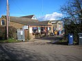
 Cross Keys Inn, Molesworth - geograph.org.uk - 961998.jpg 640 × 340; 44 KB
-
 Cruise missile bunkers (former) - geograph.org.uk - 2743553.jpg 3,648 × 2,736; 2.12 MB
-
 Dead end lane north of Molesworth - geograph.org.uk - 962007.jpg 640 × 455; 87 KB
-

-
 Entering Cambridgeshire - geograph.org.uk - 4735283.jpg 640 × 480; 81 KB
-
 Entrance to RAF Molesworth - geograph.org.uk - 3867378.jpg 4,320 × 3,240; 4.76 MB
-
 Entrance to Scrapyard - geograph.org.uk - 345924.jpg 640 × 480; 70 KB
-
 Farm buildings, Molesworth Lodge Farm - geograph.org.uk - 6540693.jpg 1,024 × 768; 165 KB
-
 Farmland near Brington - geograph.org.uk - 3484193.jpg 2,038 × 1,329; 988 KB
-
 Farmland near Mariner's Gorse - geograph.org.uk - 2997868.jpg 640 × 480; 44 KB
-
 Farmland off Cockbrook Lane - geograph.org.uk - 2998036.jpg 640 × 480; 98 KB
-
 Field by Glebe Farm, Brington - geograph.org.uk - 6538466.jpg 1,920 × 1,280; 1.16 MB
-
 Field edge and Molesworth Lodge Cottages - geograph.org.uk - 6541371.jpg 1,024 × 768; 173 KB
-
 Field edge near Molesworth Lodge Farm - geograph.org.uk - 6541292.jpg 1,024 × 768; 179 KB
-
 Fields south-east of Brington - geograph.org.uk - 3048044.jpg 2,592 × 1,944; 1.37 MB
-
 Footpath approaching Molesworth Lodge Farm - geograph.org.uk - 6540697.jpg 1,024 × 768; 178 KB
-
 Footpath to Clack Barn - geograph.org.uk - 6540695.jpg 1,024 × 768; 162 KB
-
 Footpath to Clopton - geograph.org.uk - 2998028.jpg 640 × 480; 79 KB
-
 Footpath to Molesworth Lodge Farm - geograph.org.uk - 6540893.jpg 1,024 × 768; 206 KB
-
 Glebe Farm, Brington - geograph.org.uk - 6538467.jpg 1,920 × 1,280; 1.06 MB
-
 Horses crossing ahead - geograph.org.uk - 3580434.jpg 640 × 480; 44 KB
-
-

-
 Lay-by on the eastbound A14 - geograph.org.uk - 3580418.jpg 640 × 480; 45 KB
-
 Manor Barn Granaries, Brington - geograph.org.uk - 1152154.jpg 640 × 480; 138 KB
-
 Memorial at RAF Molesworth - geograph.org.uk - 3048038.jpg 2,592 × 1,944; 1.1 MB
-

-
 Molesworth - geograph.org.uk - 3866367.jpg 4,320 × 3,240; 4 MB
-
 Molesworth Lodge Cottages and Chainbridge Lane - geograph.org.uk - 6539179.jpg 1,024 × 768; 146 KB
-
 Molesworth Lodge junction sign, A14 - geograph.org.uk - 1819753.jpg 640 × 480; 68 KB
-
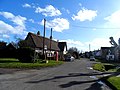
 Molesworth village - geograph.org.uk - 2675156.jpg 640 × 480; 69 KB
-
 No sign of a bridleway - geograph.org.uk - 6541379.jpg 1,024 × 768; 196 KB
-
 No through road in Molesworth - geograph.org.uk - 1498330.jpg 640 × 480; 170 KB
-
 Oilseed rape and Molesworth Lodge Farm - geograph.org.uk - 6541279.jpg 1,024 × 768; 181 KB
-
 Old Milepost - geograph.org.uk - 2880648.jpg 768 × 1,024; 385 KB
-
 Ordnance Survey Cut Mark - geograph.org.uk - 4139024.jpg 4,000 × 3,000; 3.99 MB
-
 Overgrown drain near Molesworth Lodge Farm - geograph.org.uk - 6540696.jpg 1,024 × 768; 181 KB
-
 Pigs in snow, Brington - geograph.org.uk - 1152138.jpg 480 × 640; 133 KB
-
 Pond near Molesworth Lodge Farm - geograph.org.uk - 6541064.jpg 1,024 × 768; 257 KB
-
 Post box, telephone box and houses, Brington - geograph.org.uk - 3866380.jpg 4,286 × 3,196; 3.87 MB
-
 R.A.F. Molesworth, aerial - geograph.org.uk - 3478635.jpg 1,024 × 683; 146 KB
-
 Roadway to Molesworth Lodge Farm - geograph.org.uk - 6541386.jpg 1,024 × 768; 158 KB
-
 Slip road for Molesworth farm - geograph.org.uk - 2079682.jpg 640 × 480; 67 KB
-
 St Leonard's Hall School, Brington - geograph.org.uk - 6534382.jpg 1,920 × 1,280; 1.38 MB
-
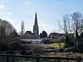
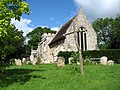 St Peter's church, Molesworth - geograph.org.uk - 3019376.jpg 2,592 × 1,944; 2.16 MB
-
 St Peter's Molesworth - geograph.org.uk - 3866363.jpg 640 × 480; 95 KB
-
 Sunrise over arable fields - geograph.org.uk - 1564461.jpg 640 × 480; 53 KB
-
 Telephone box and postbox, Molesworth - geograph.org.uk - 962006.jpg 640 × 466; 88 KB
-
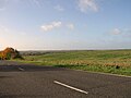
 The B660 from Old Weston, heading for the A14 - geograph.org.uk - 3018937.jpg 2,592 × 1,944; 1.18 MB
-
 The Church of St Peter at Molesworth - geograph.org.uk - 4101434.jpg 4,000 × 3,000; 3.33 MB
-
 The road to Brington - geograph.org.uk - 3048011.jpg 2,592 × 1,944; 1.28 MB
-
 Thrapston Road, Molesworth - geograph.org.uk - 6627110.jpg 1,920 × 1,280; 1.42 MB
-
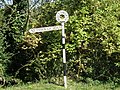
 To Thrapston 6 - geograph.org.uk - 2880666.jpg 1,024 × 768; 294 KB
-

-
 Village hall, Molesworth - geograph.org.uk - 3866354.jpg 4,320 × 3,240; 5.19 MB
-
 Village hall, Molesworth - geograph.org.uk - 962009.jpg 640 × 457; 96 KB
-

-
 Village lane, Molesworth - geograph.org.uk - 962000.jpg 640 × 429; 85 KB
-
 Village scene, Molesworth - geograph.org.uk - 962002.jpg 640 × 472; 76 KB
-
 Village street, Brington - geograph.org.uk - 962020.jpg 640 × 466; 86 KB
-
 Walls requiring support, Molewsorth - geograph.org.uk - 1504900.jpg 640 × 480; 87 KB
-
 Westbound A14 near Molesworth - geograph.org.uk - 3876140.jpg 640 × 480; 207 KB


_-_geograph.org.uk_-_2743553.jpg)


