Category:Brohl-Lützing
municipality of Germany     | |||||
| Upload media | |||||
| Instance of |
| ||||
|---|---|---|---|---|---|
| Location | Bad Breisig, Ahrweiler, Rhineland-Palatinate, Germany | ||||
| Population |
| ||||
| Area |
| ||||
| Elevation above sea level |
| ||||
| official website | |||||
 | |||||
Subcategories
This category has the following 11 subcategories, out of 11 total.
B
- Bahnhof Bad Tönisstein (1 F)
- Brohl Hafen (9 F)
C
J
L
- Landwehr (Brohl-Lützing) (5 F)
- Leo-Stausberg-Schule (3 F)
N
- Niederlützingen (2 F)
T
- Tönissteiner Tunnel (4 F)
- Tönissteiner Viadukt (4 F)
Media in category "Brohl-Lützing"
The following 33 files are in this category, out of 33 total.
-
 Brohl (Brohl-Lützing) 11.JPG 3,888 × 2,592; 7.81 MB
-
 Brohl (Brohl-Lützing)10.JPG 3,047 × 2,437; 6.87 MB
-
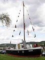
 Brohl Aalschokker2.jpg 2,584 × 1,821; 181 KB
-
 Brohl Aalschokker3.jpg 1,944 × 2,592; 190 KB
-
 Brohl Aalschokker4.jpg 2,592 × 1,944; 408 KB
-
 Brohl Aalschokker6.jpg 1,944 × 2,592; 223 KB
-
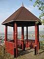 Brohl Aussichtspavillon.jpg 2,304 × 3,072; 844 KB
-
 Brohl Eselstreppe.jpg 2,190 × 2,940; 1.63 MB
-
 Brohl Luetzing Reuterslei.jpg 3,000 × 2,200; 766 KB
-
 Brohl Panorama Eselstreppe.jpg 7,140 × 2,040; 2.22 MB
-
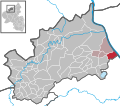 Brohl-Lützing in AW.svg 283 × 249; 362 KB
-
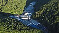
 Brohl-Lützing Luftbild 2012.jpg 2,781 × 4,171; 8.9 MB
-
 Brohl-Lützing, fontein hoek Josef-Leusch-Straße-Mühlenstraße (detail).jpg 2,500 × 1,667; 2.43 MB
-
 Brohl-Lützing, fontein hoek Josef-Leusch-Straße-Mühlenstraße.jpg 1,667 × 2,500; 2.37 MB
-
 Brohl-Lützingen DB 101 056 IC 119 Innsbruck Hbf DB 101 097 - Flickr - Rob Dammers.jpg 5,576 × 3,137; 14.42 MB
-
 Brohler Mineralbrunnen.jpg 1,597 × 1,597; 948 KB
-
 Brohler Mineralbrunnen.svg 201 × 201; 77 KB
-
 Brohltalbahn05 - panoramio.jpg 800 × 600; 208 KB
-
 CZ-20141023110128666.jpg 2,322 × 4,128; 5.6 MB
-
 Dampflok by Niederkasseler - panoramio.jpg 3,888 × 2,592; 3.91 MB
-

-
 ETH-BIB-Trassfabrik, im Brohl-Tal (Eifel)-Dia 247-05294.tif 3,536 × 2,806; 9.54 MB
-
 Hühmännche-Denkmal in Brohl-Lützing.jpeg 3,240 × 4,320; 2.73 MB
-
 Mittelrhein Hammerstein Brohl.jpg 1,280 × 960; 138 KB
-
 Rheinburgen hoehenweg.jpg 1,620 × 2,460; 297 KB
-
 Rheinhöhenweg.jpg 4,320 × 2,432; 3.15 MB
-
 Tönissteiner Privatbrunnen.JPG 4,032 × 2,268; 5.8 MB
-
 Werk 1.jpg 871 × 591; 340 KB
-
 Werk II.jpg 817 × 591; 399 KB
-
 Werk1.jpg 1,022 × 760; 375 KB
-
 Werk2.jpg 1,172 × 880; 489 KB
-
 Werk3.jpg 1,901 × 1,425; 1.02 MB
-
 Zug der Brohtlalbahn in Brohl-Lützing.jpg 4,000 × 3,000; 4.83 MB
_11.JPG)
10.JPG)


.jpg)


..jpg)


