Category:Brora

English: Brora is a village in the east of Sutherland, in the Highland area of Scotland. The village is on the A9 road and has a railway station on the Far North Line.
Gàidhlig: 'S e baile air a' Ghàidhealtachd a tha ann am Brùra (Beurla: Brora). Tha am baile suidhichte anns an t-siorrachd traidiseanta Cataibh air a' mhòr-rathaid A9. 'S e seo na co-chomharran aige: 58° 0′ 36″ Tuath agus 3° 51′ 0″ Iar.
Nederlands: Brora ( Schots-Gaelisch: Brùra) is een dorp in de Schotse council Highland in de Lieutenancy area Sutherland.
village in Sutherland, Highland, Scotland, UK  | |||||
| Upload media | |||||
| Instance of | |||||
|---|---|---|---|---|---|
| Location |
| ||||
| Located in or next to body of water | |||||
| Population |
| ||||
 | |||||
Subcategories
This category has the following 4 subcategories, out of 4 total.
Media in category "Brora"
The following 124 files are in this category, out of 124 total.
-
 "Fisherman's Hall", Brora (detail) - geograph.org.uk - 1092913.jpg 640 × 480; 202 KB
-
 "Fisherman's Hall", Brora - geograph.org.uk - 1092907.jpg 640 × 481; 167 KB
-
 14 Rosslyn Street, Brora.jpg 6,000 × 8,000; 17.82 MB
-

-
 Aultririe, West Clyne - geograph.org.uk - 779719.jpg 640 × 368; 68 KB
-
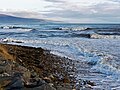
 Back Shore, Brora - geograph.org.uk - 6217654.jpg 1,024 × 633; 154 KB
-
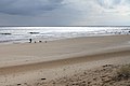
 Beach At Brora - geograph.org.uk - 4412845.jpg 640 × 437; 72 KB
-
 Beach at Brora - geograph.org.uk - 5942053.jpg 1,600 × 943; 383 KB
-
 Beach at Dalchalm - geograph.org.uk - 442399.jpg 640 × 480; 47 KB
-
 Beach south of Brora - geograph.org.uk - 129075.jpg 458 × 311; 26 KB
-
 Boats at Brora Harbour - geograph.org.uk - 5944685.jpg 1,600 × 1,094; 392 KB
-
 Brora - geograph.org.uk - 14726.jpg 640 × 447; 98 KB
-
 Brora beach - geograph.org.uk - 4024236.jpg 640 × 480; 62 KB
-
 Brora Beach - geograph.org.uk - 6178013.jpg 3,776 × 2,520; 3.9 MB
-

-
 Brora Beach looking south - geograph.org.uk - 1857511.jpg 960 × 720; 148 KB
-
 Brora Beach to the North - geograph.org.uk - 5855818.jpg 640 × 392; 27 KB
-
 Brora Beach, east coast of Scotland - geograph.org.uk - 5985470.jpg 2,800 × 1,867; 2.33 MB
-
 Brora Beach, Sutherland - geograph.org.uk - 296680.jpg 640 × 419; 58 KB
-
 Brora Coastal View - geograph.org.uk - 4410919.jpg 640 × 405; 86 KB
-
 Brora Coastline - geograph.org.uk - 4164171.jpg 4,608 × 3,456; 2.97 MB
-
 Brora Free Church of Scotland - geograph.org.uk - 225492.jpg 432 × 285; 20 KB
-
 Brora Golf Course - geograph.org.uk - 1348158.jpg 640 × 480; 35 KB
-
 Brora Harbour - geograph.org.uk - 4412841.jpg 640 × 439; 77 KB
-
 Brora Harbour - geograph.org.uk - 5100646.jpg 3,640 × 2,391; 4.23 MB
-
 Brora harbour - geograph.org.uk - 6174690.jpg 3,776 × 2,520; 3.26 MB
-
 Brora north beach - geograph.org.uk - 238232.jpg 640 × 480; 73 KB
-
 Brora River 7.jpg 649 × 856; 140 KB
-
 Brora Sutherland.jpeg 800 × 600; 58 KB
-
 Brora, duck investigates debris - geograph.org.uk - 596924.jpg 640 × 480; 94 KB
-
 Brora, Fountain Square, Jubilee Fountain.jpg 6,000 × 8,000; 15.96 MB
-
 Brora, Victoria Road, 1 Railway Terrace.jpg 6,000 × 8,000; 13.19 MB
-
 Brora, Victoria Road, 10 Railway Terrace 2.jpg 6,000 × 8,000; 14.71 MB
-
 Brora, Victoria Road, 10 Railway Terrace.jpg 8,000 × 6,000; 13.26 MB
-
 Brora, Victoria Road, 2 Railway Terrace.jpg 6,000 × 8,000; 15.34 MB
-
 Brora, Victoria Road, 3 Railway Terrace.jpg 6,000 × 8,000; 15.43 MB
-
 Brora, Victoria Road, 4 Railway Terrace.jpg 6,000 × 8,000; 16.43 MB
-
 Brora, Victoria Road, 5 Railway Terrace.jpg 6,000 × 8,000; 17.44 MB
-
 Brora, Victoria Road, 6 Railway Terrace.jpg 6,000 × 8,000; 18.41 MB
-
 Brora, Victoria Road, 7 Railway Terrace.jpg 6,000 × 8,000; 14.19 MB
-
 Brora, Victoria Road, 8 Railway Terrace.jpg 6,000 × 8,000; 16.75 MB
-
 Brora, Victoria Road, 9 Railway Terrace.jpg 6,000 × 8,000; 17.45 MB
-
 Brùra 596929.jpg 640 × 480; 78 KB
-
 Buildings by Brora Station - geograph.org.uk - 854768.jpg 640 × 444; 68 KB
-
 By Brora Beach - geograph.org.uk - 4412946.jpg 640 × 444; 84 KB
-
 Campers and Golfers - geograph.org.uk - 1348233.jpg 640 × 480; 68 KB
-
 Clyne Burn crossing Brora Beach - geograph.org.uk - 6178019.jpg 3,776 × 2,520; 3.89 MB
-
 Cows on the Beach, Brora - geograph.org.uk - 4990885.jpg 3,000 × 1,987; 1.37 MB
-
 Dawn Breaks (Well Sort Of^) - geograph.org.uk - 90059.jpg 640 × 480; 80 KB
-
 Dog walking near Brora. - geograph.org.uk - 1800653.jpg 3,888 × 2,592; 3.23 MB
-
 East Clynemilton House - geograph.org.uk - 501624.jpg 425 × 567; 53 KB
-
 Fascally Recreation Area plaque - geograph.org.uk - 484150.jpg 640 × 480; 90 KB
-
 Football pitch, Brora - geograph.org.uk - 1112300.jpg 640 × 480; 119 KB
-
 Foxgloves - geograph.org.uk - 483556.jpg 573 × 640; 117 KB
-
 Gordonbush Lodge - geograph.org.uk - 1771280.jpg 640 × 481; 125 KB
-
 Grazing land off the A9 - geograph.org.uk - 548451.jpg 640 × 480; 77 KB
-
 Harbour Road Brora (geograph 6259555).jpg 512 × 640; 131 KB
-
 High tide at Brora - geograph.org.uk - 4791470.jpg 1,600 × 1,200; 574 KB
-
 High tide at Brora - geograph.org.uk - 4791472.jpg 1,600 × 1,200; 705 KB
-
 High tide at Brora - geograph.org.uk - 4791476.jpg 1,600 × 1,200; 808 KB
-
 Jubilee Fountain, Fountain Square, Brora (geograph 5941906).jpg 1,023 × 1,600; 436 KB
-
 Kintradwell Lodge driveway - geograph.org.uk - 483468.jpg 640 × 480; 124 KB
-
 Level crossing at Kintradwell - geograph.org.uk - 483476.jpg 640 × 534; 74 KB
-
 Level crossing near Doll - geograph.org.uk - 548441.jpg 640 × 480; 81 KB
-
 Lobster pots at Brora - geograph.org.uk - 254311.jpg 640 × 480; 123 KB
-
 Looking towards Brora beach - geograph.org.uk - 944289.jpg 640 × 480; 176 KB
-
 Low tide at Brora - geograph.org.uk - 1327984.jpg 640 × 480; 81 KB
-
 Market Street, Brora. - geograph.org.uk - 1800165.jpg 3,888 × 2,592; 594 KB
-
 Megan Boyd's house.jpg 1,417 × 942; 1.33 MB
-
 Mouth of Brora River - geograph.org.uk - 486876.jpg 640 × 480; 78 KB
-
 Mouth of the Brora River - geograph.org.uk - 484113.jpg 640 × 480; 78 KB
-
 Mouth of the River Brora - geograph.org.uk - 4412844.jpg 640 × 439; 88 KB
-
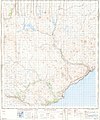 Ordnance Survey One-Inch Sheet 15 Helmsdale, Published 1958.jpg 8,239 × 9,896; 8.22 MB
-
 Ordnance Survey One-Inch Sheet 21 Dornoch, Published 1947.jpg 12,229 × 9,266; 12.5 MB
-
 Ordnance Survey One-Inch Sheet 22 Dornoch, Published 1958.jpg 8,229 × 9,867; 8.55 MB
-
 Outflow pipe on Brora Beach - geograph.org.uk - 5680480.jpg 1,800 × 1,013; 1,021 KB
-
 Patterns on the water - geograph.org.uk - 5942021.jpg 1,600 × 1,067; 561 KB
-
 Pipe running to the sea at Brora - geograph.org.uk - 6174638.jpg 3,776 × 2,520; 3.18 MB
-
 Post box at Doll - geograph.org.uk - 548445.jpg 640 × 480; 73 KB
-
 River Brora - geograph.org.uk - 238230.jpg 640 × 480; 89 KB
-
 River Brora - geograph.org.uk - 4410998.jpg 640 × 462; 95 KB
-
 River Brora - geograph.org.uk - 5942007.jpg 1,600 × 1,033; 451 KB
-
 River Brora - geograph.org.uk - 5942011.jpg 1,600 × 1,067; 443 KB
-
 River Brora - geograph.org.uk - 6264071.jpg 1,024 × 731; 257 KB
-
 River Brora and Brora Harbour - geograph.org.uk - 6251034.jpg 4,608 × 3,456; 2.48 MB
-
 River Brora Mouth - geograph.org.uk - 4412915.jpg 640 × 451; 90 KB
-
 Royal Marine Hotel - geograph.org.uk - 484127.jpg 640 × 449; 61 KB
-
 Seals at Lothbeg beach - geograph.org.uk - 184258.jpg 640 × 451; 124 KB
-
 Seals off the beach south of Lothbeg Point - geograph.org.uk - 6178528.jpg 3,776 × 2,520; 4.19 MB
-
 Shingle on the shore - geograph.org.uk - 5942038.jpg 1,600 × 1,025; 383 KB
-
 Shore at Brora - geograph.org.uk - 4899128.jpg 1,800 × 1,013; 1.46 MB
-
 Shoreline at Brora - geograph.org.uk - 871693.jpg 640 × 480; 72 KB
-
 Stream near Dalchalm - geograph.org.uk - 1800213.jpg 3,888 × 2,592; 695 KB
-
 The 7th hole, Brora golf course - geograph.org.uk - 1335377.jpg 640 × 458; 60 KB
-
 The mouth of the River Brora - geograph.org.uk - 6174677.jpg 3,681 × 2,457; 1.44 MB
-
 The old petrol station - geograph.org.uk - 1341532.jpg 640 × 480; 99 KB
-
 The River Brora - geograph.org.uk - 4413011.jpg 640 × 459; 148 KB
-
 The River Brora meets the sea - geograph.org.uk - 4164131.jpg 4,608 × 3,456; 3.09 MB
-
 View upstream River Brora - geograph.org.uk - 486886.jpg 640 × 480; 111 KB
-
 Waves at the entrance to Brora Harbour - geograph.org.uk - 4791478.jpg 1,600 × 900; 464 KB
-
 West Clyne - geograph.org.uk - 902218.jpg 640 × 480; 105 KB
-
 WK875 Anna-Marie II at Brora Harbour - geograph.org.uk - 5944694.jpg 1,600 × 1,061; 439 KB
-
 Achrimsdale Road - geograph.org.uk - 483598.jpg 640 × 455; 50 KB
-
 Back Beach and Carpark - geograph.org.uk - 484111.jpg 640 × 480; 54 KB
-
 Balnacoil junction - geograph.org.uk - 483544.jpg 640 × 480; 87 KB
-
 Brora Academy - geograph.org.uk - 486894.jpg 640 × 433; 78 KB
-
 Brora beach - geograph.org.uk - 583052.jpg 640 × 425; 136 KB
-
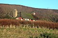
 Brora, Clyne Parish Church - geograph.org.uk - 225489.jpg 432 × 285; 17 KB
-
 Brora, coastline at the river mouth - geograph.org.uk - 596919.jpg 640 × 409; 58 KB
-

-
 Brora, mouth of the River Brora - geograph.org.uk - 596917.jpg 640 × 480; 93 KB
-

-
 Capaldi's - geograph.org.uk - 162558.jpg 640 × 480; 86 KB
-
 Disused building - geograph.org.uk - 483551.jpg 640 × 480; 121 KB
-
 Disused building - geograph.org.uk - 483576.jpg 640 × 482; 73 KB
-
 Gair Cottage - geograph.org.uk - 442413.jpg 640 × 480; 99 KB
-
 Indicator board - geograph.org.uk - 486866.jpg 640 × 480; 130 KB
-

-
 Memorial clock tower - geograph.org.uk - 484123.jpg 455 × 640; 53 KB
-
 Old disc harrow - geograph.org.uk - 484211.jpg 640 × 480; 100 KB
-
 River Brora rocky riverbank - geograph.org.uk - 484134.jpg 640 × 480; 129 KB
-
 Road Bridge over the River Brora - geograph.org.uk - 573569.jpg 640 × 480; 77 KB
-
 Road to Balnacoil - geograph.org.uk - 484131.jpg 640 × 480; 84 KB
-
 Sports' Pavilion, Brora - geograph.org.uk - 484143.jpg 640 × 411; 49 KB
_-_geograph.org.uk_-_1092913.jpg)


_-_geograph.org.uk_-_90059.jpg)


.jpg)


.jpg)


