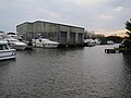
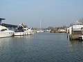
Category:Brundall
English: Brundall is a village and civil parish in the English county of Norfolk. It is located on the north bank of the River Yare adjacent to Surlingham Broad and about 7 miles (11 km) east of the city of Norwich.
Norsk bokmål: Brundall er en landsby og et verdslig sogn i Norfolk i England. Den ligger ved nordbredden av Yare, nær Surlingham Broad, omkring 11 km øst for Norwich.
village and civil parish in Norfolk, United Kingdom  | |||||
| Upload media | |||||
| Instance of | |||||
|---|---|---|---|---|---|
| Location | Broadland, Norfolk, East of England, England | ||||
| Area |
| ||||
 | |||||
Subcategories
This category has the following 7 subcategories, out of 7 total.
B
- Brundall Church Fen (4 F)
- Brundall Gardens railway station (11 F)
- Buildings in Brundell (1 F)
L
M
S
- Brundall railway station (56 F)
Media in category "Brundall"
The following 200 files are in this category, out of 369 total.
(previous page) (next page)-
 A bend in the boardwalk - geograph.org.uk - 5502205.jpg 640 × 476; 415 KB
-
 A bus shelter on The Street - geograph.org.uk - 1531868.jpg 640 × 480; 66 KB
-
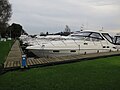
 A cruiser on the River Yare - geograph.org.uk - 5502096.jpg 640 × 618; 558 KB
-
 A fallen tree beside the path - geograph.org.uk - 5502035.jpg 640 × 480; 441 KB
-
 A farmer harrowing his field - geograph.org.uk - 6078819.jpg 800 × 576; 155 KB
-
 A glimpse of the reed bed - geograph.org.uk - 5502040.jpg 640 × 480; 410 KB
-
 A path in Church Fen - geograph.org.uk - 5502046.jpg 640 × 480; 446 KB
-
 A R Peachment, Brundall - geograph.org.uk - 6025432.jpg 1,600 × 1,167; 679 KB
-
 A47 Yarmouth Road, Brundall - geograph.org.uk - 3488427.jpg 3,072 × 2,304; 1.18 MB
-
 Alder carr, Rockland Broad - geograph.org.uk - 812254.jpg 640 × 426; 141 KB
-

-
 Apple of Peru (Nicandra physalodes) - geograph.org.uk - 5502021.jpg 640 × 588; 341 KB
-
 Apple of Peru (Nicandra physalodes) - geograph.org.uk - 5502024.jpg 640 × 599; 418 KB
-
 Apple of Peru (Nicandra physalodes) - geograph.org.uk - 5502025.jpg 640 × 598; 369 KB
-
 Apple of Peru (Nicandra physalodes) - geograph.org.uk - 5502026.jpg 640 × 593; 398 KB
-

-

-
 Approaching the A47 on Yarmouth Road - geograph.org.uk - 5971785.jpg 800 × 600; 138 KB
-
 Approaching the end of Church Lane - geograph.org.uk - 5501985.jpg 640 × 480; 327 KB
-
 Arable field, Brundall - geograph.org.uk - 5229555.jpg 4,160 × 2,340; 4.83 MB
-
 Arriving at Brundall - geograph.org.uk - 2146408.jpg 640 × 424; 85 KB
-
 Back gardens - geograph.org.uk - 1070606.jpg 480 × 640; 152 KB
-
 Berryfields in Winter - geograph.org.uk - 1025785.jpg 640 × 480; 111 KB
-
 Beware of the very swampy carr - geograph.org.uk - 5502060.jpg 640 × 480; 454 KB
-
-
 Boardwalk through Church Fen - geograph.org.uk - 5502210.jpg 640 × 478; 436 KB
-
 Boardwalk through the carr - geograph.org.uk - 5502119.jpg 640 × 609; 521 KB
-
 Boardwalk to the River Yare - geograph.org.uk - 5502118.jpg 640 × 480; 373 KB
-
 Boardwalk traversing Church Fen - geograph.org.uk - 5502117.jpg 640 × 480; 400 KB
-
 Boat cruising on the River Yare - geograph.org.uk - 5502077.jpg 640 × 478; 346 KB
-
 Boat lift - geograph.org.uk - 855174.jpg 640 × 480; 103 KB
-
 Boat moulds, Riverside Estate, Brundall - geograph.org.uk - 6025475.jpg 1,600 × 1,200; 953 KB
-
 Boatlift at Brundall Marina - geograph.org.uk - 1531844.jpg 640 × 480; 78 KB
-
 Boatyard, Brundall Gardens - geograph.org.uk - 812131.jpg 640 × 426; 77 KB
-
 Braydeston Hall (south elevation) - geograph.org.uk - 6079098.jpg 800 × 570; 174 KB
-
 Braydeston Hall - geograph.org.uk - 5070441.jpg 1,600 × 1,200; 902 KB
-
 Braydeston Hall Farm - geograph.org.uk - 5573307.jpg 3,456 × 2,592; 3.89 MB
-

-
 Braydeston St Michael's church - geograph.org.uk - 2212724.jpg 640 × 480; 176 KB
-
 Braydeston St. Michael's church - geograph.org.uk - 5573305.jpg 3,456 × 2,592; 3.84 MB
-
 Brecklands Road - geograph.org.uk - 855110.jpg 640 × 480; 83 KB
-
 Bridge over a drainage ditch - geograph.org.uk - 5502074.jpg 640 × 480; 377 KB
-
 Broom Boats, Brundall - geograph.org.uk - 4769570.jpg 1,600 × 1,200; 842 KB
-
 Broom Boats, Brundall - geograph.org.uk - 4769591.jpg 1,600 × 1,200; 716 KB
-
 Broom Boats, Brundall - geograph.org.uk - 4769755.jpg 1,600 × 1,200; 695 KB
-
 Broom boats, Brundall - geograph.org.uk - 4769763.jpg 1,600 × 1,200; 618 KB
-
 Broom Boats, Brundall - geograph.org.uk - 6020684.jpg 1,600 × 1,200; 286 KB
-
 Broom Marina, Brundall - geograph.org.uk - 4769555.jpg 1,600 × 1,200; 751 KB
-
 Broom marina, Brundall - geograph.org.uk - 4769557.jpg 1,600 × 1,200; 692 KB
-
 Broom marina, Brundall - geograph.org.uk - 4769564.jpg 1,600 × 1,200; 1,013 KB
-
 Broom Marina, Brundall - geograph.org.uk - 4769585.jpg 1,600 × 1,200; 778 KB
-
 Broom Marina, Brundall - geograph.org.uk - 6025385.jpg 1,600 × 1,200; 623 KB
-
 Brundall Allotments - geograph.org.uk - 6347235.jpg 4,096 × 3,072; 6.66 MB
-
 Brundall Bay Marina - geograph.org.uk - 6025394.jpg 1,600 × 1,064; 696 KB
-
 Brundall Country Park - geograph.org.uk - 6347251.jpg 4,096 × 3,072; 5.51 MB
-
 Brundall Cricket Pitch - geograph.org.uk - 1123822.jpg 640 × 480; 99 KB
-
 Brundall cricket pitch no more - geograph.org.uk - 4769697.jpg 1,600 × 1,200; 929 KB
-
 Brundall Gardens railway station, Norfolk - geograph.org.uk - 4193452.jpg 1,024 × 768; 243 KB
-
 Brundall Memorial Hall, Brundall - geograph.org.uk - 6304872.jpg 4,608 × 3,072; 5.06 MB
-
 Brundall Parkrun - geograph.org.uk - 6347249.jpg 2,442 × 1,831; 1.06 MB
-
 Brundall Pet and Hardware Shop - geograph.org.uk - 1531864.jpg 454 × 640; 71 KB
-
 Brundall Railway Station - geograph.org.uk - 3052890.jpg 640 × 424; 284 KB
-
 Brundall Railway Station - geograph.org.uk - 3052899.jpg 640 × 424; 294 KB
-
 Brundall Railway Station - geograph.org.uk - 3052906.jpg 640 × 424; 321 KB
-
 Brundall Railway Station - geograph.org.uk - 3052908.jpg 424 × 640; 280 KB
-

-
 Brundall railway station, Norfolk - geograph.org.uk - 4193430.jpg 1,024 × 768; 214 KB
-
 Brundall railway station, Norfolk - geograph.org.uk - 4193443.jpg 1,024 × 768; 192 KB
-
 Brundall ROC Post - entrance shaft - geograph.org.uk - 6078848.jpg 800 × 582; 233 KB
-
 Brundall ROC Post - geograph.org.uk - 6078827.jpg 800 × 580; 200 KB
-
 Brundall ROC Post - geograph.org.uk - 6078831.jpg 800 × 570; 212 KB
-
 Brundall ROC Post - geograph.org.uk - 6078837.jpg 800 × 600; 208 KB
-
 Brundall ROC Post - geograph.org.uk - 6078844.jpg 800 × 600; 238 KB
-
 Brundall ROC Post - geograph.org.uk - 6078846.jpg 800 × 600; 210 KB
-
 Brundall ROC Post - geograph.org.uk - 6078856.jpg 800 × 600; 148 KB
-
 Brundall ROC Post - geograph.org.uk - 6078858.jpg 800 × 588; 154 KB
-
 Brundall ROC Post - geograph.org.uk - 6078859.jpg 800 × 600; 200 KB
-
 Brundall St Laurence' church - geograph.org.uk - 2212634.jpg 640 × 480; 247 KB
-
 Brundall War Memorial brass plaque - geograph.org.uk - 4774166.jpg 3,456 × 2,592; 3.87 MB
-
 Brundall World War One Memorial window - geograph.org.uk - 4774164.jpg 2,592 × 3,456; 2.89 MB
-
 Brundall World War Two Memorial - geograph.org.uk - 4774156.jpg 2,592 × 3,456; 2.8 MB
-
 Buccaneer Houseboats - geograph.org.uk - 6025469.jpg 1,600 × 1,200; 829 KB
-
 Buddleia - geograph.org.uk - 5455880.jpg 632 × 640; 333 KB
-
 Buddleia - geograph.org.uk - 5455884.jpg 640 × 480; 301 KB
-
 Buddleia - geograph.org.uk - 5455886.jpg 640 × 586; 363 KB
-
 Buddleia - geograph.org.uk - 5455887.jpg 616 × 640; 314 KB
-
 Buddleia - geograph.org.uk - 5455889.jpg 640 × 480; 325 KB
-
 Buddleia - geograph.org.uk - 5455892.jpg 640 × 610; 374 KB
-
 Building on the cricket pitch - geograph.org.uk - 5070447.jpg 1,600 × 1,200; 460 KB
-
 Bungalow on Cucumber Lane - geograph.org.uk - 5971846.jpg 800 × 581; 124 KB
-
 Cattle grazing by Highnoon Farm - geograph.org.uk - 6079092.jpg 800 × 577; 112 KB
-

-

-

-
 Coldham Hall Public House, Brundall - geograph.org.uk - 887399.jpg 640 × 352; 129 KB
-
 Comma butterfly (Polygonia c-album) - geograph.org.uk - 5455948.jpg 640 × 607; 292 KB
-
 Commemorative bench - geograph.org.uk - 5971797.jpg 800 × 588; 205 KB
-
 Common hemp nettle (Galeopsis tetrahit) - geograph.org.uk - 5502166.jpg 640 × 590; 438 KB
-
 Common hemp nettle (Galeopsis tetrahit) - geograph.org.uk - 5502170.jpg 613 × 640; 343 KB
-
 Common hemp nettle (Galeopsis tetrahit) - geograph.org.uk - 5502173.jpg 640 × 622; 358 KB
-
 Common hemp nettle (Galeopsis tetrahit) - geograph.org.uk - 5502175.jpg 599 × 640; 334 KB
-
 Common hemp nettle (Galeopsis tetrahit) - geograph.org.uk - 5502180.jpg 640 × 622; 530 KB
-
 Common hemp nettle (Galeopsis tetrahit) - geograph.org.uk - 5502182.jpg 640 × 588; 351 KB
-
 Common hemp nettle (Galeopsis tetrahit) - geograph.org.uk - 5502186.jpg 640 × 624; 519 KB
-
 Cone flower (Rudbeckia laciniata) - geograph.org.uk - 5502196.jpg 640 × 599; 491 KB
-
 Cone flower (Rudbeckia laciniata) - geograph.org.uk - 5502200.jpg 623 × 640; 321 KB
-
 Cottage by Brundall Gardens station - geograph.org.uk - 1531877.jpg 480 × 640; 98 KB
-

-

-
 Crop fields by Highnoon Farm - geograph.org.uk - 6078854.jpg 800 × 600; 185 KB
-
 Crop fields north of Brundall - geograph.org.uk - 5971777.jpg 800 × 600; 144 KB
-
 Crossing a drain - geograph.org.uk - 1070508.jpg 480 × 640; 97 KB
-
 Crossing Gates at Brundall - geograph.org.uk - 3052922.jpg 640 × 424; 272 KB
-
 Cruising up the River Yare - geograph.org.uk - 5502097.jpg 624 × 640; 518 KB
-
 Cuckoo Lane - geograph.org.uk - 5070437.jpg 1,600 × 1,200; 968 KB
-
 Cuckoo Lane past Highnoon Farm - geograph.org.uk - 6079000.jpg 800 × 572; 126 KB
-
 Cucumber Lane to Brundall - geograph.org.uk - 3488335.jpg 3,072 × 2,304; 1.38 MB
-
 Double gates in Church Lane - geograph.org.uk - 5501993.jpg 640 × 480; 389 KB
-
 East Hills cafe and bistro - geograph.org.uk - 6025420.jpg 1,600 × 1,149; 969 KB
-
 End of Brundall station platform - geograph.org.uk - 4769538.jpg 1,600 × 1,200; 1.2 MB
-
 Entering the A47 Yarmouth Road - geograph.org.uk - 3488345.jpg 2,948 × 2,214; 798 KB
-
 Entrance to Hobro's Dyke, River Yare - geograph.org.uk - 699296.jpg 640 × 480; 52 KB
-

-
 Fairline Targa 52, Norfolk Yacht Agency - geograph.org.uk - 6025409.jpg 1,600 × 939; 516 KB
-
 Farm track into fields - geograph.org.uk - 6078816.jpg 800 × 567; 131 KB
-
 Farm track to Cuckoo Lane - geograph.org.uk - 6078818.jpg 800 × 581; 149 KB
-
 Felled tree beside Run Dike - geograph.org.uk - 1070589.jpg 480 × 640; 142 KB
-
 Field between Yarmouth Road and the A47 - geograph.org.uk - 5971775.jpg 800 × 600; 105 KB
-
 Field by Cuckoo Lane - geograph.org.uk - 5070434.jpg 1,600 × 1,200; 938 KB
-
 Field east of Cuckoo Lane - geograph.org.uk - 6078872.jpg 800 × 567; 168 KB
-
 Fields beside Cuckoo Lane - geograph.org.uk - 6079087.jpg 800 × 573; 138 KB
-
 Fields by Braydeston - geograph.org.uk - 6078810.jpg 800 × 569; 128 KB
-
 Fields by Highnoon Farm - geograph.org.uk - 6078817.jpg 800 × 572; 185 KB
-

-
 Flowering hawthorn - geograph.org.uk - 6079100.jpg 800 × 573; 203 KB
-

-
 Footpath behind Brundall - geograph.org.uk - 855070.jpg 640 × 480; 148 KB
-
 Former cricket pitch, Brundall - geograph.org.uk - 4769705.jpg 1,600 × 1,491; 1.24 MB
-
 Gate into cattle pasture - geograph.org.uk - 1070539.jpg 640 × 400; 69 KB
-
 Gate into the Brundall cemetery - geograph.org.uk - 5971837.jpg 800 × 600; 202 KB
-
 Gate into the soccer practice field - geograph.org.uk - 5971829.jpg 800 × 585; 130 KB
-
 Globe thistle (Echinops ritro) - geograph.org.uk - 5455910.jpg 640 × 628; 335 KB
-
 Gravestones in Brundall cemetery - geograph.org.uk - 5971816.jpg 800 × 592; 163 KB
-

-
 Hebe Gauntletii - geograph.org.uk - 5455913.jpg 640 × 480; 386 KB
-
 Hebe Gauntletii - geograph.org.uk - 5455916.jpg 640 × 480; 306 KB
-
 Highnoon Farm (farmhouse) - geograph.org.uk - 6079002.jpg 800 × 597; 141 KB
-
 Highnoon Farm - geograph.org.uk - 1070542.jpg 640 × 480; 87 KB
-
 Highnoon Farm as seen from Cuckoo Lane - geograph.org.uk - 6079084.jpg 800 × 572; 128 KB
-

-
 Himalayan Balsam flanking the boardwalk - geograph.org.uk - 5502192.jpg 640 × 480; 423 KB
-
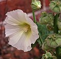
 Hollyhock (Alcea rosea) - geograph.org.uk - 5455929.jpg 600 × 640; 228 KB
-
 Hollyhock (Alcea rosea) - geograph.org.uk - 5455930.jpg 530 × 640; 238 KB
-
 Hollyhock (Alcea rosea) - geograph.org.uk - 5455932.jpg 607 × 640; 208 KB
-
 Hollyhock (Alcea rosea) - geograph.org.uk - 5455935.jpg 640 × 611; 244 KB
-

-
 House on Strumpshaw Road, Brundall - geograph.org.uk - 4956333.jpg 640 × 412; 115 KB
-

-
 Houses in Brundall - geograph.org.uk - 1070594.jpg 640 × 370; 82 KB
-
 Houses under construction, Brundall - geograph.org.uk - 5070451.jpg 1,600 × 1,200; 490 KB
-
 Housing development, Brundall - geograph.org.uk - 4769712.jpg 1,600 × 1,200; 1.1 MB
-
 Hunters estate agents, Brundall - geograph.org.uk - 6025487.jpg 1,600 × 1,128; 655 KB
-
 Hydrangea sp - geograph.org.uk - 5464295.jpg 630 × 640; 193 KB
-
 Ivy-clad tree beside the boardwalk - geograph.org.uk - 5502209.jpg 620 × 640; 131 KB
-
 Ivy-clad trees - geograph.org.uk - 1070615.jpg 480 × 640; 197 KB
-

-
 JPC direct - geograph.org.uk - 6025447.jpg 1,600 × 1,200; 1.03 MB
-
 Knot For Sail for sale - geograph.org.uk - 6025429.jpg 1,600 × 1,200; 691 KB
-
 Lamb's ear (Stachys byzantina) - geograph.org.uk - 5455918.jpg 640 × 620; 447 KB
-
 Lamb's ear (Stachys byzantina) - geograph.org.uk - 5455919.jpg 640 × 608; 359 KB
-
 Lamb's ear (Stachys byzantina) - geograph.org.uk - 5455922.jpg 640 × 625; 389 KB
-
 Lamb's ear (Stachys byzantina) - geograph.org.uk - 5455924.jpg 640 × 608; 381 KB
-
 Level crossing, Brundall - geograph.org.uk - 6020680.jpg 1,600 × 1,200; 287 KB
-
 Level crossing, Norfolk Broads style - geograph.org.uk - 855061.jpg 640 × 480; 123 KB
-
 Line to Norwich - geograph.org.uk - 3052919.jpg 640 × 424; 304 KB
-
 Local garage - geograph.org.uk - 855154.jpg 640 × 480; 99 KB
-
 Lodges for hire, Riverside Estate, Brundall - geograph.org.uk - 6025472.jpg 1,600 × 1,200; 810 KB
-
 Lords and Ladies (Arum maculatum) - geograph.org.uk - 5502216.jpg 640 × 480; 459 KB
-
 Manor Garage, Brundall - geograph.org.uk - 6025497.jpg 1,600 × 1,142; 664 KB
-
 Marina by the Yare - geograph.org.uk - 855172.jpg 640 × 480; 103 KB
-
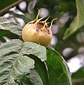
 Medlar (Mespilus germanicus) - geograph.org.uk - 5455984.jpg 633 × 640; 331 KB
-
 Medlar (Mespilus germanicus) - geograph.org.uk - 5455987.jpg 637 × 640; 291 KB
-
 Medlar (Mespilus germanicus) - geograph.org.uk - 5455989.jpg 640 × 614; 351 KB
-
 Mini-roundabout - geograph.org.uk - 855151.jpg 640 × 480; 88 KB
-
 Moorings on site of former Riverside Shop - geograph.org.uk - 2185401.jpg 3,648 × 2,736; 2.45 MB
-
 Morning Mist on the Yare - geograph.org.uk - 452568.jpg 640 × 480; 28 KB
-
 Muddy drainage ditch in Church Fen - geograph.org.uk - 5502084.jpg 640 × 480; 401 KB
-
 Mushrooms in Brundall cemetery - geograph.org.uk - 5971824.jpg 800 × 595; 224 KB
-
 Narrow path past Himalayan balsam - geograph.org.uk - 5502053.jpg 640 × 480; 460 KB
-
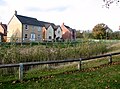
 New housing at The Pastures - geograph.org.uk - 5971810.jpg 800 × 562; 112 KB
-
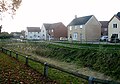
 New housing in Brundall - geograph.org.uk - 5971807.jpg 800 × 585; 90 KB
-
 New housing off Cucumber Lane - geograph.org.uk - 5971840.jpg 800 × 592; 136 KB
-
 New housing on Maurecourt Drive - geograph.org.uk - 5971842.jpg 800 × 573; 90 KB
-
 New war memorial in Brundall - geograph.org.uk - 5971793.jpg 800 × 637; 181 KB
-
 New war memorial in Brundall - geograph.org.uk - 5971794.jpg 800 × 598; 176 KB
-

-
 No kite flying (sign) - geograph.org.uk - 5971838.jpg 800 × 544; 149 KB
-
 Norfolk Yacht Agency - geograph.org.uk - 6025398.jpg 1,600 × 1,200; 682 KB
-
 Norfolk Yacht Agency service centre, Brundall - geograph.org.uk - 6025433.jpg 1,600 × 1,200; 626 KB
-
 Oak trees growing along Cuckoo Lane - geograph.org.uk - 6078807.jpg 800 × 570; 149 KB


_-_geograph.org.uk_-_5502021.jpg)
_-_geograph.org.uk_-_5502024.jpg)
_-_geograph.org.uk_-_5502025.jpg)
_-_geograph.org.uk_-_5502026.jpg)
_-_seed_pods_-_geograph.org.uk_-_5502028.jpg)
_-_seed_pods_-_geograph.org.uk_-_5502029.jpg)


_-_geograph.org.uk_-_6079098.jpg)


_-_geograph.org.uk_-_5455948.jpg)

_-_geograph.org.uk_-_5502166.jpg)
_-_geograph.org.uk_-_5502170.jpg)
_-_geograph.org.uk_-_5502173.jpg)
_-_geograph.org.uk_-_5502175.jpg)
_-_geograph.org.uk_-_5502180.jpg)
_-_geograph.org.uk_-_5502182.jpg)
_-_geograph.org.uk_-_5502186.jpg)
_-_geograph.org.uk_-_5502196.jpg)
_-_geograph.org.uk_-_5502200.jpg)


_-_geograph.org.uk_-_5455910.jpg)

_-_geograph.org.uk_-_5502204.jpg)


_-_geograph.org.uk_-_6079002.jpg)


_-_geograph.org.uk_-_5455929.jpg)
_-_geograph.org.uk_-_5455930.jpg)
_-_geograph.org.uk_-_5455932.jpg)
_-_geograph.org.uk_-_5455935.jpg)
_-_flower_-_geograph.org.uk_-_5455938.jpg)


_-_geograph.org.uk_-_5455918.jpg)
_-_geograph.org.uk_-_5455919.jpg)
_-_geograph.org.uk_-_5455922.jpg)
_-_geograph.org.uk_-_5455924.jpg)


_-_geograph.org.uk_-_5502216.jpg)


_-_geograph.org.uk_-_5455984.jpg)
_-_geograph.org.uk_-_5455987.jpg)
_-_geograph.org.uk_-_5455989.jpg)


_-_geograph.org.uk_-_5971838.jpg)


