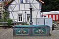
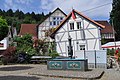
Category:Brunnen Finsternthal
This is the category of the Hessian Kulturdenkmal (cultural monument) with the ID Unknown? (Wikidata)
|
| Object location | | View all coordinates using: OpenStreetMap |
|---|
| Upload media | |||||
| Instance of | |||||
|---|---|---|---|---|---|
| Location | Weilrod, Hochtaunuskreis, Darmstadt Government Region, Hesse, Germany | ||||
 | |||||
Media in category "Brunnen Finsternthal"
The following 4 files are in this category, out of 4 total.
-
 Finsternthal gusseiserner Brunnen.jpg 4,608 × 3,456; 6.1 MB
-
 Finsternthal, Brunnen, frontal.JPG 4,288 × 2,848; 6.41 MB
-
 Finsternthal, Brunnen, Seite.JPG 2,848 × 4,288; 5.63 MB
-
 Finsternthal, Brunnen.JPG 4,288 × 2,848; 6.49 MB


