Category:Buildings in Birstall, West Yorkshire
Subcategories
This category has the following 5 subcategories, out of 5 total.
Media in category "Buildings in Birstall, West Yorkshire"
The following 18 files are in this category, out of 18 total.
-
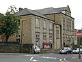
 Batley Birstall CP School - Birstall - geograph.org.uk - 491809.jpg 640 × 397; 39 KB
-
-
 Blackburn Road Medical Centre, Birstall - geograph.org.uk - 5484315.jpg 1,024 × 768; 560 KB
-
 Church Lane, Birstall - geograph.org.uk - 5110847.jpg 1,280 × 853; 605 KB
-
 Golden Chopsticks - Bradford Road - geograph.org.uk - 3069943.jpg 620 × 640; 116 KB
-
 Kirkgate Surgery, Birstall - geograph.org.uk - 491840.jpg 640 × 392; 40 KB
-

-
 National School - Kirkgate, Birstall - geograph.org.uk - 491836.jpg 640 × 491; 46 KB
-

-
 Old St Patrick's Church, Birstall 06-09-2016 15-19-37 (40233247950).jpg 1,280 × 853; 512 KB
-

-

-

-
 St Patrick's, Birstall 07-09-2016 11-42-36 (28167732958).jpg 1,280 × 853; 501 KB
-

-
 The co-operative food - Low La - geograph.org.uk - 1748035.jpg 640 × 480; 58 KB
-
 The Venue, Market Street, Birstall - geograph.org.uk - 5484324.jpg 1,024 × 768; 528 KB
-
 XPO Logistics, Nab Lane Industrial Estate - geograph.org.uk - 5275458.jpg 1,024 × 683; 226 KB


.jpg)


.jpg)


