Category:Buinen
| Object location | | View all coordinates using: OpenStreetMap |
|---|
human settlement in the Netherlands   | |||||
| Upload media | |||||
| Instance of | |||||
|---|---|---|---|---|---|
| Location | Borger-Odoorn, Drenthe, Netherlands | ||||
 | |||||
Subcategories
This category has the following 7 subcategories, out of 7 total.
B
- Cocki Boonstra (7 F)
- Buunerbult (3 F)
H
- Hoofdstraat 40, Buinen (7 F)
K
- Kanaal Buinen-Schoonoord (17 F)
L
- LOFAR in Exloo and Buinen (46 F)
Media in category "Buinen"
The following 9 files are in this category, out of 9 total.
-
 Buinen op de topografische kaart van 1928.jpg 732 × 696; 273 KB
-
 Exterieur overzicht, voorgevel, linker zijgevel - Buinen - 20322972 - RCE.jpg 1,178 × 1,200; 307 KB
-
 Forrest of the horizontal trees (11140105284).jpg 3,367 × 2,245; 2.7 MB
-
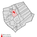 Map - NL - Borger-Odoorn - Wijk 01 Buinen - Buurt 00 Buinen.svg 375 × 375; 48 KB
-

-
 Map - NL - Borger-Odoorn - Wijk 01 Buinen.svg 625 × 575; 18 KB
-
 Map NL - Borger-Odoorn - Buinen.png 800 × 600; 14 KB
-
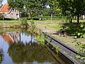 Spoordok te Buinen - panoramio.jpg 2,048 × 1,536; 667 KB
-
 Trafohuisje Hoofdstraat Buinen.jpg 2,466 × 3,060; 955 KB


.jpg)


