Category:Bulford
village and civil parish in Wiltshire, England  | |||||
| Upload media | |||||
| Instance of | |||||
|---|---|---|---|---|---|
| Location | Wiltshire, South West England, England | ||||
| official website | |||||
 | |||||
English: Bulford is a village and civil parish in Wiltshire, England, close to Salisbury Plain. According to the 2001 census the parish had a population of 4,698.
Français : Bulford est un village du district de Salisbury, dans le comté du Wiltshire en Angleterre. Le village est situé sur le plateau calcaire de Salisbury Plain, célèbre pour son monument de pierres dressées, Stonehenge.
Nederlands: Bulford is een dorp (village) en civil parish in de unitary authority Wiltshire, in het Engelse graafschap Wiltshire. De civil parish telt
Subcategories
This category has the following 5 subcategories, out of 5 total.
B
- Bulford Camp (17 F)
- Bulford Kiwi (3 F)
- Bulford railway station (2 F)
S
- St Leonard's church, Bulford (8 F)
Media in category "Bulford"
The following 86 files are in this category, out of 86 total.
-

-
 A3028 - geograph.org.uk - 5176038.jpg 640 × 426; 80 KB
-
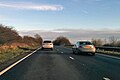
 A303 eastbound - geograph.org.uk - 5629318.jpg 640 × 428; 89 KB
-
 A303 eastbound - geograph.org.uk - 5629327.jpg 640 × 428; 76 KB
-
 A303 eastbound - geograph.org.uk - 5629339.jpg 640 × 428; 89 KB
-
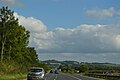
 A303 heading east - geograph.org.uk - 3702292.jpg 1,830 × 1,087; 860 KB
-
 A303 skirting the Managed Access area - geograph.org.uk - 3686977.jpg 1,591 × 972; 974 KB
-
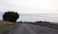
 A303 south of Bulford - geograph.org.uk - 2518948.jpg 800 × 600; 263 KB
-
 A303 south of Scotland Lodge - geograph.org.uk - 3824656.jpg 3,648 × 2,736; 1.4 MB
-
 A303 westbound - geograph.org.uk - 4577566.jpg 640 × 480; 53 KB
-
 A303 westbound - geograph.org.uk - 4577569.jpg 640 × 480; 47 KB
-
 A303, eastbound - geograph.org.uk - 4784698.jpg 640 × 384; 40 KB
-
 A303, eastbound - geograph.org.uk - 4784700.jpg 640 × 426; 49 KB
-
 A303, westbound - geograph.org.uk - 5287282.jpg 640 × 426; 45 KB
-

-
 Amesbury Rd off A303 - geograph.org.uk - 5287266.jpg 640 × 400; 64 KB
-
 Amesbury Rd off A303 - geograph.org.uk - 5377171.jpg 640 × 426; 36 KB
-
 Bulford - Avondale Private School - geograph.org.uk - 1279852.jpg 640 × 480; 67 KB
-
 Bulford - Bridge Over The River Avon - geograph.org.uk - 1279881.jpg 640 × 480; 106 KB
-
 Bulford - Bulford Manor - geograph.org.uk - 1279877.jpg 640 × 480; 117 KB
-
 Bulford - Graveyard - geograph.org.uk - 1279828.jpg 640 × 480; 138 KB
-
 Bulford - Old Coach Road - geograph.org.uk - 1279834.jpg 640 × 480; 95 KB
-
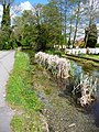 Bulford - Riverside Walk - geograph.org.uk - 1279839.jpg 480 × 640; 151 KB
-
 Bulford - Riverside Walk - geograph.org.uk - 1279846.jpg 640 × 480; 132 KB
-

-
 Bulford - The River Avon - geograph.org.uk - 1279857.jpg 640 × 480; 112 KB
-
 Bulford - The River Avon - geograph.org.uk - 1279865.jpg 640 × 480; 129 KB
-
 Bulford - The River Avon - geograph.org.uk - 1279868.jpg 640 × 480; 110 KB
-
 Bulford - Tidworth Road - geograph.org.uk - 1918980.jpg 640 × 480; 69 KB
-
 Bulford - Tidworth Road - geograph.org.uk - 1918996.jpg 640 × 480; 85 KB
-
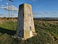 Bulford - Triangulation Pillar - 20221008165540.jpg 4,608 × 3,456; 6.25 MB
-
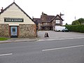 Bulford, Rose ^ Crown - geograph.org.uk - 3691000.jpg 1,024 × 768; 145 KB
-

-
 Byway near Bulford - geograph.org.uk - 952634.jpg 640 × 480; 145 KB
-
 Byway near Bulford - geograph.org.uk - 952685.jpg 640 × 480; 147 KB
-
 Cattle below Beacon Hill - geograph.org.uk - 483939.jpg 640 × 480; 143 KB
-
 Cholderton, byway - geograph.org.uk - 2072591.jpg 1,024 × 768; 199 KB
-
 Cholderton, road bridge - geograph.org.uk - 2072607.jpg 1,024 × 768; 200 KB
-
 Downland near Bulford Camp - geograph.org.uk - 453589.jpg 640 × 478; 154 KB
-
 Earl's Farm Down - geograph.org.uk - 478994.jpg 640 × 480; 167 KB
-
 East of Beacon Hill - geograph.org.uk - 478833.jpg 640 × 480; 197 KB
-
 Farmland east of Durrington - geograph.org.uk - 6256566.jpg 2,592 × 1,944; 1.61 MB
-
 Mast and trig point, Beacon Hill - geograph.org.uk - 478821.jpg 480 × 640; 116 KB
-
 Mast, Beacon Hill - geograph.org.uk - 5287273.jpg 640 × 426; 26 KB
-
 Milston Rd - geograph.org.uk - 5176040.jpg 640 × 411; 42 KB
-
 Milston Rd - geograph.org.uk - 5176047.jpg 640 × 353; 38 KB
-
 Milston Road exits Bulford - geograph.org.uk - 3452266.jpg 3,478 × 2,520; 1.09 MB
-
 Murco Garage at Bulford, Wiltshire.jpg 3,296 × 1,536; 1.3 MB
-
 Nine Mile River, Bulford - geograph.org.uk - 896971.jpg 640 × 480; 132 KB
-
 Office block on Soltice Park - geograph.org.uk - 469060.jpg 640 × 480; 72 KB
-
 Ordnance Survey One-inch Sheet 122 Salisbury and Bulford, Published 1919.jpg 11,739 × 8,883; 43.93 MB
-
 Pasture beneath Beacon Hill - geograph.org.uk - 483927.jpg 640 × 480; 124 KB
-
 Pillar box near Bulford - geograph.org.uk - 1426962.jpg 640 × 480; 155 KB
-
 River Avon near Durrington - geograph.org.uk - 290070.jpg 640 × 409; 104 KB
-
 Rough grazing beside the A303 - geograph.org.uk - 952602.jpg 640 × 480; 90 KB
-
 Rough grazing near Bulford - geograph.org.uk - 952579.jpg 640 × 442; 96 KB
-
 Salisbury Rd - geograph.org.uk - 5176045.jpg 640 × 376; 60 KB
-
 Salisbury Road descends into Bulford - geograph.org.uk - 3452254.jpg 3,511 × 2,631; 1.41 MB
-
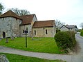
 St Leonard's Church, Bulford Village - geograph.org.uk - 4714792.jpg 640 × 427; 85 KB
-
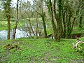
 Stream at Bulford - geograph.org.uk - 4714787.jpg 640 × 427; 139 KB
-
 Stream in Bulford - geograph.org.uk - 1139504.jpg 640 × 480; 102 KB
-
 The Orange Way in Wiltshire (234) - geograph.org.uk - 3442739.jpg 800 × 600; 142 KB
-
 The Orange Way in Wiltshire (235) - geograph.org.uk - 3442742.jpg 600 × 800; 257 KB
-
 The Orange Way in Wiltshire (236) - geograph.org.uk - 3442746.jpg 800 × 600; 133 KB
-
 The Orange Way in Wiltshire (237) - geograph.org.uk - 3442748.jpg 800 × 600; 183 KB
-
 The Orange Way in Wiltshire (238) - geograph.org.uk - 3442751.jpg 800 × 600; 196 KB
-
 The Orange Way in Wiltshire (239) - geograph.org.uk - 3442753.jpg 800 × 600; 119 KB
-
 The Orange Way in Wiltshire (240) - geograph.org.uk - 3442756.jpg 800 × 600; 114 KB
-
 The Orange Way in Wiltshire (241) - geograph.org.uk - 3442763.jpg 800 × 600; 95 KB
-
 The Orange Way in Wiltshire (242) - geograph.org.uk - 3442765.jpg 800 × 600; 164 KB
-
 The Orange Way in Wiltshire (243) - geograph.org.uk - 3442767.jpg 800 × 600; 123 KB
-
 The Orange Way in Wiltshire (244) - geograph.org.uk - 3442770.jpg 800 × 600; 202 KB
-
 The Orange Way in Wiltshire (245) - geograph.org.uk - 3442774.jpg 800 × 600; 242 KB
-
 The Orange Way in Wiltshire (246) - geograph.org.uk - 3442783.jpg 800 × 600; 256 KB
-
 The Orange Way in Wiltshire (247) - geograph.org.uk - 3442787.jpg 800 × 600; 197 KB
-
-
 Track near Bulford Camp - geograph.org.uk - 457220.jpg 640 × 478; 174 KB
-
 Track, Bulford - geograph.org.uk - 457208.jpg 640 × 478; 141 KB
-
 View north of the Bulford Droveway - geograph.org.uk - 485310.jpg 640 × 480; 102 KB
-
 Wiltshire , The A303 - geograph.org.uk - 5739436.jpg 6,000 × 4,000; 6.17 MB
-
 Wiltshire , The A303 - geograph.org.uk - 5739439.jpg 6,000 × 4,000; 6.17 MB
-
 Wiltshire , The A303 - geograph.org.uk - 5739440.jpg 6,000 × 4,000; 6.29 MB
-
 Bulford Field - geograph.org.uk - 453586.jpg 640 × 478; 153 KB
-
 Downland, Bulford - geograph.org.uk - 434733.jpg 640 × 480; 125 KB
-
 Field and wood near the A303 - geograph.org.uk - 485335.jpg 640 × 480; 107 KB
-
 Hampshire Close, Bulford - geograph.org.uk - 485318.jpg 640 × 480; 69 KB


_-_geograph.org.uk_-_3442739.jpg)
_-_geograph.org.uk_-_3442742.jpg)
_-_geograph.org.uk_-_3442746.jpg)
_-_geograph.org.uk_-_3442748.jpg)
_-_geograph.org.uk_-_3442751.jpg)
_-_geograph.org.uk_-_3442753.jpg)
_-_geograph.org.uk_-_3442756.jpg)
_-_geograph.org.uk_-_3442763.jpg)
_-_geograph.org.uk_-_3442765.jpg)
_-_geograph.org.uk_-_3442767.jpg)
_-_geograph.org.uk_-_3442770.jpg)
_-_geograph.org.uk_-_3442774.jpg)
_-_geograph.org.uk_-_3442783.jpg)
_-_geograph.org.uk_-_3442787.jpg)


