Category:Bullerön
| Object location | | View all coordinates using: OpenStreetMap |
|---|
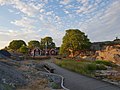
nature reserve in Värmdö Municipality and the Stockholm archipelago, Sweden  Båtklippan på Bullerön | |||||
| Upload media | |||||
| Instance of | |||||
|---|---|---|---|---|---|
| Location | Värmdö Municipality, Stockholm County, Sweden | ||||
| Operator |
| ||||
| IUCN protected areas category | |||||
| Inception |
| ||||
| Area |
| ||||
| official website | |||||
 | |||||
English: Media relating to the island and nature reserve of Bullerön, in Värmdö Municipality and the Stockholm archipelago, Sweden
Subcategories
This category has only the following subcategory.
Media in category "Bullerön"
The following 26 files are in this category, out of 26 total.
-
 Bruno Liljefors - Jaktstuga på Bullerön.jpg 1,937 × 1,262; 1.76 MB
-
 Bulleron hemviken.jpg 4,000 × 2,500; 5.11 MB
-
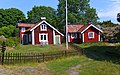
 Bulleron house.jpg 4,000 × 2,500; 4.68 MB
-
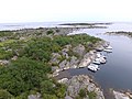 Bullerön Båtklippan.jpg 4,000 × 3,000; 4.93 MB
-
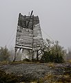
 Bullerön May 2013 01.jpg 4,928 × 3,264; 15.04 MB
-
 Bullerön May 2013 02.jpg 2,267 × 2,645; 4.19 MB
-
 Bullerön May 2013 03.jpg 3,009 × 1,993; 4.33 MB
-
 Bullerön sjöbodar.jpg 4,000 × 2,500; 6.25 MB
-
 Bullerön söderviken.jpg 4,000 × 3,000; 4.55 MB
-
 Bullerön, 2018-07-26, 01.jpg 4,032 × 3,024; 3.09 MB
-
 Bullerön, 2018-07-26, 02.jpg 4,032 × 3,024; 2.55 MB
-
 Bullerön, 2018-07-26, 03.jpg 4,032 × 3,024; 2.55 MB
-
 Bullerön, 2018-07-26, 04.jpg 3,024 × 4,032; 5.06 MB
-
 Bullerön, 2018-07-26, 05.jpg 4,032 × 3,024; 4.18 MB
-
 Bullerön, 2018-07-26, 06.jpg 4,032 × 3,024; 4.12 MB
-
 Bullerön, 2018-07-26, 07.jpg 3,024 × 4,032; 2.52 MB
-
 Bullerön, 2018-07-26, 08.jpg 4,032 × 3,024; 3.05 MB
-
 Bullerön, 2018-07-26, 09.jpg 4,032 × 3,024; 2.36 MB
-
 Bullerön, 2018-07-26, 10.jpg 4,032 × 3,024; 2.31 MB
-
 Bullerön, 2018-07-26, 11.jpg 3,024 × 4,032; 2.83 MB
-
 Bullerön, 2018-07-26, 12.jpg 4,032 × 3,024; 2.52 MB
-
 Bullerön, 2018-07-26, 14.jpg 4,032 × 3,024; 2.61 MB
-
 Bullerön, 2018-07-26, 15.jpg 4,032 × 3,024; 2.36 MB
-
 Bullerön, 2018-07-26, 16.jpg 4,032 × 3,024; 2.31 MB
-
 Bullerön, 2018-07-26, panorama.jpg 22,064 × 3,728; 66.17 MB
-
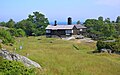
 Förrummetmuseet.jpg 4,005 × 2,611; 6.48 MB


