Category:Bulwell
town in Nottinghamshire, England, UK  | |||||
| Upload media | |||||
| Instance of | |||||
|---|---|---|---|---|---|
| Location | City of Nottingham, Nottinghamshire, East Midlands, England | ||||
| Different from | |||||
 | |||||
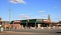
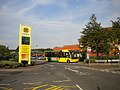
English: Bulwell is an English market town which lies approximately Northwest of Nottingham city centre, on the northern edge of the city. The United Kingdom Census 2001 showed there were almost 30,000 people living in the Bulwell area, accounting for over 10% of the population of the city of Nottingham.
Subcategories
This category has the following 6 subcategories, out of 6 total.
B
- Bulwell Forest NET stop (2 F)
- Bulwell station (15 F)
J
- St John's Church, Bulwell (1 F)
M
- St Mary's Church, Bulwell (1 F)
O
- Old Town Hall, Bulwell (8 F)
Media in category "Bulwell"
The following 200 files are in this category, out of 491 total.
(previous page) (next page)-
 CS p4.208 - Bulwell Hall, Nottinghamshire - Morris's County Seats, 1879.jpg 2,768 × 1,953; 958 KB
-

-
 500 Hucknall Road - geograph.org.uk - 1206846.jpg 631 × 465; 103 KB
-
 A Bus at Bulwell Hall Estate terminus - geograph.org.uk - 2840222.jpg 1,469 × 1,232; 278 KB
-
 A tram nearing Bulwell - geograph.org.uk - 4484678.jpg 1,024 × 731; 1.11 MB
-
 A wet morning in Vernon Road - geograph.org.uk - 4483301.jpg 894 × 1,024; 1.19 MB
-
 Abandoned allotment garden - geograph.org.uk - 1465908.jpg 640 × 479; 137 KB
-
 Academy Day Nursery - geograph.org.uk - 2004893.jpg 1,280 × 854; 224 KB
-
 Access road, Broxtowe country park - geograph.org.uk - 99983.jpg 640 × 432; 90 KB
-
 Alleyway off Coventry Road - geograph.org.uk - 5539334.jpg 960 × 1,280; 460 KB
-
 Allotment Gardens - geograph.org.uk - 56272.jpg 640 × 480; 65 KB
-
 Allotment gate - geograph.org.uk - 1465912.jpg 640 × 479; 96 KB
-
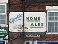 Apollo Table Waters and Home Ales - geograph.org.uk - 2400192.jpg 1,024 × 768; 814 KB
-
 Armstrong Drive - geograph.org.uk - 1556590.jpg 640 × 479; 141 KB
-

-
 Arnold Road, play area on old railway land - geograph.org.uk - 2475332.jpg 1,024 × 768; 689 KB
-
 Arnold Road, where Derby trains once crossed - geograph.org.uk - 2475354.jpg 1,024 × 768; 814 KB
-
 Arnold Road, where the Great Central was - geograph.org.uk - 2477267.jpg 1,024 × 740; 864 KB
-
 Aston Drive - geograph.org.uk - 3903335.jpg 1,280 × 949; 289 KB
-
 Austin Street - geograph.org.uk - 5368722.jpg 1,280 × 853; 297 KB
-
 Bagnall Cottages, Cinderhill - geograph.org.uk - 3288129.jpg 1,024 × 768; 199 KB
-
 Bagnall Road, former railway bridges - geograph.org.uk - 3593631.jpg 1,024 × 792; 948 KB
-
 Baptist Church, Bullwell - geograph.org.uk - 1830427.jpg 640 × 485; 39 KB
-
 Baptist Church, Old Basford - geograph.org.uk - 1830376.jpg 640 × 460; 54 KB
-
 Basford Library - geograph.org.uk - 859010.jpg 640 × 412; 78 KB
-
 Basford United football ground - geograph.org.uk - 3443275.jpg 1,200 × 902; 1.38 MB
-
-
 Basford, Arnold Road off-licence - geograph.org.uk - 2037260.jpg 800 × 550; 104 KB
-
 Basford, cowslips by the Leen - geograph.org.uk - 3443218.jpg 1,200 × 898; 1.58 MB
-
 Basford, former school changing rooms - geograph.org.uk - 4561385.jpg 1,024 × 732; 885 KB
-
 Basford, Greenwich Avenue Playing Fields - geograph.org.uk - 4561372.jpg 1,024 × 732; 835 KB
-
 Basford, Lauriston Drive and Gabrielle Close - geograph.org.uk - 4484337.jpg 1,024 × 554; 647 KB
-
 Basford, The Horse and Jockey, David Lane - geograph.org.uk - 4561361.jpg 1,024 × 731; 826 KB
-
-
 Basford, the site of Northern Bridge - geograph.org.uk - 4484321.jpg 1,024 × 731; 792 KB
-
 Beaver and Tapley Arnold Road - geograph.org.uk - 960495.jpg 640 × 480; 58 KB
-
 Bench mark at Brownlow Drive - geograph.org.uk - 2004848.jpg 854 × 1,280; 303 KB
-

-
 Benchmark on railway bridge, Highbury Road - geograph.org.uk - 5616257.jpg 1,024 × 657; 320 KB
-
 Benchmark on St Mary's Church - geograph.org.uk - 5615699.jpg 640 × 1,024; 173 KB
-
 Benchmark on St Mary's School - geograph.org.uk - 5641398.jpg 683 × 1,024; 305 KB
-

-
-
 Benchmark on ^112 St Albans Road - geograph.org.uk - 5638062.jpg 1,024 × 683; 155 KB
-
 Bestwood NG5, Notts. - geograph.org.uk - 3463941.jpg 3,401 × 2,514; 1.82 MB
-
 Bestwood NG5, Notts. - geograph.org.uk - 3463960.jpg 3,539 × 2,040; 1.6 MB
-
 Bestwood NG5, Notts. - geograph.org.uk - 3463970.jpg 3,906 × 2,433; 1.63 MB
-
 Bestwood NG5, Notts. - geograph.org.uk - 3463998.jpg 3,696 × 2,355; 1.76 MB
-
 Bestwood NG5, Notts. - geograph.org.uk - 3464037.jpg 3,382 × 2,028; 1.5 MB
-
 Bestwood Park Drive West - geograph.org.uk - 2004885.jpg 1,280 × 854; 248 KB
-
 Bestwood Park Drive West - geograph.org.uk - 2004889.jpg 1,280 × 823; 249 KB
-

-
 Bestwood Road Social Club - geograph.org.uk - 949905.jpg 640 × 480; 81 KB
-
 Bestwood Road, Nottingham - geograph.org.uk - 3824568.jpg 3,689 × 2,751; 1.63 MB
-
 Bestwood Road, Nottingham - geograph.org.uk - 3824573.jpg 3,627 × 2,592; 1.62 MB
-
 Bestwood Terrace, Bulwell - geograph.org.uk - 3285148.jpg 1,024 × 768; 192 KB
-
 Blenheim New Site Allotments - geograph.org.uk - 917854.jpg 640 × 480; 81 KB
-
 BMX cycle race track, Bulwell - geograph.org.uk - 1830438.jpg 640 × 480; 70 KB
-
 Bonington Junior Community School - geograph.org.uk - 341232.jpg 640 × 480; 89 KB
-
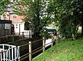
 Bridge Over the Leen, Bulwell - geograph.org.uk - 949885.jpg 640 × 480; 122 KB
-
 Bridge over the River Leen - geograph.org.uk - 3882279.jpg 800 × 533; 181 KB
-
 Bridge Over the River Leen - geograph.org.uk - 621162.jpg 640 × 480; 64 KB
-
 Bring your own nets - geograph.org.uk - 3882267.jpg 800 × 533; 65 KB
-
 Brooklyn Road, Highbury Vale - geograph.org.uk - 3648318.jpg 1,024 × 768; 100 KB
-
 Brownlow Drive - geograph.org.uk - 2004806.jpg 1,280 × 854; 276 KB
-
 Brownlow Drive - geograph.org.uk - 2004816.jpg 1,280 × 854; 220 KB
-
 Brownlow Drive - geograph.org.uk - 2004847.jpg 1,280 × 854; 255 KB
-

-

-
 Bulwell (Northern) Cemetery - geograph.org.uk - 3221983.jpg 856 × 1,280; 268 KB
-
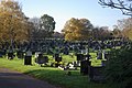 Bulwell (Northern) Cemetery - geograph.org.uk - 3221984.jpg 1,280 × 856; 335 KB
-
 Bulwell (Northern) Cemetery - geograph.org.uk - 3223826.jpg 1,280 × 856; 530 KB
-
 Bulwell - geograph.org.uk - 5539360.jpg 960 × 1,280; 604 KB
-
 Bulwell Academy - geograph.org.uk - 1465469.jpg 640 × 474; 163 KB
-
 Bulwell Baptist Church - geograph.org.uk - 3882278.jpg 800 × 533; 83 KB
-
 Bulwell Baptist Church - geograph.org.uk - 5330307.jpg 640 × 480; 54 KB
-
 Bulwell Bogs Park - geograph.org.uk - 4484698.jpg 1,024 × 732; 1.23 MB
-
 Bulwell Bus Station - geograph.org.uk - 1465739.jpg 640 × 479; 85 KB
-
 Bulwell Bus Station - geograph.org.uk - 3882275.jpg 800 × 533; 88 KB
-
 Bulwell centre - geograph.org.uk - 5366979.jpg 1,280 × 853; 251 KB
-
 Bulwell Church - geograph.org.uk - 3224129.jpg 859 × 1,280; 250 KB
-
 Bulwell Common - geograph.org.uk - 2400101.jpg 1,024 × 705; 580 KB
-
 Bulwell common rail station 1936793 bd850afa.jpg 640 × 374; 128 KB
-
 Bulwell Community Toy Library - geograph.org.uk - 1465867.jpg 640 × 479; 98 KB
-
 Bulwell Dovecote.jpg 2,780 × 3,932; 6.14 MB
-
 Bulwell forest railstation 1936768 0483075c.jpg 640 × 374; 119 KB
-
 Bulwell Forest Vicinity, Nottingham - geograph.org.uk - 3651050.jpg 3,383 × 2,129; 1.46 MB
-
 Bulwell Hall Park Fish Ponds, Bulwell, Notts. - geograph.org.uk - 3857365.jpg 3,407 × 2,275; 1.55 MB
-
 Bulwell Hall Park Fish Ponds, Bulwell, Notts. - geograph.org.uk - 3857378.jpg 3,287 × 2,341; 1.41 MB
-
 Bulwell Hall Park Fish Ponds, Bulwell, Notts. - geograph.org.uk - 3857394.jpg 2,735 × 1,883; 1.32 MB
-
 Bulwell Hall Park, Bulwell NG6, Notts. - geograph.org.uk - 3858024.jpg 4,032 × 3,024; 2.28 MB
-
 Bulwell Hall Park, Bulwell NG6, Notts. - geograph.org.uk - 3858042.jpg 3,612 × 2,523; 1.76 MB
-
 Bulwell Hall Park, Bulwell NG6, Notts. - geograph.org.uk - 3858057.jpg 3,962 × 2,497; 1.79 MB
-
 Bulwell Hall Park, Bulwell NG6, Notts. - geograph.org.uk - 3858070.jpg 2,102 × 1,594; 654 KB
-
 Bulwell Hall Park, Bulwell NG6, Notts. - geograph.org.uk - 3858089.jpg 3,838 × 2,471; 1.94 MB
-
 Bulwell Hall Park, Bulwell NG6, Notts. - geograph.org.uk - 3858190.jpg 3,344 × 2,093; 1.51 MB
-
 Bulwell Hall Park, Bulwell, Notts. - geograph.org.uk - 3857385.jpg 2,959 × 2,848; 1.49 MB
-
 Bulwell Hall Park, Bulwell, Notts. - geograph.org.uk - 3857402.jpg 2,968 × 2,233; 1.24 MB
-

-
 Bulwell Library (1) - geograph.org.uk - 1465501.jpg 640 × 479; 65 KB
-
 Bulwell Library (2) - geograph.org.uk - 1465503.jpg 640 × 479; 111 KB
-
 Bulwell Market - geograph.org.uk - 3443407.jpg 970 × 1,200; 1.27 MB
-
 Bulwell Market Place - geograph.org.uk - 1465735.jpg 640 × 476; 87 KB
-
 Bulwell Market Place - geograph.org.uk - 3443422.jpg 1,200 × 818; 1.14 MB
-
 Bulwell NG5, Notts. - geograph.org.uk - 3463910.jpg 3,176 × 2,544; 1.68 MB
-
 Bulwell NG5, Notts. - geograph.org.uk - 3463920.jpg 2,854 × 1,780; 1.05 MB
-
 Bulwell NG6, Notts. - geograph.org.uk - 3858173.jpg 4,032 × 3,024; 2.68 MB
-
 Bulwell Riverside - geograph.org.uk - 3886338.jpg 4,000 × 2,248; 4.06 MB
-
 Bulwell Riverside - geograph.org.uk - 5330303.jpg 640 × 508; 48 KB
-
 Bulwell Tram Depot - geograph.org.uk - 1465475.jpg 640 × 479; 74 KB
-
 Bulwell's Golden Arches - geograph.org.uk - 3882270.jpg 800 × 458; 65 KB
-
 Bulwell, aerial 2014 - geograph.org.uk - 3925875.jpg 1,024 × 597; 151 KB
-
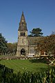
 Bulwell, St Mary and All Souls - geograph.org.uk - 2036442.jpg 800 × 590; 400 KB
-
 Bulwell, under Stone Bridge - geograph.org.uk - 3443397.jpg 1,200 × 874; 1.23 MB
-
 Bus at Morrisons supermarket, Bulwell - geograph.org.uk - 3285055.jpg 1,024 × 768; 170 KB
-

-
 Bus stop on Cinderhill Road - geograph.org.uk - 5330300.jpg 640 × 480; 64 KB
-
 Bus turning at Snape Wood - geograph.org.uk - 3006774.jpg 1,024 × 768; 175 KB
-
 Bus turning circle, Rise Park - geograph.org.uk - 3504596.jpg 1,024 × 768; 168 KB
-
 Calvary Family Church, Vernon Road - geograph.org.uk - 1830394.jpg 640 × 429; 57 KB
-
 Cantrell Road - geograph.org.uk - 5368726.jpg 1,280 × 854; 251 KB
-
 Car Park at Rise Park - geograph.org.uk - 2004850.jpg 1,280 × 854; 188 KB
-
 Carey Road level crossing - geograph.org.uk - 1465791.jpg 640 × 479; 102 KB
-
 Carey Road level crossing, Bulwell - geograph.org.uk - 3285154.jpg 1,024 × 768; 135 KB
-
 Catchems Corner - geograph.org.uk - 1465458.jpg 640 × 479; 104 KB
-
 Children's playground and bridge over River Leen, Bulwell - geograph.org.uk - 3886341.jpg 4,000 × 2,248; 6.38 MB
-

-

-
 Chris Firth Cottages - geograph.org.uk - 1465844.jpg 640 × 479; 79 KB
-
 Church of St. Mary the Virgin and All Souls, Bulwell - geograph.org.uk - 3886345.jpg 4,000 × 2,248; 4.99 MB
-
 Cinderhill Convenience Store - geograph.org.uk - 5330296.jpg 640 × 518; 63 KB
-
 Cinderhill Road - geograph.org.uk - 5328439.jpg 2,848 × 2,136; 1.2 MB
-
 Cinderhill to Highbury Vale - geograph.org.uk - 1869466.jpg 800 × 598; 245 KB
-
 Cinderhill Tram Stop - geograph.org.uk - 5330289.jpg 640 × 480; 108 KB
-
 City bound NET tram - geograph.org.uk - 5539341.jpg 1,280 × 960; 526 KB
-
 Close up, Elizabeth II postbox on Cinderhill Road - geograph.org.uk - 5328436.jpg 1,523 × 2,509; 842 KB
-
 Closed Library - geograph.org.uk - 3036169.jpg 640 × 480; 84 KB
-
 Closed-off steps - geograph.org.uk - 5368759.jpg 853 × 1,280; 284 KB
-
 Colinwood Avenue - geograph.org.uk - 2004801.jpg 1,280 × 854; 266 KB
-
 Commercial Road, Bulwell - geograph.org.uk - 3886335.jpg 4,000 × 2,248; 5.4 MB
-
 Convenience store on Coventry Road - geograph.org.uk - 5328449.jpg 2,528 × 1,936; 1.06 MB
-
 Coventry Road, Bullwell - geograph.org.uk - 1830430.jpg 640 × 480; 69 KB
-
 Coventry Road, Bulwell - geograph.org.uk - 5330309.jpg 640 × 480; 50 KB
-
 Crowthorne Close - geograph.org.uk - 2004797.jpg 1,280 × 854; 245 KB
-
 Cycle path beside Hucknall Road - geograph.org.uk - 1829175.jpg 640 × 480; 119 KB
-
 Cycle Route 6 approaching Mill Street playing fields - geograph.org.uk - 3238405.jpg 3,686 × 2,806; 2.35 MB
-
 Cycle Route 6 joining the River Leen - geograph.org.uk - 3238412.jpg 4,000 × 3,000; 4.68 MB
-
 Cycle Route 6 leading towards Bestwood Park - geograph.org.uk - 3238447.jpg 4,000 × 3,000; 4.86 MB
-
 Dance hall post renovation.jpg 3,072 × 2,304; 3.27 MB
-
 David Lane tram stop - geograph.org.uk - 5326995.jpg 640 × 458; 69 KB
-
 East end of Norwich Gardens, Bulwell - geograph.org.uk - 3285124.jpg 1,024 × 768; 256 KB
-
 East from Park Lane bridge - geograph.org.uk - 2400206.jpg 1,024 × 764; 626 KB
-
 Elizabeth II postbox on Bagnall Road, Cinderhill - geograph.org.uk - 5328402.jpg 1,797 × 2,833; 992 KB
-
 Elizabeth II postbox on Bagnall Road, Cinderhill - geograph.org.uk - 5328405.jpg 2,782 × 1,833; 1.15 MB
-
 Elizabeth II postbox on Cinderhill Road - geograph.org.uk - 5328430.jpg 2,136 × 2,848; 1.2 MB
-

-
 Entrance to Wilkinson, Bulwell - geograph.org.uk - 3226544.jpg 1,280 × 856; 394 KB
-
 Extension to school, Hempshill Lane - geograph.org.uk - 2816580.jpg 640 × 480; 54 KB
-
 Factory off Arnold Road - geograph.org.uk - 1206757.jpg 640 × 479; 96 KB
-
 Filling station at Cinderhill - geograph.org.uk - 1556656.jpg 640 × 436; 135 KB
-
 Fire hydrant, Bulwell Market - geograph.org.uk - 3903327.jpg 941 × 1,280; 226 KB
-
 Fishermen in Vernon Park - geograph.org.uk - 859018.jpg 480 × 640; 127 KB
-
 Fishing on Vernon Park lake - geograph.org.uk - 859013.jpg 640 × 426; 104 KB
-
 Flats at Wyton Close - geograph.org.uk - 1206775.jpg 640 × 479; 94 KB
-
 Flats off Coventry Road - geograph.org.uk - 5330312.jpg 640 × 480; 56 KB
-
 Flats on Belconnen Road - geograph.org.uk - 1206778.jpg 640 × 479; 109 KB
-

-
 Football pitch Southglade Park - geograph.org.uk - 1829162.jpg 640 × 480; 59 KB
-
 Footbridge over railway and tramlines - geograph.org.uk - 5330435.jpg 640 × 480; 126 KB
-
 Footbridge over railway and tramway lines, Bulwell - geograph.org.uk - 3238436.jpg 3,534 × 2,731; 1.88 MB
-
-
 Footbridge over the River Leen - geograph.org.uk - 5330428.jpg 640 × 480; 105 KB
-
 Footbridge over the River Leen - geograph.org.uk - 5330449.jpg 640 × 480; 101 KB
-
 Footbridge over the River Leen - geograph.org.uk - 5330450.jpg 640 × 480; 130 KB
-
 Footbridge over the River Leen, Bulwell - geograph.org.uk - 5330407.jpg 640 × 480; 105 KB
-
 Footpath in Top Valley - geograph.org.uk - 2004921.jpg 1,280 × 854; 380 KB
-
 Footpath off Coventry Road, Bulwell - geograph.org.uk - 3288119.jpg 1,024 × 768; 284 KB
-
 Footpath on the former Leen Valley Railway - geograph.org.uk - 2399931.jpg 1,024 × 768; 1.17 MB
-
 Former bus turning circle, Bulwell Hall - geograph.org.uk - 3285105.jpg 1,024 × 768; 149 KB
-
 Former course of the Leen Valley Railway - geograph.org.uk - 2400124.jpg 800 × 578; 627 KB
-
 Former Midland Bank, Lincoln Street - geograph.org.uk - 860385.jpg 640 × 480; 84 KB
-
 Former Padstow School site - geograph.org.uk - 1205287.jpg 640 × 479; 71 KB
-
 Former parkland - geograph.org.uk - 1556528.jpg 640 × 479; 114 KB
-
 Former Rise Park Shopping Centre - geograph.org.uk - 3203630.jpg 640 × 480; 67 KB
-

-
 Framesmiths Arms - geograph.org.uk - 3882274.jpg 800 × 533; 143 KB
-
 Gainsford Crescent - geograph.org.uk - 1206742.jpg 640 × 479; 62 KB
-
 George VI postbox on Coventry Road - geograph.org.uk - 5328446.jpg 1,580 × 2,604; 987 KB
-

-
 Greenwich Avenue Playing Fields - geograph.org.uk - 1869486.jpg 800 × 600; 158 KB
-
 Hartcroft Road - geograph.org.uk - 1206588.jpg 640 × 479; 97 KB
-
 Hartcroft Road - geograph.org.uk - 1206607.jpg 640 × 479; 72 KB
-
 Haswell Road, Bulwell - geograph.org.uk - 3288122.jpg 1,024 × 768; 171 KB
-
 Haverhill Crescent postbox ref NG5 158 - geograph.org.uk - 2004811.jpg 1,280 × 854; 240 KB
-
 Headstocks public house, Cinderhill - geograph.org.uk - 5330283.jpg 640 × 480; 46 KB
-
 Headstocks public house, Cinderhill - geograph.org.uk - 5330285.jpg 640 × 480; 66 KB
-
 Hempshill Hall Farm - geograph.org.uk - 1556624.jpg 640 × 479; 99 KB
-
 Hempshill Vale bus turn-round - geograph.org.uk - 1556587.jpg 640 × 479; 159 KB
-

-
 Highbury Road - geograph.org.uk - 5368743.jpg 1,280 × 854; 293 KB


_railway_station_and_tram_stop,_Nottingham_-_geograph.org.uk_-_4791111.jpg)
_railway_station_and_tram_stop,_Nottingham_-_geograph.org.uk_-_4791115.jpg)
_Cemetery_-_geograph.org.uk_-_3221983.jpg)
_Cemetery_-_geograph.org.uk_-_3221984.jpg)
_Cemetery_-_geograph.org.uk_-_3223826.jpg)


.jpg)
_-_geograph.org.uk_-_1465501.jpg)
_-_geograph.org.uk_-_1465503.jpg)


