Category:Burg Kirchberg
| Object location | | View all coordinates using: OpenStreetMap |
|---|
This is the category of the Bavarian Baudenkmal (cultural heritage monument) with the ID D-2-74-141-20 (Wikidata)
|
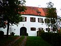
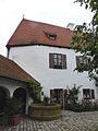
castle in Hohenthann, Germany  | |||||
| Upload media | |||||
| Instance of | |||||
|---|---|---|---|---|---|
| Location | Hohenthann, Landshut, Lower Bavaria, Bavaria, Germany | ||||
| Street address |
| ||||
| Has part(s) |
| ||||
| Heritage designation | |||||
 | |||||
Media in category "Burg Kirchberg"
The following 20 files are in this category, out of 20 total.
-
 Burg Kirchberg (Hohenthann)-1.PNG 636 × 435; 750 KB
-
 Burg Kirchberg (Hohenthann).JPG 2,304 × 1,728; 1.5 MB
-
 Burg Kirchberg Hohenthann.png 797 × 582; 455 KB
-
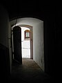 Eingang in die Hauskapelle.JPG 960 × 1,280; 100 KB
-
 Hauskapelle.JPG 2,048 × 1,536; 1.04 MB
-
 Innenhof der Burg Kirchberg.JPG 1,536 × 2,048; 1.57 MB
-
 Kirchberg (Hohenthann).jpg 2,304 × 963; 567 KB
-
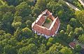 Luftaufnahme Burg 2015.jpg 846 × 544; 378 KB
-
 Marienstatue Kirchberg.JPG 1,536 × 2,048; 1.03 MB
-
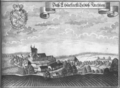
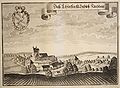 Michael Wening Daß Churfürstl schloß Kirchberg.jpg 814 × 600; 172 KB
-
 Schloss Kirchberg-1.jpg 3,264 × 2,448; 2.13 MB
-
 Schloss Kirchberg-2.jpg 3,264 × 2,448; 1.28 MB
-
 Schloss Kirchberg-3.jpg 3,264 × 2,448; 894 KB
-
 Schloss Kirchberg-4.JPG 1,920 × 2,560; 2.06 MB
-
 Schloss Kirchberg-5.JPG 1,920 × 2,560; 398 KB
-
 Schloss Kirchberg-6.JPG 2,560 × 1,920; 945 KB
-
 Schloss Kirchberg-7.JPG 2,560 × 1,920; 904 KB
-
 Schloss Kirchberg-8.JPG 1,920 × 2,560; 635 KB
-
 Schloss Kirchberg-9.JPG 2,560 × 1,920; 1.19 MB
-
 Vorderansicht Burg Kirchberg.JPG 480 × 640; 157 KB
-1.PNG)
.JPG)


.jpg)


