Category:Burg Kirkel
| Object location | | View all coordinates using: OpenStreetMap |
|---|
castle     | |||||
| Upload media | |||||
| Instance of | |||||
|---|---|---|---|---|---|
| Location | Kirkel, Saarpfalz-Kreis, Saarland, Germany | ||||
| Heritage designation | |||||
| Inception |
| ||||
| Elevation above sea level |
| ||||
 | |||||
Media in category "Burg Kirkel"
The following 37 files are in this category, out of 37 total.
-
 20180708 Burg Kirkel 01.jpg 6,000 × 4,000; 2.31 MB
-
 20180708 Burg Kirkel 02.jpg 6,000 × 4,000; 18.45 MB
-
 20180708 Burg Kirkel 03.jpg 6,000 × 4,000; 5.13 MB
-
 20180708 Burg Kirkel 04.jpg 6,000 × 4,000; 3.14 MB
-
 20180708 Burg Kirkel 05.jpg 6,000 × 4,000; 4.53 MB
-
 20180708 Burg Kirkel 06.jpg 6,000 × 4,000; 3.4 MB
-
 20180708 Burg Kirkel 07.jpg 5,567 × 3,712; 3.54 MB
-
 20210214 Burg Kirkel.jpg 5,870 × 3,924; 3.34 MB
-
 20240323Kirkel1.jpg 3,000 × 2,250; 2.28 MB
-
 Burg Kirkel 1.jpg 1,536 × 1,024; 1.11 MB
-
 Burg Kirkel 2.jpg 1,536 × 1,024; 1.2 MB
-
 Burg Kirkel 3.jpg 1,024 × 1,536; 1.08 MB
-
 Burg Kirkel DSC 0059.jpg 536 × 800; 339 KB
-
 Burg Kirkel Panoramablick.jpg 8,937 × 1,540; 2.87 MB
-
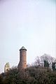
 Burg Kirkel Turmspitze.jpg 1,815 × 2,519; 599 KB
-
 Burg Kirkel von unten.jpg 2,304 × 3,072; 1.47 MB
-
 Burg Kirkel-01.jpg 4,320 × 3,240; 5.85 MB
-
 Burg Kirkel-02-Zugang.jpg 4,320 × 3,240; 6.02 MB
-
 Burg Kirkel-03-Zugang.jpg 3,240 × 4,320; 4.68 MB
-
 Burg Kirkel-04-Bergfried.jpg 3,240 × 4,320; 4.83 MB
-
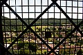
 Burg Kirkel-05-Bergfried innen.jpg 4,320 × 3,240; 5.64 MB
-
 Burg Kirkel-06-Ausblick.jpg 4,320 × 3,240; 5.26 MB
-
 Burg Kirkel.jpg 3,456 × 2,304; 7.52 MB
-
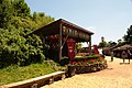
 BurgKirkel Burgschänke.jpg 2,652 × 1,920; 1.02 MB
-
 BurgKirkel Mauer.jpg 2,304 × 3,072; 1 MB
-
 BurgKirkel pano1.jpg 3,920 × 3,289; 1.84 MB
-
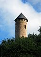
 BurgKirkel Turm1.jpg 2,097 × 3,072; 1.04 MB
-
 BurgKirkel.jpg 2,800 × 3,432; 5.04 MB
-
 Burgruiene Kirkel Saarland 1 0101 2.jpg 536 × 800; 374 KB
-
 Burgruine von Kirkel.jpg 797 × 588; 104 KB
-
 Burgturm Kirkel 3.jpg 568 × 800; 290 KB
-
 Burgturm Kirkel DSC 0059 3 5.jpg 1,501 × 2,114; 2.89 MB
-
 Burgturm Kirkel Saar DSC 0048.jpg 536 × 800; 329 KB
-
 Eschweilerhof 1 (fcm).jpg 4,320 × 3,240; 7.04 MB
-
 Fortification of Kirkel.JPG 2,240 × 1,680; 1.33 MB
-
 Kirkeler Burg im Winter 01.JPG 1,427 × 1,242; 1.55 MB
-
 Kirkeler Burg im Winter 02.JPG 1,290 × 1,550; 1.84 MB


.jpg)

