Category:Bylaugh
English: Bylaugh is a village and civil parish in the Breckland district of Norfolk, England, about 6 miles north-east of East Dereham. According to the 2001 census it had a population of 65.
village in the United Kingdom  | |||||
| Upload media | |||||
| Instance of | |||||
|---|---|---|---|---|---|
| Location | Breckland, Norfolk, East of England, England | ||||
| Area |
| ||||
 | |||||
Subcategories
This category has the following 2 subcategories, out of 2 total.
B
- Bylaugh Hall (15 F)
M
Media in category "Bylaugh"
The following 93 files are in this category, out of 93 total.
-
 A brick-built blast shelter - geograph.org.uk - 4278830.jpg 640 × 480; 288 KB
-
 A wet Slad Lane - geograph.org.uk - 4956052.jpg 1,600 × 1,200; 765 KB
-
 Access road to Bylaugh Hall - geograph.org.uk - 4274571.jpg 640 × 434; 133 KB
-
 Airmen's accommodation hut - geograph.org.uk - 4279392.jpg 640 × 480; 361 KB
-
 Airmen's accommodation huts - geograph.org.uk - 4279398.jpg 640 × 480; 302 KB
-
 Asbestos hut (interior) - geograph.org.uk - 4279395.jpg 640 × 480; 174 KB
-
 Asbestos hut from WW2 - geograph.org.uk - 4278835.jpg 640 × 554; 524 KB
-
 Braithwaite water tank - geograph.org.uk - 4276983.jpg 640 × 480; 87 KB
-
 Brick-built blast shelter - geograph.org.uk - 4278859.jpg 640 × 480; 317 KB
-
 Bylaugh Hall (north doorway - detail) - geograph.org.uk - 4277270.jpg 640 × 568; 461 KB
-
 Bylaugh Hall (north doorway) - geograph.org.uk - 4277266.jpg 480 × 640; 372 KB
-
 Bylaugh Hall (north facade) - geograph.org.uk - 4277260.jpg 640 × 552; 367 KB
-
 Bylaugh Hall (pagoda) - geograph.org.uk - 4277271.jpg 480 × 640; 353 KB
-
 Bylaugh Hall (south facade) - geograph.org.uk - 4277238.jpg 640 × 544; 402 KB
-
 Bylaugh Hall (stone dragon) - geograph.org.uk - 4277275.jpg 480 × 640; 463 KB
-
 Bylaugh Hall (west facade) - geograph.org.uk - 4277244.jpg 640 × 532; 236 KB
-
 Bylaugh Hall - geograph.org.uk - 1947384.jpg 2,048 × 1,536; 844 KB
-
 Bylaugh Hall - geograph.org.uk - 1947385.jpg 1,536 × 2,048; 894 KB
-
 Bylaugh Hall - geograph.org.uk - 4253694.jpg 4,000 × 3,000; 2.33 MB
-
 Bylaugh Hall from the north-west - geograph.org.uk - 4277254.jpg 640 × 503; 270 KB
-
 Bylaugh Hall from the south-east - geograph.org.uk - 4277249.jpg 640 × 513; 330 KB
-
 Bylaugh Hall near Bawdeswell - geograph.org.uk - 4254969.jpg 640 × 390; 181 KB
-
 Clock tower at Bylaugh Hall - geograph.org.uk - 4277287.jpg 480 × 640; 142 KB
-

-
 Crop fields by Old Hall Farm - geograph.org.uk - 4274567.jpg 640 × 480; 199 KB
-
 Dereham Road past Bylaugh Wood - geograph.org.uk - 4274797.jpg 640 × 480; 219 KB
-
 Derelict hut - geograph.org.uk - 4278840.jpg 640 × 511; 263 KB
-
 Detail of the pagoda at Bylaugh Hall - geograph.org.uk - 4277002.jpg 640 × 480; 118 KB
-
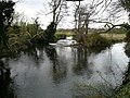
 Downstream from the bridge - geograph.org.uk - 2031095.jpg 640 × 480; 146 KB
-
 Elsing Lane - geograph.org.uk - 5005394.jpg 2,040 × 1,364; 2.04 MB
-
 Emergency water supply - geograph.org.uk - 4279368.jpg 640 × 531; 225 KB
-
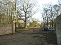 Entrance into Bylaugh Park - geograph.org.uk - 4274800.jpg 640 × 480; 231 KB
-
 Entrance to the duty cook's rest room - geograph.org.uk - 4279303.jpg 640 × 502; 352 KB
-
 Fields by Elsing Lodge Plantation - geograph.org.uk - 4274568.jpg 640 × 480; 205 KB
-
 Fireplace in the Officers' Mess - geograph.org.uk - 4279322.jpg 640 × 480; 259 KB
-
 High-level Braithwaite water tank - geograph.org.uk - 4278848.jpg 536 × 640; 306 KB
-
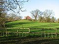 House on the hill - geograph.org.uk - 4274572.jpg 640 × 480; 201 KB
-
 Hut 015 (interior) - geograph.org.uk - 4279411.jpg 640 × 480; 181 KB
-
 Hut 015 - geograph.org.uk - 4279407.jpg 640 × 480; 270 KB
-
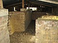 Inside a brick-built blast shelter - geograph.org.uk - 4278861.jpg 640 × 480; 394 KB
-
 Junction by Swanton Lodge - geograph.org.uk - 4274790.jpg 640 × 480; 220 KB
-
 Minor road to Bylaugh - geograph.org.uk - 4274569.jpg 640 × 480; 215 KB
-
 Minor road to Sparham Hole - geograph.org.uk - 4274564.jpg 640 × 480; 220 KB
-
 New house on the hill - geograph.org.uk - 4274573.jpg 640 × 480; 195 KB
-
 Oak Cottages - geograph.org.uk - 4274793.jpg 640 × 480; 156 KB
-
 Officers' latrines (urinal) - geograph.org.uk - 4279381.jpg 480 × 640; 149 KB
-
 Officers' latrines - geograph.org.uk - 4279375.jpg 640 × 480; 218 KB
-
 Officers' latrines - geograph.org.uk - 4279379.jpg 640 × 480; 302 KB
-
 RAF Workshop buildings - geograph.org.uk - 4278844.jpg 640 × 480; 208 KB
-

-
 Sergeants' and officers' ablutions block - geograph.org.uk - 4278833.jpg 640 × 500; 359 KB
-
 Sewage And Souls - geograph.org.uk - 275288.jpg 640 × 480; 100 KB
-
 Slad Lane past Oak Farm - geograph.org.uk - 4274796.jpg 640 × 480; 214 KB
-
 Snack bar in the Social Club - geograph.org.uk - 4279339.jpg 640 × 480; 170 KB
-
 Snack bar in the Social Club - geograph.org.uk - 4279341.jpg 640 × 480; 184 KB
-
 Swanton Lodge - geograph.org.uk - 4274791.jpg 640 × 480; 150 KB
-
 The Airmen's dining room (detail) - geograph.org.uk - 4279290.jpg 640 × 480; 177 KB
-
 The Airmen's dining room (detail) - geograph.org.uk - 4279293.jpg 640 × 527; 380 KB
-
 The Airmen's dining room (detail) - geograph.org.uk - 4279295.jpg 640 × 539; 210 KB
-
 The Airmen's dining room - geograph.org.uk - 4279283.jpg 640 × 480; 247 KB
-
 The Airmen's dining room - geograph.org.uk - 4279287.jpg 640 × 480; 258 KB
-
 The Church of St Mary at Bylaugh - geograph.org.uk - 4253689.jpg 4,000 × 3,000; 2.31 MB
-
 The duty cook's rest room - geograph.org.uk - 4279305.jpg 480 × 640; 206 KB
-

-
 The north facade - geograph.org.uk - 4277006.jpg 640 × 470; 118 KB
-
 The Officers' Mess (interior) - geograph.org.uk - 4279317.jpg 640 × 480; 431 KB
-
 The Officers' Mess (interior) - geograph.org.uk - 4279319.jpg 640 × 480; 349 KB
-
 The Officers' Mess (interior) - geograph.org.uk - 4279324.jpg 640 × 480; 219 KB
-
 The Officers' Mess (interior) - geograph.org.uk - 4279327.jpg 640 × 480; 397 KB
-
 The Officers' Mess (interior) - geograph.org.uk - 4279329.jpg 640 × 480; 402 KB
-
 The Officers' Mess - geograph.org.uk - 4279314.jpg 640 × 480; 453 KB
-

-

-

-

-
 The old electricity substation - geograph.org.uk - 4278871.jpg 640 × 480; 502 KB
-
 The old electricity substation - geograph.org.uk - 4278872.jpg 640 × 480; 523 KB
-
 The old picket post (detail) - geograph.org.uk - 4278847.jpg 640 × 480; 210 KB
-
 The old picket post - geograph.org.uk - 4278845.jpg 640 × 480; 286 KB
-
 The Social Club (fireplace) - geograph.org.uk - 4279352.jpg 640 × 477; 236 KB
-
 The Social Club (fireplace) - geograph.org.uk - 4279354.jpg 640 × 480; 209 KB
-
 The Social Club (fireplace) - geograph.org.uk - 4279356.jpg 640 × 480; 216 KB
-
 The Social Club (fireplace) - geograph.org.uk - 4279357.jpg 640 × 480; 232 KB
-
 The Social Club - geograph.org.uk - 4279346.jpg 640 × 561; 219 KB
-
 The Standby set house - geograph.org.uk - 4278866.jpg 640 × 480; 345 KB
-
 The Standby set house - geograph.org.uk - 4278867.jpg 640 × 480; 483 KB
-
 Toilets in the Social Club - geograph.org.uk - 4279337.jpg 559 × 640; 242 KB
-
 Trailer by Slad Lane - geograph.org.uk - 4956054.jpg 1,600 × 1,200; 960 KB
-
 View south along Dereham Road - geograph.org.uk - 4274801.jpg 640 × 480; 180 KB
-
 View towards Sparhamhole Plantation - geograph.org.uk - 4274565.jpg 640 × 480; 132 KB
-
 War Memorial at Bylaugh - Lest we Forgot^ - geograph.org.uk - 4941769.jpg 2,592 × 3,456; 2.93 MB
-
 Weir - geograph.org.uk - 1244190.jpg 640 × 480; 102 KB
-
 Entrance to Oak Farm, Bylaugh - geograph.org.uk - 523524.jpg 640 × 480; 93 KB


_-_geograph.org.uk_-_4279395.jpg)


_-_geograph.org.uk_-_4277270.jpg)
_-_geograph.org.uk_-_4277266.jpg)
_-_geograph.org.uk_-_4277260.jpg)
_-_geograph.org.uk_-_4277271.jpg)
_-_geograph.org.uk_-_4277238.jpg)
_-_geograph.org.uk_-_4277275.jpg)
_-_geograph.org.uk_-_4277244.jpg)


_-_geograph.org.uk_-_4279411.jpg)


_-_geograph.org.uk_-_4279381.jpg)


_-_geograph.org.uk_-_4279290.jpg)
_-_geograph.org.uk_-_4279293.jpg)
_-_geograph.org.uk_-_4279295.jpg)


_-_geograph.org.uk_-_4279317.jpg)
_-_geograph.org.uk_-_4279319.jpg)
_-_geograph.org.uk_-_4279324.jpg)
_-_geograph.org.uk_-_4279327.jpg)
_-_geograph.org.uk_-_4279329.jpg)

_-_geograph.org.uk_-_4278878.jpg)
_-_geograph.org.uk_-_4278876.jpg)
_-_geograph.org.uk_-_4278873.jpg)
_-_geograph.org.uk_-_4278875.jpg)


_-_geograph.org.uk_-_4278847.jpg)

_-_geograph.org.uk_-_4279352.jpg)
_-_geograph.org.uk_-_4279354.jpg)
_-_geograph.org.uk_-_4279356.jpg)
_-_geograph.org.uk_-_4279357.jpg)


