Category:CCC Kei To Secondary School
| Object location | | View all coordinates using: OpenStreetMap |
|---|
中文:中華基督教會基道中學
secondary school in Hong Kong  | |||||
| Upload media | |||||
| Instance of | |||||
|---|---|---|---|---|---|
| Location | Kowloon City District, Hong Kong, PRC | ||||
| Street address |
| ||||
| official website | |||||
 | |||||
Media in category "CCC Kei To Secondary School"
The following 14 files are in this category, out of 14 total.
-
 2021年3月尾-基道中學東南面.jpg 5,664 × 4,248; 7.09 MB
-
 2021年3月尾-基道中學西北面.jpg 5,664 × 4,248; 4.23 MB
-
 2021年3月尾-基道中學西南面.jpg 5,664 × 4,248; 5.12 MB
-
 2021年3月尾-基道中學西面.jpg 3,264 × 2,448; 2.81 MB
-
 2021年3月尾-顏寶鈴書院及基道中學東面.jpg 5,664 × 4,248; 6.52 MB
-
 2022年10月-基道中學A.jpg 3,864 × 2,174; 1.58 MB
-
 2022年10月-基道中學B.jpg 9,248 × 6,936; 10.36 MB
-
 2022年10月-基道中學C.jpg 9,248 × 6,936; 11.95 MB
-
 KETI TO1.JPG 768 × 576; 62 KB
-
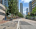 Sung On Street near Po Leung Kuk Ngan Po Ling College.jpg 3,666 × 3,000; 3.94 MB
-
 To Kwa Wan.jpg 1,600 × 1,200; 371 KB
-
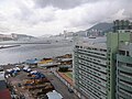
 View from Hoi Sham Pavilion 03.jpg 2,560 × 1,536; 1.44 MB
-
 View from Hoi Sham Pavilion 04.jpg 2,560 × 1,536; 1.36 MB
-
 View from Hoi Sham Pavilion 05.jpg 2,560 × 1,536; 1.29 MB


