Category:Cadastral maps of Western Australia
Media in category "Cadastral maps of Western Australia"
The following 15 files are in this category, out of 15 total.
-
 Avon land district WA.png 400 × 575; 39 KB
-
 Nelson land district WA.png 400 × 575; 38 KB
-
 Perth County 1886.jpg 1,041 × 1,266; 329 KB
-
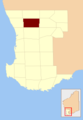
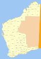
 Perth County location.PNG 200 × 290; 10 KB
-
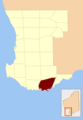 Plantagenet County location.PNG 200 × 290; 10 KB
-
 Sussex land district WA.png 400 × 575; 38 KB
-
 Swan land district WA.png 400 × 575; 39 KB
-
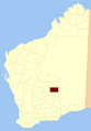
 Victoria plains County location.PNG 200 × 290; 10 KB
-
 Weld land district WA.png 400 × 575; 38 KB
-
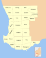
 Wellington land district WA.png 400 × 575; 38 KB
-
 Western Australia cadastral divisions.png 800 × 1,012; 116 KB
-
 Western Australia land districts blank.png 400 × 575; 39 KB
-
 Western Australia land districts.png 1,200 × 1,725; 289 KB
-
 Western Australia land districts.svg 3,123 × 4,490; 286 KB
-
 Western Australia land divisions.png 500 × 719; 48 KB


