Category:Caistor St Edmund and Bixley
English: Caistor St Edmund and Bixley is a civil parish in the South Norfolk district, in the county of Norfolk, England.
civil parish in South Norfolk, Norfolk, England | |||||
| Upload media | |||||
| Instance of | |||||
|---|---|---|---|---|---|
| Location | South Norfolk, Norfolk, East of England, England | ||||
 | |||||
Subcategories
This category has the following 5 subcategories, out of 5 total.
Media in category "Caistor St Edmund and Bixley"
The following 200 files are in this category, out of 1,047 total.
(previous page) (next page)-
 6-bay workshop at Syfer Technology Ltd - geograph.org.uk - 4881138.jpg 640 × 360; 315 KB
-
 A busy food source (1) - geograph.org.uk - 5438510.jpg 640 × 617; 305 KB
-
 A busy food source (2) - geograph.org.uk - 5438512.jpg 640 × 610; 298 KB
-

-
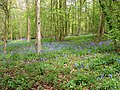
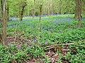
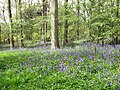
 A carpet of bluebells - geograph.org.uk - 5361890.jpg 640 × 480; 533 KB
-
 A carpet of bluebells - geograph.org.uk - 5361900.jpg 640 × 480; 554 KB
-
 A carpet of bluebells in Arminghall Wood - geograph.org.uk - 5361886.jpg 640 × 480; 545 KB
-
 A carpet of Wood anemones - geograph.org.uk - 5362024.jpg 640 × 480; 551 KB
-
 A chalk road - geograph.org.uk - 4940503.jpg 640 × 480; 369 KB
-
 A crop of field peas (Pisum sativum) - geograph.org.uk - 5438540.jpg 640 × 480; 345 KB
-

-
 A field full of poppies - geograph.org.uk - 5801433.jpg 640 × 586; 113 KB
-

-
 A field^ - geograph.org.uk - 3528118.jpg 1,024 × 766; 126 KB
-
 A large heap of flint stones - geograph.org.uk - 4940575.jpg 640 × 480; 483 KB
-
 A Mule sheep at Venta Icenorum - geograph.org.uk - 5500670.jpg 621 × 640; 596 KB
-
 A natural wall - geograph.org.uk - 4940632.jpg 640 × 480; 468 KB
-
 A new hedgerow in the making - geograph.org.uk - 4376151.jpg 640 × 480; 517 KB
-
 A patch of wild garlic - geograph.org.uk - 5361940.jpg 640 × 480; 512 KB
-
 A pea crop field - geograph.org.uk - 5438541.jpg 640 × 480; 333 KB
-
 A poppy field - geograph.org.uk - 5801430.jpg 640 × 480; 62 KB
-
 A screen machine - geograph.org.uk - 4940536.jpg 640 × 480; 475 KB
-
 A sea of red - geograph.org.uk - 5801441.jpg 640 × 285; 83 KB
-
 A section of old brick wall, Arminghall - geograph.org.uk - 2349262.jpg 640 × 480; 338 KB
-
 A selection of flints - geograph.org.uk - 4940577.jpg 633 × 559; 455 KB
-

-
-
 A view from Chapel Hill - geograph.org.uk - 2298228.jpg 640 × 480; 120 KB
-
 A workshed at Caistor quarry - geograph.org.uk - 4940451.jpg 640 × 516; 342 KB
-
 A140 at the Norwich bypass - geograph.org.uk - 4272827.jpg 640 × 473; 64 KB
-
 A146 Loddon Road, Trowse Newton - geograph.org.uk - 3581887.jpg 3,072 × 2,304; 1.44 MB
-
 A47 bridge over the A140 - geograph.org.uk - 4591019.jpg 640 × 480; 60 KB
-
 A47 Crash - geograph.org.uk - 1956170.jpg 800 × 531; 114 KB
-
 A47 Crash - geograph.org.uk - 1956181.jpg 800 × 531; 95 KB
-
 A47 junction with A140 - geograph.org.uk - 3757518.jpg 640 × 430; 32 KB
-
 A47 Norwich Southern Bypass - geograph.org.uk - 3756141.jpg 3,072 × 2,304; 2 MB
-

-
 A47 slip road - geograph.org.uk - 4203901.jpg 3,072 × 2,304; 1.9 MB
-
 A47, Norwich bypass - geograph.org.uk - 3757511.jpg 640 × 430; 40 KB
-
 A47, Norwich bypass - geograph.org.uk - 3757513.jpg 640 × 430; 39 KB
-
 A47, Norwich bypass - geograph.org.uk - 3757515.jpg 640 × 383; 37 KB
-
 A47, Norwich bypass - geograph.org.uk - 3757520.jpg 640 × 430; 41 KB
-
 A47, South of Norwich - geograph.org.uk - 5413618.jpg 640 × 480; 67 KB
-

-
 Abandoned shed at Harford Farm - geograph.org.uk - 2295736.jpg 640 × 480; 91 KB
-
 Abandoned shed at Harford Farm - geograph.org.uk - 2295770.jpg 514 × 640; 152 KB
-
 Abandoned sheds at Harford Farm - geograph.org.uk - 2295724.jpg 640 × 530; 128 KB
-

-

-
-

-

-

-

-

-
 Access road to the sewage works - geograph.org.uk - 5288533.jpg 640 × 360; 247 KB
-
 Accident on the A47 road - geograph.org.uk - 1956458.jpg 640 × 480; 235 KB
-

-
 Alder growing beside the River Tas - geograph.org.uk - 5282572.jpg 640 × 360; 296 KB
-
 An overgrown heap of bricks, Arminghall - geograph.org.uk - 2349241.jpg 480 × 640; 349 KB
-
 Ancient hawthorn (Crataegus monogyna) - geograph.org.uk - 5500806.jpg 640 × 543; 551 KB
-
 Ancient hawthorn (Crataegus monogyna) - geograph.org.uk - 5500809.jpg 640 × 480; 501 KB
-

-
 Ancient trees on Chapel Hill, Markshall - geograph.org.uk - 2298340.jpg 640 × 480; 225 KB
-

-

-

-

-

-

-
 Approaching Harford Farm - geograph.org.uk - 2295694.jpg 640 × 480; 148 KB
-
 Arable farming at Bixley - geograph.org.uk - 4399281.jpg 1,024 × 768; 400 KB
-
 Archaeologists at Venta Icenorum - geograph.org.uk - 2028542.jpg 640 × 480; 215 KB
-
 Archaeologists at work at Venta Icenorum - geograph.org.uk - 2028555.jpg 640 × 481; 190 KB
-
 Arminghall Lane sign - geograph.org.uk - 3413330.jpg 3,072 × 2,304; 1.39 MB
-
 Arminghall Lane sign - geograph.org.uk - 3756027.jpg 3,049 × 2,290; 1.77 MB
-
 Arminghall Lane ^ Arminghall Postbox - geograph.org.uk - 3756033.jpg 2,948 × 2,214; 1.02 MB
-
 Arminghall Lane, Arminghall - geograph.org.uk - 3413331.jpg 3,072 × 2,304; 1.31 MB
-
 Arminghall Lane, Arminghall - geograph.org.uk - 3756031.jpg 3,072 × 2,304; 1.77 MB
-
 Arminghall Lane, Arminghall - geograph.org.uk - 3756050.jpg 3,072 × 2,304; 1.95 MB
-
 Arminghall Lane, Arminghall - geograph.org.uk - 3756130.jpg 3,072 × 2,304; 736 KB
-
 Arminghall Lane, Arminghall - geograph.org.uk - 3756132.jpg 3,072 × 2,304; 1.97 MB
-
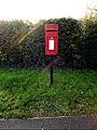
 Arminghall Postbox - geograph.org.uk - 3756038.jpg 2,304 × 3,072; 1.37 MB
-
 Arminghall Postbox - geograph.org.uk - 3756039.jpg 2,279 × 3,042; 1.6 MB
-
 Arminghall Postbox ^ Bus Shelter - geograph.org.uk - 3756037.jpg 2,241 × 2,992; 984 KB
-
 Arminghall pumping station - geograph.org.uk - 4876678.jpg 640 × 364; 331 KB
-
 Arminghall pumping station - geograph.org.uk - 4876680.jpg 640 × 360; 339 KB
-
 Arminghall pumping station - geograph.org.uk - 4876681.jpg 640 × 360; 307 KB
-
 Arminghall pumping station - geograph.org.uk - 4876683.jpg 640 × 360; 312 KB
-
 Arminghall St Mary's church - geograph.org.uk - 2212614.jpg 640 × 480; 176 KB
-
 Arminghall Village Hall - geograph.org.uk - 3756065.jpg 2,304 × 3,072; 573 KB
-
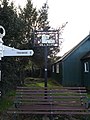
 Arminghall Village sign - geograph.org.uk - 3756075.jpg 3,072 × 2,304; 1.8 MB
-
 Arminghall Village sign ^ seat - geograph.org.uk - 3756073.jpg 2,304 × 3,072; 1.92 MB
-
 Arminghall Wood in spring - geograph.org.uk - 1840706.jpg 640 × 480; 196 KB
-
 B1332 Bungay Road ^ footpath - geograph.org.uk - 4854140.jpg 3,072 × 2,304; 1.99 MB
-
 B1332 Bungay Road ^ footpath sign - geograph.org.uk - 4854151.jpg 3,072 × 2,304; 1.88 MB
-
 B1332 Bungay Road, Arminghall - geograph.org.uk - 3413325.jpg 3,072 × 2,304; 1.45 MB
-
 B1332 Bungay Road, Arminghall - geograph.org.uk - 3413328.jpg 3,072 × 2,304; 1.19 MB
-
 B1332 Bungay Road, Arminghall - geograph.org.uk - 3870048.jpg 3,072 × 2,304; 1.74 MB
-
 B1332 Bungay Road, Arminghall - geograph.org.uk - 3870064.jpg 3,072 × 2,304; 1.93 MB
-
 B1332 Bungay Road, Arminghall - geograph.org.uk - 4854155.jpg 2,692 × 2,132; 2.15 MB
-
 B1332 Bungay Road, Bixley - geograph.org.uk - 3680341.jpg 3,072 × 2,304; 1.44 MB
-
 B1332 Bungay Road, Bixley - geograph.org.uk - 3680979.jpg 3,072 × 2,086; 1.27 MB
-
 B1332 Bungay Road, Bixley - geograph.org.uk - 3680989.jpg 2,965 × 2,228; 1.65 MB
-
 B1332 Bungay Road, Bixley - geograph.org.uk - 3681009.jpg 2,888 × 2,170; 1.51 MB
-
 B1332 Bungay Road, Bixley - geograph.org.uk - 3681223.jpg 3,072 × 2,304; 1.86 MB
-
 B1332 Bungay Road,Trowse Newton - geograph.org.uk - 3581886.jpg 3,072 × 2,304; 1.44 MB
-
 Barn at Oaks Farm - geograph.org.uk - 3581954.jpg 3,072 × 2,304; 1.4 MB
-
 Barn conversion at Caistor Old Hall - geograph.org.uk - 5804446.jpg 640 × 478; 104 KB
-
 Barn, Oaks Farm - geograph.org.uk - 3751786.jpg 640 × 430; 49 KB
-
 Basal leaf rosette of Common mullein - geograph.org.uk - 5489116.jpg 640 × 549; 469 KB
-
 Base of transmitter mast - geograph.org.uk - 4831947.jpg 640 × 480; 307 KB
-
 BBC mobile studio at Highash Farm - geograph.org.uk - 5956310.jpg 3,456 × 2,592; 3.93 MB
-

-
 Bends on Trumpery Lane - geograph.org.uk - 5891524.jpg 800 × 450; 111 KB
-
 Beneath tower 4 - geograph.org.uk - 4833538.jpg 640 × 526; 254 KB
-
 Beware of the bull - geograph.org.uk - 5361974.jpg 640 × 480; 432 KB
-
 Bird scarer in field - geograph.org.uk - 4375827.jpg 640 × 569; 434 KB
-
 Bixley church tower through the trees - geograph.org.uk - 4399293.jpg 1,024 × 768; 749 KB
-
 Bixley Park Farms sign - geograph.org.uk - 3681002.jpg 2,143 × 2,861; 2.13 MB
-

-
 Black medick (Medicago lupulina) - geograph.org.uk - 5489135.jpg 640 × 606; 509 KB
-
 Black Medick (Medicago lupulina) - geograph.org.uk - 5489136.jpg 640 × 598; 574 KB
-
 Black medick (Medicago lupulina) - seeds - geograph.org.uk - 5489139.jpg 640 × 588; 431 KB
-
 Black nightshade (Solanum nigrum) - geograph.org.uk - 5486754.jpg 640 × 617; 296 KB
-
 Blue and white bluebells - geograph.org.uk - 5361891.jpg 619 × 640; 478 KB
-
 Bluebells (Hyacinthoides non-scripta) - geograph.org.uk - 5361822.jpg 583 × 640; 457 KB
-
 Bluebells (Hyacinthoides non-scripta) - geograph.org.uk - 5361893.jpg 640 × 480; 572 KB
-
 Bluebells (Hyacinthoides non-scripta) - geograph.org.uk - 5361909.jpg 601 × 640; 499 KB
-
 Bluebells and Dog's mercury - geograph.org.uk - 5361839.jpg 640 × 530; 588 KB
-

-
 Bluebells beside Hallback Lane - geograph.org.uk - 4466998.jpg 640 × 601; 679 KB
-
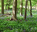
 Bluebells in Arminghall Wood - geograph.org.uk - 1840710.jpg 640 × 480; 212 KB
-
 Bluebells in Arminghall Wood - geograph.org.uk - 1840713.jpg 640 × 480; 207 KB
-
 Bluebells in Arminghall Wood - geograph.org.uk - 1840719.jpg 640 × 480; 215 KB
-
 Bluebells in Arminghall Wood - geograph.org.uk - 1840721.jpg 480 × 640; 221 KB
-
 Bluebells in Arminghall Wood - geograph.org.uk - 4467004.jpg 640 × 597; 663 KB
-
 Bluebells in Arminghall Wood - geograph.org.uk - 4467005.jpg 640 × 562; 679 KB
-
 Bluebells in Arminghall Wood - geograph.org.uk - 4467007.jpg 640 × 591; 728 KB
-
 Bluebells in Arminghall Wood - geograph.org.uk - 4467008.jpg 640 × 480; 572 KB
-
 Bluebells in Arminghall Wood - geograph.org.uk - 4467010.jpg 640 × 480; 598 KB
-
 Bluebells in Arminghall Wood - geograph.org.uk - 4467012.jpg 640 × 577; 685 KB
-
 Bluebells in Arminghall Wood - geograph.org.uk - 4467014.jpg 640 × 480; 601 KB
-
 Bluebells in Arminghall Wood - geograph.org.uk - 4467015.jpg 640 × 540; 617 KB
-
 Bluebells in Arminghall Wood - geograph.org.uk - 5361906.jpg 640 × 480; 546 KB
-
 Bluebells in late April - geograph.org.uk - 5361896.jpg 640 × 480; 547 KB
-
 Boer Plantation - geograph.org.uk - 3751749.jpg 640 × 430; 49 KB
-
 Boudica's Way footpath to Valley Farm Lane - geograph.org.uk - 3682502.jpg 2,872 × 2,157; 2.91 MB
-
 Boudica's Way footpath to Valley Farm Lane - geograph.org.uk - 3682509.jpg 2,189 × 2,922; 1.27 MB
-
 Boudica's Way footpath to Valley Farm Lane - geograph.org.uk - 3682510.jpg 2,074 × 2,924; 1.57 MB
-
 Boudica's Way past Caistor chalk pit - geograph.org.uk - 5486796.jpg 640 × 480; 292 KB
-

-

-
 Brassica crop field by Park Farm - geograph.org.uk - 4376119.jpg 640 × 480; 362 KB
-
 Brassica crop field east of Bungay Road - geograph.org.uk - 4376142.jpg 640 × 480; 351 KB
-
 Bridge over the A47 road - geograph.org.uk - 5438495.jpg 640 × 475; 315 KB
-
 Bridge over the railway track - geograph.org.uk - 5801456.jpg 640 × 476; 62 KB
-
 Bridge over the River Tas - geograph.org.uk - 3260328.jpg 640 × 480; 359 KB
-
 Bridge over the River Tas - geograph.org.uk - 5287289.jpg 640 × 480; 409 KB
-
 Bridge over the River Tas - geograph.org.uk - 5287294.jpg 640 × 480; 395 KB
-
 Bridge over the River Tas - geograph.org.uk - 5287300.jpg 640 × 480; 453 KB
-
 Broken Back plantation - geograph.org.uk - 4206165.jpg 640 × 480; 159 KB
-
 Broken Back Plantation beyond the horses - geograph.org.uk - 5956297.jpg 3,456 × 2,592; 3.88 MB
-
 Broken tree in a field boundary hedge - geograph.org.uk - 4376139.jpg 640 × 480; 405 KB
-
 Bugle (Ajuga reptans) - geograph.org.uk - 5361980.jpg 640 × 580; 672 KB
-
 Bugle (Ajuga reptans) - geograph.org.uk - 5361982.jpg 640 × 634; 660 KB
-
 Bugle (Ajuga reptans) - geograph.org.uk - 5361986.jpg 536 × 640; 470 KB
-
 Building in Caistor quarry - geograph.org.uk - 4940517.jpg 640 × 480; 372 KB
-
 Bullet hole in tower 4 - geograph.org.uk - 4833544.jpg 575 × 640; 110 KB
-
 Bungay Road (B1332) - geograph.org.uk - 4376146.jpg 640 × 601; 456 KB
-
 Burnet moth and Essex skipper butterfly - geograph.org.uk - 5438527.jpg 640 × 604; 304 KB
-
 Caistor Hall Hotel - south elevation - geograph.org.uk - 5801618.jpg 640 × 553; 90 KB
-
 Caistor Hall Hotel - south elevation - geograph.org.uk - 5801620.jpg 640 × 548; 93 KB
-

-
 Caistor Hall Hotel - stable block - geograph.org.uk - 5801614.jpg 640 × 426; 72 KB
-
 Caistor Hall Hotel - stable block - geograph.org.uk - 5801615.jpg 640 × 451; 72 KB
-
 Caistor Hall Hotel - west elevation - geograph.org.uk - 5801609.jpg 640 × 536; 95 KB
-
 Caistor Hall Hotel - west elevation - geograph.org.uk - 5801611.jpg 640 × 564; 102 KB
-
 Caistor Hall Hotel - west elevation - geograph.org.uk - 5801612.jpg 640 × 480; 122 KB
-
 Caistor Hall Norwich Road Postbox - geograph.org.uk - 3757755.jpg 2,304 × 3,072; 1.85 MB
-
 Caistor Hall Norwich Road Postbox - geograph.org.uk - 3757758.jpg 2,241 × 2,992; 1.94 MB
-
 Caistor Hall Norwich Road Postbox - geograph.org.uk - 3757766.jpg 2,179 × 2,909; 1.45 MB
-
 Caistor Lane Framingham Pigot - geograph.org.uk - 5956325.jpg 3,456 × 2,592; 3.85 MB
-
 Caistor Lane ^ Caistor Hall Norwich Road Postbox - geograph.org.uk - 3757630.jpg 3,072 × 2,304; 1.91 MB
-
 Caistor Lane, Caistor St.Edmund - geograph.org.uk - 3682491.jpg 3,072 × 2,304; 1.37 MB
-
 Caistor Lane, Caistor St.Edmund - geograph.org.uk - 3682518.jpg 3,072 × 2,304; 2.23 MB
-

-
 Caistor St Edmund sewage works - geograph.org.uk - 5288507.jpg 640 × 360; 329 KB
-
 Caistor St Edmund sewage works - geograph.org.uk - 5288522.jpg 640 × 360; 247 KB
-

-

-

-

-

-

-

-

-

-
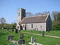
 Caistor St Edmund's church - geograph.org.uk - 2212602.jpg 640 × 480; 135 KB
-
 Caistor St. Edmund Village Name sign - geograph.org.uk - 3757584.jpg 3,072 × 2,304; 1.48 MB

_-_geograph.org.uk_-_5438510.jpg)
_-_geograph.org.uk_-_5438512.jpg)
_-_the_four_are_having_a_party_-_geograph.org.uk_-_5438515.jpg)


_-_geograph.org.uk_-_5438540.jpg)


_-_geograph.org.uk_-_5500757.jpg)
_-_geograph.org.uk_-_5438529.jpg)


_-_geograph.org.uk_-_2295765.jpg)


_-_geograph.org.uk_-_5500806.jpg)
_-_geograph.org.uk_-_5500809.jpg)
_-_geograph.org.uk_-_5500803.jpg)

_-_geograph.org.uk_-_4206207.jpg)
_-_geograph.org.uk_-_4206208.jpg)


_-_geograph.org.uk_-_4600728.jpg)


_flower_-_geograph.org.uk_-_5801580.jpg)


_-_geograph.org.uk_-_5489135.jpg)
_-_geograph.org.uk_-_5489136.jpg)
_-_seeds_-_geograph.org.uk_-_5489139.jpg)
_-_geograph.org.uk_-_5486754.jpg)

_-_geograph.org.uk_-_5361822.jpg)
_-_geograph.org.uk_-_5361893.jpg)
_-_geograph.org.uk_-_5361909.jpg)


_-_geograph.org.uk_-_5361980.jpg)
_-_geograph.org.uk_-_5361982.jpg)
_-_geograph.org.uk_-_5361986.jpg)


_-_geograph.org.uk_-_4376146.jpg)


_-_geograph.org.uk_-_5801616.jpg)


