Category:Caldbeck
English: Caldbeck is a village and civil parish in the borough of Allerdale, Cumbria, England. The parish had 714 inhabitants according to the census of 2001. It lies on the northern edge of the Lake District. The nearest town is Wigton, 6 miles north east of the village. In the last few years it has seen a massive house price boom, with many properties more than doubling their value over a couple of years.
village and civil parish in Cumbria, England, UK  | |||||
| Upload media | |||||
| Instance of | |||||
|---|---|---|---|---|---|
| Location | Allerdale, Cumbria, North West England, England | ||||
| Said to be the same as | Caldbeck (Wikimedia duplicated page, civil parish) | ||||
 | |||||
Subcategories
This category has the following 11 subcategories, out of 11 total.
B
- Brae Fell (5 F)
- Branthwaite, Caldbeck (5 F)
C
- Carrock Beck Ford (7 F)
F
- Faulds Brow (6 F)
H
- High Pike, Allerdale (9 F)
- High Row, Allerdale (1 F)
K
- St Kentigern's Church, Caldbeck (11 F)
- Knott, Caldbeck (21 F)
U
- Upton, Cumbria (3 F)
W
- Whelpo Bridge (3 F)
Media in category "Caldbeck"
The following 200 files are in this category, out of 674 total.
(previous page) (next page)-
 "Remember NOW thy creator" - geograph.org.uk - 1245596.jpg 640 × 480; 313 KB
-
 'After the storm'. The lane at Green Head - geograph.org.uk - 2732374.jpg 1,024 × 768; 190 KB
-
 'The Street' heading east - geograph.org.uk - 5017200.jpg 1,024 × 768; 175 KB
-
 'The Street' heading west - geograph.org.uk - 5017203.jpg 1,024 × 768; 133 KB
-
 A damp morning in the Caldbecks - geograph.org.uk - 879094.jpg 640 × 424; 40 KB
-
 A minor road junction north of Mosedale - geograph.org.uk - 2595361.jpg 2,592 × 1,944; 1.44 MB
-
 A pretty corner of Caldbeck. - panoramio.jpg 3,220 × 1,556; 1.77 MB
-
 A road across Faulds Brow - geograph.org.uk - 3382153.jpg 2,592 × 1,944; 1.25 MB
-
 A Thief Gill - geograph.org.uk - 2627962.jpg 1,500 × 1,061; 1.44 MB
-
 AA village sign, Caldbeck - geograph.org.uk - 4678932.jpg 640 × 480; 440 KB
-
 Above Charleton Gill - geograph.org.uk - 1952271.jpg 640 × 480; 66 KB
-
 Above Drygill Beck - geograph.org.uk - 2889409.jpg 1,920 × 2,560; 2.16 MB
-
 Above Drygill Beck - geograph.org.uk - 3479286.jpg 640 × 480; 110 KB
-
 Above Little Fellside - geograph.org.uk - 1951138.jpg 640 × 480; 57 KB
-
 Above the Level Drygill Beck - geograph.org.uk - 2889414.jpg 2,560 × 1,920; 2.08 MB
-
 Above Thief Gills - geograph.org.uk - 2389248.jpg 2,560 × 1,920; 950 KB
-
 Angular boulders on Carrock Fell - geograph.org.uk - 5983106.jpg 2,000 × 1,337; 1.87 MB
-
 Approaching Brae Fell - geograph.org.uk - 3285494.jpg 2,560 × 1,920; 2.06 MB
-
 Approaching Caldbeck - geograph.org.uk - 4969173.jpg 1,600 × 1,200; 264 KB
-
 Approaching Caldbeck and journey's end - geograph.org.uk - 4235914.jpg 3,776 × 2,520; 4.24 MB
-
 Approaching High Pike - geograph.org.uk - 3088360.jpg 2,560 × 1,920; 2.12 MB
-
 Approaching Knott from the east - geograph.org.uk - 5779418.jpg 2,592 × 1,944; 1.71 MB
-
 Approaching Little Lingy Hill - geograph.org.uk - 4919966.jpg 4,608 × 3,072; 3.18 MB
-
 Approaching Nether Row - geograph.org.uk - 2000547.jpg 640 × 427; 274 KB
-
 Approaching the summit of Carrock Fell - geograph.org.uk - 2595344.jpg 2,592 × 1,944; 1.67 MB
-
 Approaching Wiley Gill - geograph.org.uk - 2027507.jpg 2,560 × 1,920; 1.3 MB
-
 Archway Cottage, Caldbeck - geograph.org.uk - 5586796.jpg 768 × 1,024; 194 KB
-
 Ascending Carrock Fell - geograph.org.uk - 2887894.jpg 2,560 × 1,920; 1,022 KB
-
 Autumn colours by Cald Beck - geograph.org.uk - 5586859.jpg 1,024 × 768; 304 KB
-
 B5299 heading east, Ellerbeck Common - geograph.org.uk - 5016331.jpg 1,024 × 768; 119 KB
-
 B5299 heading east, Ellerbeck Common - geograph.org.uk - 5016739.jpg 1,024 × 768; 127 KB
-
 B5299 heading west, Ellerbeck Common - geograph.org.uk - 5016786.jpg 1,024 × 768; 137 KB
-
 Barn - geograph.org.uk - 1541578.jpg 640 × 335; 77 KB
-
 Beck on the side of Knock - geograph.org.uk - 1024080.jpg 640 × 480; 121 KB
-
 Beech Cottages - geograph.org.uk - 4969689.jpg 1,600 × 1,200; 271 KB
-
 Bield on Howthwaite - geograph.org.uk - 3469937.jpg 2,560 × 1,920; 2.03 MB
-
 Bield, Caldew Valley - geograph.org.uk - 2000258.jpg 427 × 640; 263 KB
-
 Bield, Carrock Beck - geograph.org.uk - 2330084.jpg 4,320 × 3,240; 4.17 MB
-
 Biggards - geograph.org.uk - 1520721.jpg 640 × 335; 61 KB
-
 Biggards - geograph.org.uk - 1541586.jpg 640 × 240; 45 KB
-
 Biggards - geograph.org.uk - 1541596.jpg 640 × 312; 84 KB
-
 Biggards and Wath farms - geograph.org.uk - 5342246.jpg 2,410 × 1,675; 761 KB
-

-
 Bog Gill - geograph.org.uk - 2579709.jpg 2,560 × 1,920; 2.08 MB
-
 Boulder and moorland of Great Lingy Hill - geograph.org.uk - 2626380.jpg 1,500 × 999; 1.26 MB
-
 Boulder in valley of River Caldew - geograph.org.uk - 3339585.jpg 1,500 × 1,125; 1.58 MB
-
 Boulder in Whelpo Beck - geograph.org.uk - 948370.jpg 426 × 640; 76 KB
-
 Boulder under Carrock Fell - geograph.org.uk - 2330052.jpg 4,320 × 3,240; 2.43 MB
-
 Boulder, Great Lingy Fell - geograph.org.uk - 4392546.jpg 640 × 480; 153 KB
-
 Boulder, Sandbed Mine - geograph.org.uk - 4387563.jpg 640 × 480; 136 KB
-
 Boulders on moorland north of Mosedale - geograph.org.uk - 2622572.jpg 1,500 × 952; 1.28 MB
-
 Boundary wall, Ellerbeck Common - geograph.org.uk - 5016695.jpg 1,024 × 768; 125 KB
-
 Bracken Heads - geograph.org.uk - 1521733.jpg 640 × 355; 98 KB
-
 Bracken Heads - geograph.org.uk - 1521741.jpg 640 × 312; 55 KB
-
 Brae Fell Summit - geograph.org.uk - 1951273.jpg 640 × 480; 68 KB
-
 Brae Fell summit cairn - geograph.org.uk - 5807056.jpg 1,600 × 1,067; 293 KB
-
 Bridge over Cald Beck - geograph.org.uk - 1245558.jpg 640 × 477; 318 KB
-
 Bridge over Carrock Beck - geograph.org.uk - 5005457.jpg 640 × 480; 488 KB
-
 Bridge over Carrock Beck - geograph.org.uk - 5163762.jpg 640 × 480; 283 KB
-
 Bridge over the River Caldew - geograph.org.uk - 4908304.jpg 2,592 × 1,944; 2.14 MB
-
 Bridleway on north side of Carrock Beck - geograph.org.uk - 2625741.jpg 1,500 × 1,125; 1.42 MB
-
 Burblethwaite Beck - geograph.org.uk - 1952296.jpg 640 × 480; 74 KB
-
 Burblethwaite Beck - geograph.org.uk - 4726541.jpg 640 × 427; 104 KB
-
 By The Caldew - geograph.org.uk - 2027502.jpg 2,560 × 1,920; 1.7 MB
-
 Cairn on Carrock Fell - geograph.org.uk - 3285464.jpg 2,560 × 1,920; 2.09 MB
-
 Cairn on Coomb Height - geograph.org.uk - 3895937.jpg 2,560 × 1,920; 2.05 MB
-
 Cairn on Fauld's Brow, Calbeck Mast Visible in Distance - geograph.org.uk - 3194400.jpg 3,264 × 2,448; 2.73 MB
-
 Cairn on Pike - geograph.org.uk - 5013143.jpg 4,608 × 3,072; 3.26 MB
-
 Cald Beck - geograph.org.uk - 5586823.jpg 1,024 × 768; 329 KB
-
 Cald Beck weir - geograph.org.uk - 6268468.jpg 1,600 × 900; 668 KB
-
 Cald Beck, Caldbeck - geograph.org.uk - 2895897.jpg 600 × 450; 119 KB
-
 Cald Beck, Caldbeck - geograph.org.uk - 2895908.jpg 600 × 450; 137 KB
-
 Caldbeck - geograph.org.uk - 6090561.jpg 1,280 × 850; 592 KB
-
 Caldbeck - geograph.org.uk - 6090565.jpg 1,280 × 850; 633 KB
-
 Caldbeck duck pond - geograph.org.uk - 1245542.jpg 640 × 480; 328 KB
-
 Caldbeck Fell - geograph.org.uk - 2231546.jpg 640 × 320; 37 KB
-
 Caldbeck Fells - geograph.org.uk - 5292290.jpg 1,600 × 1,067; 207 KB
-
 Caldbeck from the west - geograph.org.uk - 5591070.jpg 1,024 × 768; 191 KB
-
 Caldbeck Methodist Chapel - geograph.org.uk - 951288.jpg 640 × 426; 53 KB
-
 Caldbeck School - geograph.org.uk - 3154253.jpg 3,456 × 2,028; 1.16 MB
-
 Caldbeck War Memorial - April 2017 - geograph.org.uk - 5347387.jpg 782 × 1,200; 733 KB
-
 Calebreck - geograph.org.uk - 3479295.jpg 640 × 480; 60 KB
-
 Caravans at Throstle Hall - geograph.org.uk - 791196.jpg 640 × 480; 99 KB
-
 Carrock Beck - geograph.org.uk - 2330063.jpg 4,320 × 3,240; 3.98 MB
-
 Carrock Beck - geograph.org.uk - 2330071.jpg 4,320 × 3,240; 4.46 MB
-
 Carrock Beck - geograph.org.uk - 2889435.jpg 2,560 × 1,920; 2.2 MB
-
 Carrock Beck - geograph.org.uk - 3479282.jpg 640 × 480; 54 KB
-
 Carrock Beck - geograph.org.uk - 4969814.jpg 1,600 × 1,200; 413 KB
-
 Carrock Beck - geograph.org.uk - 4970103.jpg 1,600 × 1,200; 471 KB
-
 Carrock Beck - geograph.org.uk - 5122301.jpg 640 × 480; 124 KB
-
 Carrock Beck - looking upstream - geograph.org.uk - 1046735.jpg 640 × 480; 89 KB
-
 Carrock Beck, looking downstream - geograph.org.uk - 1046715.jpg 640 × 480; 92 KB
-
 Carrock Beck, looking upstream - geograph.org.uk - 1046716.jpg 640 × 480; 76 KB
-
 Carrock Fell from Sunny Bank - geograph.org.uk - 4863597.jpg 640 × 384; 69 KB
-
 Cattle and sheep, Ellerbeck Common - geograph.org.uk - 5016706.jpg 1,024 × 768; 116 KB
-
 Cattle grid at Parkend Bridge - geograph.org.uk - 3279330.jpg 3,872 × 2,592; 3.96 MB
-
 Cattle Grid, Calebreck - geograph.org.uk - 4387583.jpg 640 × 360; 92 KB
-
 Chapel, Hesket Newmarket - geograph.org.uk - 2629881.jpg 1,500 × 891; 1.09 MB
-
 Charleton Gill - geograph.org.uk - 1952281.jpg 640 × 480; 64 KB
-
 Charleton Gill - geograph.org.uk - 2579703.jpg 1,920 × 2,560; 1.52 MB
-
 Charleton Wath - geograph.org.uk - 4387836.jpg 3,872 × 2,592; 4.67 MB
-
 Charleton Wath - geograph.org.uk - 58637.jpg 480 × 360; 23 KB
-
 Clints Gill, Peteraw - geograph.org.uk - 4387604.jpg 640 × 480; 131 KB
-
 Clogmaker and clock shop, Caldbeck - geograph.org.uk - 4678520.jpg 480 × 640; 401 KB
-
 Clogmaker's sign, J strong ^ Son - geograph.org.uk - 4678531.jpg 480 × 640; 374 KB
-
 Colourful cottages in Caldbeck - geograph.org.uk - 2595562.jpg 2,592 × 1,944; 1.41 MB
-
 Colourful houses next to Gill Beck, Caldbeck - geograph.org.uk - 4235923.jpg 3,776 × 2,520; 3.95 MB
-
 Copse beyond the pasture - geograph.org.uk - 4969840.jpg 1,600 × 1,164; 253 KB
-
 Copse in a Field near Wath - geograph.org.uk - 2000552.jpg 640 × 427; 236 KB
-
 Cottage, Nether Row - geograph.org.uk - 97143.jpg 640 × 454; 76 KB
-
 Cottages and Gardens at Calbeck - geograph.org.uk - 2000560.jpg 640 × 427; 300 KB
-
 Country at Hesket Newmarket - geograph.org.uk - 3592160.jpg 2,592 × 1,944; 1.7 MB
-
 Country west of Pasture Lane - geograph.org.uk - 3592170.jpg 2,592 × 1,944; 1.82 MB
-
 Dale Beck - geograph.org.uk - 1279989.jpg 640 × 427; 71 KB
-
 Dale Beck - geograph.org.uk - 1951171.jpg 640 × 480; 63 KB
-
 Dale Beck - geograph.org.uk - 1951180.jpg 640 × 480; 70 KB
-
 Dale Beck - geograph.org.uk - 1951191.jpg 640 × 480; 82 KB
-
 Dale Beck - geograph.org.uk - 1951195.jpg 640 × 480; 70 KB
-
 Dale Beck - geograph.org.uk - 4726562.jpg 640 × 480; 100 KB
-
 Dale Beck - geograph.org.uk - 4726569.jpg 640 × 480; 88 KB
-
 Dale Beck flowing downstream - geograph.org.uk - 3339219.jpg 1,500 × 1,125; 2.22 MB
-
 Dales ponies - geograph.org.uk - 1280137.jpg 640 × 425; 80 KB
-
 Descending Brae Fell - geograph.org.uk - 1952265.jpg 640 × 480; 50 KB
-
 Descending Carrock Fell - geograph.org.uk - 2331891.jpg 4,320 × 3,240; 1.95 MB
-
 Descending High Pike - geograph.org.uk - 2888398.jpg 2,560 × 1,920; 805 KB
-
 Descending High Pike - geograph.org.uk - 3285469.jpg 2,560 × 1,920; 2.15 MB
-
 Descending off High Pike - geograph.org.uk - 2000306.jpg 640 × 427; 312 KB
-
 Descending off High Pike - geograph.org.uk - 2000310.jpg 640 × 427; 258 KB
-
 Desolation at location of Sandbeds Mine - geograph.org.uk - 5980065.jpg 2,000 × 1,295; 2.13 MB
-
 Digger in field near Holborn - geograph.org.uk - 3337103.jpg 1,500 × 913; 985 KB
-
 Disused Mine Workings - geograph.org.uk - 4387499.jpg 640 × 480; 158 KB
-
 Disused quarry east of Sandale Hill - geograph.org.uk - 2493278.jpg 2,592 × 1,944; 1.75 MB
-
 Ditch under Deer Hills - geograph.org.uk - 1951153.jpg 640 × 480; 87 KB
-
 Door at Joe Strong ^ Son, Clogmakers - geograph.org.uk - 4678527.jpg 480 × 640; 422 KB
-
 Drive to Hudscales Farm - geograph.org.uk - 5587987.jpg 1,024 × 768; 275 KB
-
 Driving the sheep to pasture - geograph.org.uk - 4726539.jpg 640 × 427; 63 KB
-
 Dry stone wall bounding moorland - geograph.org.uk - 3339301.jpg 1,500 × 982; 1.26 MB
-
 Drygill Beck - geograph.org.uk - 2889411.jpg 2,560 × 1,920; 2.13 MB
-
 Drygill Beck - geograph.org.uk - 2889412.jpg 1,920 × 2,560; 2.06 MB
-
 East slopes of High Pike - geograph.org.uk - 2525223.jpg 640 × 480; 94 KB
-
 Eastern slopes of Brae Fell - geograph.org.uk - 2627998.jpg 1,500 × 1,125; 1.37 MB
-
 Ellerbeck Common - geograph.org.uk - 2932462.jpg 2,592 × 1,944; 1.34 MB
-
 Ellerbeck Common, looking south - geograph.org.uk - 5016709.jpg 1,024 × 768; 127 KB
-
 Ellerbeck Common, looking south-east - geograph.org.uk - 5016713.jpg 1,024 × 768; 138 KB
-
 Enclosure on Carrock Fell - geograph.org.uk - 5122294.jpg 640 × 480; 74 KB
-
 Erosion Gully, High Pike - geograph.org.uk - 4387548.jpg 640 × 480; 144 KB
-
 Evidence of Motorbike Usage - geograph.org.uk - 3955117.jpg 640 × 480; 451 KB
-
 Falls of Whelpo Beck - geograph.org.uk - 947978.jpg 640 × 426; 70 KB
-
 Farm Buildings, Nether Row - geograph.org.uk - 780156.jpg 640 × 480; 104 KB
-
 Farm or mine road on north side of Carrock Beck - geograph.org.uk - 2622673.jpg 1,500 × 980; 1.34 MB
-
 Farm track to Matthew Rudding - geograph.org.uk - 1275625.jpg 480 × 640; 134 KB
-
 Farmland above the valley of Whelpo Beck - geograph.org.uk - 5017233.jpg 1,024 × 768; 151 KB
-
 Farmland between Parkend and Long Lea - geograph.org.uk - 5017208.jpg 1,024 × 768; 140 KB
-
 Farmland east of Mickle How - geograph.org.uk - 5017262.jpg 1,024 × 768; 212 KB
-
 Farmland east of Parkend Farm - geograph.org.uk - 5017205.jpg 1,024 × 768; 122 KB
-
 Farmland on the north side of The Street - geograph.org.uk - 5017239.jpg 1,024 × 768; 149 KB
-
 Farmland south east of Caldbeck - geograph.org.uk - 1275624.jpg 640 × 480; 98 KB
-
 Fauld's Brow - geograph.org.uk - 2744600.jpg 640 × 360; 213 KB
-
 Faulds - geograph.org.uk - 93895.jpg 640 × 427; 72 KB
-
 Faulds Brow - geograph.org.uk - 2493224.jpg 2,592 × 1,944; 1.45 MB
-
 Faulds Brow - geograph.org.uk - 4726575.jpg 640 × 360; 14 KB
-
 Fell Side - geograph.org.uk - 1520717.jpg 640 × 422; 86 KB
-
 Fellside - geograph.org.uk - 1951129.jpg 640 × 480; 77 KB
-
 Fellside - geograph.org.uk - 2524190.jpg 640 × 480; 70 KB
-
 Fellside - geograph.org.uk - 5177622.jpg 640 × 427; 405 KB
-
 Fellside - geograph.org.uk - 780100.jpg 640 × 480; 70 KB
-
 Fellside above Fell Side - geograph.org.uk - 1951130.jpg 640 × 480; 68 KB
-
 Fellside Farm - geograph.org.uk - 5177626.jpg 640 × 427; 431 KB
-

-
 Fellside, village street - geograph.org.uk - 780101.jpg 640 × 480; 105 KB
-
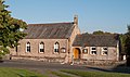
 Fellview Primary School, Caldbeck - geograph.org.uk - 5591053.jpg 1,024 × 760; 295 KB
-
 Field adjacent to Pasture Lane - geograph.org.uk - 2622640.jpg 1,500 × 957; 1.33 MB
-
 Field east of Bonners Farm - geograph.org.uk - 3339249.jpg 1,500 × 996; 1.8 MB
-
 Field entrance on the north side of The Street - geograph.org.uk - 5017230.jpg 1,024 × 768; 137 KB
-
 Field entrance on the south side of The Street - geograph.org.uk - 5017241.jpg 1,024 × 768; 145 KB
-
 Field with barn north of Lonning Foot - geograph.org.uk - 2628499.jpg 1,500 × 1,125; 1.96 MB
-
 Fields and woods east of Caldbeck - geograph.org.uk - 3592156.jpg 2,592 × 1,944; 1.68 MB
-
 Fields west of Pasture Lane - geograph.org.uk - 3592165.jpg 2,592 × 1,944; 1.66 MB
-
 Footbridge across Cald Beck - geograph.org.uk - 5586854.jpg 1,024 × 768; 387 KB
-
 Footbridge Alternative to Ford - geograph.org.uk - 3085527.jpg 3,264 × 2,448; 2.24 MB
-
 Footbridge over Unnamed Stream - geograph.org.uk - 2891157.jpg 600 × 450; 144 KB
-
 Footpath junction above Carrock Beck - geograph.org.uk - 5292293.jpg 1,600 × 1,067; 349 KB
-
 Footpath to Whelpo Beck - geograph.org.uk - 338470.jpg 399 × 599; 183 KB
-
 Footpath ^ barn near Caldbeck - geograph.org.uk - 5591064.jpg 1,024 × 768; 191 KB
-
 Ford and footbridge over the Carrock Beck - geograph.org.uk - 4969820.jpg 1,600 × 1,200; 445 KB
-
 Ford and Ponies - geograph.org.uk - 93951.jpg 640 × 427; 90 KB
-

-
 Former Rectory, Caldbeck - April 2017 - geograph.org.uk - 5347384.jpg 1,386 × 1,200; 1.28 MB
-
 Friar Row, Caldbeck - geograph.org.uk - 5586793.jpg 1,024 × 768; 155 KB
-
 Frogspawn - geograph.org.uk - 2331758.jpg 4,320 × 3,240; 4.16 MB
-
 From Carrock Fell - geograph.org.uk - 835765.jpg 640 × 480; 73 KB
-
 Gate on the track above Fellside - geograph.org.uk - 4357638.jpg 640 × 480; 124 KB
-
 Gates at Home Farm - geograph.org.uk - 1245605.jpg 640 × 480; 293 KB
-
 Gill Beck - geograph.org.uk - 4969498.jpg 1,600 × 1,164; 346 KB
-
 Gill Beck in Caldbeck - geograph.org.uk - 2895924.jpg 600 × 450; 115 KB
-
 Gill Beck, Caldbeck - geograph.org.uk - 2895926.jpg 600 × 450; 131 KB
-
 Gill Foot Cottage, Nether Row - geograph.org.uk - 780160.jpg 640 × 480; 123 KB
-

-
 Grassed slopes west of Coomb Height - geograph.org.uk - 2628262.jpg 1,500 × 1,125; 1.28 MB
-
 Grassy ridge to east of High Pike - geograph.org.uk - 2626289.jpg 1,500 × 1,125; 1.16 MB


