Category:Caldercruix
village in North Lanarkshire, Scotland, UK  | |||||
| Upload media | |||||
| Instance of | |||||
|---|---|---|---|---|---|
| Location |
| ||||
| Population |
| ||||
 | |||||
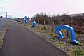
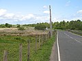
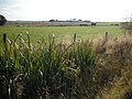
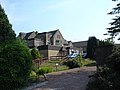
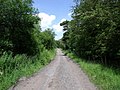
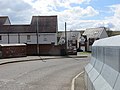
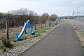
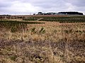
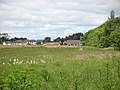
English: Caldercruix is a village in North Lanarkshire, Scotland, approximately 4 miles (7 km) to the north-east of Airdrie. The village developed in the 19th century as the papermaking and mining industries grew. The village is situated by the North Calder Water and takes its name from the bends or crooks (cruix) in the river.
Subcategories
This category has the following 13 subcategories, out of 13 total.
A
- Alice Hill (2 F)
- Annie's Hill (6 F)
B
C
- Caldercruix church (2 F)
- Caldercruix railway station (10 F)
D
- Drumfin (5 F)
F
G
- Glengowan School (3 F)
H
- Hillend Reservoir (54 F)
- Hillend Plantation (3 F)
L
- "Legs", Caldercruix (2 F)
- Lily Loch, North Lanarkshire (13 F)
M
Media in category "Caldercruix"
The following 89 files are in this category, out of 89 total.
-
 A89 beneath the Moffat Hills - geograph.org.uk - 896813.jpg 640 × 480; 67 KB
-
 A89 passing Caldercruix - geograph.org.uk - 1216108.jpg 640 × 480; 96 KB
-
 Airdrie - Bathgate railway - geograph.org.uk - 1074279.jpg 640 × 480; 130 KB
-
 Airdrie to Bathgate cycle path - geograph.org.uk - 2499334.jpg 1,024 × 768; 111 KB
-
 Arbuckle Road - geograph.org.uk - 2499420.jpg 1,024 × 768; 161 KB
-
 Arbuckle Road - geograph.org.uk - 2499469.jpg 1,024 × 768; 153 KB
-
 Arden Glen - geograph.org.uk - 2499382.jpg 1,024 × 768; 148 KB
-
 Arden Moss - geograph.org.uk - 2499402.jpg 1,024 × 768; 113 KB
-
 Arden, track - geograph.org.uk - 2499347.jpg 1,024 × 768; 145 KB
-
 B825, Caldercruix - geograph.org.uk - 1075126.jpg 640 × 480; 135 KB
-
 Barblues, railway bridge - geograph.org.uk - 2499538.jpg 1,024 × 768; 190 KB
-
 Bing on the muir - geograph.org.uk - 2499427.jpg 1,024 × 768; 91 KB
-
 Blocked road - geograph.org.uk - 1492651.jpg 640 × 480; 129 KB
-
 Blue legs two - geograph.org.uk - 3945546.jpg 4,288 × 2,848; 4.69 MB
-

-
 Bogs, Easterton - geograph.org.uk - 1492647.jpg 640 × 480; 136 KB
-
 Bookies, Caldercruix - geograph.org.uk - 1074288.jpg 640 × 480; 68 KB
-
 Bookies, Caldercruix - geograph.org.uk - 4226723.jpg 800 × 600; 454 KB
-
 Bowling club, Caldercruix - geograph.org.uk - 4226716.jpg 800 × 600; 415 KB
-

-
 Bracco Road - geograph.org.uk - 1465923.jpg 640 × 480; 78 KB
-

-
 Building site, Caldercruix - geograph.org.uk - 1216180.jpg 640 × 480; 80 KB
-
 Burn, Bracco - geograph.org.uk - 1470612.jpg 640 × 480; 119 KB
-
 Caldercruix - geograph.org.uk - 1075087.jpg 640 × 480; 66 KB
-
 Caldercruix - geograph.org.uk - 4226692.jpg 800 × 600; 413 KB
-
 Caldercruix - geograph.org.uk - 4226744.jpg 800 × 600; 405 KB
-
 Caldercruix Road - geograph.org.uk - 1075143.jpg 640 × 480; 87 KB
-
 Caldercruix, new housing - geograph.org.uk - 1209610.jpg 640 × 480; 100 KB
-
 Caldercruix, new housing - geograph.org.uk - 1216192.jpg 640 × 480; 126 KB
-
 Cattle, Easterton - geograph.org.uk - 1492638.jpg 640 × 480; 121 KB
-
 Clarky Ballantyne's Garage - geograph.org.uk - 1600465.jpg 640 × 427; 53 KB
-
 Cochrane's Nursery - geograph.org.uk - 1600471.jpg 640 × 360; 70 KB
-
 Craigsmill Wynd - geograph.org.uk - 3986427.jpg 3,264 × 2,448; 4.07 MB
-
 Crossrigg Wood - geograph.org.uk - 1806285.jpg 980 × 735; 213 KB
-
 Double boundary - geograph.org.uk - 2499328.jpg 1,024 × 768; 191 KB
-
 Drumbow triangulation pillar - geograph.org.uk - 1075162.jpg 363 × 640; 104 KB
-
 Eastercroft Care Home, Caldercruix - geograph.org.uk - 205179.jpg 640 × 480; 95 KB
-
 Easterton , track - geograph.org.uk - 2499393.jpg 1,024 × 768; 161 KB
-
 Easterton Farm - geograph.org.uk - 2499385.jpg 1,024 × 768; 103 KB
-
 Easterton, enclosed field - geograph.org.uk - 2499376.jpg 1,024 × 768; 73 KB
-
 Easterton, road - geograph.org.uk - 2499339.jpg 1,024 × 768; 211 KB
-
 Eastfield Woodland - geograph.org.uk - 1075091.jpg 640 × 480; 146 KB
-
 Farmland near Midtown - geograph.org.uk - 1140800.jpg 640 × 480; 46 KB
-
 Forrestfield Road - geograph.org.uk - 1075172.jpg 640 × 359; 74 KB
-
 Granary Hill - geograph.org.uk - 1307725.jpg 640 × 480; 75 KB
-
 High Limerigg, Caldercruix Road (2) - geograph.org.uk - 2526709.jpg 1,024 × 768; 100 KB
-
 Hillside, Caldercruix Road - geograph.org.uk - 2529564.jpg 1,024 × 768; 120 KB
-
 Housing estate at Caldercruix - geograph.org.uk - 3986444.jpg 3,264 × 2,448; 3.73 MB
-
 Legs and cycle path - geograph.org.uk - 4229885.jpg 800 × 600; 412 KB
-
 Low Cruix School - geograph.org.uk - 1600491.jpg 640 × 360; 48 KB
-
 Main Street, Caldercruix - geograph.org.uk - 4226733.jpg 800 × 600; 420 KB
-
 Meadow and woodland - geograph.org.uk - 2448990.jpg 1,024 × 768; 112 KB
-
 Midtown Farm - geograph.org.uk - 2499390.jpg 3,648 × 2,736; 993 KB
-
 Midtown Farm, road block - geograph.org.uk - 2789166.jpg 1,024 × 768; 164 KB
-
 Midtown, coal waste - geograph.org.uk - 2499476.jpg 1,024 × 768; 128 KB
-
 Midtown, former tramway - geograph.org.uk - 2499484.jpg 1,024 × 768; 177 KB
-
 Midtown, mini wind turbine - geograph.org.uk - 2499503.jpg 1,024 × 768; 110 KB
-
 Midtown, rough pasture - geograph.org.uk - 2788636.jpg 1,024 × 768; 130 KB
-

-
 Milldam Road - geograph.org.uk - 4226743.jpg 800 × 600; 393 KB
-
 Moorland, Drumbow - geograph.org.uk - 1075155.jpg 640 × 340; 61 KB
-
 Muddy Field by North Calder Water - geograph.org.uk - 146200.jpg 640 × 480; 178 KB
-
 NCN Millennium Milepost MP615 Caldercruix.jpeg 800 × 1,067; 892 KB
-
 Nether Bracco Pasture - geograph.org.uk - 402144.jpg 640 × 480; 91 KB
-
 Nether Bracco Pasture - geograph.org.uk - 402155.jpg 640 × 480; 112 KB
-
 New blue legs - geograph.org.uk - 3945542.jpg 4,288 × 2,848; 4.5 MB
-
 New Trees - geograph.org.uk - 150306.jpg 640 × 480; 55 KB
-
 Newly planted woodland, Caldercruix - geograph.org.uk - 1075132.jpg 640 × 480; 103 KB
-
 Opencast workings - geograph.org.uk - 2023708.jpg 640 × 359; 96 KB
-
 Owl and Trout - geograph.org.uk - 1470684.jpg 640 × 480; 83 KB
-
 Railway bridge, Caldercruix - geograph.org.uk - 896818.jpg 640 × 480; 92 KB
-
 Railway Tavern, Caldercruix - geograph.org.uk - 4226727.jpg 800 × 600; 375 KB
-
 Railway Under Construction - geograph.org.uk - 1600431.jpg 640 × 360; 57 KB
-
 Railway under construction, Caldercruix - geograph.org.uk - 1293246.jpg 640 × 480; 102 KB
-
 Reforestation Near Drumbow - geograph.org.uk - 146231.jpg 640 × 480; 154 KB
-
 Road junction - geograph.org.uk - 3485573.jpg 640 × 460; 60 KB
-
 Roadside Burn, Caldercruix - geograph.org.uk - 148037.jpg 480 × 640; 186 KB
-
 Rough grazing, Caldercruix - geograph.org.uk - 1293236.jpg 640 × 480; 98 KB
-
 Route75, Caldercruix - geograph.org.uk - 4226697.jpg 800 × 600; 454 KB
-
 Sparkling road - geograph.org.uk - 4226704.jpg 800 × 600; 526 KB
-
 Telegraph Road - geograph.org.uk - 3485562.jpg 640 × 480; 71 KB
-
 Telegraph Road end - geograph.org.uk - 2448939.jpg 1,600 × 1,200; 268 KB
-
 The Telegraph Road - geograph.org.uk - 2449036.jpg 768 × 1,024; 115 KB
-

-
 Track to Easterton - geograph.org.uk - 146189.jpg 640 × 480; 184 KB
-
 Track to Eastfield - geograph.org.uk - 146222.jpg 480 × 640; 163 KB
-
 Track, Easterton - geograph.org.uk - 1492642.jpg 640 × 480; 107 KB
-
 Wetland flowers, Caldercruix - geograph.org.uk - 1074283.jpg 640 × 480; 101 KB


_-_geograph.org.uk_-_2526709.jpg)


