Category:Camelford
town in north Cornwall, UK  | |||||
| Upload media | |||||
| Instance of | |||||
|---|---|---|---|---|---|
| Location | Cornwall, South West England, England | ||||
| Population |
| ||||
| Said to be the same as | Camelford (Wikimedia duplicated page, civil parish) | ||||
 | |||||
Ænglisc: Gafolford is tūn in Cornƿealle.
Brezhoneg: Ur gêr eus Norzh Kernev-Veur eo Ryskammel
Kernowek: Ryskammel ( Sowsnek: Camelford) yw tre yn Kernow, Breten Veur. Avel Dintagell (gwig gentrevek), Ryskammel yw an destenn a nebes henhwedhlow yn kever an Myghtern Arthur. Rag ensompel, kas Kammlann po lys Camelot a via yn Ryskammel herwydh an hwedhlow ma.
Nederlands: Camelford is een plaats in het bestuurlijke gebied Noord-Cornwall, in het Engelse graafschap Cornwall. De plaats telt 2256 inwoners.
Polski: Camelford - miasto w Wielkiej Brytanii, w Anglii, w regionie South West England, w hrabstwie Kornwalia. W 2001r, miasto to zamieszkiwało 2 256 osób.
Română: Camelford ( Limba cornică: Ryskammel) este un oraş în comitatul Cornwall, regiunea South West, Anglia. Oraşul se află în districtul North Cornwall.
Subcategories
This category has the following 8 subcategories, out of 8 total.
B
C
- Castle Goff (3 F)
- Countryside around Camelford (47 F)
L
R
- Rough Tor (28 F)
S
- Slaughterbridge (14 F)
- Streets in Camelford (13 F)
T
- Transport in Camelford (23 F)
Media in category "Camelford"
The following 96 files are in this category, out of 96 total.
-
 A Stone Cross - geograph.org.uk - 1755022.jpg 1,024 × 824; 217 KB
-
 A39 at Helstone - geograph.org.uk - 5460712.jpg 3,072 × 2,048; 1.16 MB
-

-
 B3266 approaching Valley Truckle - geograph.org.uk - 5460489.jpg 3,058 × 1,932; 1,000 KB
-
 Bench and bin, Chapel Street, Camelford, Cornwall - April 2023.jpg 3,743 × 2,723; 3.62 MB
-
 BP filling station by A39 in Valley Truckle - geograph.org.uk - 5761646.jpg 1,600 × 1,067; 633 KB
-
 Camelford and District Bowling Club - geograph.org.uk - 5460611.jpg 2,734 × 1,851; 1.16 MB
-
-

-
 Camelford Primary School sign, Dark Lane, Camelford, Cornwall - April 2023.jpg 2,668 × 3,858; 2.3 MB
-
 Camelford skatepark, Cornwall - April 2023 (1).jpg 3,742 × 2,269; 950 KB
-
 Camelford skatepark, Cornwall - April 2023 (2).jpg 3,969 × 2,798; 1.31 MB
-
 Camelford skatepark, Cornwall - April 2023 (3).jpg 4,196 × 3,175; 1.05 MB
-
 Camelford skatepark, Cornwall - April 2023 (4).jpg 3,856 × 2,548; 1.21 MB
-
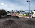 Camelford skatepark, Cornwall - April 2023 (5).jpg 3,969 × 3,176; 1.71 MB
-
 Camelford skatepark, Cornwall - April 2023 (6).jpg 3,343 × 3,970; 2.46 MB
-
 Camelford, Bowood Park - geograph.org.uk - 934443.jpg 640 × 427; 141 KB
-
 Camelford, Victoria Road Car Park - geograph.org.uk - 5925015.jpg 6,470 × 4,313; 5.17 MB
-

-
 Clease Road, Camelford - geograph.org.uk - 5761645.jpg 1,600 × 1,281; 694 KB
-
 Crowdy dam - geograph.org.uk - 700994.jpg 640 × 429; 83 KB
-
 Crowdy dam and Roughtor - geograph.org.uk - 701000.jpg 640 × 477; 66 KB
-
-
 Easter post box topper, Market Place, Camelford, Cornwall - April 2023.jpg 3,630 × 2,798; 2.02 MB
-
 Enfield Park Play Area, Camelford, Cornwall - April 2023.jpg 4,196 × 2,609; 1.8 MB
-
 Farm at Helstone - geograph.org.uk - 5460696.jpg 2,939 × 1,763; 843 KB
-
 Farm Driveway west of Hendra - geograph.org.uk - 1755057.jpg 1,024 × 682; 159 KB
-
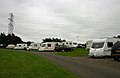
 Field beside Juliots Well Holiday Park - geograph.org.uk - 5460566.jpg 3,072 × 2,048; 1.35 MB
-
 Field near Pitt House - geograph.org.uk - 5460731.jpg 3,064 × 1,959; 1.57 MB
-
 Fish Ladder on the River Camel, Camelford Bridge - geograph.org.uk - 5639266.jpg 2,056 × 1,535; 1.12 MB
-
 Former Davidstow Airfield Museum Complex. - panoramio.jpg 3,648 × 2,736; 2.19 MB
-
 Graffiti at Camelford skatepark, Cornwall - April 2023 (1).jpg 4,479 × 2,659; 2.08 MB
-
 Graffiti at Camelford skatepark, Cornwall - April 2023 (2).jpg 4,428 × 2,431; 1.78 MB
-
 Graffiti at Camelford skatepark, Cornwall - April 2023 (3).jpg 4,083 × 2,608; 1.55 MB
-
 Graffiti at Camelford skatepark, Cornwall - April 2023 (4).jpg 3,456 × 4,608; 2.66 MB
-
 Greylake Barton - geograph.org.uk - 5692101.jpg 640 × 425; 129 KB
-
 Hedgehog sign, Camelford, Cornwall - April 2023.jpg 3,024 × 3,630; 1.06 MB
-
 Helstone Methodist Church - geograph.org.uk - 5267347.jpg 1,736 × 1,150; 429 KB
-
 Houses at Valley Truckle - geograph.org.uk - 5460484.jpg 2,965 × 1,981; 1.28 MB
-
 Junction at Broadlea - geograph.org.uk - 5263977.jpg 3,072 × 2,048; 1.32 MB
-
 Junction at Valley Truckle - geograph.org.uk - 5460480.jpg 2,695 × 1,649; 843 KB
-
 Junction in Trefrew - geograph.org.uk - 734585.jpg 640 × 480; 108 KB
-
 Junction on A39 - geograph.org.uk - 5460732.jpg 3,072 × 2,048; 1.75 MB
-
 Lane approaching Tregoodwell - geograph.org.uk - 5692119.jpg 4,288 × 2,848; 2.8 MB
-
 Lane from Helstone - geograph.org.uk - 5460379.jpg 3,072 × 2,048; 1.26 MB
-
 Lane near Longcarne Farm - geograph.org.uk - 5691980.jpg 4,288 × 2,848; 2.57 MB
-
 Lane to Helstone - geograph.org.uk - 5460384.jpg 2,030 × 2,849; 1.21 MB
-
 Mossy bench, Camelford, Cornwall - April 2023.jpg 3,515 × 3,024; 3.99 MB
-
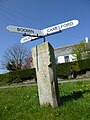
 Old Boundary Marker (geograph 6426333).jpg 630 × 841; 249 KB
-
 Old Boundary Marker (geograph 6426389).jpg 633 × 843; 226 KB
-
 Old Boundary Marker (geograph 6426401).jpg 685 × 914; 287 KB
-
 Old Boundary Marker (geograph 6426411).jpg 536 × 830; 214 KB
-
 Old Milestone by the A39, Tramagenna - geograph.org.uk - 5623225.jpg 640 × 431; 90 KB
-

-
 Old Milestone by Trefrew Road, Camelford - geograph.org.uk - 5623223.jpg 480 × 640; 189 KB
-
 Old Wayside Cross (geograph 6601713).jpg 960 × 720; 157 KB
-
 Pasture near Broadlea - geograph.org.uk - 5460442.jpg 3,072 × 2,048; 1.35 MB
-
 Post box and bandstand, Market Place, Camelford, Cornwall - April 2023.jpg 3,236 × 4,495; 2.05 MB
-
 Post box and fuel station signage, Camelot Garage, Camelford, Cornwall - April 2023.jpg 2,889 × 4,197; 1.33 MB
-
 Post box with Easter post box topper, Market Place, Camelford, Cornwall - April 2023.jpg 2,722 × 3,692; 2.25 MB
-

-
 Recycling bins, Camelford skatepark, Cornwall - April 2023.jpg 3,402 × 2,608; 1.45 MB
-
 Road Junction - geograph.org.uk - 4197448.jpg 4,000 × 2,664; 3.84 MB
-
 RoadsignAtCamelfordStationCornwallUK.jpg 538 × 600; 118 KB
-
 SketchMapOfSlaughterbridgeCornwallUk.jpg 2,244 × 1,179; 177 KB
-
 Squirrel street art, Enfield Park, Camelford, Cornwall - April 2023.jpg 4,032 × 3,024; 4.88 MB
-
 Street art at Camelford skatepark, Cornwall - April 2023.jpg 4,042 × 3,289; 1.71 MB
-
 Street art, Enfield Park, Camelford, Cornwall - April 2023 (1).jpg 4,438 × 3,062; 2.02 MB
-
 Street art, Enfield Park, Camelford, Cornwall - April 2023 (2).jpg 4,608 × 3,456; 4.28 MB
-
 Table tennis table, Camelford skatepark, Cornwall - April 2023.jpg 3,742 × 2,835; 971 KB
-
 The A39 - geograph.org.uk - 4197467.jpg 4,000 × 2,664; 4.23 MB
-
 The A39 - geograph.org.uk - 4197469.jpg 3,000 × 1,998; 5.81 MB
-
 The A39 at Knightsmill Bridge - geograph.org.uk - 3528849.jpg 1,024 × 768; 236 KB
-
 The A39 at Valley Truckle - geograph.org.uk - 4607992.jpg 3,264 × 2,448; 2.44 MB
-
 The A39 in Camelford - geograph.org.uk - 3528780.jpg 1,024 × 768; 239 KB
-
 The Masons Arms, 9-11 Market Place, Camelford - geograph.org.uk - 6212577.jpg 11,443 × 3,611; 6.95 MB
-
 The River Camel - geograph.org.uk - 5015905.jpg 640 × 480; 72 KB
-
 The River Camel in Camelford - geograph.org.uk - 1808485.jpg 640 × 480; 120 KB
-
 Traffic jam, Camelford - geograph.org.uk - 3032455.jpg 1,600 × 1,064; 340 KB
-
 Tregoodwell Ancient Cross, Camelford - geograph.org.uk - 4285132.jpg 1,024 × 768; 280 KB
-
 Trewalder - geograph.org.uk - 729494.jpg 640 × 480; 99 KB
-
 Trewen Bridge - geograph.org.uk - 734526.jpg 480 × 640; 121 KB
-
 Tyland Road - geograph.org.uk - 3958138.jpg 480 × 640; 137 KB
-
 Victoria Road, Camelford (geograph 5692167).jpg 4,288 × 2,848; 2.26 MB
-
 View to Delabole Wind Farm - geograph.org.uk - 2821750.jpg 1,024 × 680; 157 KB
-
 Warrens Field, Camelford - geograph.org.uk - 734627.jpg 640 × 448; 69 KB
-
 Watermill Walk near Tregoodwell - geograph.org.uk - 5692132.jpg 4,003 × 2,675; 2.17 MB
-
 Welcome to Camelford sign, A39, Cornwall - April 2023.jpg 2,897 × 3,629; 1.82 MB
-
 Cat on a track, Hendra - geograph.org.uk - 734249.jpg 474 × 640; 128 KB
-
 Lane at Hendra - geograph.org.uk - 734242.jpg 480 × 640; 140 KB
-
 Lane junction, Hendra - geograph.org.uk - 734238.jpg 480 × 640; 139 KB
-
 Lane past Trewen - geograph.org.uk - 729495.jpg 640 × 480; 123 KB
-
 Lane to Delabole - geograph.org.uk - 734300.jpg 480 × 640; 124 KB
-
 Lane to Trewen - geograph.org.uk - 733710.jpg 640 × 480; 162 KB
-
-
 The Delabole wind farm - geograph.org.uk - 216985.jpg 640 × 480; 113 KB


.jpg)
.jpg)
.jpg)
.jpg)
.jpg)
.jpg)


.jpg)
.jpg)
.jpg)
.jpg)


.jpg)
.jpg)
.jpg)
.jpg)


.jpg)


.jpg)
.jpg)


.jpg)


