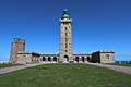
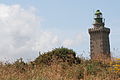
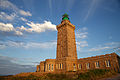
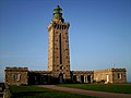
Category:Cap Fréhel lighthouse (1950)
| Object location | | View all coordinates using: OpenStreetMap |
|---|
lighthouse built 1950 in Côtes-d'Armor, France  | |||||
| Upload media | |||||
| Instance of | |||||
|---|---|---|---|---|---|
| Part of | |||||
| Made from material | |||||
| Location | Cap Fréhel, Côtes-d'Armor, Brittany, Q88521114, Metropolitan France, France | ||||
| Located in or next to body of water | |||||
| Architect | |||||
| Heritage designation | |||||
| Service entry |
| ||||
| Significant event |
| ||||
| Height |
| ||||
| Replaces | |||||
| Different from | |||||
 | |||||
Media in category "Cap Fréhel lighthouse (1950)"
The following 36 files are in this category, out of 36 total.
-
 .00 2803 Leuchtturm am Cap Fréhel, Frankreich.jpg 1,667 × 2,500; 3.68 MB
-
 00 0603 Cap Fréhel - Leuchtturm (Phare du Cap Fréhel).jpg 1,616 × 2,424; 3.37 MB
-
 00 3605 Leuchtturms am Cap Fréhel, Frankreich.jpg 3,000 × 4,500; 8.56 MB
-
 05 BRE - Côtes d'Armor - Plevenon - Cap Frehel (2007-07-13 16-29-12).jpg 3,264 × 2,448; 2.4 MB
-
-
-
-
 Cap Frehel 20220409 02.jpg 6,240 × 4,160; 9.02 MB
-
 Cap Frehel 20220409 03.jpg 4,160 × 6,240; 8.66 MB
-
 Cap frehel lighthouse vegetation.jpg 3,456 × 2,304; 2.39 MB
-
 Cap Frehel Lighthouse.jpg 5,472 × 3,648; 4.45 MB
-
 Cap Fréhel - panoramio - cisko66.jpg 1,920 × 2,560; 3.47 MB
-
 Cap Fréhel - panoramio.jpg 2,560 × 1,920; 3.4 MB
-
 Cap Fréhel 06.jpg 1,944 × 2,896; 2.11 MB
-
 Cap Fréhel lighthouse (1950) - Côtes-d'Armor - Bretagne - France - 11 July 2013.jpg 2,560 × 1,920; 1.29 MB
-
 CapFrehel-phare1946-sud-byRundvald.jpg 3,072 × 2,304; 4.22 MB
-
 CapFrehel-phare1946-sudest-byRundvald.jpg 3,072 × 2,304; 4.58 MB
-
 FARO - panoramio (1).jpg 4,288 × 2,848; 6.8 MB
-
 FR-22179capfrehel phare01.jpg 640 × 1,000; 562 KB
-
 FR-22179capfrehel phare02.jpg 640 × 1,000; 498 KB
-
 FREHEL01.JPG 2,160 × 1,440; 1.07 MB
-
 FREHEL09.JPG 2,160 × 1,440; 975 KB
-
 La tête dans les nuages.jpg 3,050 × 4,576; 4.75 MB
-
 Le Cap Fréhel - panoramio (12).jpg 3,888 × 5,184; 7.13 MB
-
 Le Cap Fréhel - panoramio (15).jpg 3,888 × 5,184; 6.8 MB
-
 Le Cap Fréhel - panoramio (9).jpg 3,888 × 5,184; 6.04 MB
-
 Phare Cap Fréhel.jpg 1,760 × 2,640; 649 KB
-
 Phare de Cap Fréhel Bretagne1986-027.jpg 2,925 × 2,925; 1.66 MB
-
 Phare du Cap Fréhel (35246289375).jpg 5,960 × 3,385; 6.16 MB
-
 Phare-4996.jpg 2,760 × 1,836; 2.16 MB
-
 Plévenon - Cap Fréhel 20210519-01.jpg 5,410 × 3,607; 11.09 MB
-
 Plévenon - Cap Fréhel 20210519-02.jpg 2,141 × 3,212; 4.8 MB
-
 Plévenon - Cap Fréhel 20210519-03.jpg 5,217 × 3,478; 13.64 MB
-
 Plévenon - Cap Fréhel 20210519-04.jpg 3,648 × 4,705; 13.14 MB
-
 Plévenon - Cap Fréhel 20210519-08.jpg 4,608 × 3,072; 6.77 MB
-
 Plévenon - Cap Fréhel 20210519-09.jpg 2,523 × 3,784; 3.48 MB
.jpg)

.jpg)


_-_C%C3%B4tes-d%27Armor_-_Bretagne_-_France_-_11_July_2013.jpg)


.jpg)


.jpg)
.jpg)
.jpg)


.jpg)


