Category:Cape Clear
island | |||||
| Upload media | |||||
| Instance of | |||||
|---|---|---|---|---|---|
| Location | County Cork, Munster, Ireland | ||||
| Located in or next to body of water | |||||
| Width |
| ||||
| Length |
| ||||
| Population |
| ||||
| Area |
| ||||
| Elevation above sea level |
| ||||
| official website | |||||
 | |||||
Subcategories
This category has the following 2 subcategories, out of 2 total.
C
- Cape Clear Lighthouse (9 F)
- Séipéal Naomh Ciarán, Cléire (1 F)
Media in category "Cape Clear"
The following 56 files are in this category, out of 56 total.
-
 1979 Fastnet race memorial.jpg 480 × 640; 144 KB
-
 2019-08-01-Cape Clear-0837.jpg 8,192 × 4,096; 17.73 MB
-
 2019-08-01-Cape Clear-0838.jpg 5,464 × 3,640; 15.41 MB
-
 2019-08-01-Cape Clear-7071.jpg 6,000 × 4,000; 10.73 MB
-
 2019-08-01-Cape Clear-7085.jpg 6,000 × 3,375; 16.43 MB
-
 2019-08-01-Cape Clear-7086.jpg 6,000 × 4,000; 15.3 MB
-

-
 Blananarragaun, Cape Clear Island - geograph.org.uk - 2616091.jpg 640 × 427; 47 KB
-
 Blowhole, The Bill, Cape Clear Island - geograph.org.uk - 4609683.jpg 640 × 480; 109 KB
-
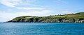
 Cape Clear - geograph.org.uk - 18540.jpg 640 × 480; 73 KB
-
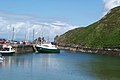
 Cape Clear Harbour.jpg 4,032 × 3,024; 3.74 MB
-
 Cape Clear Island - N Harbour - geograph.org.uk - 6008817.jpg 5,184 × 2,920; 5.82 MB
-
 Cape Clear Island - North Harbour - geograph.org.uk - 6008614.jpg 5,184 × 2,920; 4.96 MB
-
 Cape Clear Island - North Harbour - geograph.org.uk - 6008616.jpg 5,184 × 2,920; 5 MB
-
 Cape Clear Island - South Harbour - geograph.org.uk - 6008623.jpg 5,184 × 2,920; 5.18 MB
-
 Cape Clear Island - The Bill of Cape Clear - geograph.org.uk - 6008798.jpg 5,184 × 2,920; 4.76 MB
-
 Cape Clear Island Baile Iarthach Thuadh.jpg 1,400 × 258; 102 KB
-
 Cape Clear Island.jpg 4,326 × 2,879; 3.53 MB
-
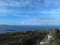
 CapeClearCoast.jpg 1,280 × 960; 595 KB
-
 CapeClearFerryInHarbour.jpg 1,280 × 960; 612 KB
-
 CapeClearGraveyardAndInnerHarbour.jpg 1,280 × 960; 654 KB
-
 CapeClearInnerHarbourFromHill.jpg 1,280 × 960; 604 KB
-
 CapeClearInnerHarbourView.jpg 1,280 × 960; 550 KB
-
 CapeClearLandscape.jpg 1,280 × 960; 566 KB
-
 CapeClearNaomhCiaranFerry.jpg 1,280 × 960; 521 KB
-
 CapeClearNorthernView.jpg 1,280 × 960; 630 KB
-
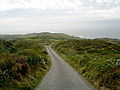
 CapeClearRoad.jpg 1,280 × 960; 614 KB
-
 Carberys100.jpg 3,264 × 2,448; 1.03 MB
-
 Clear Island - croix de cimetière.jpg 3,310 × 4,965; 12.52 MB
-
 Clear Island, north harbour - geograph.org.uk - 98530.jpg 640 × 401; 85 KB
-
 Clear Island.jpg 6,037 × 2,550; 10.86 MB
-
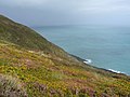
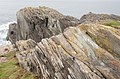
 Coastal Features - geograph.org.uk - 5588869.jpg 3,120 × 4,160; 3.89 MB
-
 Dun an Oir, Cleire (geograph 2612642).jpg 480 × 640; 71 KB
-

-

-
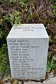 Fastnet Race 1979.jpg 4,032 × 6,048; 18.95 MB
-

-

-
-

-

-

-
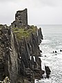
 Lighthouse monument - geograph.org.uk - 267810.jpg 640 × 480; 126 KB
-
 Loch Iorol, Cleire - geograph.org.uk - 2612728.jpg 640 × 430; 59 KB
-
 Ordnance Survey Ireland Half-Inch Sheet 24 Bantry, Published 1951.jpg 12,514 × 8,611; 9.3 MB
-
 Pointanbullig, Cape Clear Island - geograph.org.uk - 2615663.jpg 640 × 460; 58 KB
-
 Puerto de Cape Clear - panoramio.jpg 1,760 × 1,168; 248 KB
-

-
 Sea Arches - geograph.org.uk - 5589073.jpg 1,200 × 1,600; 360 KB
-
 Sign to Loch Ioral, Clear Island - geograph.org.uk - 2612632.jpg 640 × 427; 65 KB
-
 Slipway on Clear Island - geograph.org.uk - 2614878.jpg 640 × 427; 41 KB
-
 The coast road - geograph.org.uk - 5588914.jpg 4,160 × 3,120; 4.17 MB
-
-
 The Old Post Office, Clear Island - geograph.org.uk - 2615135.jpg 640 × 446; 58 KB
-
 The Wedding Stones, Clear Island - geograph.org.uk - 2614890.jpg 640 × 427; 53 KB
-
 Towards South Harbour, Cape Clear - geograph.org.uk - 2615576.jpg 640 × 480; 57 KB


.jpg)


