Category:Capel, Surrey
English: Capel is a village in Surrey situated about 6 miles south of Dorking alongside the A24 road. Neighbouring villages are Ockley, Coldharbour and Newdigate. The pub is called The Crown; there are also several shops, a church, St John the Baptist, a Friends Meeting House (see history below), a first and middle school, a garage, a cricket club and a tennis club. The village is served by Ockley railway station on the Mole Valley Line between Dorking and Horsham. A bus service runs to Dorking and Horsham.
village and civil parish in Surrey, UK  | |||||
| Upload media | |||||
| Instance of | |||||
|---|---|---|---|---|---|
| Location | Mole Valley, Surrey, South East England, England | ||||
| Area |
| ||||
| Said to be the same as | Capel (Wikimedia duplicated page, civil parish) | ||||
 | |||||
Subcategories
This category has the following 9 subcategories, out of 9 total.
B
C
- Capel Methodist Chapel (5 F)
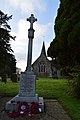
- Capel War Memorial, Surrey (4 F)
- The Crown, Capel (5 F)
F
- Friends Meeting House, Capel (4 F)
L
S
- Shiremark Mill, Capel (18 F)
Media in category "Capel, Surrey"
The following 200 files are in this category, out of 560 total.
(previous page) (next page)-

-
 A farming landscape - geograph.org.uk - 4346459.jpg 640 × 426; 46 KB
-
 A field in south Surrey - geograph.org.uk - 4346458.jpg 640 × 426; 50 KB
-
 A London Country bus at Coldharbour - geograph.org.uk - 3752878.jpg 2,163 × 1,830; 614 KB
-
 A most unusual sign - geograph.org.uk - 3177729.jpg 800 × 600; 182 KB
-
 A shaded Temple Lane - geograph.org.uk - 3579906.jpg 3,264 × 2,448; 5.33 MB
-
 A Surrey field - geograph.org.uk - 4151186.jpg 640 × 430; 80 KB
-
 A young crop poking through - geograph.org.uk - 4367895.jpg 640 × 426; 64 KB
-
 A24 exit to Horsham, Beare Green - geograph.org.uk - 2375872.jpg 1,597 × 1,010; 506 KB
-
 A24 south to Kingsfold - geograph.org.uk - 2874223.jpg 4,000 × 3,000; 3.47 MB
-
 Abinger Forest, Public Bridleway - geograph.org.uk - 4451046.jpg 3,360 × 2,520; 7.3 MB
-
 Abinger Road - geograph.org.uk - 4489158.jpg 1,200 × 800; 1.64 MB
-
 Abinger Road and Broomehall Road junction - geograph.org.uk - 5579794.jpg 5,202 × 3,465; 3.21 MB
-
 Abinger Road, Coldharbour - geograph.org.uk - 4293474.jpg 2,560 × 1,920; 2 MB
-
 Abinger Road, Coldharbour - geograph.org.uk - 5190455.jpg 2,048 × 1,536; 1.41 MB
-
 Aldhurst Farm - geograph.org.uk - 4346558.jpg 640 × 426; 77 KB
-
 Aldhurst Farmhouse - geograph.org.uk - 4346561.jpg 640 × 426; 84 KB
-
 Alterations on Scramble Track by the Sussex Border Path - geograph.org.uk - 2874126.jpg 4,000 × 3,000; 3.57 MB
-
 Anstie Lane - geograph.org.uk - 2278916.jpg 2,560 × 1,920; 1.77 MB
-
 Anstie Lane, looking south - geograph.org.uk - 5579738.jpg 5,202 × 3,465; 3.52 MB
-
 Anstie Lane, looking towards East Lodge - geograph.org.uk - 5579731.jpg 5,202 × 3,465; 4.32 MB
-
 Anstiebury Farm gate - geograph.org.uk - 5579742.jpg 5,202 × 3,465; 3.08 MB
-
 Arable land south of Temple Lane - geograph.org.uk - 3579920.jpg 3,172 × 2,331; 3.4 MB
-
 Autumn beeches on Coldharbour Common - geograph.org.uk - 2143861.jpg 2,272 × 1,704; 3.14 MB
-
 Autumn colour - geograph.org.uk - 4346454.jpg 640 × 426; 82 KB
-

-

-
 Autumnal colour - geograph.org.uk - 4359546.jpg 640 × 426; 103 KB
-
 Barn at Bearehurst - geograph.org.uk - 2278893.jpg 2,560 × 1,920; 1.76 MB
-
 Barn at Wattlehurst - geograph.org.uk - 4143035.jpg 640 × 430; 66 KB
-
 Barn by the Sussex Border Path - geograph.org.uk - 2845433.jpg 4,000 × 3,000; 3.51 MB
-
 Barn conversion near Holmwood station - geograph.org.uk - 5578880.jpg 5,202 × 3,465; 3.13 MB
-
 Barn, Collickmoor Farm (geograph 6598010).jpg 1,024 × 684; 229 KB
-
 Barn, Wattlehurst - geograph.org.uk - 4143036.jpg 640 × 430; 88 KB
-
 Barns at Bearehurst - geograph.org.uk - 5581324.jpg 5,202 × 3,465; 3.61 MB
-
 Bay Cottage, Capel - geograph.org.uk - 1153003.jpg 640 × 480; 102 KB
-
 Beare Green Road - geograph.org.uk - 1509783.jpg 640 × 480; 95 KB
-
 Beare Green, Palmer's Farm - geograph.org.uk - 4383134.jpg 4,608 × 3,456; 6 MB
-
 Beare Green, The 'British Raj' - geograph.org.uk - 4383125.jpg 4,608 × 3,456; 6.41 MB
-
 Beare Green, Wigmore Lodge - geograph.org.uk - 4383101.jpg 3,480 × 2,562; 4.96 MB
-
 Bearehurst Byre - geograph.org.uk - 2278900.jpg 2,560 × 1,920; 1.4 MB
-
 Bearehurst estate - geograph.org.uk - 4383083.jpg 4,608 × 3,456; 6.22 MB
-
 Bearehurst estate road and lodge - geograph.org.uk - 5581326.jpg 5,202 × 3,465; 4.78 MB
-
 Bearehurst Lodge - geograph.org.uk - 4383057.jpg 4,320 × 3,240; 5.5 MB
-
 Bearehurst Lodge - geograph.org.uk - 5181615.jpg 2,048 × 1,536; 1.51 MB
-
 Beech line - geograph.org.uk - 2143856.jpg 2,272 × 1,704; 2.98 MB
-
 Beech roots - geograph.org.uk - 2273303.jpg 640 × 480; 199 KB
-
 Bench on open space above Capel - geograph.org.uk - 1152563.jpg 640 × 427; 102 KB
-
 Bennett's Wood - geograph.org.uk - 4362662.jpg 640 × 426; 61 KB
-
 Bluebell wood and stream near Minnickfold - geograph.org.uk - 779150.jpg 640 × 480; 157 KB
-
 Bluebells in Frank's Wood - geograph.org.uk - 2940151.jpg 4,705 × 1,270; 1.15 MB
-
 Bluebells in Frank's Wood - geograph.org.uk - 2940158.jpg 4,207 × 1,449; 1.41 MB
-
 Bridge over Fylls Brook on Rusper Road - geograph.org.uk - 5329780.jpg 800 × 600; 180 KB
-
 Bridleway 157 near Hillhouse Farm - geograph.org.uk - 2319296.jpg 640 × 480; 193 KB
-
-
 Bridleway BW183 - geograph.org.uk - 3211251.jpg 4,000 × 3,000; 4.22 MB
-
 Bridleway gates near Hillhouse Farm - geograph.org.uk - 5811967.jpg 1,024 × 768; 516 KB
-

-
 Bridleway junction south of Beare Green - geograph.org.uk - 2319317.jpg 640 × 480; 185 KB
-
 Bridleway over Railway, near Kingsfold - geograph.org.uk - 1779288.jpg 800 × 600; 211 KB
-
 Bridleway towards Holmwood - geograph.org.uk - 5581330.jpg 5,202 × 3,465; 4.76 MB
-
 Bridleway towards Seaman's Green - geograph.org.uk - 5811969.jpg 1,024 × 768; 482 KB
-
 Bridleway with blossom to Rusper Road - geograph.org.uk - 5330390.jpg 800 × 600; 207 KB
-
 Brook Copse, Surrey, Stile and wooden footbridge - geograph.org.uk - 4395196.jpg 2,304 × 1,728; 5.19 MB
-
 Brook with footbridge and horse crossing - geograph.org.uk - 5812216.jpg 1,024 × 768; 456 KB
-
 Broome Hall, Coldharbour - geograph.org.uk - 2277910.jpg 2,560 × 1,920; 1.61 MB
-
 Broomehall Road, Coldharbour - geograph.org.uk - 4818714.jpg 1,876 × 1,262; 905 KB
-
 Bus stop by Laundry Way Capel - geograph.org.uk - 3598307.jpg 3,264 × 2,448; 3.58 MB
-
 By Great Copse, Coldharbour - geograph.org.uk - 2277920.jpg 2,560 × 1,920; 1.62 MB
-
 Camping on Wattlehurst Farm - geograph.org.uk - 1972089.jpg 640 × 428; 89 KB
-
 Capel News - geograph.org.uk - 4359999.jpg 640 × 426; 77 KB
-
 Capel News - geograph.org.uk - 4360000.jpg 640 × 426; 68 KB
-
 Capel pressure reducing station - geograph.org.uk - 1982533.jpg 640 × 428; 122 KB
-
 Capel War Memorial - geograph.org.uk - 4359640.jpg 426 × 640; 87 KB
-
 Capel War Memorial - geograph.org.uk - 4359644.jpg 426 × 640; 65 KB
-
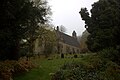
 Capel, Church of St. John the Beptist - geograph.org.uk - 4380701.jpg 3,840 × 2,880; 7 MB
-
 Capel, Road junction - geograph.org.uk - 4380731.jpg 2,560 × 1,920; 4.96 MB
-
 Capel, United Kingdom (Unsplash).jpg 6,016 × 4,016; 12.44 MB
-
 Carterdale Cottages - geograph.org.uk - 5330442.jpg 800 × 600; 116 KB
-
 Carters Car Care - geograph.org.uk - 904872.jpg 640 × 480; 121 KB
-
 Carters of Capel - geograph.org.uk - 1153563.jpg 640 × 427; 106 KB
-
 Cattle grid - geograph.org.uk - 4346467.jpg 640 × 426; 60 KB
-
 Cattle shed, Pleystowe Farm - geograph.org.uk - 4362698.jpg 640 × 426; 72 KB
-
 Charlotte Broadwood Flats - geograph.org.uk - 4359582.jpg 640 × 426; 71 KB
-
 Charlotte Broadwood Flats - geograph.org.uk - 4359585.jpg 640 × 426; 78 KB
-
 Cherry Tree Cottage - geograph.org.uk - 5811748.jpg 1,024 × 768; 460 KB
-
 Christ Church Coldharbour - geograph.org.uk - 3685113.jpg 1,600 × 1,200; 657 KB
-
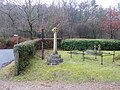
 Christ Church lych gate, Coldharbour - geograph.org.uk - 5581309.jpg 5,202 × 3,465; 5.29 MB
-
 Christ Church, Coldharbour - geograph.org.uk - 4818715.jpg 1,486 × 2,012; 927 KB
-
 Christ Church, Coldharbour - geograph.org.uk - 4818716.jpg 1,952 × 1,400; 1.13 MB
-
 Christ church, Coldharbour - geograph.org.uk - 5579802.jpg 5,202 × 3,465; 3.12 MB
-

-
 Christ Church, Coldharbour, churchyard - geograph.org.uk - 5272033.jpg 640 × 480; 124 KB
-

-
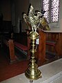 Christ Church, Coldharbour, lectern - geograph.org.uk - 5272074.jpg 480 × 640; 61 KB
-
 Christ Church, Coldharbour, seat - geograph.org.uk - 5272036.jpg 640 × 480; 109 KB
-

-

-
-
-

-
-

-
 Christ Church, Coldharbour, tablet - geograph.org.uk - 5272075.jpg 640 × 480; 70 KB
-

-

-
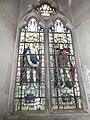
 Church of St John The Baptist - geograph.org.uk - 4359609.jpg 640 × 426; 71 KB
-
 Church of St John The Baptist - geograph.org.uk - 4359618.jpg 426 × 640; 70 KB
-
 Church of St John The Baptist - geograph.org.uk - 4359622.jpg 426 × 640; 73 KB
-
 Church of St John The Baptist - geograph.org.uk - 4359625.jpg 640 × 426; 98 KB
-
 Clark's Green roundabout - geograph.org.uk - 147823.jpg 640 × 480; 97 KB
-
 Clark's Green roundabout, Capel - geograph.org.uk - 2375836.jpg 1,597 × 1,081; 330 KB
-
 Clay Pit, Clock House, near Capel - geograph.org.uk - 1779315.jpg 800 × 600; 127 KB
-
 Coldharbour - Cricket Pavilion - geograph.org.uk - 5259214.jpg 2,560 × 1,920; 2.8 MB
-
 Coldharbour - Telephone Call Box - geograph.org.uk - 5259210.jpg 2,560 × 1,920; 2.7 MB
-
 Coldharbour cottages - geograph.org.uk - 5579768.jpg 5,202 × 3,465; 2.19 MB
-
 Coldharbour Lane - geograph.org.uk - 5579793.jpg 5,202 × 3,465; 2.87 MB
-
 Coldharbour Lane in Abinger Forest - geograph.org.uk - 4294565.jpg 2,560 × 1,920; 2.03 MB
-
 Coldharbour parish hall - geograph.org.uk - 5579798.jpg 5,202 × 3,465; 2.89 MB
-
 Coldharbour, Beeches at the Landslip car park - geograph.org.uk - 4247857.jpg 2,936 × 2,164; 5.91 MB
-
 Coldharbour, Christ Church - geograph.org.uk - 4247886.jpg 3,584 × 2,688; 7.11 MB
-
 Coldharbour, Christ Church - geograph.org.uk - 4355520.jpg 3,678 × 2,456; 7.05 MB
-
 Coldharbour, Crockers Wood Cottages - geograph.org.uk - 4247956.jpg 3,840 × 2,880; 6.37 MB
-
 Coldharbour, Gordon Lodge - geograph.org.uk - 4247898.jpg 3,475 × 2,630; 6.65 MB
-
 Coldharbour, Landslip car park - geograph.org.uk - 4247873.jpg 3,840 × 2,880; 6.76 MB
-
 Coldharbour, Track to Leith Hill - geograph.org.uk - 4247921.jpg 2,560 × 1,920; 5.52 MB
-
 Collickmoor Farm - geograph.org.uk - 2293643.jpg 640 × 480; 135 KB
-
 Cottage in Capel - geograph.org.uk - 4359983.jpg 640 × 426; 70 KB
-
 Cottage in Capel - geograph.org.uk - 4359984.jpg 640 × 426; 85 KB
-
 Cottage on Rusper Road - geograph.org.uk - 5846723.jpg 2,048 × 1,536; 1.42 MB
-
 Cottage, Coldharbour - geograph.org.uk - 4039091.jpg 1,024 × 768; 194 KB
-
 Cottages at Coldharbour - geograph.org.uk - 3311354.jpg 1,024 × 826; 217 KB
-
 Countryside around Lodge Farm - geograph.org.uk - 3834227.jpg 1,920 × 2,356; 814 KB
-
 Countryside near Capel - geograph.org.uk - 4362653.jpg 640 × 426; 69 KB
-
 Decaying Barn at Temple Elfande - geograph.org.uk - 632225.jpg 640 × 480; 427 KB
-
 Delightful bridleway west of Coldharbour - geograph.org.uk - 3177721.jpg 800 × 600; 199 KB
-
 Derelict Brickworks, Capel - geograph.org.uk - 48558.jpg 640 × 480; 56 KB
-
 Drive to Knoll Farm - geograph.org.uk - 1151834.jpg 427 × 640; 99 KB
-
 East Lodge on Anstie Lane - geograph.org.uk - 5181673.jpg 2,048 × 1,536; 1.47 MB
-
 Edge of Rome Wood - geograph.org.uk - 4371744.jpg 640 × 426; 51 KB
-
 Entering Rome Wood - geograph.org.uk - 4371745.jpg 640 × 426; 118 KB
-
 Entrance to Brick Works on Thurbarns Hill - geograph.org.uk - 3581267.jpg 3,264 × 2,448; 4.94 MB
-
 Entrance to Knoll Farm - geograph.org.uk - 2847044.jpg 4,000 × 3,000; 3.48 MB
-
 Entrance to platform 1, Holmwood Station - geograph.org.uk - 5166275.jpg 2,048 × 1,536; 1.45 MB
-
 Entrance to platform 2, Holmwood Station - geograph.org.uk - 5166278.jpg 2,048 × 1,536; 1.45 MB
-
 Entrance to the Nightless Copse guest house - geograph.org.uk - 5846714.jpg 2,048 × 1,536; 1.51 MB
-
 Extensive ploughed field - geograph.org.uk - 4367894.jpg 640 × 426; 63 KB
-
 Fallow field - geograph.org.uk - 4367884.jpg 640 × 426; 61 KB
-
 Farm machinery - geograph.org.uk - 4142951.jpg 640 × 430; 106 KB
-
 Farm track - geograph.org.uk - 4143026.jpg 640 × 430; 84 KB
-
 Farm track at the end of Temple Lane near Capel - geograph.org.uk - 5166359.jpg 1,986 × 1,450; 1.36 MB
-
 Farm track goes north from Temple Lane - geograph.org.uk - 5330474.jpg 800 × 600; 187 KB
-
 Farm track leaves bridleway - geograph.org.uk - 5330396.jpg 800 × 600; 117 KB
-
 Farm Track Near Bearehurst - geograph.org.uk - 2278816.jpg 2,560 × 1,920; 1.64 MB
-
 Farmland near Taylor's Gill Wood - geograph.org.uk - 4367906.jpg 640 × 426; 64 KB
-
 Farmland, Pleystowe Farm - geograph.org.uk - 4367881.jpg 640 × 426; 56 KB
-
 Field and woodland by Henhurst Cross Lane - geograph.org.uk - 3596613.jpg 3,264 × 2,448; 3.27 MB
-
 Field by Rusper Road seen from bridleway (geograph 5330381).jpg 800 × 600; 117 KB
-
 Field from the footpath to Moorhouse Lane - geograph.org.uk - 5578883.jpg 5,202 × 3,465; 4.1 MB
-
 Field near Lipscomb's Corner - geograph.org.uk - 4371859.jpg 640 × 426; 87 KB
-
 Field near Lodge Farm - geograph.org.uk - 4346455.jpg 640 × 426; 62 KB
-
 Field near Taylor's Gill Wood - geograph.org.uk - 4367911.jpg 640 × 426; 54 KB
-
 Field Near Waterden Wood - geograph.org.uk - 2277359.jpg 2,560 × 1,920; 1.65 MB
-
 Field next to Rome Wood - geograph.org.uk - 4371847.jpg 640 × 426; 67 KB
-
 Field of Stubble - geograph.org.uk - 4367887.jpg 640 × 426; 83 KB
-
 Field of stubble - geograph.org.uk - 4367888.jpg 640 × 426; 84 KB
-
 Filling Station - geograph.org.uk - 4359629.jpg 640 × 426; 55 KB
-
 Fine tree, Lyne House - geograph.org.uk - 4371734.jpg 640 × 426; 83 KB
-
 Fishing lake, Henfold Lakes - geograph.org.uk - 2319263.jpg 640 × 480; 123 KB
-
 Footbridge and ford, Henfold Lakes - geograph.org.uk - 5811693.jpg 1,024 × 768; 425 KB
-
 Footbridge over Gages Gill - geograph.org.uk - 4371844.jpg 640 × 426; 125 KB
-
 Footbridge over Gages Gill - geograph.org.uk - 4371891.jpg 640 × 426; 114 KB
-
 Footbridge over stream - geograph.org.uk - 4346453.jpg 640 × 426; 97 KB
-
 Footbridge, Strood Copse - geograph.org.uk - 4362688.jpg 640 × 426; 134 KB
-
 Footbridge, Taylor's Gill Wood - geograph.org.uk - 4367900.jpg 640 × 426; 128 KB
-
 Footpath 212 enters Lodge Copse - geograph.org.uk - 2319396.jpg 640 × 480; 164 KB
-
 Footpath 250 in a beech plantation - geograph.org.uk - 2293633.jpg 640 × 480; 182 KB
-
 Footpath along hedgeline - geograph.org.uk - 4346447.jpg 640 × 426; 108 KB
-
 Footpath along woodland edge - geograph.org.uk - 4151189.jpg 640 × 430; 107 KB
-
 Footpath and stile - geograph.org.uk - 2143859.jpg 2,272 × 1,704; 2.77 MB
-
 Footpath from Capel - geograph.org.uk - 4362649.jpg 640 × 426; 116 KB
-
 Footpath goes west from Rusper Road - geograph.org.uk - 5330423.jpg 800 × 600; 247 KB
-
 Footpath heading south - geograph.org.uk - 4362655.jpg 640 × 426; 99 KB
-
 Footpath into Birchy Copse - geograph.org.uk - 5811980.jpg 1,024 × 768; 526 KB
-
 Footpath junction - geograph.org.uk - 4362674.jpg 640 × 426; 88 KB
-
 Footpath leading from Moorhurst Lane to Bognor Road (A29) - geograph.org.uk - 5578885.jpg 5,202 × 3,465; 4.63 MB
-
 Footpath to Broomehall Road - geograph.org.uk - 5813359.jpg 1,024 × 768; 499 KB
-
 Footpath to Bushy Copse - geograph.org.uk - 2277559.jpg 2,560 × 1,920; 1.66 MB
-
 Footpath to Bushy Copse - geograph.org.uk - 5581316.jpg 5,202 × 3,465; 3.36 MB
-
 Footpath to Capel - geograph.org.uk - 4359542.jpg 640 × 426; 125 KB
-
 Footpath to Capel - geograph.org.uk - 4359543.jpg 640 × 426; 114 KB
-
 Footpath to Holmwood - geograph.org.uk - 5581337.jpg 5,202 × 3,465; 3.81 MB
-
 Footpath to Lyne Farm - geograph.org.uk - 4367879.jpg 640 × 426; 58 KB
-
 Footpath to Lyne Farm - geograph.org.uk - 4367929.jpg 640 × 426; 82 KB
-
 Footpath to Lyne House - geograph.org.uk - 4367916.jpg 640 × 426; 60 KB
-
 Footpath to Strood Copse - geograph.org.uk - 4362677.jpg 640 × 426; 73 KB
-
 Footpath to Vicarage Lane - geograph.org.uk - 4359550.jpg 640 × 426; 118 KB
-
 Footpath towards Coldharbour - geograph.org.uk - 2273273.jpg 640 × 480; 192 KB
-
 Footpath tree tunnel - geograph.org.uk - 2143854.jpg 1,704 × 2,272; 3.28 MB
-
 Footpath westward - geograph.org.uk - 4346462.jpg 640 × 426; 68 KB


_-_geograph.org.uk_-_3177742.jpg)
_-_geograph.org.uk_-_3177744.jpg)


.jpg)


.jpg)


_-_geograph.org.uk_-_5272056.jpg)
_-_geograph.org.uk_-_5272057.jpg)
_-_geograph.org.uk_-_5272059.jpg)
_-_geograph.org.uk_-_5272060.jpg)
_-_geograph.org.uk_-_5272062.jpg)
_-_geograph.org.uk_-_5272064.jpg)
_-_geograph.org.uk_-_5272076.jpg)

_-_geograph.org.uk_-_5272069.jpg)
_-_geograph.org.uk_-_5272071.jpg)


.jpg)


_-_geograph.org.uk_-_5578885.jpg)


