Category:Carlingford, County Louth
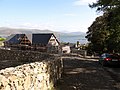
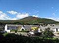
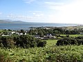
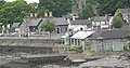
English: Carlingford is a coastal village in northern County Louth, Ireland. It is situated between Carlingford Lough (to the east) and Slieve Foy, sometimes known as Carlingford Mountain (to the west) at GPS co-ordinates: 54.02.463N 6.11.120W.
Español: Carlingford en inglés y Cairlinn en gaélico es un pueblo medieval en el norte del Condado de Louth (Contae Lú en gaélico), en Irlanda (Éire en gaélico), en la frontera con Irlanda del Norte (Tuaisceart Éireann en gaélico). Se encuentra entre la desembocadura del río Newry (Abhainn Ghleann Rí en gaélico) en Carlingford Lough (Loch Chairlinn en gaélico) (al este) y la montaña llamada Slieve Foy(al oeste), en las coordenadas GPS N54.02.463 W6.11.120. En las carreteras R176/R173 entre la punta de Greenore (An Grianphort en gaélico) y Omeath (Ó Méith en gaélico). Carlingford está a 27 km. al norte de Dundalk (Dún Dealgan en gaélico) (por carretera, 15.6 km en línea recta) y 90 km. al norte de Dublín (Ath Cliath en gaélico).
Gaeilge: Is baile beag i g Contae Lú é Cairlinn atá suite le chois Loch Cairlinn. Tá an baile gar don teorann idir Phoblacht na hÉireann agus Tuaisceart Éireann, 12 míle ó Dhún Dealgan agus 8 mile ón Iúr. Tá timpeall 2,000 daoine ina chónaí ann.
Slovenčina: Carlingford ( ír. Cairlinn) je obec v Írsku, v grófstve Louth. Žije tu 623 obyvateľov (2006).
town in Leinster, Ireland  | |||||
| Upload media | |||||
| Instance of | |||||
|---|---|---|---|---|---|
| Location | County Louth, Leinster, Ireland | ||||
| Area |
| ||||
| Elevation above sea level |
| ||||
 | |||||
Subcategories
This category has the following 9 subcategories, out of 9 total.
A
- The Abbey Bar, Carlingford (2 F)
C
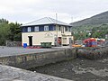
- Carlingford Marina (4 F)
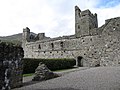
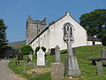
- Carlingford Priory (114 F)
K
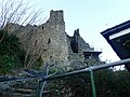
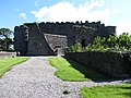
- King John's Castle (Carlingford) (39 F)
M
- The Mint, Carlingford (6 F)
T
- Tholsel Gate, Carlingford (8 F)
Media in category "Carlingford, County Louth"
The following 200 files are in this category, out of 344 total.
(previous page) (next page)-
 'No Camping or Overnight Parking' sign in the Harbour area - geograph.org.uk - 5404168.jpg 3,907 × 2,931; 1.64 MB
-
 20180403 203732 Carlingford.jpg 2,880 × 2,160; 1.69 MB
-
 20180403 204504 Carlingford.jpg 2,880 × 2,160; 3.1 MB
-
 20180403 204659 Carlingford.jpg 2,880 × 2,160; 1.84 MB
-
 20180403 204954 Carlingford.jpg 2,880 × 2,160; 1.97 MB
-
 20180403 204956 Carlingford.jpg 2,880 × 2,160; 2.24 MB
-
 20180403 204959 Carlingford.jpg 2,880 × 2,160; 2.58 MB
-
 20180403 205202 Carlingford.jpg 2,880 × 2,160; 2.13 MB
-
 20180403 205756 Carlingford.jpg 2,880 × 2,160; 1.52 MB
-
-
 A Leprechaun and his Wee Pot of Gold on Ghan Road - geograph.org.uk - 5404263.jpg 3,936 × 2,207; 2.3 MB
-

-
-

-

-
 Abbey Court - sheltered housing for the elderly - geograph.org.uk - 3107604.jpg 1,024 × 755; 152 KB
-
 Aerial View of Carlingford Loch, Newry Canal and Newry.jpg 320 × 318; 56 KB
-

-

-
 Alleyway off Market Street, Carlingford - geograph.org.uk - 3111147.jpg 768 × 1,024; 160 KB
-
 Arrival at Carlingford harbour - geograph.org.uk - 251799.jpg 640 × 426; 148 KB
-
 Art work on builders' entrance doors at King John's Castle - geograph.org.uk - 5692374.jpg 3,197 × 2,863; 7.02 MB
-
-
 Beautifully renovated house on Old Quay Lane, Carlingford - geograph.org.uk - 5406654.jpg 4,000 × 3,000; 3.51 MB
-
 Boats at the southern breakwater of Carlingford Harbour - geograph.org.uk - 5591847.jpg 2,941 × 1,699; 2.42 MB
-
 Boats in Carlingford Harbour - geograph.org.uk - 5854686.jpg 3,330 × 1,968; 2.23 MB
-
 Boats tied up at Carlingford north breakwater - geograph.org.uk - 5405369.jpg 2,927 × 3,903; 1.71 MB
-
 Bog Asphodel - geograph.org.uk - 1402477.jpg 600 × 400; 206 KB
-
 Bollard, Carlingford harbour (1) - geograph.org.uk - 2434413.jpg 831 × 570; 113 KB
-
 Bollard, Carlingford harbour (2) - geograph.org.uk - 2434425.jpg 709 × 571; 114 KB
-
 Bracken infestation on Carlingsford Common - geograph.org.uk - 5570006.jpg 3,022 × 1,806; 2.07 MB
-
 Bridge on the Tain Way track - geograph.org.uk - 5692090.jpg 4,000 × 3,000; 7.77 MB
-
 Carlingford Abbey from Dundalk Street - geograph.org.uk - 3112654.jpg 1,024 × 946; 258 KB
-
 Carlingford Abbey from the south - geograph.org.uk - 3112679.jpg 1,024 × 768; 223 KB
-
 Carlingford Adventure Assault Course in Slieve Foye Forest - geograph.org.uk - 5691233.jpg 3,922 × 2,894; 5.73 MB
-
 Carlingford Adventure Centre - geograph.org.uk - 5404307.jpg 3,813 × 2,861; 1.8 MB
-
 Carlingford and Slieve Foye - geograph.org.uk - 174420.jpg 640 × 426; 151 KB
-
 Carlingford Arms Pub and Restaurant, Carlingford - geograph.org.uk - 5406630.jpg 3,843 × 2,881; 1.52 MB
-
 Carlingford from across the Harbour - geograph.org.uk - 987301.jpg 640 × 428; 55 KB
-
 Carlingford from the Commons Loop Path - geograph.org.uk - 3160201.jpg 1,024 × 765; 202 KB
-
 Carlingford Garda Station - geograph.org.uk - 3092795.jpg 768 × 1,024; 154 KB
-
 Carlingford harbour - geograph.org.uk - 282882.jpg 640 × 426; 129 KB
-
 Carlingford Harbour - geograph.org.uk - 5849098.jpg 2,587 × 1,888; 2 MB
-
 Carlingford harbour - geograph.org.uk - 697738.jpg 640 × 401; 82 KB
-
 Carlingford harbour - panoramio.jpg 2,592 × 1,347; 2.23 MB
-
 Carlingford Harbour - panoramio.jpg 2,592 × 1,936; 1.9 MB
-
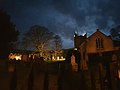
 Carlingford Harbour as nightfall approaches - geograph.org.uk - 5690647.jpg 3,920 × 2,890; 5.75 MB
-
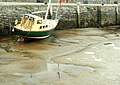
 Carlingford Harbour at low tide - geograph.org.uk - 3160419.jpg 1,024 × 676; 147 KB
-
 Carlingford Harbour at Low Water - geograph.org.uk - 5404167.jpg 3,907 × 2,931; 2.19 MB
-
 Carlingford Harbour at Low Water - geograph.org.uk - 5849235.jpg 3,172 × 1,836; 2.64 MB
-
 Carlingford Harbour Co Louth - geograph.org.uk - 974900.jpg 640 × 428; 76 KB
-
 Carlingford Harbour from Carlingford Mountain - geograph.org.uk - 5548820.jpg 2,436 × 1,583; 972 KB
-
 Carlingford Harbour from Goylin Pass - geograph.org.uk - 3162109.jpg 1,024 × 768; 160 KB
-
 Carlingford Harbour from the Carlingford Loops - geograph.org.uk - 5691174.jpg 2,655 × 1,982; 2.2 MB
-
 Carlingford Harbour in Moonlight - geograph.org.uk - 987282.jpg 640 × 346; 24 KB
-
 Carlingford Heritage Centre.jpg 2,592 × 1,944; 1.74 MB
-

-

-

-
 Carlingford Lough from R173 - geograph.org.uk - 5403217.jpg 3,797 × 2,847; 1.51 MB
-
 Carlingford Lough from Slieve Foye Woodland - geograph.org.uk - 5700399.jpg 3,102 × 2,000; 2.45 MB
-
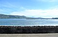
 Carlingford Lough.jpg 800 × 598; 128 KB
-
 Carlingford Marina - geograph.org.uk - 3092460.jpg 1,024 × 736; 122 KB
-
 Carlingford Marina - geograph.org.uk - 3114646.jpg 1,024 × 553; 114 KB
-
 Carlingford Marina at Eventide - geograph.org.uk - 5585889.jpg 3,968 × 2,513; 1 MB
-
 Carlingford Marina in the morning sun - geograph.org.uk - 5585892.jpg 3,906 × 2,872; 5.6 MB
-
 Carlingford Mountain and harbour - geograph.org.uk - 617842.jpg 640 × 362; 61 KB
-
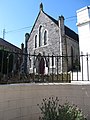 Carlingford Presbyterian Church - geograph.org.uk - 4432112.jpg 1,200 × 1,600; 437 KB
-
 Carlingford Presbyterian Church - geograph.org.uk - 5402102.jpg 3,000 × 4,000; 2.86 MB
-
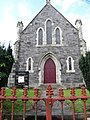 Carlingford Presbyterian Church, Newry Street - geograph.org.uk - 3111108.jpg 768 × 1,024; 239 KB
-
 Carlingford Priory from Dundalk Street - geograph.org.uk - 3160933.jpg 1,024 × 673; 169 KB
-
 Carlingford Priory from the footpath - geograph.org.uk - 3160866.jpg 1,024 × 757; 162 KB
-
 Carlingford Priory from the south - geograph.org.uk - 3160917.jpg 1,024 × 757; 233 KB
-
 Carlingford Sailing Club - geograph.org.uk - 5404183.jpg 3,998 × 2,424; 1.78 MB
-
 Carlingford Town and Lough.jpg 2,596 × 1,873; 976 KB
-
 Carlingford Town.JPG 3,072 × 2,304; 1.84 MB
-
 Carlingford village - geograph.org.uk - 820434.jpg 640 × 416; 95 KB
-

-
 Carlingford's former Wood Quay - geograph.org.uk - 5405545.jpg 3,651 × 1,930; 1.42 MB
-
 Carlingford's Garda Síochána Station - geograph.org.uk - 5406479.jpg 2,904 × 3,873; 1.3 MB
-
 Carlingford's Heritage Centre - geograph.org.uk - 3112628.jpg 1,024 × 668; 159 KB
-
 Carlingford's north breakwater - geograph.org.uk - 5405500.jpg 3,892 × 2,604; 1.24 MB
-

-
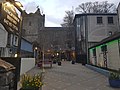
 Carlingford's Tholsel from within the old town - geograph.org.uk - 3109472.jpg 1,024 × 732; 226 KB
-

-
 Carlingford, Cooley peninsula.jpg 640 × 426; 135 KB
-
 Carlingford, July 2010 (01).JPG 4,272 × 2,848; 3.67 MB
-
 Carlingford03.jpg 3,456 × 2,304; 3.07 MB
-
 Castle Hill, Carlingford - geograph.org.uk - 5406648.jpg 4,000 × 3,000; 2.24 MB
-
 Chapel Hill, Carlingford - geograph.org.uk - 3109059.jpg 1,024 × 651; 97 KB
-
 Choppy waters on Carlingford Lough - geograph.org.uk - 3106438.jpg 1,024 × 768; 175 KB
-
 Civil Defence station, Carlingford - geograph.org.uk - 349846.jpg 640 × 426; 142 KB
-
 Clos an Manach estate, Carlingford - geograph.org.uk - 5130543.jpg 3,993 × 2,995; 2.13 MB
-
 Coach, Carlingford - geograph.org.uk - 820532.jpg 640 × 478; 110 KB
-
 Coast Guard House, Newry Street - geograph.org.uk - 3111124.jpg 1,024 × 768; 132 KB
-

-
 Crane on the southern breakwater at Carlingford - geograph.org.uk - 5404479.jpg 2,995 × 3,228; 1.23 MB
-
 Cross roads on the Ghan Road - geograph.org.uk - 5404313.jpg 3,457 × 2,248; 1.18 MB
-
 Dan's Cafe Carlingford - geograph.org.uk - 969114.jpg 640 × 428; 77 KB
-
 Detached houses on Ghan Road, Carlingford - geograph.org.uk - 3108792.jpg 1,024 × 768; 174 KB
-
 Disused granite quarry on Carlingford Mountain - geograph.org.uk - 5549937.jpg 2,949 × 1,690; 1.49 MB
-
 Dundalk Street, Carlingford - geograph.org.uk - 3160945.jpg 1,024 × 769; 185 KB
-
 East breakwater, Carlingford Harbour - geograph.org.uk - 980039.jpg 640 × 480; 60 KB
-
 Elegant stone built houses on Ghan Road - geograph.org.uk - 5404197.jpg 3,929 × 2,095; 1.62 MB
-

-
 Exfoliated grave stone at Carlingford Graveyard - geograph.org.uk - 5402235.jpg 2,626 × 3,501; 2.5 MB
-
 Fields above Carlingford - geograph.org.uk - 980088.jpg 640 × 480; 83 KB
-
 Fishing Boats Carlingford Harbour - geograph.org.uk - 986343.jpg 640 × 405; 69 KB
-
 Floating studio, Carlingford - geograph.org.uk - 1170888.jpg 640 × 388; 80 KB
-
 Footpath at the rear of Carlingford Priory - geograph.org.uk - 3160872.jpg 768 × 1,024; 248 KB
-
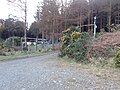
 Forestry road descending towards Carlingford - geograph.org.uk - 5692024.jpg 2,668 × 2,000; 3.52 MB
-
 Forestry road used as part of the Tain Way trail - geograph.org.uk - 5696693.jpg 3,996 × 2,994; 7.96 MB
-
 Forestry track approaching the Slieve Foye Woods - geograph.org.uk - 5695383.jpg 3,998 × 2,998; 5.86 MB
-
 Former cinema, Carlingford - geograph.org.uk - 2434582.jpg 640 × 424; 90 KB
-
 Former railway crossing cottage at Carlingford - geograph.org.uk - 5404501.jpg 3,998 × 1,669; 1.21 MB
-
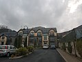
 Four Seasons Hotel and Leisure Club, Carlingford - geograph.org.uk - 5407743.jpg 3,998 × 2,626; 1.81 MB
-
 Garda Telecommunications Mast in Newry Street, Carlingford - geograph.org.uk - 5404551.jpg 3,000 × 4,000; 3.27 MB
-
-

-
 Ghan House, Carlingford - geograph.org.uk - 3160964.jpg 1,024 × 768; 261 KB
-
-
 Harbour Cottages and Oyster Bay Court, Carlingford - geograph.org.uk - 5691204.jpg 3,938 × 2,916; 3.19 MB
-
 Harbour Cottages, Carlingford - geograph.org.uk - 5401876.jpg 3,921 × 2,186; 1.39 MB
-
 Haulbowline Light, Carlingford Lough - panoramio.jpg 2,316 × 1,570; 1.86 MB
-
 Headstone, Carlingford - geograph.org.uk - 397313.jpg 640 × 426; 153 KB
-
 High and dry at Carlingford - geograph.org.uk - 820400.jpg 640 × 451; 90 KB
-
 High water at Carlingford Harbour - geograph.org.uk - 5692138.jpg 3,765 × 2,669; 5.24 MB
-
 High water in Carlingford Harbour - geograph.org.uk - 5403214.jpg 3,998 × 2,518; 1.84 MB
-
 Houses in the North Commons, Carlingford - geograph.org.uk - 5130665.jpg 3,904 × 1,792; 3.11 MB
-
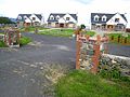
 Housing estate, Carlingford - geograph.org.uk - 980034.jpg 640 × 480; 78 KB
-

-
 Ireland's Ancient East - geograph.org.uk - 5405574.jpg 4,000 × 3,000; 2.16 MB
-
 Irish Customs Drug Watch sign at Carlingford Harbour - geograph.org.uk - 5403777.jpg 2,845 × 3,793; 1.33 MB
-
 King John's Castle and Carlingford Harbour - geograph.org.uk - 5700424.jpg 3,978 × 2,049; 3.72 MB
-

-
 King John's Castle Carlingford - geograph.org.uk - 986317.jpg 640 × 343; 64 KB
-
 King John's Castle from the entrance to the North Quay - geograph.org.uk - 5690652.jpg 2,878 × 3,468; 6.46 MB
-
 King John's Castle from the north - geograph.org.uk - 5406840.jpg 4,000 × 3,000; 3.31 MB
-
 King John's Castle from the Quay - geograph.org.uk - 3111196.jpg 1,024 × 513; 130 KB
-
 King John's Castle from the R173 - geograph.org.uk - 5692136.jpg 2,950 × 2,030; 3.51 MB
-
 King John's Castle from the Railway Bridge - geograph.org.uk - 3106524.jpg 1,024 × 768; 257 KB
-
 King John's Castle, Carlingford - geograph.org.uk - 5404397.jpg 4,000 × 3,000; 2.16 MB
-
 King John's Castle, Carlingford - geograph.org.uk - 5405377.jpg 4,000 × 3,000; 3.88 MB
-
 King John's Castle, Carlingford - geograph.org.uk - 5582309.jpg 2,668 × 2,000; 2.02 MB
-
 King John's Castle, Carlingford - geograph.org.uk - 5689936.jpg 2,628 × 1,947; 2.12 MB
-
 King John's Castle, Carlingford, at eventide - geograph.org.uk - 5692144.jpg 4,000 × 3,000; 2.23 MB
-

-
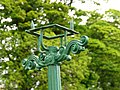 Lamppost, Carlingford - geograph.org.uk - 820486.jpg 640 × 480; 76 KB
-

-

-
 Low water at Carlingford Harbour - geograph.org.uk - 5404170.jpg 3,796 × 2,386; 2.27 MB
-
 Ma Bakers PH in Market Square, Carlingford - geograph.org.uk - 5690659.jpg 4,000 × 3,000; 2.48 MB
-
 Ma Bakers Restaurant , Carlingford - geograph.org.uk - 3109516.jpg 882 × 1,024; 203 KB
-
-
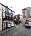
 Market Street from the east - geograph.org.uk - 3109508.jpg 1,024 × 768; 181 KB
-
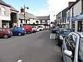 Market Street, Carlingford - geograph.org.uk - 3107945.jpg 1,024 × 768; 196 KB
-
-
 Millgrange House - geograph.org.uk - 980364.jpg 640 × 480; 84 KB
-
 Misty Morning Carlingford Lough - geograph.org.uk - 969106.jpg 640 × 428; 36 KB
-
 Mobile Ice Cream Bar below Taaffes Castle - geograph.org.uk - 3109012.jpg 1,024 × 768; 214 KB
-
 Modern detached villas in St Oliver's Park - geograph.org.uk - 3161070.jpg 1,024 × 574; 147 KB
-
 Modern residential estate in the Grove Road area - geograph.org.uk - 3160998.jpg 1,024 × 769; 181 KB
-
 Modern terrace housing on Ghan Road - geograph.org.uk - 5404189.jpg 3,929 × 2,201; 1.54 MB
-
 Monument to Thomas D'Arcy McGee - geograph.org.uk - 3159184.jpg 1,024 × 768; 211 KB
-
 Morning at Carlingford Marina - geograph.org.uk - 5585881.jpg 3,930 × 2,906; 5.29 MB
-
 Mussel dredgers at Carlingford harbour - geograph.org.uk - 174327.jpg 640 × 426; 147 KB
-
 Mussel dredgers at work off Carlingford - geograph.org.uk - 4340298.jpg 1,600 × 959; 163 KB
-
 New bungalows on the St Oliver's Park hill - geograph.org.uk - 3160138.jpg 1,024 × 767; 212 KB
-
 New house at Monksland - geograph.org.uk - 980093.jpg 640 × 480; 78 KB
-
 New house in Dundalk Street, Carlingford - geograph.org.uk - 3109064.jpg 1,024 × 768; 149 KB
-
-
 New houses in Dundalk Street, Carlingford - geograph.org.uk - 3109030.jpg 1,024 × 768; 166 KB
-
 New houses in St Oliver's Park - geograph.org.uk - 3161064.jpg 1,024 × 769; 185 KB
-
 Newly built stone house on Ghan Road - geograph.org.uk - 5404194.jpg 3,753 × 2,815; 1.91 MB
-

-
 Northern breakwater of Carlingford Harbour - geograph.org.uk - 5690055.jpg 3,990 × 2,986; 6.25 MB
-
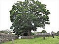 Oak tree in the graveyard of Holy Trinity Church - geograph.org.uk - 5404586.jpg 4,000 × 3,000; 2.36 MB
-
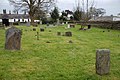 Old cemetery, Carlingford - geograph.org.uk - 397284.jpg 640 × 426; 163 KB
-
 Old pump, Carlingford (1) - geograph.org.uk - 2434510.jpg 539 × 503; 120 KB
-
 Old pump, Carlingford (2) - geograph.org.uk - 2434517.jpg 637 × 568; 113 KB
-

-
 P20230412AS-2857.jpg 3,000 × 2,000; 1.47 MB
-
 P20230412AS-2903.jpg 3,000 × 2,000; 1 MB
-
 P20230412AS-3196.jpg 3,000 × 2,000; 2.09 MB
-
 Path in Slieve Foye Woodland - geograph.org.uk - 5700405.jpg 3,836 × 2,768; 7.11 MB
-
 Poster advertising the Poc Fada at Carlingford - geograph.org.uk - 5857219.jpg 1,754 × 1,333; 1.14 MB
-

-
 Public Library, Carlingford - geograph.org.uk - 5406641.jpg 4,000 × 3,000; 2.22 MB
-
-
 Ruined cottage behind Carlingford Abbey - geograph.org.uk - 3106678.jpg 1,024 × 768; 298 KB
-
 Scaffolding at King John's Castle, Carlingford - geograph.org.uk - 5405405.jpg 3,000 × 4,000; 2.9 MB
-
 Scaffolding on King John's Castle, Carlingford - geograph.org.uk - 5690878.jpg 3,000 × 4,000; 4.86 MB
-
 Scoil Naomh Oilibheir-St Oliver's School - geograph.org.uk - 3160911.jpg 1,024 × 769; 194 KB
-

-
 Semi-detached stone house in Old Quay Lane, Carlingford - geograph.org.uk - 5547261.jpg 3,264 × 2,448; 1.97 MB
-
 Sheep alongside the Tain Way - geograph.org.uk - 5692095.jpg 4,000 × 3,000; 5.64 MB
-
 Sheltered waters in Carlingford harbour - geograph.org.uk - 3106510.jpg 1,024 × 768; 183 KB
-
 Shiltie's Lough, Carlingford, Co. Louth - geograph.org.uk - 353132.jpg 639 × 426; 119 KB
-

-
 Shingle beach west of Carlingford Point - geograph.org.uk - 5404186.jpg 3,765 × 2,823; 3.59 MB


_-_geograph.org.uk_-_2434413.jpg)
_-_geograph.org.uk_-_2434425.jpg)


.JPG)


_at_Carlingford_-_geograph.org.uk_-_3107547.jpg)


_-_geograph.org.uk_-_2434510.jpg)
_-_geograph.org.uk_-_2434517.jpg)


