Category:Carlton in Cleveland
village in United Kingdom  | |||||
| Upload media | |||||
| Instance of | |||||
|---|---|---|---|---|---|
| Location | Carlton, Hambleton, North Yorkshire, Yorkshire and the Humber, England | ||||
 | |||||
English: Carlton in Cleveland is a village and civil parish in the Hambleton district of North Yorkshire, England, on the edge of the North York Moors National Park. It is about 12 miles south of Middlesbrough. According to the 2001 census it had a population of 301. It has a school, Carlton and Faceby Primary School, and a pub, the Blackwell Ox, but no longer has a post office or shop.
Subcategories
This category has the following 2 subcategories, out of 2 total.
C
- Carlton Bank (10 F)
Media in category "Carlton in Cleveland"
The following 87 files are in this category, out of 87 total.
-
 A kink in the road - geograph.org.uk - 3824428.jpg 4,298 × 2,583; 2.1 MB
-
 A summit frame up - geograph.org.uk - 3777580.jpg 3,264 × 2,448; 1.53 MB
-
 A172 near Carlton in Cleveland - geograph.org.uk - 4812664.jpg 640 × 428; 105 KB
-
 A172 traffic - geograph.org.uk - 4812586.jpg 640 × 428; 99 KB
-
 Above Carlton Bank - geograph.org.uk - 4137316.jpg 4,000 × 2,248; 5.67 MB
-
 Alum House Lane - geograph.org.uk - 2641281.jpg 640 × 360; 226 KB
-
 Alum House Lane - geograph.org.uk - 4497117.jpg 6,000 × 4,000; 4.36 MB
-
 Alum House Lane - geograph.org.uk - 4497147.jpg 6,000 × 4,000; 4.64 MB
-
 Alum House Lane approaching Carlton in Cleveland - geograph.org.uk - 4497136.jpg 6,000 × 4,000; 3.96 MB
-
 Alum Workings, Carlton Bank - geograph.org.uk - 4662507.jpg 640 × 480; 109 KB
-
 An emerging crop - geograph.org.uk - 2641297.jpg 640 × 360; 213 KB
-
 An old gate - geograph.org.uk - 2641308.jpg 640 × 408; 253 KB
-
 At the edge of the escarpment - geograph.org.uk - 3835594.jpg 4,320 × 3,240; 2.25 MB
-
 Blacksmith, Carlton-in-Cleveland - geograph.org.uk - 56188.jpg 640 × 480; 78 KB
-
 Boundary Stone - geograph.org.uk - 5613586.jpg 359 × 640; 43 KB
-
 Buildings of gliding club from Cleveland Way - geograph.org.uk - 2276972.jpg 1,600 × 1,200; 1.64 MB
-
 Busby Hall - geograph.org.uk - 4497151.jpg 6,000 × 4,000; 4.72 MB
-
 Busby Wood - geograph.org.uk - 4497105.jpg 6,000 × 4,000; 6.07 MB
-
 Carlton Bank - geograph.org.uk - 3777574.jpg 3,240 × 2,414; 1.08 MB
-
 Carlton Bank Trig Point - geograph.org.uk - 5883400.jpg 640 × 427; 94 KB
-
 Carlton from Carlton Bank - geograph.org.uk - 1190585.jpg 640 × 483; 59 KB
-
 Carlton in Cleveland - geograph.org.uk - 2641290.jpg 640 × 360; 256 KB
-
 Carlton in Cleveland - geograph.org.uk - 377291.jpg 640 × 426; 67 KB
-
 Carlton Methodist Church - geograph.org.uk - 594608.jpg 640 × 426; 83 KB
-
 Carlton Moor - geograph.org.uk - 4890797.jpg 640 × 384; 21 KB
-
 Carlton Moor Trig pillar - geograph.org.uk - 2836165.jpg 640 × 480; 63 KB
-
 Carlton Moor, with Roseberry Topping in distance - geograph.org.uk - 4137472.jpg 4,000 × 2,248; 5.3 MB
-
 Carlton moor. - geograph.org.uk - 2202832.jpg 640 × 480; 54 KB
-
 Carlton-in-Cleveland 2011.jpg 1,024 × 683; 645 KB
-
 Carlton-in-Cleveland.jpg 640 × 480; 66 KB
-
 Cattle Grid, Alum House Lane - geograph.org.uk - 40382.jpg 480 × 640; 119 KB
-
 Churchyard of St Botolph's, Carlton in Cleveland - geograph.org.uk - 4499554.jpg 6,000 × 4,000; 3.7 MB
-
 Cleveland Way above Carlton and Green Banks - geograph.org.uk - 4137293.jpg 4,000 × 2,248; 6.22 MB
-
 Cleveland Way above Carlton Bank - geograph.org.uk - 4137349.jpg 4,000 × 2,248; 3.81 MB
-
 Cleveland Way descending from Carlton Moor - geograph.org.uk - 5342014.jpg 1,500 × 954; 1.12 MB
-
 Cleveland Way on Carlton Moor - geograph.org.uk - 3777582.jpg 2,448 × 3,264; 1.39 MB
-
 Cleveland Way, Carlton Moor - geograph.org.uk - 2836175.jpg 640 × 480; 102 KB
-
 Cottages in Carlton in Cleveland - geograph.org.uk - 2815788.jpg 3,648 × 2,736; 2.85 MB
-
 Disused quarries on Carlton Bank - geograph.org.uk - 4495661.jpg 6,000 × 4,000; 4.15 MB
-
 Duffin Wood Gatehouse Level Crossing - geograph.org.uk - 1735656.jpg 640 × 480; 69 KB
-
-
 Footpath approaching Carlton in Cleveland - geograph.org.uk - 4499578.jpg 6,000 × 4,000; 5.81 MB
-
 Footpath at Lordstones - geograph.org.uk - 5931738.jpg 1,024 × 768; 879 KB
-
 Footpath cutting the corner - geograph.org.uk - 4497097.jpg 6,000 × 4,000; 5.69 MB
-
 Footpath to Faceby - geograph.org.uk - 3610279.jpg 1,600 × 1,064; 529 KB
-
 Grazing land under Carlton Bank - geograph.org.uk - 3610274.jpg 1,600 × 1,067; 391 KB
-
 Grove Cottages - geograph.org.uk - 2647569.jpg 640 × 428; 84 KB
-
 Lady Cross - geograph.org.uk - 3824426.jpg 4,320 × 2,788; 2.07 MB
-

-

-
 Looking north from top of Carlton Bank - geograph.org.uk - 4137337.jpg 3,912 × 2,076; 5.74 MB
-
 Looking north from top of Carlton Bank - geograph.org.uk - 4137343.jpg 3,994 × 2,238; 5.98 MB
-
 Lord Stones Cafe - geograph.org.uk - 1411783.jpg 640 × 427; 107 KB
-
 Meeks Farm - geograph.org.uk - 940641.jpg 640 × 427; 250 KB
-
 Minor road near Carlton Grange - geograph.org.uk - 2101652.jpg 3,088 × 2,056; 1.91 MB
-
 Mist rolling through the gap - geograph.org.uk - 3777558.jpg 3,264 × 1,740; 893 KB
-

-
 On Carlton Bank - geograph.org.uk - 3777579.jpg 3,264 × 1,632; 650 KB
-
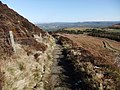
 Path on Carlton Bank - geograph.org.uk - 3777568.jpg 3,264 × 1,876; 1.02 MB
-
 Plane Tree Farm - geograph.org.uk - 6086408.jpg 1,024 × 768; 217 KB
-
 Road junction near Carlton Grange - geograph.org.uk - 2101639.jpg 3,088 × 2,056; 2.41 MB
-
 Road junctions near Low Farm - geograph.org.uk - 2101598.jpg 3,088 × 2,056; 2.01 MB
-
 Ruined barn - geograph.org.uk - 6086401.jpg 1,024 × 768; 128 KB
-
 Sheep near Fourwinds - geograph.org.uk - 4499605.jpg 6,000 × 4,000; 5.42 MB
-
 Sheep on the path - geograph.org.uk - 4499595.jpg 6,000 × 4,000; 5.39 MB
-
 St Botolph's, Carlton in Cleveland - geograph.org.uk - 4497200.jpg 6,000 × 4,000; 4.36 MB
-
 The Blackwell Ox, Carlton in Cleveland - geograph.org.uk - 4497172.jpg 6,000 × 4,000; 3.93 MB
-
 The Cleveland Way below Carlton Bank - geograph.org.uk - 4495695.jpg 6,000 × 4,000; 4.74 MB
-
 The Cleveland Way coming off Carlton Bank - geograph.org.uk - 4495683.jpg 6,000 × 4,000; 4.62 MB
-
 The Cleveland Way near Carton Bank - geograph.org.uk - 2095424.jpg 2,048 × 1,536; 1.05 MB
-
 The main street in Carlton in Cleveland - geograph.org.uk - 4497187.jpg 6,000 × 4,000; 4.26 MB
-
 The top of Carlton Moor - geograph.org.uk - 5931736.jpg 1,024 × 768; 677 KB
-
 The west side of Carlton Bank - geograph.org.uk - 4495606.jpg 6,000 × 4,000; 5.6 MB
-
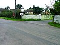
 Toft Hill Farm Caravan and Camping Park - geograph.org.uk - 582051.jpg 640 × 427; 103 KB
-
 Track of Old Railway - geograph.org.uk - 108356.jpg 640 × 482; 68 KB
-

-
 Triangulation Pillar, Carlton Bank - geograph.org.uk - 4915455.jpg 640 × 480; 121 KB
-
 Trig Point and Boundary Marker - geograph.org.uk - 3904291.jpg 1,600 × 1,200; 335 KB
-
 Trig point and boundary marker on Carlton Moor - geograph.org.uk - 2095460.jpg 2,048 × 1,536; 580 KB
-
 Trig point and boundary stone on Carlton Bank - geograph.org.uk - 4495634.jpg 6,000 × 4,000; 4.21 MB
-

-
 View from Carlton Moor - geograph.org.uk - 2959445.jpg 1,600 × 1,067; 302 KB
-
 Village school - geograph.org.uk - 3598608.jpg 640 × 480; 177 KB
-
 Weather station on Carlton Bank - geograph.org.uk - 4495619.jpg 6,000 × 4,000; 3.28 MB
-
 Whorl Hill - geograph.org.uk - 6034672.jpg 640 × 427; 77 KB
-

-
 Depth indicator post - geograph.org.uk - 594591.jpg 480 × 640; 133 KB


