Category:Carrathool Shire
Deutsch: Carrathool Shire ist ein lokales Verwaltungsgebiet (LGA) im australischen Bundesstaat New South Wales. Das Gebiet ist 18.940 km² groß und hat etwa 2.800 Einwohner. (→Carrathool Shire)
English: Carrathool Shire is a Local Government Area (LGA) in the Far West of New South Wales on the Mid-Western Highway and north of the Sturt Highway. (→Carrathool Shire)
Français : Le comté de Carrathool est une zone d'administration locale dans l'outback de la Nouvelle-Galles-du-Sud en Australie. (→Comté de Carrathool)
Nederlands: Carrathool Shire Council is een Local Government Area (LGA) in de Australische deelstaat Nieuw-Zuid-Wales. (→Carrathool Shire Council)
local government area in New South Wales, Australia  | |||||
| Upload media | |||||
| Instance of | |||||
|---|---|---|---|---|---|
| Location | New South Wales, AUS | ||||
| Capital | |||||
| Population |
| ||||
| Area |
| ||||
| Elevation above sea level |
| ||||
| official website | |||||
 | |||||
Subcategories
This category has the following 10 subcategories, out of 10 total.
Media in category "Carrathool Shire"
The following 7 files are in this category, out of 7 total.
-
 Cobar Carrathool Municipal Border Sign.JPG 4,494 × 3,471; 7.58 MB
-
 Goolgowi Carrathool Shire Centenary Monument.JPG 3,872 × 2,592; 4.32 MB
-
 Goolgowi Carrathool Shire Chambers 001.JPG 3,872 × 2,592; 3.75 MB
-
 Goolgowi Carrathool Shire Chambers 002.JPG 3,872 × 2,592; 4.05 MB
-
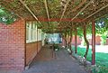 Goolgowi Carrathool Shire Chambers 003.JPG 3,652 × 2,472; 3.64 MB
-
 Goolgowi Carrathool Shire Chambers 004.JPG 3,872 × 2,592; 4.12 MB
-
 Hillston Carrathool Shire Offices.JPG 3,616 × 2,540; 3.34 MB


