Category:Cartmel
English: Cartmel is a village in Cumbria, England several miles west of Grange-over-Sands, and close to the River Eea. It is traditionally in Lancashire but boundary changes brought it into the newly created county of Cumbria in 1974. The village is the location of the 12th century Cartmel Priory. It has more recently become known as the "home of sticky toffee pudding", which can be purchased in various sizes from the Cartmel Village Shop. Its racecourse hosts popular meetings two or three times a year, traditionally in Whit Week. The ancient parish was traditionally known as the Land of Cartmel - formerly regarded as an area quite separate from the Furness peninsula. Holker Hall, associated with the Cavendish family and the Dukes of Devonshire, is located within the original boundaries of the parish.
Italiano: Cartmel è un villaggio della contea di Cumbria, nel nordovest dell'Inghilterra, diverse miglia a ovest di Grange-over-Sands.
village in South Lakeland, Cumbria, UK  | |||||
| Upload media | |||||
| Instance of | |||||
|---|---|---|---|---|---|
| Location | Lower Allithwaite, South Lakeland, Cumbria, North West England, England | ||||
 | |||||
Subcategories
This category has the following 7 subcategories, out of 7 total.
C
- Cartmel Priory School (3 F)
- Cartmel Racecourse (5 F)
L
- L'Enclume (3 F)
P
- Priory Close House (1 F)
W
Media in category "Cartmel"
The following 84 files are in this category, out of 84 total.
-
 ... former Post Office, Cartmel, Cumbria. ... (2714691189).jpg 1,280 × 960; 277 KB
-
 Archway in Cartmel - geograph.org.uk - 5724392.jpg 3,840 × 2,160; 4.24 MB
-
 Baines Paddock - geograph.org.uk - 116373.jpg 640 × 480; 182 KB
-
 Barn conversion at Gate Side Farm - geograph.org.uk - 446935.jpg 640 × 480; 98 KB
-
 Beck in Cartmel - geograph.org.uk - 2422137.jpg 1,024 × 768; 249 KB
-
 Beckside Farm - panoramio.jpg 3,072 × 1,728; 1.95 MB
-
 Beckside House Farm - panoramio.jpg 3,072 × 1,728; 1.66 MB
-
 Black horses in Cartmel - geograph.org.uk - 3047738.jpg 1,280 × 856; 308 KB
-
 Boulders, Cartmel Racecourse - geograph.org.uk - 1522609.jpg 427 × 640; 251 KB
-
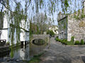
 Bridge over the River Eea in Cartmel - geograph.org.uk - 500913.jpg 640 × 480; 127 KB
-
 Cark Hall Allotment - geograph.org.uk - 502250.jpg 640 × 480; 100 KB
-
 Cartmel - panoramio (1).jpg 1,089 × 763; 442 KB
-
 Cartmel - panoramio.jpg 1,019 × 607; 254 KB
-

-
 Cartmel and the River Eea Valley - geograph.org.uk - 2666804.jpg 800 × 600; 125 KB
-
 Cartmel Cross.jpg 425 × 640; 255 KB
-
 Cartmel near water pump.jpg 3,264 × 2,448; 2.45 MB
-
 Cartmel Priory and Racecourse - geograph.org.uk - 2666809.jpg 600 × 800; 168 KB
-
 Cartmel Priory gates - geograph.org.uk - 3126433.jpg 640 × 441; 190 KB
-
 Cartmel village - geograph.org.uk - 39872.jpg 640 × 480; 75 KB
-
 Cartmel Village - geograph.org.uk - 447517.jpg 640 × 480; 82 KB
-
 Cartmel Village Shop - geograph.org.uk - 3047749.jpg 856 × 1,280; 273 KB
-

-
 Cartmel.jpg 3,264 × 2,448; 2.64 MB
-
 CARTMELL VILLAGE SHOP. CUMBRIA, ENGLAND.jpg 358 × 540; 48 KB
-
 Cartmell Village.jpg 1,024 × 768; 804 KB
-
 Cattery - geograph.org.uk - 116358.jpg 640 × 480; 156 KB
-
 Cavendish Arms (sign), Cartmel, Cumbria.jpg 2,592 × 3,872; 5.86 MB
-
 Church Bridge, Cartmel.jpg 3,382 × 2,205; 2.91 MB
-
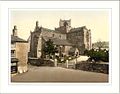 Church Cartmel England.jpg 1,086 × 850; 147 KB
-
 Cottages by the River Eea in Cartmel - geograph.org.uk - 2422128.jpg 1,024 × 768; 275 KB
-
 Cottages in Cartmel - geograph.org.uk - 2422142.jpg 1,024 × 768; 124 KB
-
 Cross at Headless Cross, Cartmel.jpg 600 × 800; 663 KB
-
 Ducks and drakes - geograph.org.uk - 954097.jpg 640 × 426; 84 KB
-
 Ford across Muddy Pool.jpg 640 × 425; 377 KB
-
 Guidestone, The Causeway, Cartmel.jpg 1,280 × 856; 291 KB
-
 High Cark Hall - geograph.org.uk - 502280.jpg 640 × 427; 91 KB
-
 House west side of The Square, Cartmel - geograph.org.uk - 446959.jpg 640 × 480; 100 KB
-
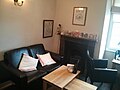 Inside sticky toffee cafe in cartmel.jpg 3,264 × 2,448; 1.71 MB
-
 John bigland martyr.jpg 2,448 × 3,264; 2.52 MB
-
 King's Arms, Cartmel.jpg 800 × 534; 279 KB
-
 Kings Arms, Cartmel - geograph.org.uk - 2915310.jpg 640 × 425; 113 KB
-
 L'Enclume, Cartmel.jpg 6,000 × 4,000; 3.54 MB
-

-
 Ordnance Survey One-Inch Sheet 89 Lancaster & Kendal, Published 1965.jpg 8,224 × 9,891; 12.73 MB
-
 Ordnance Survey One-Inch sheet 89 Lancaster and Kendal, published 1947.jpg 8,174 × 9,601; 10.93 MB
-
 Parkside House, Cartmel.jpg 3,456 × 2,304; 3.56 MB
-
 Preparing an Exhibit .Cartmel Show - geograph.org.uk - 774563.jpg 382 × 604; 54 KB
-
 Priory Hotel, Cartmel.jpg 640 × 425; 159 KB
-
 Raleigh sign, Cartmel - geograph.org.uk - 1844316.jpg 640 × 500; 226 KB
-
 Ready for Judging. Cartmel Show - geograph.org.uk - 774569.jpg 640 × 408; 63 KB
-
 River Eea, Cartmel - geograph.org.uk - 3047903.jpg 1,280 × 855; 400 KB
-
 Sheep grazing at Sturdy's Farm - geograph.org.uk - 502322.jpg 640 × 427; 86 KB
-
 Slate wall on Cark Hall Allotment - geograph.org.uk - 502239.jpg 640 × 427; 126 KB
-
 Sticky toffee in Cartmel.jpg 3,264 × 2,448; 1.66 MB
-
 The Cavendish Arms in Cartmel - geograph.org.uk - 210409.jpg 640 × 480; 140 KB
-
 The River Eea at Cartmel - geograph.org.uk - 2422132.jpg 1,024 × 768; 161 KB
-
 The River Eea, Cartmel - geograph.org.uk - 446964.jpg 640 × 480; 99 KB
-
 The Square, Cartmel - geograph.org.uk - 3047758.jpg 1,280 × 856; 255 KB
-
 The Square, Cartmel - geograph.org.uk - 3047871.jpg 1,280 × 857; 235 KB
-
 Upper Course of the River Eea (Whitestone Beck) near to its source.jpg 3,872 × 2,592; 2.34 MB
-
 Wright StreetLite bus.jpg 4,608 × 3,456; 2.5 MB
-
 Beck Side - geograph.org.uk - 155024.jpg 640 × 480; 130 KB
-
 Cark Hall Allotment - geograph.org.uk - 502222.jpg 640 × 427; 84 KB
-
 Cark Hall Allotment - geograph.org.uk - 502230.jpg 640 × 427; 103 KB
-
 Coming down Ellerside - geograph.org.uk - 242590.jpg 640 × 480; 136 KB
-
 Country Road - geograph.org.uk - 155049.jpg 640 × 480; 81 KB
-
 Entrance - geograph.org.uk - 446943.jpg 640 × 480; 97 KB
-
 Entrance to Gate Side Farm - geograph.org.uk - 446937.jpg 640 × 480; 96 KB
-
 Entrance to Hard Crag - geograph.org.uk - 155148.jpg 640 × 480; 108 KB
-
 Farm road to Sturdy's Farm - geograph.org.uk - 502298.jpg 640 × 427; 104 KB
-
 Fells Newby Bridge - geograph.org.uk - 116376.jpg 640 × 480; 94 KB
-
 Geese - geograph.org.uk - 116276.jpg 640 × 480; 198 KB
-
 Hawthorn trees on grazing land - geograph.org.uk - 502341.jpg 640 × 427; 133 KB
-
 Hill Farm in Cartmel - geograph.org.uk - 382629.jpg 640 × 416; 82 KB
-
 How Barrow - geograph.org.uk - 241812.jpg 640 × 480; 117 KB
-
 How Barrow - geograph.org.uk - 242434.jpg 640 × 480; 102 KB
-
 Limekiln and bales. - geograph.org.uk - 243195.jpg 640 × 480; 102 KB
-
 Near High Gateside Farm - geograph.org.uk - 155021.jpg 640 × 480; 85 KB
-
 Pines Speel bank - geograph.org.uk - 155028.jpg 640 × 480; 98 KB
-
 Tarn with spaniel - geograph.org.uk - 241995.jpg 640 × 480; 131 KB
-
 The final straight at Cartmel - geograph.org.uk - 153320.jpg 640 × 480; 129 KB
-
 The Square, Cartmel - geograph.org.uk - 447174.jpg 640 × 480; 126 KB
-
 Wall Nook - geograph.org.uk - 242593.jpg 640 × 480; 124 KB
.jpg)


.jpg)

_-_geograph.org.uk_-_1167000.jpg)


,_Cartmel,_Cumbria.jpg)


.jpg)


_near_to_its_source.jpg)


