Category:Cartuja de Vall de Cristo
| Object location | | View all coordinates using: OpenStreetMap |
|---|
cultural property in Altura, Spain  .svg) | |||||
| Upload media | |||||
| Instance of |
| ||||
|---|---|---|---|---|---|
| Location |
| ||||
| Heritage designation | |||||
| Inception |
| ||||
| Date of official closure |
| ||||
 | |||||
Català: Cartoixa de Valldecrist (Altura)
This is a category about a monument indexed in the Valencian and Spanish heritage registers of Béns d'Interés Cultural / Bienes de Interés Cultural under the reference RI-51-0011352. |
Subcategories
This category has only the following subcategory.
C
Pages in category "Cartuja de Vall de Cristo"
This category contains only the following page.
Media in category "Cartuja de Vall de Cristo"
The following 112 files are in this category, out of 112 total.
-
 2 Grabadocalcografico.Perspectiva.jpg 1,024 × 670; 107 KB
-
 3 axonometria actual.jpg 1,200 × 700; 340 KB
-
 Accés a la capella inferior de Sant Martí, cartoixa de Valldecrist.JPG 3,664 × 2,748; 2.3 MB
-
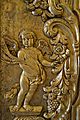 Angelot de la porta de la capella del Salvador, catedral de Sogorb.JPG 3,060 × 4,608; 2.4 MB
-
 Arrancada de nervis gòtics a la cartoixa de Valldecrist.JPG 2,666 × 3,594; 2.22 MB
-
 Arrancada de nervis gòtics, cartoixa de Valldecrist.JPG 3,664 × 2,748; 2.35 MB
-
 Arrancada de nervis i arrels, cartoixa de Valldecrist.JPG 3,664 × 2,748; 2.67 MB
-
 Arrancades de nervis gòtics al lateral de l'església, cartoixa de Valldecrist.JPG 2,269 × 3,662; 1.78 MB
-
 Basa d'una columna gòtica, cartoixa de Valldecrist.JPG 3,664 × 2,748; 2.55 MB
-
 Blason de la Chartreuse de Val de Christo (Espagne).svg 603 × 763; 43 KB
-
 Capella de Sant Martí de la cartoixa de Valldecrist.JPG 3,464 × 2,609; 1.43 MB
-
 Capella de sant Martí, vista posterior, cartoixa de Valldecrist.JPG 3,664 × 2,748; 1.94 MB
-
 Capella inferior de sant Martí, cartoixa de Valldecrist, Altura.JPG 3,664 × 2,748; 1.36 MB
-
 Capella inferior de sant Martí, cartoixa de Valldecrist.JPG 2,748 × 3,664; 1.41 MB
-
 Cartoixa de Valldecrist - entrada a les bodegues -1911.jpg 653 × 648; 115 KB
-
 Cartoixa de Valldecrist - església de Sant Martí -1911.jpg 661 × 657; 105 KB
-
-
 Cartoixa de Valldecrist - pati del convent -1911.jpg 651 × 653; 94 KB
-
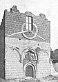
 Cartoixa de Valldecrist - porta principal -1911.jpg 654 × 644; 95 KB
-
 Cartoixa de Valldecrist - vista general -1911.jpg 1,213 × 698; 137 KB
-
 Cartoixa de Valldecrist, Altura, Alt Palància, País Valencià.JPG 3,664 × 2,748; 1.97 MB
-
 Cartoixa de Valldecrist, part restaurada.JPG 2,748 × 3,664; 1.93 MB
-
 Cartuja de VAl de Cristo.JPG 480 × 640; 54 KB
-
 Cartuja de Vall de Cristo.jpg 4,752 × 3,168; 7.92 MB
-

-
 Chartreuse Altura.jpg 3,503 × 2,457; 2.96 MB
-
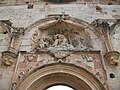
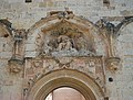 Conjunt escultòric de la portada de l'església de la cartoixa de Valldecrist, Altura.JPG 3,610 × 2,746; 2.11 MB
-
 Conjunt escultòric de la portada de l'església de la cartoixa de Valldecrist.JPG 3,664 × 2,748; 2.25 MB
-
 Conjunt escultòric de la portalada de l'església de la cartoixa de Valldecrist.JPG 3,541 × 2,746; 2.1 MB
-
 Cuines, pou i ametllers, cartoixa de Valldecrist.JPG 3,664 × 2,748; 2.28 MB
-
 Detall de la porta de la capella del Salvador, catedral de Sogorb.JPG 3,072 × 4,608; 2.51 MB
-
 Detall de la portada de l'església de Valldecrist amb els escuts dels fundadors.JPG 3,664 × 2,748; 2.32 MB
-
 Detall de la portada de l'església de Valldecrist amb un escut dels fundadors.JPG 3,540 × 2,746; 2.03 MB
-
 Detall de la portada gòtica de l'església de la cartoixa de Valldecrist.JPG 3,664 × 2,748; 2.28 MB
-

-
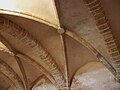 Detall de la volta de la capella inferior de Sant Martí, Valldecrist.JPG 3,664 × 2,748; 1.25 MB
-
 Detall de les voltes de la capella inferior de sant Martí, cartoixa de Valldecrist.JPG 3,591 × 2,746; 1.21 MB
-

-
 Detall dels capitells que coronen les pilastres de l'església de Valldecrist.JPG 3,664 × 2,748; 2.13 MB
-
 Detall escultòric, cartoixa de Valldecrist.JPG 3,664 × 2,748; 2.63 MB
-
 Detalls de la porta de la capella del Salvador, catedral de Sogorb.JPG 2,981 × 4,578; 2.58 MB
-
 Dibuja 38.jpg 1,360 × 2,048; 680 KB
-
 Dibuja 39.jpg 2,048 × 1,360; 646 KB
-
 Dibuja 40.jpg 2,880 × 1,728; 999 KB
-
 Dos monjos cartoixans, Francesc d'Osona, museu catedralici de Sogorb.JPG 4,608 × 2,811; 1.53 MB
-
 El Pozo de la Cartuja.jpg 3,168 × 4,752; 7.74 MB
-
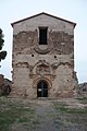
 Església de la Mare de Déu dels Àngels de la cartoixa de Valldecrist.JPG 3,664 × 2,748; 2.04 MB
-

-
-
 Església de la Mare de Déu dels Àngels, interior, cartoixa de Valldecrist.JPG 2,748 × 3,664; 2.15 MB
-
 Església de la Mare de Déu dels Àngels, vista cap a l'altar, cartoixa de Valldecrist.JPG 2,748 × 3,664; 2.17 MB
-
 Església de la Mare de Déu dels Àngels, vista cap a l'altar. Cartoixa de Valldecrist.JPG 3,664 × 2,748; 2.06 MB
-
 Església de la Mare de Déu dels Àngels, vista des de la portada, cartoixa de Valldecrist.JPG 3,515 × 2,746; 1.61 MB
-
 Església de Valldecrist des de l'entrada.JPG 3,664 × 2,748; 1.76 MB
-
 Façana de l'església de la Mare de Déu dels Àngels, cartoixa de Valldecrist.JPG 2,724 × 3,662; 1.91 MB
-
 Finestres gòtiques de l'església de la Mare de Déu dels Àngels, Valldecrist.JPG 3,653 × 2,731; 2.71 MB
-
 Francisco de Osona La fuite en Égypte.jpg 1,357 × 2,344; 961 KB
-
 Francisco de Osona Saint Grégoire le Grand v 1500.jpg 1,284 × 3,086; 1.21 MB
-
 Fugida a Egipte, Francesc d'Osona, museu catedralici de Sogorb.JPG 2,364 × 3,751; 1.27 MB
-
 Grabado del S.XIX de la Cartuja de Vall de Cristo.jpg 278 × 181; 14 KB
-

-

-

-
 Hostatgeria o dependències de la cartoixa de Valldecrist.JPG 3,664 × 2,748; 2.36 MB
-
 Hostatgeria o dependències, cartoixa de Valldecrist.JPG 3,664 × 2,748; 2.36 MB
-
 Interior de l'església de la Mare de Déu dels Àngels de la cartoixa de Valldecrist.JPG 3,664 × 2,748; 1.87 MB
-
 Interior de la capella de Sant Martí, cartoixa de Valldecrist.JPG 3,664 × 2,748; 1.28 MB
-
 La cartuja de Noche.jpg 3,168 × 4,752; 7.5 MB
-
 Lateral de la capella de Sant martí de la cartoixa de Valldecrist.JPG 3,588 × 2,746; 2.1 MB
-
 Lateral exterior de l'església de la Mare de Déu dels Àngels, cartoixa de Valldecrist.JPG 3,664 × 2,748; 2.19 MB
-
 Lateral interior de l'església de la Mare de Déu dels Àngels, cartoixa de Valldecrist.JPG 3,664 × 2,748; 2.21 MB
-

-
 Mare de Déu amb el Nen "la Primitiva", museu catedralici de Sogorb.JPG 2,125 × 3,561; 969 KB
-

-

-
 Part posterior de l'església de la Mare de Déu dels Àngels de la cartoixa de Valldecrist.JPG 3,664 × 2,748; 2.01 MB
-
 Part posterior de la capella de sant martí de la cartoixa de Vall de Crist.JPG 3,664 × 2,748; 2.05 MB
-
 Perspectiva de la Cartuja.jpg 1,003 × 650; 136 KB
-
 Pilastres, església de la cartoixa de Valldecrist.JPG 2,704 × 3,662; 1.8 MB
-
 Porta barroca procedent de la cartoixa de Valldecrist, museu catedralici de Sogorb.JPG 2,714 × 3,566; 1.63 MB
-
 Porta conopial a la cartoixa de Valldecrist.JPG 2,748 × 3,664; 2.04 MB
-
 Portada d'accés a la cartoixa de Valldecrist, Altura, Alt Palància, País Valencià.JPG 3,664 × 2,748; 2.55 MB
-
 Portada de l'església de la Mare de Déu dels Àngels, cartoixa de Valldecrist.JPG 2,748 × 3,664; 2.2 MB
-
 Portada de la capella de Sant Martí de la cartoixa de Valldecrist.JPG 3,664 × 2,748; 2.26 MB
-
 Portada reconstruïda d'una cel·la del claustre major de Valldecrist.JPG 2,748 × 3,664; 2.37 MB
-
 Portalada, ajuntament de Sogorb.JPG 3,048 × 4,608; 1.77 MB
-
 Pou de la cartoixa de Valldecrist a Altura.JPG 2,908 × 4,407; 2.1 MB
-
 Pou procedent de la cartoixa de Valldecrist a Altura.JPG 2,932 × 4,529; 1.93 MB
-
 Restes de dependències monacals, cartoixa de Valldecrist.JPG 3,664 × 2,748; 1.92 MB
-
 Restes de la capella de Santa maria Magdalena, cartoixa de Valldecrist.JPG 3,664 × 2,748; 2.64 MB
-

-

-
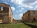
 Ruïnes de la cartoixa de Valldecrist i el seu entorn.JPG 3,664 × 2,748; 1.7 MB
-
 Ruïnes de la cartoixa de Valldecrist.JPG 3,664 × 2,748; 2.24 MB
-

-
 Sant Gregori Papa, Francesc d'Osona, Museu catedralici, Sogorb.JPG 2,496 × 4,395; 1.6 MB
-
 Sant Vicent màrtir (detall) de Francesc d'Osona, museu catedralici de Sogorb.JPG 4,608 × 2,932; 2.15 MB
-
 Sant Vicent màrtir de Francesc d'Osona, museu catedralici de Sogorb.JPG 4,535 × 2,893; 2.02 MB
-

-

-

-
 Valdecristo2.jpg 640 × 480; 58 KB
-
 Vall de Crist 1.JPG 2,272 × 1,704; 861 KB
-
 Vall de Crist 2.JPG 2,272 × 1,704; 846 KB
-
 Vegetació envaïnt les ruïnes de la cartoixa de Valldecrist.JPG 3,664 × 2,748; 2.74 MB
-
 Vista cap a l'eixida de la cartoixa de Valldecrist des del claustre menor.JPG 3,664 × 2,748; 2.25 MB
-
 Volta de la capella de Sant Martí de la cartoixa de Valldecrist.JPG 3,599 × 2,746; 1.26 MB
-
 Voltes de la capella de Sant Martí de la cartoixa de Valldecrist, Altura.JPG 3,664 × 2,748; 1.3 MB
-
 Voltes de la capella de Sant Martí de la cartoixa de Valldecrist.JPG 2,748 × 3,664; 1.53 MB
-
 Voltes de la capella de Sant Martí, cartoixa de Valldecrist.JPG 3,664 × 2,748; 1.25 MB
-
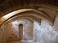
 Voltes de la capella inferior de Sant Martí de la cartoixa de Valldecrist.JPG 3,610 × 2,746; 1.31 MB
-
 Voltes de la capella inferior de Sant Martí, cartoixa de Valldecrist.JPG 3,664 × 2,748; 1.31 MB


,_cartoixa_de_Valldecrist.JPG)


,_Joan_Reixac,_museu_catedralici_de_Sogorb.JPG)


,_Francesc_d%27Osona,_Museu_de_Belles_Arts_de_Castell%C3%B3.JPG)

_de_Francesc_d%27Osona,_museu_catedralici_de_Sogorb.JPG)


