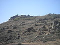
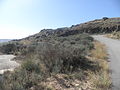
Category:Castro de Tintinolho
| Object location | | View all coordinates using: OpenStreetMap |
|---|
building in Guarda, Guarda District, Portugal  | |||||
| Upload media | |||||
| Instance of | |||||
|---|---|---|---|---|---|
| Location | Faia, Guarda, Portugal | ||||
| Heritage designation | |||||
 | |||||
|
This monument is classified as
Monumento Nacional .It is indexed in the IGESPAR database ( Instituto de Gestão do Património Arquitectónico e Arqueológico ), under the reference 70474.It is indexed in the SIPA database (Sistema de Informação para o Património Arquitectónico) under the reference 3922. |
Media in category "Castro de Tintinolho"
The following 14 files are in this category, out of 14 total.
-
 Castro do Tintinolho 0.jpg 3,968 × 2,976; 4.95 MB
-
 Castro do Tintinolho 1.jpg 3,968 × 2,976; 4.95 MB
-
 Castro do Tintinolho 2.jpg 3,968 × 2,976; 4.39 MB
-
 Castro do Tintinolho 3.jpg 2,976 × 3,968; 4.53 MB
-
 Castro do Tintinolho 4.jpg 3,968 × 2,976; 4.88 MB
-
 Castro do Tintinolho 5.jpg 3,968 × 2,976; 4.26 MB
-
 Castro do Tintinolho 6.jpg 3,968 × 2,976; 5.12 MB
-
 Castro do Tintinolho 7.jpg 2,976 × 3,968; 4.42 MB
-
 Castro do Tintinolho 8.jpg 3,968 × 2,976; 5.18 MB
-
 Cerámica visigoda Castelo de Vide y Tintinolho 1.jpg 2,322 × 4,128; 2.25 MB
-
 Cerámica visigoda Castelo de Vide y Tintinolho 2.jpg 4,128 × 2,322; 3.57 MB
-
 Cerámica visigoda Castelo de Vide y Tintinolho.jpg 4,128 × 2,322; 3.76 MB
-
 Cerámica visigoda y ponderal bizantino 1.jpg 2,322 × 4,128; 2.21 MB
-
 Cerámica visigoda y ponderal bizantino.jpg 2,322 × 4,128; 3.22 MB


