Category:Cemetery in Drozdowo
| Object location | | View all coordinates using: OpenStreetMap |
|---|
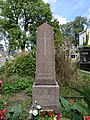
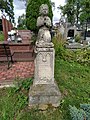
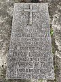
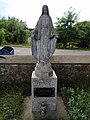
Polski: Drozdowo - cmentarz rzymsko-katolicki, XIX w.
Subcategories
This category has only the following subcategory.
Media in category "Cemetery in Drozdowo"
The following 30 files are in this category, out of 30 total.
-
 Drozdowo cmentarz 01.jpg 6,000 × 8,000; 22.77 MB
-
 Drozdowo cmentarz 02.jpg 6,000 × 8,000; 21.34 MB
-
 Drozdowo cmentarz 03.jpg 6,000 × 8,000; 20.04 MB
-
 Drozdowo cmentarz 04.jpg 6,000 × 8,000; 19.42 MB
-
 Drozdowo cmentarz 05.jpg 6,000 × 8,000; 19.26 MB
-
 Drozdowo cmentarz 06.jpg 6,000 × 8,000; 18.81 MB
-
 Drozdowo cmentarz 07.jpg 6,000 × 8,000; 22.46 MB
-
 Drozdowo cmentarz 08.jpg 6,000 × 8,000; 21.42 MB
-
 Drozdowo cmentarz 09.jpg 6,000 × 8,000; 19.34 MB
-
 Drozdowo cmentarz 10.jpg 8,000 × 6,000; 23.42 MB
-
 Drozdowo cmentarz 11.jpg 6,000 × 8,000; 21.37 MB
-
 Drozdowo cmentarz 12.jpg 6,000 × 8,000; 21.41 MB
-
 Drozdowo cmentarz 13.jpg 6,000 × 8,000; 22.72 MB
-
 Drozdowo cmentarz 14.jpg 6,000 × 8,000; 27.24 MB
-
 Drozdowo cmentarz 15.jpg 6,000 × 8,000; 19.39 MB
-
 Drozdowo cmentarz 16.jpg 8,000 × 6,000; 20.4 MB
-
 Drozdowo cmentarz 17.jpg 8,000 × 6,000; 20.42 MB
-
 Drozdowo cmentarz 18.jpg 6,000 × 8,000; 22.22 MB
-
 Drozdowo cmentarz 19.jpg 3,000 × 4,000; 5.99 MB
-
 Drozdowo cmentarz 20.jpg 6,000 × 8,000; 20.32 MB
-
 Drozdowo cmentarz 21.jpg 8,000 × 6,000; 18.98 MB
-
 Drozdowo cmentarz 22.jpg 8,000 × 6,000; 24.57 MB
-
 Drozdowo cmentarz 23.jpg 6,000 × 8,000; 22.62 MB
-
 Drozdowo cmentarz 24.jpg 6,000 × 8,000; 21.04 MB
-
 Drozdowo cmentarz 25.jpg 6,000 × 8,000; 19.31 MB
-
 Drozdowo cmentarz 26.jpg 8,000 × 6,000; 18.35 MB
-
 Drozdowo cmentarz 27.jpg 8,000 × 6,000; 18.5 MB
-
 Drozdowo cmentarz 28.jpg 6,000 × 8,000; 17.12 MB
-
 Drozdowo cmentarz 29.jpg 8,000 × 6,000; 21.65 MB
-
 Drozdowo cmentarz 30.jpg 8,000 × 6,000; 21.43 MB


