Category:Cemetery on Kościuszki Street in Prudnik
| Object location | | View all coordinates using: OpenStreetMap |
|---|

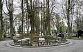
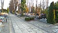
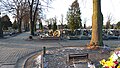
 Fragment cmentarza komunalnego w Prudniku (wrzesień 2012) | |||||
| Upload media | |||||
| Instance of | |||||
|---|---|---|---|---|---|
| Part of | |||||
| Location | Prudnik, Gmina Prudnik, Prudnik County, Opole Voivodeship, Poland | ||||
| Street address |
| ||||
| Located on street | |||||
| Heritage designation |
| ||||
| Inception |
| ||||
 | |||||
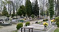
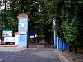
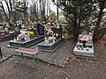
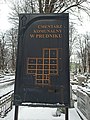
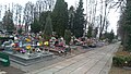
Polski: Prudnik, ulica Tadeusza Kościuszki 19, cmentarz komunalny, założony w 1870 roku.
English: Cemetery on Kościuszki Street in Prudnik.
Subcategories
This category has the following 2 subcategories, out of 2 total.
Media in category "Cemetery on Kościuszki Street in Prudnik"
The following 67 files are in this category, out of 67 total.
-
 Cmentarz Komunalny w Prudniku - grobowiec księży.jpg 2,457 × 1,554; 1.16 MB
-
 Cmentarz Komunalny w Prudniku - grobowiec sióstr elżbietanek.jpg 1,058 × 2,527; 1 MB
-
 Cmentarz Komunalny w Prudniku - Miejsce spoczynku sióstr św. Elżbiety.jpg 2,517 × 1,162; 1.04 MB
-
 Cmentarz Komunalny w Prudniku - pomnik Franciszka Ksawerego.jpg 1,339 × 2,153; 1,009 KB
-
 Cmentarz Komunalny w Prudniku - pomnik Nepomucena.jpg 1,389 × 2,429; 1.12 MB
-
 Cmentarz Komunalny w Prudniku - pomnik pierwszowojenny.jpg 1,120 × 2,408; 957 KB
-
 Cmentarz Komunalny w Prudniku - pomnik sybiraków.jpg 1,511 × 2,390; 1,006 KB
-
 Cmentarz komunalny w Prudniku 2022-05-01.jpg 2,491 × 1,361; 1.03 MB
-
 Cmentarz komunalny, wejście gł. pik.JPG 4,000 × 3,000; 10.88 MB
-
 Pomnik żołnierzy I wojny światowej.JPG 3,000 × 4,000; 7.78 MB
-
 Prudnik, 2021.11.23 10.jpg 4,624 × 3,472; 9.16 MB
-
 Prudnik, 2021.11.30 03.jpg 3,472 × 4,624; 5.97 MB
-
 Prudnik, 2021.11.30 04.jpg 4,624 × 3,472; 7.3 MB
-
 Prudnik, 2024.05.16 02.jpg 4,624 × 3,472; 9.38 MB
-
 Prudnik, 2024.05.16 03.jpg 4,624 × 3,472; 9.33 MB
-
 Prudnik, 2024.05.16 04.jpg 3,472 × 4,624; 8.13 MB
-
 Prudnik, 2024.05.16 05.jpg 4,624 × 3,472; 8.75 MB
-
 Prudnik, 2024.05.16 06.jpg 4,624 × 3,472; 8.54 MB
-
 Prudnik, 2024.05.16 07.jpg 4,624 × 3,472; 8.7 MB
-
 Prudnik, 2024.05.16 08.jpg 4,624 × 3,472; 7.33 MB
-
 Prudnik, 2024.05.16 09.jpg 3,472 × 4,624; 7.58 MB
-
 Prudnik, 2024.05.16 10.jpg 4,624 × 3,472; 8.42 MB
-
 Prudnik, 2024.05.16 11.jpg 4,624 × 3,472; 8.14 MB
-
 Prudnik, 2024.05.16 12.jpg 4,624 × 3,472; 7.5 MB
-
 Prudnik, 2024.05.16 13.jpg 4,624 × 3,472; 6.91 MB
-
 Prudnik, 2024.05.16 14.jpg 4,624 × 3,472; 8.44 MB
-
 Prudnik, 2024.05.16 15.jpg 3,472 × 4,624; 9.02 MB
-
 Prudnik, 2024.05.16 16.jpg 3,472 × 4,624; 7.64 MB
-
 Prudnik, 2024.05.16 17.jpg 4,624 × 3,472; 9.46 MB
-
 Prudnik, 2024.05.16 18.jpg 3,472 × 4,624; 8.1 MB
-
 Prudnik, 2024.05.16 19.jpg 3,472 × 4,624; 7.65 MB
-
 Prudnik, 2024.05.16 20.jpg 4,624 × 3,472; 7.1 MB
-
 Prudnik, 2024.05.16 21.jpg 4,624 × 3,472; 7.71 MB
-
 Prudnik, 2024.05.16 22.jpg 4,624 × 3,472; 8.71 MB
-
 Prudnik, 2024.05.16 23.jpg 3,472 × 4,624; 8.01 MB
-
 Prudnik, 2024.05.16 24.jpg 3,472 × 4,624; 6.94 MB
-
 Prudnik, cmentarz przy ul. Kościuszki, 19.12.2018 (1).jpg 4,032 × 2,272; 4.1 MB
-
 Prudnik, cmentarz przy ul. Kościuszki, 19.12.2018 (10).jpg 4,032 × 2,272; 4.7 MB
-
 Prudnik, cmentarz przy ul. Kościuszki, 19.12.2018 (11).jpg 4,032 × 2,272; 5.24 MB
-
 Prudnik, cmentarz przy ul. Kościuszki, 19.12.2018 (12).jpg 4,032 × 2,272; 4.8 MB
-
 Prudnik, cmentarz przy ul. Kościuszki, 19.12.2018 (13).jpg 4,032 × 2,272; 5.04 MB
-
 Prudnik, cmentarz przy ul. Kościuszki, 19.12.2018 (14).jpg 4,032 × 2,272; 4.66 MB
-
 Prudnik, cmentarz przy ul. Kościuszki, 19.12.2018 (15).jpg 4,032 × 2,272; 4.74 MB
-
 Prudnik, cmentarz przy ul. Kościuszki, 19.12.2018 (16).jpg 4,032 × 2,272; 4.76 MB
-
 Prudnik, cmentarz przy ul. Kościuszki, 19.12.2018 (17).jpg 4,032 × 2,272; 4.27 MB
-
 Prudnik, cmentarz przy ul. Kościuszki, 19.12.2018 (18).jpg 4,032 × 2,272; 3.87 MB
-
 Prudnik, cmentarz przy ul. Kościuszki, 19.12.2018 (19).jpg 4,032 × 2,272; 3.79 MB
-
 Prudnik, cmentarz przy ul. Kościuszki, 19.12.2018 (2).jpg 4,032 × 2,272; 4 MB
-
 Prudnik, cmentarz przy ul. Kościuszki, 19.12.2018 (20).jpg 4,032 × 2,272; 3.57 MB
-
 Prudnik, cmentarz przy ul. Kościuszki, 19.12.2018 (3).jpg 4,032 × 2,272; 3.78 MB
-
 Prudnik, cmentarz przy ul. Kościuszki, 19.12.2018 (4).jpg 4,032 × 2,272; 3.68 MB
-
 Prudnik, cmentarz przy ul. Kościuszki, 19.12.2018 (5).jpg 4,032 × 2,272; 3.34 MB
-
 Prudnik, cmentarz przy ul. Kościuszki, 19.12.2018 (6).jpg 4,032 × 2,272; 2.43 MB
-
 Prudnik, cmentarz przy ul. Kościuszki, 19.12.2018 (7).jpg 4,032 × 2,272; 4.77 MB
-
 Prudnik, cmentarz przy ul. Kościuszki, 19.12.2018 (8).jpg 4,032 × 2,272; 4.89 MB
-
 Prudnik, cmentarz przy ul. Kościuszki, 19.12.2018 (9).jpg 4,032 × 2,272; 3.28 MB
-
 Prudnik, ul. Kościuszki, cmentarz (1) 28.11.2018.jpg 4,032 × 2,272; 4.59 MB
-
 Prudnik, ul. Kościuszki, cmentarz (2) 28.11.2018.jpg 4,032 × 2,272; 4.5 MB
-
 Zabytkowy grób lekarza. pik.JPG 3,000 × 4,000; 9.25 MB
-
 Zabytkowy grób z XIX wieku. pik 2.JPG 3,000 × 4,000; 9.45 MB
-
 Zabytkowy grób z XIX wieku. pik 3.JPG 2,039 × 3,643; 6.17 MB
-
 Zabytkowy grób z XIX wieku. pik 4.JPG 3,000 × 4,000; 9.66 MB
-
 Zabytkowy grób z XIX wieku. pik 5.JPG 3,000 × 4,000; 8.84 MB
-
 Zabytkowy grób z XIX wieku. pik 6.JPG 3,000 × 4,000; 8.81 MB
-
 Zabytkowy grób z XIX wieku. pik 7.JPG 3,000 × 4,000; 7.11 MB
-
 Zabytkowy grób z XIX wieku. pik.JPG 3,000 × 4,000; 8.6 MB
-
 Zabytkowy pomnik na cmentarzu. pik.JPG 3,000 × 4,000; 9.5 MB


.jpg)
.jpg)
.jpg)
.jpg)
.jpg)
.jpg)
.jpg)
.jpg)
.jpg)
.jpg)
.jpg)
.jpg)
.jpg)
.jpg)
.jpg)
.jpg)
.jpg)
.jpg)
.jpg)
.jpg)
_28.11.2018.jpg)
_28.11.2018.jpg)


