Category:Chadwell, Leicestershire
village in Leicestershire, United Kingdom  | |||||
| Upload media | |||||
| Instance of | |||||
|---|---|---|---|---|---|
| Location | Scalford, Melton, Leicestershire, East Midlands, England | ||||
 | |||||
Subcategories
This category has only the following subcategory.
M
Media in category "Chadwell, Leicestershire"
The following 19 files are in this category, out of 19 total.
-

-
 A607 near Waltham on the Wolds - geograph.org.uk - 79543.jpg 640 × 427; 163 KB
-
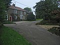 Chadwell, Leicestershire - geograph.org.uk - 67007.jpg 640 × 480; 107 KB
-
 Footpath near Waltham on the Wolds - geograph.org.uk - 157152.jpg 640 × 427; 96 KB
-
 Straw bales near Waltham on the Wolds - geograph.org.uk - 157159.jpg 640 × 427; 95 KB
-
 A607 towards Grantham - geograph.org.uk - 676882.jpg 640 × 425; 71 KB
-
 Ashleigh and milepost - geograph.org.uk - 676881.jpg 640 × 471; 104 KB
-

-
 Farm track near Waltham on the Wolds - geograph.org.uk - 157157.jpg 640 × 480; 140 KB
-

-

-

-
 Goldsmith Grange and Debdale Farm - geograph.org.uk - 148322.jpg 640 × 374; 48 KB
-
 Melton Spinney Farm - geograph.org.uk - 79699.jpg 640 × 427; 134 KB
-
 Small Pond near Waltham in the Wolds - geograph.org.uk - 157160.jpg 640 × 427; 180 KB
-
 The Hindles, near Scalford - geograph.org.uk - 79705.jpg 640 × 480; 75 KB
-
 The Mowbray Way, Leicestershire - geograph.org.uk - 67008.jpg 640 × 480; 92 KB
-
 Woodfold Lane, near Waltham on the Wolds - geograph.org.uk - 68275.jpg 640 × 480; 126 KB
-
 Woodfold Lane, near Waltham on the Wolds - geograph.org.uk - 68277.jpg 640 × 480; 134 KB


