Category:Chantada
Municipalities in the province of Lugo: Abadín · Alfoz · Antas de Ulla · Baleira · Baralla · Barreiros · Becerreá · Begonte · Bóveda · Burela · Carballedo · Castro de Rei · Castroverde · Cervantes · Cervo · Chantada · O Corgo · Cospeito · Folgoso do Courel · A Fonsagrada · Foz · Friol · Guitiriz · Guntín · O Incio · Láncara · Lourenzá · Lugo · Meira · Mondoñedo · Monforte de Lemos · Monterroso · Muras · Navia de Suarna · Negueira de Muñiz · As Nogais · Ourol · Outeiro de Rei · Palas de Rei · Pantón · Paradela · O Páramo · A Pastoriza · Pedrafita do Cebreiro · A Pobra do Brollón · Pol · A Pontenova · Portomarín · Quiroga · Rábade · Ribadeo · Ribas de Sil · Ribeira de Piquín · Riotorto · Samos · Sarria · O Saviñao · Sober · Taboada · Trabada · Triacastela · O Valadouro · O Vicedo · Vilalba · Viveiro · Xermade · Xove
Spanish municipality in the province of Lugo, Galicia    | |||||
| Upload media | |||||
| Instance of | |||||
|---|---|---|---|---|---|
| Location | Lugo Province, Galicia | ||||
| Located in or next to body of water | |||||
| Capital | |||||
| Head of government |
| ||||
| Highest point | |||||
| Population |
| ||||
| Area |
| ||||
| Elevation above sea level |
| ||||
| Different from | |||||
| official website | |||||
 | |||||
Subcategories
This category has the following 15 subcategories, out of 15 total.
A
- Asma River (11 F)
B
- Belesar Dam (7 F)
C
- Casa da Cultura, Chantada (5 F)
E
- Entroido Ribeirao (111 F)
F
- Folión dos carros (8 F)
H
M
- Maps of Chantada (6 F)
- Monte Faro (47 F)
P
S
Media in category "Chantada"
The following 64 files are in this category, out of 64 total.
-
 A verba viva Cinema Palleiriso.jpg 904 × 483; 167 KB
-
 Aser Álvarez González.jpg 530 × 480; 114 KB
-
 Biblioteca Pública Municipal de Chantada Xoan de Requeixo.jpg 4,000 × 3,000; 4.4 MB
-
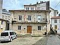 Casa consistorial de Chantada.jpg 4,000 × 3,000; 4.83 MB
-
 Casa do concello Chantada (Lugo) - 2011.jpg 3,968 × 2,232; 3.65 MB
-
 Casa do concello de Chantada.jpg 4,780 × 3,186; 11.9 MB
-
 Casa en Chantada.jpg 5,100 × 3,400; 9.65 MB
-
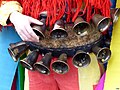 Cencerros 2018.jpg 4,608 × 3,456; 2.14 MB
-
 Chantada - panoramio (1).jpg 5,184 × 3,456; 14.16 MB
-
 Chantada - panoramio (10).jpg 5,184 × 3,456; 12.26 MB
-
 Chantada - panoramio (2).jpg 5,184 × 3,456; 12.14 MB
-
 Chantada - panoramio (3).jpg 3,456 × 5,184; 10.24 MB
-
 Chantada - panoramio (5).jpg 5,184 × 3,456; 10.5 MB
-
 Chantada - panoramio.jpg 5,184 × 3,456; 13.85 MB
-
 Chantada 006An2020.jpg 6,000 × 4,000; 6.93 MB
-
 Chantada 2017-1.jpg 4,160 × 3,120; 4.42 MB
-
 Chantada 2017-2.jpg 4,160 × 3,120; 4.19 MB
-
 Chantada 2017-3.jpg 3,120 × 4,160; 4.41 MB
-
 Chantada 2017-4.jpg 4,160 × 3,120; 4.11 MB
-
 Chantada 2017-5.jpg 4,160 × 3,120; 3.17 MB
-
 Chantada 2017-6.jpg 3,120 × 4,160; 3.59 MB
-
 Chantada 2017-7.jpg 3,120 × 4,160; 3.88 MB
-
 Chantada 2017-8.jpg 4,160 × 3,120; 3.82 MB
-
 Con la manada.jpg 4,608 × 3,456; 2.89 MB
-
 Contrastes - panoramio (2).jpg 4,288 × 2,848; 5.11 MB
-
 Cornamenta.jpg 4,608 × 3,456; 1.84 MB
-
 Ermida de Nosa Señora do Faro.png 2,046 × 1,149; 2.93 MB
-
 Folión de carros 2013 (Chantada) 2.JPG 3,968 × 2,232; 3.71 MB
-
 Folión de carros 2013 (Chantada) 3.JPG 3,968 × 2,232; 3.87 MB
-
 Folión de carros 2013 (Chantada) 4.JPG 3,968 × 2,232; 3.84 MB
-
 Folión de carros 2013 (Chantada) 5.JPG 3,968 × 2,232; 3.62 MB
-
 Folión de carros 2013 (Chantada) 6.JPG 3,968 × 2,232; 3.87 MB
-
 Folión de carros 2013 (Chantada) 7.JPG 3,968 × 2,232; 3.78 MB
-
 Folión de carros 2013 (Chantada) 8.JPG 3,968 × 2,232; 3.64 MB
-
 Folión de carros 2013 (Chantada).JPG 3,968 × 2,232; 3.51 MB
-
 Fonte campo da feira de Chantada.jpg 2,304 × 1,728; 1.24 MB
-
 Galería en Chantada.jpg 5,184 × 3,456; 15.39 MB
-
 Hórreo - panoramio.jpg 4,288 × 2,848; 6.34 MB
-
 Illa preto de Sernande.JPG 3,968 × 2,232; 3.13 MB
-
 Interior da capela do Corpo Santo de Santa Cruz de Viana.jpg 2,016 × 908; 241 KB
-

-
 MIGUEL ANGEL REY CIDRE.jpg 5,168 × 3,445; 5.05 MB
-
 N540 o seu paso por Chantada.JPG 3,968 × 2,232; 2.76 MB
-
 O Corpo Santo de Santa Cruz de Viana.jpg 888 × 1,411; 138 KB
-
 O Corpo Santo na igrexa de Santa Cruz de Viana.jpg 1,198 × 800; 189 KB
-
 Palomar Pazo Piñeiro.jpg 1,024 × 768; 246 KB
-
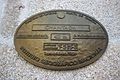 Placa altimétrica Chantada.jpg 4,522 × 3,015; 7.97 MB
-
 Placa instituto xeografico no concello.jpg 4,160 × 3,120; 6.09 MB
-
 Ponte novo - panoramio (1).jpg 4,288 × 2,848; 5.79 MB
-
 Porta na praza de España de Chantada.jpg 3,351 × 5,026; 21.3 MB
-
 Praza de España de Chantada.jpg 5,100 × 3,400; 12.64 MB
-
 Q24002049.jpg 4,000 × 3,000; 4.84 MB
-
 Ribeira Sacra (Chantada desde Saviñao) (4503857630).jpg 2,238 × 1,304; 1.4 MB
-
 Roberto Fernández Álvarez 2023.jpg 1,598 × 2,783; 1.02 MB
-
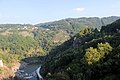
 Río Asma - panoramio.jpg 4,288 × 2,848; 6.21 MB
-
 Río Asma.jpg 5,100 × 3,400; 10.01 MB
-
 Socalcos Chantada 01.jpg 6,000 × 4,000; 12.81 MB
-
 Socalcos Chantada 02.jpg 6,000 × 4,000; 10.42 MB
-
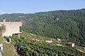
 Socalcos sobre o río Miño preto de Belesar.JPG 3,248 × 2,160; 2.66 MB
-
 Televinte - Chantada.JPG 3,968 × 2,232; 3.84 MB
-
 Vilamor - Chantada.jpg 595 × 381; 201 KB
-
 Vista de Chantada dende O Convento.JPG 3,968 × 2,232; 3.88 MB
-
 Viñedos na Ribeira Sacra - panoramio.jpg 2,560 × 1,920; 1.65 MB
-
 Viñedos pola zona de Chantada - panoramio.jpg 2,560 × 1,920; 1.83 MB


_-_2011.jpg)


.jpg)
.jpg)
.jpg)
.jpg)
.jpg)


.jpg)


_2.JPG)
_3.JPG)
_4.JPG)
_5.JPG)
_6.JPG)
_7.JPG)
_8.JPG)
.JPG)


.jpg)


_(4503857630).jpg)


