Category:Chapel St Leonards
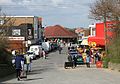
English: Chapel St. Leonards is a village in Lincolnshire on the east coast of England and is situated just 5 miles to the north of the resort of Skegness. It is administered by East Lindsey District Council.
village and civil parish in Lincolnshire, United Kingdom  | |||||
| Upload media | |||||
| Instance of | |||||
|---|---|---|---|---|---|
| Location | East Lindsey, Lincolnshire, East Midlands, England | ||||
 | |||||
Subcategories
This category has the following 2 subcategories, out of 2 total.
L
N
- North Sea Observatory (6 F)
Media in category "Chapel St Leonards"
The following 200 files are in this category, out of 216 total.
(previous page) (next page)-

-
 A very muddy Ember Lane - geograph.org.uk - 3253869.jpg 2,256 × 1,504; 946 KB
-
 A52 and Orby Drain - geograph.org.uk - 3438425.jpg 2,256 × 1,504; 1.77 MB
-
 A52 at Skegness Road junction - geograph.org.uk - 3665560.jpg 640 × 481; 55 KB
-

-

-
 Ancaster Avenue, Chapel St Leonards - geograph.org.uk - 3525296.jpg 640 × 480; 88 KB
-
 Anderby Creek - Cloud Station - geograph.org.uk - 1497454.jpg 640 × 480; 51 KB
-
 Anderby Creek outflow - geograph.org.uk - 385578.jpg 640 × 427; 22 KB
-
 Anderby Road heading south - geograph.org.uk - 3525289.jpg 640 × 480; 72 KB
-

-
 Bank Farm along Anderby Road - geograph.org.uk - 4769785.jpg 800 × 492; 101 KB
-
-
 Beach and dunes at Chapel Six Marshes - geograph.org.uk - 6211674.jpg 1,024 × 683; 201 KB
-

-

-

-
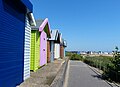
 Beach Huts - geograph.org.uk - 385729.jpg 640 × 427; 50 KB
-
 Beach huts and promenade at Chapel Point - geograph.org.uk - 4768181.jpg 800 × 581; 103 KB
-

-

-
 Beach huts at Chapel Point - geograph.org.uk - 233690.jpg 640 × 480; 55 KB
-
 Beach huts at Chapel Point - geograph.org.uk - 2901615.jpg 800 × 600; 86 KB
-

-
 Beach near Ingoldmells - geograph.org.uk - 3440162.jpg 2,256 × 1,504; 1.24 MB
-
 Benchmark on the Ship Bridge - geograph.org.uk - 2319786.jpg 768 × 1,024; 388 KB
-

-

-

-

-
 Boulder clay outcrop on beach - geograph.org.uk - 244084.jpg 447 × 640; 138 KB
-

-
-
 Bungalow on Anderby Road - geograph.org.uk - 3525291.jpg 640 × 480; 61 KB
-
 But dogs are welcome^ - geograph.org.uk - 6083578.jpg 768 × 1,024; 91 KB
-
 Car park and cafe at Chapel Point - geograph.org.uk - 4768468.jpg 800 × 461; 109 KB
-
 Car Park behind Chapel Point - geograph.org.uk - 4374095.jpg 2,000 × 1,333; 1.34 MB
-

-
 Chapel Point - geograph.org.uk - 154879.jpg 640 × 427; 107 KB
-
 Chapel Point beach huts - geograph.org.uk - 385744.jpg 640 × 427; 48 KB
-
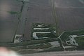
 Chapel Point, aerial 2013 - geograph.org.uk - 3681222.jpg 427 × 640; 69 KB
-
 Chapel Six Marshes Car Park Sea Gate - geograph.org.uk - 4840430.jpg 640 × 427; 52 KB
-
 Chapel Six Marshes Car Park Sea Gate - geograph.org.uk - 4840455.jpg 640 × 427; 86 KB
-
 Chapel St Leonards (5025195203).jpg 4,256 × 2,832; 1.88 MB
-
 Chapel St Leonards (5025811426).jpg 4,256 × 2,832; 2.01 MB
-
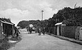
 Chapel St Leonards - The Pullover - 1909.jpg 436 × 683; 231 KB
-
 Chapel St Leonards - The Pullover - 1921.jpg 1,004 × 613; 407 KB
-
 Chapel St Leonards in 2006.jpg 640 × 446; 111 KB
-
 Chapel St Leonards road to the Pullover 1914.jpg 1,587 × 975; 678 KB
-
 Chapel St. Leonard's, aerial 2013 - geograph.org.uk - 3680628.jpg 640 × 427; 85 KB
-

-
 Chapel St. Leonards, aerial 2014 - geograph.org.uk - 4271314.jpg 640 × 427; 80 KB
-
 Chapel St. Leonards, aerial 2018 - geograph.org.uk - 5835063.jpg 800 × 533; 87 KB
-
 Closing soon - geograph.org.uk - 6367161.jpg 4,608 × 3,456; 2.51 MB
-
 Coastal farmland - geograph.org.uk - 3525288.jpg 640 × 480; 71 KB
-

-
 Confirmation - geograph.org.uk - 385646.jpg 640 × 427; 32 KB
-
 Confluence of two drains - geograph.org.uk - 6358802.jpg 1,024 × 768; 139 KB
-

-

-
 Dunes at Chapel St Leonards - geograph.org.uk - 154869.jpg 640 × 427; 95 KB
-
 Eastfield's Leisure Park - geograph.org.uk - 2901562.jpg 800 × 600; 97 KB
-

-

-
 Ember Lane - geograph.org.uk - 385881.jpg 640 × 427; 64 KB
-
 Ember Lane - geograph.org.uk - 4657243.jpg 640 × 480; 67 KB
-
 Empty beach and dunes at Chapel Point - geograph.org.uk - 4768477.jpg 800 × 589; 104 KB
-
 Entering Chapel St. Leonards - geograph.org.uk - 5142402.jpg 640 × 427; 46 KB
-
 Entrance to caravan park - geograph.org.uk - 3525309.jpg 640 × 480; 49 KB
-
 Entrance to field Farm equestrian Centre - geograph.org.uk - 3062439.jpg 2,256 × 1,504; 1.08 MB
-
 Fish ^ Chips - geograph.org.uk - 2051036.jpg 640 × 426; 88 KB
-

-
 Footbridge over a narrow drain - geograph.org.uk - 2319846.jpg 1,152 × 864; 285 KB
-

-
 Golden Anchor Caravan Park - geograph.org.uk - 4768077.jpg 800 × 638; 179 KB
-

-
 Hair Studio, Chapel St Leonards - geograph.org.uk - 3525298.jpg 640 × 480; 73 KB
-

-
 Horse riders on the beach at Wolla Bank - geograph.org.uk - 4768657.jpg 800 × 562; 118 KB
-
 Houses along Anderby Road - geograph.org.uk - 4771531.jpg 800 × 521; 101 KB
-

-
 Landseer Avenue, Chapel St Leonards - geograph.org.uk - 4374163.jpg 2,000 × 1,362; 1,023 KB
-

-
 Lane to the Chapel Six Marshes car park - geograph.org.uk - 4771513.jpg 800 × 466; 110 KB
-
 Little Mermaid Fish and Chips - geograph.org.uk - 385751.jpg 640 × 427; 66 KB
-
 Looking North at Chapel Point beach - geograph.org.uk - 4045394.jpg 3,264 × 2,448; 2.66 MB
-
 Looking north at Chapel Six Marshes - geograph.org.uk - 2901546.jpg 800 × 600; 80 KB
-

-

-
 Low tide at Chapel Six Marshes - geograph.org.uk - 385639.jpg 640 × 427; 20 KB
-
 Low tide at Wolla Bank - geograph.org.uk - 385624.jpg 640 × 427; 30 KB
-
 Low tide on the beach at Chapel Point - geograph.org.uk - 4768590.jpg 800 × 536; 105 KB
-
 Marine Observatory under construction at Chapel St Leonards - geograph.org.uk - 5473382.jpg 5,312 × 2,988; 4.01 MB
-
 Menu board - geograph.org.uk - 2051048.jpg 426 × 640; 74 KB
-
 Methodist Chapel - Chapel St Leonards - geograph.org.uk - 2319752.jpg 1,280 × 960; 289 KB
-

-
 Near Chapel St. Leonards (1) - geograph.org.uk - 2159557.jpg 1,024 × 768; 263 KB
-
 Near Chapel St. Leonards (2) - geograph.org.uk - 2159566.jpg 1,024 × 768; 175 KB
-
 Near Chapel St. Leonards (3) - geograph.org.uk - 2159568.jpg 1,024 × 768; 183 KB
-
 Nelson Villa caravans - geograph.org.uk - 385787.jpg 640 × 427; 53 KB
-
 North of Chapel Point - geograph.org.uk - 1497164.jpg 640 × 480; 64 KB
-
 North Sea Observatory, Chapel Point - geograph.org.uk - 6083303.jpg 4,608 × 3,456; 2.88 MB
-
 North Sea Observatory, Chapel Point - geograph.org.uk - 6357290.jpg 1,024 × 768; 145 KB
-
 Not Cape Horn, but Chapel Point - geograph.org.uk - 4840608.jpg 640 × 427; 39 KB
-
 Not Cape Horn, but Chapel Point - geograph.org.uk - 4840614.jpg 1,600 × 1,067; 525 KB
-

-
 On the beach at Wolla Bank - geograph.org.uk - 4768696.jpg 800 × 544; 77 KB
-
 On the promenade near Ingoldmells - geograph.org.uk - 4768073.jpg 800 × 597; 98 KB
-
 On the seafront at Chapel St Leonards - geograph.org.uk - 2319889.jpg 1,280 × 960; 254 KB
-

-
 Orby Drain outflow - geograph.org.uk - 4768100.jpg 800 × 573; 105 KB
-

-
 Ordnance Survey Flush Bracket S0616 - geograph.org.uk - 6088524.jpg 3,807 × 2,855; 3.31 MB
-
 Path off Sea Bank Road, Chapel St Leonards - geograph.org.uk - 4152671.jpg 1,600 × 1,200; 429 KB
-
 Point Cafe, Chapel St Leonards - geograph.org.uk - 3525295.jpg 640 × 480; 84 KB
-
 Pond, Bank Farm - geograph.org.uk - 3525284.jpg 640 × 480; 81 KB
-
 Poplar Zareba caravan park - geograph.org.uk - 385972.jpg 640 × 427; 47 KB
-

-
 Promenade, Chapel St Leonards - geograph.org.uk - 4374117.jpg 2,000 × 1,333; 1.38 MB
-

-
 Public loos, Chapel St Leonards - geograph.org.uk - 2319880.jpg 1,280 × 960; 324 KB
-
 Pullover at Wolla Bank - geograph.org.uk - 4839438.jpg 640 × 427; 50 KB
-
 Reed beds at Chapel Six Marshes - geograph.org.uk - 4771516.jpg 800 × 588; 185 KB
-
 Reedbeds at Wolla Bank - geograph.org.uk - 4839433.jpg 640 × 427; 48 KB
-
 Ridge and Furrow field behind the church - geograph.org.uk - 2319813.jpg 1,152 × 864; 282 KB
-
 River Overflow - geograph.org.uk - 1008929.jpg 640 × 427; 62 KB
-
 Road to Chapel Point - geograph.org.uk - 4840586.jpg 640 × 427; 58 KB
-
 Roman Bank heading south - geograph.org.uk - 3525286.jpg 640 × 480; 75 KB
-
 Sandfield Club, Chapel St. Leonards - geograph.org.uk - 5142512.jpg 640 × 427; 42 KB
-
 School Safety Zone - geograph.org.uk - 4374142.jpg 2,000 × 1,207; 1.42 MB
-
 Sea Road in Chapel St Leonards - geograph.org.uk - 4771644.jpg 800 × 533; 139 KB
-

-

-
 Shelter and Footpath at Chapel Point - geograph.org.uk - 1496755.jpg 640 × 480; 66 KB
-

-
 Ship Bridge, Chapel St Leonards - geograph.org.uk - 2319767.jpg 1,152 × 864; 300 KB
-
 Sluice on Orby Drain - geograph.org.uk - 4768107.jpg 800 × 632; 181 KB
-
 Small Fishing Pond at Base of Sea Wall - geograph.org.uk - 151887.jpg 640 × 480; 124 KB
-

-
 South Road, Chapel St Leonards - geograph.org.uk - 3525307.jpg 640 × 480; 74 KB
-
 South Road, Chapel St Leonards - geograph.org.uk - 3525310.jpg 640 × 480; 44 KB
-
 St Leonards Drive in Chapel St Leonards - geograph.org.uk - 4771535.jpg 800 × 533; 112 KB
-

-

-
 Static caravans - geograph.org.uk - 385977.jpg 640 × 427; 54 KB
-
 Stone's Lane pillbox - geograph.org.uk - 385848.jpg 640 × 427; 68 KB
-
 Structures on the Edge, Chapel Six Marshers - geograph.org.uk - 4152678.jpg 1,600 × 1,200; 422 KB
-
 Sun ,Sea and Sand - geograph.org.uk - 2627355.jpg 640 × 448; 94 KB
-
 Sunset and sea grasses on the beach, Chapel St. Leonards - geograph.org.uk - 4840649.jpg 1,600 × 1,067; 353 KB
-
 The beach at Wolla Bank - geograph.org.uk - 2901535.jpg 800 × 600; 116 KB
-

-
 The carpark at Wolla Bank - geograph.org.uk - 2901539.jpg 800 × 600; 111 KB
-

-

-
 The North Sea at Wolla Bank - geograph.org.uk - 4768699.jpg 800 × 599; 110 KB
-
 The path to the beach - geograph.org.uk - 2901528.jpg 800 × 600; 113 KB
-
 The promenade at Chapel Point - geograph.org.uk - 4768451.jpg 800 × 488; 88 KB
-
 The promenade at Chapel St Leonards - geograph.org.uk - 4768087.jpg 800 × 650; 93 KB
-
 The public area at White Horses - geograph.org.uk - 2901556.jpg 800 × 600; 97 KB
-

-
 The public toilets at White Horses - geograph.org.uk - 2901543.jpg 800 × 600; 90 KB
-

-
 The Seayr Hotel, Chapel St Leonards - geograph.org.uk - 3525304.jpg 640 × 480; 74 KB
-
 The Ship Inn - geograph.org.uk - 2319774.jpg 1,152 × 864; 257 KB
-

-
 The Ship Inn, Chapel St Leonards - geograph.org.uk - 3464478.jpg 4,046 × 3,035; 2.9 MB
-
 The Sound Tower at Chapel Six Marshes - geograph.org.uk - 4771520.jpg 650 × 800; 127 KB
-

-
 The Thatched Cottage - geograph.org.uk - 2051384.jpg 640 × 426; 163 KB
-
 The Trafalgar Inn, Chapel Saint Leonards - geograph.org.uk - 2901632.jpg 800 × 600; 103 KB
-
 The Vine, Chapel St Leonards - geograph.org.uk - 3525301.jpg 640 × 480; 83 KB
-
 The White House Inn, Chapel St Leonards - geograph.org.uk - 2319855.jpg 1,280 × 960; 276 KB
-
 Timber lookout shelter on Chapel Point - geograph.org.uk - 4768578.jpg 800 × 503; 118 KB
-

-
 Trunch Lane heading east - geograph.org.uk - 3525314.jpg 640 × 480; 56 KB
-
 Trunch Lane, Chapel St. Leonards - geograph.org.uk - 2159542.jpg 1,024 × 768; 125 KB
-

-
 View from the Sound Tower, Wolla Bank - geograph.org.uk - 6083363.jpg 4,608 × 3,456; 3.06 MB
-
 View north from Chapel Point - geograph.org.uk - 385665.jpg 640 × 427; 43 KB
-

-
 View towards Anderby Creek - geograph.org.uk - 385494.jpg 640 × 427; 27 KB
-

-
 Willoughby High Drain - geograph.org.uk - 2051388.jpg 640 × 426; 123 KB
-

-

-
 Willoughby High Drain, looking seawards - geograph.org.uk - 2319757.jpg 1,152 × 864; 361 KB
-
 Wolla Bank - geograph.org.uk - 385602.jpg 640 × 427; 28 KB
-
 Wolla Bank Pit Nature Reserve - geograph.org.uk - 4839430.jpg 640 × 427; 58 KB
-
 Wolla Bank Pit Nature Reserve - geograph.org.uk - 4839431.jpg 640 × 427; 63 KB
-

-

-
 Anderby - Sea Road - geograph.org.uk - 1497495.jpg 640 × 480; 48 KB
-
 Anderby - Sharp bend near Manor Farm - geograph.org.uk - 1497490.jpg 640 × 480; 52 KB
-
 Anderby Creek - Footpath View - geograph.org.uk - 1497464.jpg 640 × 480; 83 KB
-
 Anderby Creek - Footpath View - geograph.org.uk - 1497467.jpg 640 × 480; 88 KB
-
 Anderby Creek - geograph.org.uk - 1497449.jpg 640 × 480; 85 KB
-
 Anderby Creek - Lane Junction - geograph.org.uk - 1497479.jpg 640 × 480; 60 KB
-
 Anderby Road - geograph.org.uk - 1497471.jpg 640 × 480; 87 KB
-
 Chapel Point - geograph.org.uk - 385661.jpg 640 × 427; 61 KB
-
 Chapel Point shelter - geograph.org.uk - 385669.jpg 640 × 427; 57 KB


.jpg)
.jpg)


_-_geograph.org.uk_-_2159557.jpg)
_-_geograph.org.uk_-_2159566.jpg)
_-_geograph.org.uk_-_2159568.jpg)


