Category:Chapelle Saint-Léon (Cité Léon Kauffman, Soleuvre)
| Object location | | View all coordinates using: OpenStreetMap |
|---|
 | |||||
| Upload media | |||||
| Instance of | |||||
|---|---|---|---|---|---|
| Location | Soleuvre, Sanem, Canton of Esch-sur-Alzette, Luxembourg | ||||
 | |||||
Media in category "Chapelle Saint-Léon (Cité Léon Kauffman, Soleuvre)"
The following 2 files are in this category, out of 2 total.
-
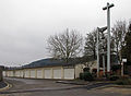 Kierch Cité Kauffmann, Zolwer.jpg 1,900 × 1,394; 1.58 MB
-
 Klackentuerm Kierch Cité Kauffmann, Zolwer.jpg 1,250 × 2,045; 1.68 MB
