Category:Chapels in Cumbria
Ceremonial counties of England: Bedfordshire · Berkshire · Buckinghamshire · Cambridgeshire · Cheshire · Cornwall · Cumbria · Derbyshire · Devon · Dorset · Durham · East Riding of Yorkshire · East Sussex · Essex · Gloucestershire · Greater London · Greater Manchester · Hampshire · Herefordshire · Hertfordshire · Kent · Lancashire · Leicestershire · Lincolnshire · Merseyside · Norfolk · North Yorkshire · Northamptonshire · Northumberland · Nottinghamshire · Oxfordshire · Rutland · Shropshire · Somerset · South Yorkshire · Staffordshire · Suffolk · Surrey · Tyne and Wear · Warwickshire · West Midlands · West Sussex · West Yorkshire · Wiltshire · Worcestershire
City-counties: Bristol · City of London
Former historic counties:
Other former counties:
City-counties: Bristol · City of London
Former historic counties:
Other former counties:
Subcategories
This category has the following 10 subcategories, out of 10 total.
F
K
- Keld Chapel (10 F)
M
N
- St Nicholas church, Whitehaven (11 F)
S
- Sedbergh School Chapel (5 F)
T
- Tottlebank Baptist Church (2 F)
W
- Winton United Chapel (2 F)
Media in category "Chapels in Cumbria"
The following 36 files are in this category, out of 36 total.
-
 Anthorn, Bowness - geograph.org.uk - 40481.jpg 640 × 480; 89 KB
-
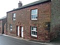
 Bethesda Free Chapel - geograph.org.uk - 475540.jpg 640 × 480; 225 KB
-
 Wesleyan Chapel, Bowness on Solway - geograph.org.uk - 86218.jpg 480 × 640; 72 KB
-
 Chapel of Rest - panoramio (1).jpg 3,072 × 1,728; 2.5 MB
-
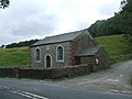
 Chapel, Firbank - geograph.org.uk - 98517.jpg 479 × 640; 93 KB
-
 Chapel, Thurstonfield - geograph.org.uk - 118249.jpg 640 × 480; 77 KB
-
 Cockermouth United Reformed Church - geograph.org.uk - 86522.jpg 640 × 462; 120 KB
-
 Datestone on the old chapel, Kirkoswald - geograph.org.uk - 1143497.jpg 640 × 603; 105 KB
-

-

-
 King's Meaburn Methodist Chapel, Sign - geograph.org.uk - 617339.jpg 426 × 640; 78 KB
-
 Kingdom Hall, The Sands, Appleby - geograph.org.uk - 277131.jpg 640 × 486; 121 KB
-
 Mortuary chapel, Wreay - geograph.org.uk - 4375497.jpg 640 × 425; 163 KB
-
 North Stainmore Chapel - geograph.org.uk - 136762.jpg 640 × 427; 126 KB
-
 Old chapel - geograph.org.uk - 283934.jpg 640 × 480; 211 KB
-
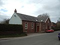
 Old Chapel, Bolton Low Houses - geograph.org.uk - 104947.jpg 640 × 480; 66 KB
-
 Old Chapel, Bolton Low Houses - geograph.org.uk - 522662.jpg 640 × 480; 213 KB
-
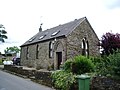
 Old chapel, Flimby - geograph.org.uk - 463802.jpg 640 × 480; 105 KB
-
 Old Chapel, Pardshaw - geograph.org.uk - 202458.jpg 640 × 480; 218 KB
-
 The old Wesleyan chapel, Kirkoswald - geograph.org.uk - 1143507.jpg 640 × 480; 82 KB
-
 Wesleyan Methodist Chapel - geograph.org.uk - 1396189.jpg 640 × 480; 64 KB
-
 Westfield Gospel Hall - geograph.org.uk - 583693.jpg 640 × 480; 141 KB
-
 Castle Sowerby Chapel, Sour Nook - geograph.org.uk - 84410.jpg 640 × 426; 157 KB
-
 Chapel at Tebay - geograph.org.uk - 162415.jpg 640 × 480; 81 KB
-
 Chapel, Plumbland - geograph.org.uk - 89722.jpg 640 × 427; 69 KB
-

-
 Corney Chapel - geograph.org.uk - 128069.jpg 640 × 427; 87 KB
-
 Foulsyke Chapel - geograph.org.uk - 91940.jpg 640 × 427; 116 KB
-
 Nentsberry Chapel - geograph.org.uk - 77272.jpg 600 × 403; 66 KB
-
 Old chapel - geograph.org.uk - 474503.jpg 640 × 480; 227 KB
-
 Old chapel, Blennerhasset - geograph.org.uk - 563950.jpg 640 × 480; 172 KB
-
 Penruddock Independent Chapel - geograph.org.uk - 325786.jpg 640 × 480; 65 KB
-
 Plumbland Evangelical Chapel - geograph.org.uk - 424971.jpg 640 × 480; 103 KB
-
 Wesleyan Chapel, Gaisgill - geograph.org.uk - 224688.jpg 640 × 426; 121 KB
-
 Wesleyan Chapel, Kirkbride - geograph.org.uk - 164272.jpg 640 × 480; 88 KB
-
 Wesleyan Chapel, Tirril - geograph.org.uk - 112317.jpg 640 × 401; 119 KB


.jpg)


