Category:Charles Brooking's Map of Dublin (1728)
Media in category "Charles Brooking's Map of Dublin (1728)"
The following 17 files are in this category, out of 17 total.
-
 Corn Market House, Dublin 8.jpg 1,500 × 1,135; 1.63 MB
-
 Dr Steevens' Hospital (1728).jpg 1,500 × 1,096; 1.65 MB
-
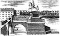 George I Essex Bridge.jpg 742 × 452; 272 KB
-
 Linen hall, Dublin.jpg 1,500 × 1,031; 1.62 MB
-
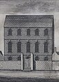
 Lord Mayors House, Dublin (1728).jpg 652 × 294; 166 KB
-
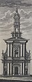 St. Ann's Church, Dawson Street (1728).jpg 592 × 1,500; 848 KB
-
 St. Werburgh's Church, Dublin (1728).jpg 594 × 1,500; 897 KB
-
 Statue of George I on Essex Bridge, Dublin.jpg 1,448 × 882; 603 KB
-
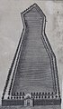 The city bason (city basin), Dublin.jpg 873 × 1,500; 1.19 MB
-
 The Custom house (1707).png 1,172 × 478; 1.5 MB
-
-
 The history and antiquities of the city of Dublin Fleuron T115001-2.png 2,009 × 861; 81 KB
-
 The history and antiquities of the city of Dublin Fleuron T115002-4.png 1,649 × 762; 82 KB
-
 The hospital in Steven's Street.jpg 1,081 × 1,500; 1.62 MB
-
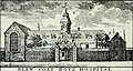
 The Poor House, Dublin.png 579 × 319; 451 KB
-
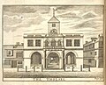 Tholsel image dublin.jpg 1,024 × 825; 329 KB
-
 Trinity College Dublin, West front (1728).png 1,082 × 700; 1.63 MB

.jpg)


.jpg)

,_Dublin.jpg)
.jpg)


.png)
.jpg)
.jpg)
.png)