Category:Chickasaw maps
Subcategories
This category has only the following subcategory.
Media in category "Chickasaw maps"
The following 33 files are in this category, out of 33 total.
-
 Indians NW of South Carolina.jpg 1,770 × 1,217; 294 KB
-

-
-
-
 A map of the Tennassee state formerly part of North Carolina (3045318235).jpg 2,000 × 1,527; 2.5 MB
-
 Broutin-Ackia 4DFC49C.jpg 1,396 × 1,268; 309 KB
-
 Carte Nouvelle-france et 13 colonies en 1710.jpg 500 × 400; 67 KB
-
 Cessions Southeastern Tribes- Andrew Jackson.jpg 2,030 × 1,512; 1.91 MB
-
 Chickasaw and Choctaw land cessions in Mississippi.jpg 2,000 × 3,183; 927 KB
-
 Chickasaw Nation map.png 400 × 398; 253 KB
-
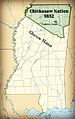 Chickasaw Tribe Mississippi 1832.jpg 2,000 × 3,183; 783 KB
-
 Chickasaw.svg 512 × 324; 29 KB
-
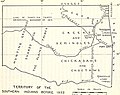
 ChickasawOSTA.svg 800 × 395; 2.49 MB
-
 ChickasawWars.jpg 490 × 809; 155 KB
-
 Côtes des environs de la rivière Mississippi en 1701.jpg 1,743 × 1,073; 886 KB
-
 DeSoto Map Leg 2 HRoe 2008.jpg 600 × 470; 290 KB
-
 DumontMemoiresLouisianeMap.jpg 644 × 789; 180 KB
-
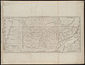
 Fort Okfuskee.jpg 1,395 × 707; 185 KB
-
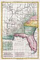
 Georgia, from the latest authorities. LOC 2010587363.jpg 4,536 × 5,105; 3.57 MB
-
 Indians of the Southwest (1903) (14765144625).jpg 2,504 × 3,754; 1.08 MB
-
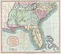
 Map of British West Florida showing 1763 and 1764 boundaries.jpg 600 × 398; 45 KB
-
 Map of Chickasaw Nation, Indian territory LOC 2007627495.jpg 9,551 × 10,701; 11.69 MB
-
 Map of Chickasaw Nation, Indian territory LOC 2007627495.tif 9,551 × 10,701; 292.41 MB
-

-
 Mappa a'n Hyns Dagrow.png 2,025 × 1,547; 3.19 MB
-
 Montigny map with locations.jpg 863 × 1,036; 454 KB
-
 NPS trail-of-tears-map.gif 4,686 × 2,310; 806 KB
-
 Oklahoma Tribal Statistical Area.svg 828 × 400; 1.49 MB
-
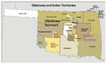 Okterritory.png 2,515 × 1,500; 534 KB
-

-
 Trails of Tears de.png 2,025 × 1,547; 3.05 MB
-
 Trails of Tears en.png 2,025 × 1,547; 3.04 MB
-
 University of California publications in history (1911) (14750237496).jpg 2,940 × 2,336; 1,001 KB


.jpg)


_(14765144625).jpg)


_(14578797348).jpg)


_(14750237496).jpg)