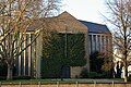
Category:Christuskirche (Düren)
| Object location | | View all coordinates using: OpenStreetMap |
|---|
church   | |||||
| Upload media | |||||
| Instance of | |||||
|---|---|---|---|---|---|
| Named after | |||||
| Location | Düren, Cologne Government Region, North Rhine-Westphalia, Germany | ||||
| Architectural style | |||||
| Heritage designation | |||||
| Inception |
| ||||
 | |||||
This is the category for an architectural monument.
It is on the list of cultural monuments of Düren, no. 1/111.
It is on the list of cultural monuments of Düren, no. 1/111.
Subcategories
This category has the following 2 subcategories, out of 2 total.
I
Media in category "Christuskirche (Düren)"
The following 2 files are in this category, out of 2 total.
-
 5974740.Erwin Quedenfeldt.jpg 1,965 × 2,523; 926 KB
-
 Fassade Christuskirche.jpg 2,329 × 1,553; 1.27 MB

