Category:Church Minshull
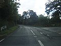
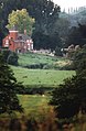
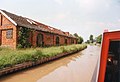
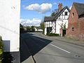
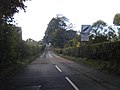
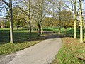
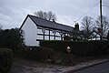
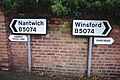
English: Church Minshull is a village and civil parish in the unitary authority of Cheshire East and the ceremonial county of Cheshire, England. The village is located approximately 5 miles north west of Crewe and to the west of the River Weaver and the Shropshire Union Canal. The principal road through Church Minshull is the B5074 between Nantwich (6 miles to the south) and Winsford (4 miles to the north). The modern village centre is a designated conservation area which contains many houses of Tudor style architecture. A large area in the east of the parish falls within the Weaver Valley Area of Special County Value.
village and civil parish in Cheshire East, England  | |||||
| Upload media | |||||
| Instance of | |||||
|---|---|---|---|---|---|
| Location | Cheshire East, Cheshire, North West England, England | ||||
| Said to be the same as | Church Minshull (Wikimedia duplicated page, civil parish) | ||||
 | |||||
Subcategories
This category has the following 6 subcategories, out of 6 total.
B
- The Badger, Church Minshull (7 F)
C
M
- Mill House, Church Minshull (2 F)
O
- Oakhurst, Church Minshull (2 F)
Media in category "Church Minshull"
The following 138 files are in this category, out of 138 total.
-
 A twenty two inch water main crosses the River Weaver - geograph.org.uk - 2697161.jpg 3,072 × 2,304; 4.24 MB
-
 A wintery scene from The White House - geograph.org.uk - 81404.jpg 640 × 480; 118 KB
-
 Across the fields to Old Hoolgrave - geograph.org.uk - 5612709.jpg 800 × 600; 128 KB
-
 Ambulance on the A530 in Minshull Vernon - geograph.org.uk - 1194706.jpg 640 × 427; 119 KB
-
 Aqueduct Marina - geograph.org.uk - 2171250.jpg 1,500 × 1,000; 135 KB
-
 Ash Brook - geograph.org.uk - 537080.jpg 640 × 480; 169 KB
-
 Ash Brook looking downstream - geograph.org.uk - 2694712.jpg 3,072 × 2,304; 5.16 MB
-
 Ash Brook looking upstream - geograph.org.uk - 2694716.jpg 3,072 × 2,304; 5.25 MB
-
 Ashbrook Bridge, Cheshire.jpg 3,072 × 2,304; 4.23 MB
-
 Ashbrook Bridge-Upper Road Level - geograph.org.uk - 2694698.jpg 3,072 × 2,304; 3.7 MB
-
 B5074 at Lee Green Lane - geograph.org.uk - 3170372.jpg 640 × 480; 45 KB
-
 B5074 near Aston Grove Farm - geograph.org.uk - 3170442.jpg 640 × 481; 69 KB
-
 B5074 south of Wades Green - geograph.org.uk - 3170437.jpg 640 × 480; 58 KB
-
 B5074-Minshull Lane junction - geograph.org.uk - 3170435.jpg 640 × 481; 74 KB
-
 Beech House, Church Minshull.jpg 3,465 × 2,698; 1.96 MB
-
 Boaters on the Canal - geograph.org.uk - 1458566.jpg 521 × 640; 64 KB
-
 Bridge House Cross Lane Church Minshull - geograph.org.uk - 3386344.jpg 1,305 × 1,995; 648 KB
-
 Bridge House, Church Minshull.jpg 1,800 × 1,350; 471 KB
-

-
 Bridge over the River Weaver, Church Minshull - geograph.org.uk - 5643099.jpg 1,280 × 851; 370 KB
-
 Canal boat approaching Brickyard Bridge - geograph.org.uk - 381629.jpg 640 × 531; 144 KB
-
 Canal Horse Stables - geograph.org.uk - 596347.jpg 640 × 439; 52 KB
-
 Canal House - geograph.org.uk - 596306.jpg 640 × 439; 81 KB
-

-
 Cheshire Estate Railing - geograph.org.uk - 6054233.jpg 6,032 × 4,014; 5.43 MB
-

-
 Church Minshull - geograph.org.uk - 5852819.jpg 1,280 × 851; 509 KB
-
 Church Minshull - Lea Green Villa Farm.jpg 640 × 480; 107 KB
-
 Church Minshull Bridge.jpg 1,800 × 1,350; 825 KB
-
 Church Minshull.jpg 800 × 600; 106 KB
-
 Countryside near Aqueduct Marina - geograph.org.uk - 4597379.jpg 640 × 427; 74 KB
-
-
 Cross near Walley's Green - geograph.org.uk - 390031.jpg 580 × 638; 101 KB
-
 Double Decker Bus - geograph.org.uk - 6054242.jpg 6,032 × 4,014; 5.23 MB
-
 Eardswick Wood - geograph.org.uk - 5600304.jpg 1,280 × 851; 716 KB
-
 Entrance driveway at Lea Green House - geograph.org.uk - 2697066.jpg 3,072 × 2,304; 5.31 MB
-
 Entrance to Aqueduct Marina - geograph.org.uk - 5211760.jpg 1,024 × 615; 376 KB
-
 Fake Black-and-white - geograph.org.uk - 6054159.jpg 6,032 × 4,014; 5.26 MB
-
 Farm track heading towards the River Weaver - geograph.org.uk - 4850777.jpg 3,264 × 2,448; 2.11 MB
-
 Farmland near Wettenhall - geograph.org.uk - 3643673.jpg 1,024 × 680; 206 KB
-

-
-
 Farmland south-west of Church Minshull, Cheshire - geograph.org.uk - 2827904.jpg 1,024 × 654; 444 KB
-

-
 Field-Woodland boundary - geograph.org.uk - 2698105.jpg 3,072 × 2,304; 3.66 MB
-
 Footbridge over the River Weaver - geograph.org.uk - 2697081.jpg 3,072 × 2,304; 4.4 MB
-
 Footpath at Minshull Vernon - geograph.org.uk - 197120.jpg 640 × 427; 100 KB
-
 Footpath from Sandicroft Wood to the Over Road - geograph.org.uk - 2697184.jpg 3,072 × 2,304; 4.25 MB
-
 Footpath in Sandicroft Wood - geograph.org.uk - 2697176.jpg 3,072 × 2,304; 4.84 MB
-
 Footpath to Church Minshull - geograph.org.uk - 5600306.jpg 851 × 1,280; 767 KB
-
 Friesians by Minshull Lane - geograph.org.uk - 6315821.jpg 1,024 × 683; 288 KB
-
 Gate near Wades Green - geograph.org.uk - 6315809.jpg 1,024 × 683; 312 KB
-
 Grazing pasture adjacent to Lea Green Lane - geograph.org.uk - 2697073.jpg 3,072 × 2,304; 3.96 MB
-
 Hoolgrave Manor - geograph.org.uk - 531888.jpg 640 × 480; 85 KB
-
 Inside Paradise Wood - geograph.org.uk - 2698102.jpg 3,072 × 2,304; 4.68 MB
-
 Lea Green Hall - geograph.org.uk - 575316.jpg 640 × 481; 80 KB
-
 Lea Green Lane - geograph.org.uk - 2697070.jpg 3,072 × 2,304; 3.61 MB
-
 Lea Green Villa Farm - geograph.org.uk - 2697068.jpg 3,072 × 2,304; 3.62 MB
-
 Lee Green Hall, Church Minshull.jpg 1,800 × 1,350; 399 KB
-
 Manor Farm Paradise Lane - geograph.org.uk - 2698084.jpg 3,072 × 2,304; 2.89 MB
-

-
 Middlewich Branch Canal near Church Minshull - geograph.org.uk - 5638494.jpg 1,280 × 851; 426 KB
-
-
 Middlewich Branch Canal, near Aqueduct Marina - geograph.org.uk - 6085094.jpg 1,280 × 851; 542 KB
-

-
 Minshull Lane - geograph.org.uk - 6315815.jpg 1,024 × 683; 290 KB
-
 Minshull Lane - geograph.org.uk - 6315817.jpg 1,024 × 683; 305 KB
-
 Minshull Lock - geograph.org.uk - 483341.jpg 640 × 449; 48 KB
-

-
 Modern Black-and-white - geograph.org.uk - 6054150.jpg 6,032 × 4,014; 5.84 MB
-
 Mooring at Aqueduct Marina - geograph.org.uk - 2171258.jpg 1,500 × 1,000; 156 KB
-
 Moorings at Aqueduct Marina - geograph.org.uk - 2170216.jpg 1,500 × 1,000; 153 KB
-
 Moorings at Aqueduct Marina - geograph.org.uk - 2171262.jpg 1,500 × 1,000; 179 KB
-
 Morris Bridge No 15 - geograph.org.uk - 376518.jpg 640 × 480; 96 KB
-

-
-
 Paradise Farm Paradise Lane - geograph.org.uk - 2698090.jpg 3,072 × 2,304; 4.1 MB
-
 Paradise Green Farm - geograph.org.uk - 2698097.jpg 3,072 × 2,304; 3.08 MB
-
 Paradise Lane at the Junction with Woodgreen Lane - geograph.org.uk - 2698094.jpg 3,072 × 2,304; 3.74 MB
-
 Paradise Lane looking SW - geograph.org.uk - 2698080.jpg 3,072 × 2,304; 3.21 MB
-
 Paradise Lane looking SW - geograph.org.uk - 2698086.jpg 3,072 × 2,304; 3.38 MB
-
 River Weaver from Shropshire Union Canal - geograph.org.uk - 394097.jpg 640 × 427; 106 KB
-
 River Weaver from the Middlewich Branch Canal - geograph.org.uk - 6085276.jpg 1,280 × 851; 638 KB
-
 River Weaver, Church Minshull - geograph.org.uk - 5638756.jpg 1,280 × 851; 401 KB
-
 River Weaver, near Church Minshull - geograph.org.uk - 5600310.jpg 1,280 × 850; 707 KB
-
 River Weaver, near Church Minshull - geograph.org.uk - 5643102.jpg 1,280 × 851; 410 KB
-
 Road sign - geograph.org.uk - 6054177.jpg 6,032 × 4,014; 4.45 MB
-
 Rough pasture beside the River Weaver - geograph.org.uk - 2697078.jpg 3,072 × 2,304; 3.31 MB
-

-
 Shropshire Union Canal from bridge 19 - geograph.org.uk - 575311.jpg 640 × 480; 60 KB
-
 Shropshire Union east of Brickyard Bridge - geograph.org.uk - 382009.jpg 640 × 430; 104 KB
-
 Smithy House, Church Minshull.jpg 1,800 × 1,350; 458 KB
-
 Steps at Minshull Bridge - geograph.org.uk - 5638875.jpg 851 × 1,280; 651 KB
-
 Stile beside an ancient Oak tree - geograph.org.uk - 2697076.jpg 3,072 × 2,304; 4.95 MB
-
-
 Stile ^ Footpath at Paradise Farm - geograph.org.uk - 2698089.jpg 3,072 × 2,304; 3.68 MB
-
 Stone work in cage - geograph.org.uk - 6054162.jpg 4,014 × 6,032; 4.7 MB
-
 That's not a bungalow - geograph.org.uk - 6054224.jpg 6,032 × 4,014; 6.46 MB
-
 The cafe at Aqueduct Marina - geograph.org.uk - 2170217.jpg 1,500 × 1,000; 136 KB
-
 The River Weaver adjacent to Sandicroft Wood - geograph.org.uk - 2697170.jpg 3,072 × 2,304; 4.76 MB
-
 The River Weaver looking downstream - geograph.org.uk - 2697087.jpg 3,072 × 2,304; 4.35 MB
-
 The River Weaver looking downstream - geograph.org.uk - 2697152.jpg 3,072 × 2,304; 4.55 MB
-
 The River Weaver looking upstream - geograph.org.uk - 2697085.jpg 2,304 × 3,072; 4.11 MB
-
 The River Weaver looking upstream - geograph.org.uk - 2697153.jpg 3,072 × 2,304; 4.53 MB
-
 The site of Vernon's Bridge, Middlewich Branch - geograph.org.uk - 5211756.jpg 1,024 × 768; 120 KB
-
-
 The Wharf, Church Minshull.jpg 4,000 × 3,000; 4.87 MB
-
 The Wharf, Minshull Vernon - geograph.org.uk - 1192551.jpg 640 × 434; 169 KB
-
 The Wharf, Minshull Vernon.jpg 1,000 × 672; 618 KB
-
 Track to Old Hoolgrave - geograph.org.uk - 5638745.jpg 1,280 × 851; 489 KB
-
 View down from the Middlewich Branch Canal - geograph.org.uk - 6085142.jpg 1,280 × 851; 685 KB
-

-
 Village Farmhouse, Church Minshull.jpg 4,000 × 3,000; 1.35 MB
-
 Village Sign - geograph.org.uk - 6054216.jpg 6,032 × 4,014; 3.24 MB
-
 Which way can I go^ - geograph.org.uk - 6054256.jpg 6,032 × 4,014; 6.15 MB
-
 Woodgreen Lane - geograph.org.uk - 2698099.jpg 3,072 × 2,304; 4.38 MB
-
 Ambulance on the A530 at Walley's Green - geograph.org.uk - 1192625.jpg 640 × 427; 157 KB
-
 Beautiful Cheshire^ - geograph.org.uk - 179899.jpg 640 × 480; 72 KB
-
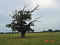 Blasted oak, Wettenhall - geograph.org.uk - 188747.jpg 640 × 480; 58 KB
-

-

-

-
 Dairy Farm, Minshull Vernon - geograph.org.uk - 197133.jpg 467 × 311; 120 KB
-
 Eardswick Lane - geograph.org.uk - 531896.jpg 640 × 480; 92 KB
-
 Footbridge over the River Weaver - geograph.org.uk - 575314.jpg 640 × 480; 144 KB
-
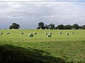 Hay Bales on Hill Top Farm. - geograph.org.uk - 537086.jpg 640 × 480; 64 KB
-
 Maize crop near Church Minhull - geograph.org.uk - 532495.jpg 640 × 480; 110 KB
-
 Marlpit at Paradise Farm - geograph.org.uk - 62452.jpg 640 × 480; 115 KB
-
 Obstruction on walk - geograph.org.uk - 682796.jpg 640 × 480; 78 KB
-
 Paradise Wood - geograph.org.uk - 532512.jpg 640 × 359; 62 KB
-
 Pond near Rosalie Farm - geograph.org.uk - 62455.jpg 640 × 480; 113 KB
-
 River Weaver - geograph.org.uk - 572265.jpg 480 × 640; 116 KB
-
 Salt Subsidence Topography, Cheshire - geograph.org.uk - 393152.jpg 640 × 427; 92 KB
-
 Sewage Treatment works - geograph.org.uk - 277193.jpg 640 × 427; 315 KB
-
 The White House adjacent to Nanneys Bridge - geograph.org.uk - 80827.jpg 640 × 480; 114 KB
-
 Valley of the Ash Brook - geograph.org.uk - 179979.jpg 640 × 480; 88 KB
-
 Wades Green Farm - geograph.org.uk - 272695.jpg 640 × 479; 75 KB
-
 Woodside Farm, Wettenhall - geograph.org.uk - 188744.jpg 640 × 480; 56 KB


_-_Shropshire_Union_canal_-_geograph.org.uk_-_114992.jpg)


