Category:Church of St Hilda, Crofton Park
| Object location | | View all coordinates using: OpenStreetMap |
|---|
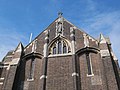
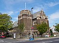
church building in Lewisham, Greater London, UK .jpg)  | |||||
| Upload media | |||||
| Instance of | |||||
|---|---|---|---|---|---|
| Dedicated to | |||||
| Location | London Borough of Lewisham, Greater London, London, England | ||||
| Diocese | |||||
| Heritage designation |
| ||||
| Religion or worldview | |||||
 | |||||
Subcategories
This category has the following 3 subcategories, out of 3 total.
Media in category "Church of St Hilda, Crofton Park"
The following 19 files are in this category, out of 19 total.
-
 Church of Saint Hilda, Crofton Park (East Face - 01).jpg 3,257 × 4,482; 12.49 MB
-
 Church of Saint Hilda, Crofton Park (East Face - 02).jpg 3,347 × 4,482; 13.49 MB
-
 Church of Saint Hilda, Crofton Park (East Face - 03).jpg 4,592 × 3,448; 7.88 MB
-
 Church of Saint Hilda, Crofton Park (South Face - 01).jpg 4,325 × 3,136; 12.52 MB
-
 Church of Saint Hilda, Crofton Park (South Face - 02).jpg 4,592 × 3,448; 8.26 MB
-
 Church of Saint Hilda, Crofton Park (Southeast Tower - 01).jpg 3,357 × 4,550; 16.87 MB
-
 Church of Saint Hilda, Crofton Park (Southeast Tower - 02).jpg 3,163 × 4,424; 14.15 MB
-
 Church of Saint Hilda, Crofton Park (Southeast View - 01).jpg 4,475 × 3,354; 14.86 MB
-
 Church of Saint Hilda, Crofton Park (Southeast View - 02).jpg 4,073 × 3,192; 12.23 MB
-
 Church of Saint Hilda, Crofton Park (Southeast View - 03).jpg 4,227 × 3,094; 10.07 MB
-
 Church of St Hilda, Crofton Park - geograph.org.uk - 4239154.jpg 1,295 × 1,600; 516 KB
-
 South London, Brockley Road, St. Hilda's Church - geograph.org.uk - 3099439.jpg 3,396 × 2,243; 4.99 MB
-
 South London, Brockley Road, St. Hillda's Church - geograph.org.uk - 3099440.jpg 3,456 × 2,304; 5.81 MB
-

-

-

-

-
 St Hilda's Church, Courtrai Road SE4 - geograph.org.uk - 2021748.jpg 640 × 480; 74 KB
-
 St Hilda's Crofton Park.jpg 6,000 × 3,540; 13.24 MB
.jpg)
.jpg)
.jpg)
.jpg)
.jpg)
.jpg)
.jpg)
.jpg)
.jpg)
.jpg)


