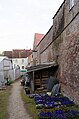
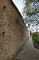
Category:City walls of Donauwörth
This is the category of the Bavarian Baudenkmal (cultural heritage monument) with the ID D-7-79-131-1 (Wikidata)
|
Deutsch: Stadtmauer von Donauwörth.
cultural heritage monument D-7-79-131-1 (0) in Donauwörth, Bavaria | |||||
| Upload media | |||||
| Instance of | |||||
|---|---|---|---|---|---|
| Location | Donauwörth, Donau-Ries, Swabia, Bavaria, Germany | ||||
| Street address |
| ||||
| Heritage designation | |||||
 | |||||
Subcategories
This category has the following 3 subcategories, out of 3 total.
*
W
- Wall towers of Donauwörth (14 F)
Media in category "City walls of Donauwörth"
The following 37 files are in this category, out of 37 total.
-
 BY Donauwoerth 8.jpg 3,968 × 2,645; 9.27 MB
-
 D-7-7230-0319 Donauwöerth Ensemble-Ried-u-Kugelplatz-v-Osten 1.jpg 4,038 × 2,675; 1.02 MB
-
 D-DON-Donauwörth5.JPG 1,024 × 768; 266 KB
-
 Donauwoerth Stadtansicht.jpg 2,304 × 3,072; 3.42 MB
-
 Donauwörth Pflegstraße 16 256.jpg 4,896 × 3,264; 12.3 MB
-
 Donauwörth Stadtbefestigung 1885.JPG 3,888 × 2,592; 9.45 MB
-
 Donauwörth Stadtbefestigung 1886.JPG 3,888 × 2,592; 10.37 MB
-
 Donauwörth Stadtmauer 250.jpg 3,264 × 4,896; 13.51 MB
-
 Donauwörth Stadtmauer 251.jpg 3,264 × 4,896; 14.53 MB
-
 Donauwörth Stadtmauer 264.jpg 4,756 × 3,170; 15.08 MB
-
 Donauwörth Stadtmauer 359.jpg 4,896 × 3,264; 12.66 MB
-
 Donauwörth Stadtmauer360.jpg 3,264 × 4,896; 14.43 MB
-
 Donauwörth, Stadtmauer Rathausgasse 4, 003.jpg 4,928 × 3,264; 12.46 MB
-
 Donauwörth, Stadtmauer Rathausgasse 5, 001.jpg 3,264 × 4,928; 9.61 MB
-
 Donauwörth, Stadtmauer Rathausgasse 5, 002.jpg 4,928 × 3,264; 10.99 MB
-
 Donauwörth, Stadtmauer, Eichgasse 3, 001.jpg 3,264 × 4,928; 12.24 MB
-
 Donauwörth, Stadtmauer, Hadergasse 1, 001.jpg 3,264 × 4,928; 8.03 MB
-
 Donauwörth, Stadtmauer, Hadergasse 1, 002.jpg 4,928 × 3,264; 8.76 MB
-
 Donauwörth, Stadtmauer, Hadergasse 17, 001.jpg 4,928 × 3,264; 9.12 MB
-
 Donauwörth, Stadtmauer, Hadergasse, Feldseite, 001.jpg 3,264 × 4,928; 7.89 MB
-
 Donauwörth, Stadtmauer, Kugelplatz 12 bis 2, 001.jpg 4,928 × 3,264; 10 MB
-
 Donauwörth, Stadtmauer, Kugelplatz 16 bis 12, 001.jpg 4,928 × 3,264; 11.25 MB
-
 Donauwörth, Stadtmauer, Kugelplatz 2, 001.jpg 4,928 × 3,264; 11.11 MB
-
 Donauwörth, Stadtmauer, Kugelplatz 34 bis 24, 001.jpg 4,928 × 3,264; 12.77 MB
-
 Donauwörth, Stadtmauer, Kugelplatz 34, 001.jpg 4,928 × 3,264; 13.82 MB
-
 Donauwörth, Stadtmauer, Münzgasse 3, 001.jpg 4,928 × 3,264; 11.4 MB
-
 Donauwörth, Stadtmauer, Pflegstraße 14, 001.jpg 4,928 × 3,264; 9.33 MB
-
 Donauwörth, Stadtmauer, Stadthof, Stadtseite, 001.jpg 4,928 × 3,264; 9.21 MB
-
 Donauwörth, Stadtmauer, Stadthof, Stadtseite, 002.jpg 4,928 × 3,264; 8.54 MB
-
 Donauwörth, Stadtmauer, Stadthof, Stadtseite, 003.jpg 4,928 × 3,264; 11.2 MB
-
 GER Donauwörth, Adolph-Kolping-Straße 002.jpg 3,963 × 2,972; 2.57 MB
-
 GER Donauwörth, Adolph-Kolping-Straße 003.jpg 3,897 × 2,922; 2.34 MB
-
 GER Donauwörth, Onkel-Ludwig-Anlage 001.jpg 3,929 × 2,947; 3.1 MB
-

-
 Stadtmauer vom Insel Ried, Donauwoerth - geo.hlipp.de - 22211.jpg 640 × 480; 108 KB
-
 Stadtmauer, Donauwoerth - geo.hlipp.de - 22197.jpg 640 × 480; 98 KB
-
 Towns walls.JPG 4,882 × 2,516; 9.21 MB


_-_geo.hlipp.de_-_22210.jpg)


