Category:Clifton Ings
Flood water storage area in York, England | |||||
| Upload media | |||||
| |||||
Media in category "Clifton Ings"
The following 32 files are in this category, out of 32 total.
-
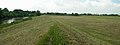
 Clifton Ings - geograph.org.uk - 3233117.jpg 3,872 × 2,592; 4.55 MB
-
 Clifton Ings - geograph.org.uk - 5122224.jpg 1,024 × 683; 307 KB
-
 Clifton Ings cycle path, York - geograph.org.uk - 5069711.jpg 640 × 452; 472 KB
-
 Clifton Ings flooding.jpg 1,600 × 864; 710 KB
-
Clifton ings in use.webm 8.0 s, 1,920 × 1,080; 1.47 MB
-
 Clifton Ings, path and flood defence - geograph.org.uk - 5122220.jpg 1,024 × 683; 291 KB
-
 Clifton Ings, Rawcliffe, York, UK in flood.jpg 1,600 × 821; 773 KB
-
 Clifton Ings, York - geograph.org.uk - 2136698.jpg 800 × 600; 261 KB
-
 Clifton Short Reach - geograph.org.uk - 23033.jpg 640 × 241; 94 KB
-
 Clifton Short Reach - geograph.org.uk - 6123828.jpg 1,024 × 768; 613 KB
-
Cliftoningssluiceopens.webm 14 s, 1,920 × 1,080; 1.35 MB
-
 Cliftoningstopview.png 666 × 542; 333 KB
-
 Cycle path towards York - geograph.org.uk - 2488916.jpg 1,600 × 1,200; 553 KB
-
 Cycle path towards York - geograph.org.uk - 2488921.jpg 1,600 × 1,200; 269 KB
-
 Cycle path towards York - geograph.org.uk - 2488936.jpg 1,600 × 1,200; 821 KB
-
 Drainage channels by Clifton Ings - geograph.org.uk - 3233124.jpg 3,872 × 2,592; 7.12 MB
-
 Embankment on Clifton Short Reach - geograph.org.uk - 3233110.jpg 3,872 × 2,592; 3.46 MB
-
 Flood bank, Clifton Ings - geograph.org.uk - 1837473.jpg 3,264 × 2,448; 1.96 MB
-
 Flood embankment - geograph.org.uk - 5788819.jpg 1,024 × 683; 551 KB
-
 Flooding on Clifton Ings - geograph.org.uk - 3833906.jpg 640 × 427; 101 KB
-
 Footbridge at edge of Clifton Ings - geograph.org.uk - 3890458.jpg 640 × 482; 132 KB
-
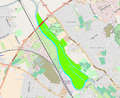
 Location of clifton ings, York, UK.png 1,244 × 474; 444 KB
-
 NCN65 path, Clifton Ings - geograph.org.uk - 5122217.jpg 1,024 × 683; 234 KB
-
 Path along the embankment - geograph.org.uk - 5788827.jpg 1,024 × 683; 527 KB
-
 Paths on Clifton Ings - geograph.org.uk - 3233129.jpg 3,872 × 2,592; 5.35 MB
-
 Red, white and green bales - geograph.org.uk - 5468273.jpg 640 × 427; 201 KB
-

-
 Riverside path, Clifton - geograph.org.uk - 5122227.jpg 1,024 × 683; 478 KB
-
 The beginning of Clifton Ings - geograph.org.uk - 3233104.jpg 3,872 × 2,592; 3.98 MB
-

-
 Walking towards Clifton Ings, York - geograph.org.uk - 2136691.jpg 800 × 600; 351 KB
-
 Wetland area, Clifton Ings - geograph.org.uk - 1837488.jpg 3,201 × 1,933; 1.89 MB


