Category:Coastal details from 16th-century maps of the Eastern Black Sea
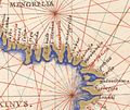
English: 16th-century portalan charts of the Black Sea located coastal cities along the shorelines. Detail enlargements of these map areas have since been used mainly for the purpose of establishing a presence of various nationalities in the area which may include but is not limited to Abkhazians, Samegrelo-people/Mingrelians, Circassians, Georgians, Armenians, Turks/Ottomans, Ukrainians, Russians, Krim-Tatars. This category serves a catch-all purpose. See also: Category:Coastal details from 17th-century maps of the Eastern Black Sea
Media in category "Coastal details from 16th-century maps of the Eastern Black Sea"
The following 25 files are in this category, out of 25 total.
-

-

-
 Piri Reis. Map of the Black Sea (Samsun).jpg 1,601 × 1,507; 2.18 MB
-
 Battista Agnese. Black Sea. HM 25. PORTOLAN ATLAS Italy, ca. 1540.F.jpg 1,368 × 1,301; 584 KB
-
 Battista Agnese. Black Sea. HM 25. PORTOLAN ATLAS Italy, ca. 1540.E.jpg 981 × 847; 301 KB
-
 Battista Agnese map of the Black Sea (B).jpg 1,136 × 1,440; 675 KB
-
 Battista Agnese. Black Sea. HM 26. PORTOLAN ATLAS Italy, ca. 1544.A.jpg 1,529 × 1,365; 759 KB
-
 Battista Agnese. Black Sea. HM 26. PORTOLAN ATLAS Italy, ca. 1544.B.jpg 978 × 1,152; 405 KB
-

-

-
 Battista Agnese. Black Sea. HM 10. PORTOLAN ATLAS Italy, ca. 1550.D.jpg 1,622 × 1,293; 701 KB
-
 Battista Agnese. Black Sea. HM 10. PORTOLAN ATLAS Italy, ca. 1550.E.jpg 2,080 × 2,248; 1.45 MB
-
 Battista Agnese. Black Sea. HM 10. PORTOLAN ATLAS Italy, ca. 1550.F.jpg 2,113 × 2,529; 667 KB
-

-
 Battista Agnese. Black Sea. HM 27. PORTOLAN ATLAS (Venice 1553).E.jpg 1,654 × 1,122; 569 KB
-
 Battista Agnese. Black Sea. HM 27. PORTOLAN ATLAS (Venice 1553).F.jpg 2,081 × 1,544; 975 KB
-
 1572 Europa Ortelius.H.jpg 853 × 577; 513 KB
-

-

-

-

-
 Antonio Lafreri, 1512 - 1577.jpg 800 × 758; 153 KB
-
 Francesco Ghisolfi. Black Sea. HM 28. PORTOLAN ATLAS. (Italy 16th century).F.jpg 1,459 × 1,699; 818 KB
-
 Francesco Ghisolfi. Black Sea. HM 28. PORTOLAN ATLAS. (Italy 16th century).G.jpg 1,177 × 1,064; 424 KB
-


.jpg)


.jpg)


.F.jpg)
.G.jpg)


.E.jpg)
.F.jpg)

.C.jpg)
.D.jpg)
.E.jpg)
.B.jpg)

.F.jpg)
.G.jpg)
.H.jpg)