Category:Coastal erosion in England

Subcategories
This category has the following 19 subcategories, out of 19 total.
Media in category "Coastal erosion in England"
The following 53 files are in this category, out of 53 total.
-
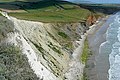
 Across Whitecliff Bay - geograph.org.uk - 1900077.jpg 640 × 426; 186 KB
-
 Beach at Charmouth - geograph.org.uk - 1208618.jpg 640 × 423; 105 KB
-
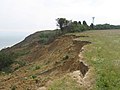
 Below Flowers Barrow - geograph.org.uk - 135816.jpg 411 × 640; 96 KB
-
 Beware of Cliff Falls at Dunwich^ - geograph.org.uk - 155653.jpg 640 × 480; 99 KB
-
 Burrow Head - geograph.org.uk - 2575656.jpg 1,600 × 1,200; 682 KB
-

-
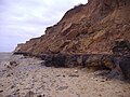
 Cliff erosion at Hengistbury Head - geograph.org.uk - 1774822.jpg 683 × 1,024; 438 KB
-
 Cliff erosion at the Naze - geograph.org.uk - 724935.jpg 640 × 427; 137 KB
-
 Cliff erosion at the Naze - geograph.org.uk - 724944.jpg 640 × 423; 64 KB
-
 Cliff erosion Bournemouth Beach - geograph.org.uk - 1207072.jpg 640 × 491; 94 KB
-
 Cliff fall at Cudmore Grove - geograph.org.uk - 1004065.jpg 427 × 640; 127 KB
-
 Cliff slump above Titchberry Water - geograph.org.uk - 3112203.jpg 800 × 533; 411 KB
-
 Cliff, Man Sands - geograph.org.uk - 1267559.jpg 640 × 460; 102 KB
-
 Cliffs below Cockpit Head, Mupe Bay - geograph.org.uk - 24367.jpg 640 × 480; 371 KB
-
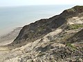
 Cliffs east of Redcar - geograph.org.uk - 795354.jpg 640 × 480; 121 KB
-
 Cliffs near Fairlight Head - geograph.org.uk - 2175917.jpg 640 × 430; 141 KB
-
 Cliffs of Dover with fresh subsidence.jpg 2,560 × 1,600; 2.43 MB
-
 Coastal Erosion at Thorpeness, Suffolk - geograph.org.uk - 42936.jpg 640 × 480; 151 KB
-
 Coastal erosion near St Catherine's Point, Isle of Wight, England.jpg 2,270 × 1,702; 1.83 MB
-
 Coastal erosion, Dunwich - geograph.org.uk - 2478110.jpg 1,024 × 768; 204 KB
-
 CoastalrockintheJurassi Coast DorsetEngland22263892945298045725812.jpg 1,194 × 672; 313 KB
-
 Compton Bay - geograph.org.uk - 1380387.jpg 640 × 426; 175 KB
-
 Crumbling Cliffs - geograph.org.uk - 1365338.jpg 640 × 480; 74 KB
-
 East Cliff, Whitby - geograph.org.uk - 2345677.jpg 2,592 × 1,944; 1.21 MB
-
 Eroded Cliff - geograph.org.uk - 1333258.jpg 640 × 480; 54 KB
-
 Eroded Cliffs - geograph.org.uk - 1286657.jpg 640 × 480; 60 KB
-
 Fallen pillbox, Redend Point - geograph.org.uk - 767205.jpg 640 × 430; 86 KB
-
 FossilBeach7 DMarshall2017.jpg 3,196 × 1,765; 1.42 MB
-
 Fresh cliff falls, The Naze - geograph.org.uk - 1187896.jpg 640 × 457; 202 KB
-
 Godrevy Point 01.jpg 640 × 426; 107 KB
-
 Hens Brook Valley - geograph.org.uk - 1365355.jpg 640 × 480; 106 KB
-
 Hornsea 2.jpg 3,072 × 2,304; 2.72 MB
-
 JurassicCoastErosion.jpg 3,828 × 2,862; 5.2 MB
-
 Landslide near Bats Head (1848).jpg 4,288 × 2,848; 5.43 MB
-
 Lost buildings on Warden Point - geograph.org.uk - 1138370.jpg 640 × 481; 84 KB
-
 Next to fall off the cliff - geograph.org.uk - 1596595.jpg 640 × 428; 80 KB
-
 Purbeck , The Pinnacles and Cliff Face - geograph.org.uk - 1711975.jpg 3,264 × 2,448; 3.67 MB
-
 Rock Fall at Bempton Cliffs.jpg 3,864 × 5,152; 8.34 MB
-

-
 South Wight , Whitecliff Bay - geograph.org.uk - 2881201.jpg 4,098 × 2,526; 3.94 MB
-
 The coast path approaching Ballard Cliff - geograph.org.uk - 2989403.jpg 1,024 × 768; 230 KB
-
 The eroding cliffs of Reculver Country Park - geograph.org.uk - 6930.jpg 640 × 427; 136 KB
-

-
 Tree on Cliff Edge - geograph.org.uk - 1365364.jpg 480 × 640; 120 KB
-
 Walton-on-the-Naze cliffs - geograph.org.uk - 258559.jpg 640 × 426; 84 KB
-
 West Runton Beach 13 January 2007 (1).JPG 2,560 × 1,920; 1.2 MB
-
 Burton Cliff, showing 2005 landslip - geograph.org.uk - 126464.jpg 480 × 640; 328 KB
-
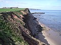
 Coastal erosion at The Naze - geograph.org.uk - 584742.jpg 640 × 480; 108 KB
-
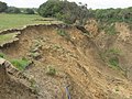
 Crumbling cliffs - geograph.org.uk - 413008.jpg 640 × 480; 102 KB
-
 Eroding Saltmarsh at Spartina, Hythe - geograph.org.uk - 372993.jpg 640 × 480; 119 KB
-
 Road to Nowhere near Warden Point - geograph.org.uk - 47157.jpg 640 × 480; 87 KB
-
 Silt erosion - geograph.org.uk - 330128.jpg 640 × 480; 98 KB
-
 The very end of the road near Warden Point - geograph.org.uk - 44901.jpg 640 × 480; 109 KB


.jpg)


.JPG)


