Category:Coasts of Alaska
States of the United States: Alabama · Alaska · California · Connecticut · Delaware · Florida · Georgia · Hawaii · Illinois · Indiana · Louisiana · Maine · Maryland · Massachusetts · Michigan · Minnesota · Mississippi · New Hampshire · New Jersey · New York · North Carolina · Ohio · Oregon · Pennsylvania · Rhode Island · South Carolina · Texas · Virginia · Washington · Wisconsin
Guam · Puerto Rico
Guam · Puerto Rico
| NO WIKIDATA ID FOUND! Search for Coasts of Alaska on Wikidata | |
| Upload media |

Subcategories
This category has the following 17 subcategories, out of 17 total.
Media in category "Coasts of Alaska"
The following 137 files are in this category, out of 137 total.
-

-

-

-

-

-

-

-

-
 A shot of a mud flat in an unconsolidated shore in Alaska.jpg 3,000 × 2,014; 248 KB
-
 Aerial view of Nome, Alaska, between 1900 and 1908 (AL+CA 6601).jpg 768 × 536; 59 KB
-

-
 Alaska (109376131).jpeg 2,048 × 1,360; 560 KB
-
 Alaska (3733278259).jpg 1,280 × 685; 233 KB
-
 Alaska (3733278427).jpg 1,279 × 474; 77 KB
-
 Alaska 2009 193.jpg 3,072 × 2,304; 2.4 MB
-
 Alaska aboard the Admiralty Dream (7762333560).jpg 1,280 × 960; 127 KB
-
 Alaska and its resources (1870) (14762149426).jpg 2,688 × 1,606; 1.41 MB
-
 Alaska bald eagle, ca 1907 (MOHAI 5226).jpg 700 × 547; 33 KB
-

-
 Alaska Marine Highway- Approaching Yakutat, Alaska (7602038266) (4).jpg 4,752 × 3,168; 3.21 MB
-
 Alaska Maritime National Wildlife Refuge; Chagulak Island in the Aleutian Islands.jpg 3,001 × 2,001; 3.21 MB
-
 Alaska seals (4335550248).jpg 3,456 × 2,304; 3.77 MB
-
 Alaska's Marine Highway - Coastal Kodiak - NARA - 7716894.jpg 1,470 × 990; 924 KB
-
 Alaskan landscape on the way to Maui (8034611647).jpg 2,000 × 1,500; 2.81 MB
-
 Alexander archipelago.jpg 1,050 × 1,400; 529 KB
-
 Amagat island nature.jpg 1,050 × 707; 146 KB
-
 Amchitka island harlequin beach.jpg 1,050 × 691; 118 KB
-
 Amchitka Island, Beach Fleabane in full bloom - Senecio pseudo-arnica.jpg 1,050 × 715; 705 KB
-
 Amchitka Island, Harlequin Beach.jpg 1,050 × 691; 132 KB
-
 Another shot of the mudflats from Little O'Malley (5452882794).jpg 3,408 × 1,963; 1.99 MB
-
 Approaching Haines (223201760).jpg 2,994 × 1,948; 3.09 MB
-
 Albert Bierstadt - Alaskan Coastal Range (c. 1889).jpg 6,360 × 4,504; 8.72 MB
-
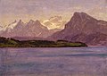 Bierstadt-Alaskan Coastal Range.jpg 1,420 × 1,001; 175 KB
-
 Bird Raft (223202499).jpg 1,711 × 2,097; 2.83 MB
-
 Boathouse and mountains, Metlakatla (NARA - 297912 reversed).jpg 3,000 × 1,956; 474 KB
-
 Cape Krusenstern1 (18510104126).jpg 4,032 × 3,024; 2.21 MB
-
 CapeAiakUnalaska.jpg 1,600 × 1,200; 362 KB
-
 CapeKrusensternNM.jpg 363 × 244; 19 KB
-
 Cgs00888 - Flickr - NOAA Photo Library.jpg 2,288 × 1,712; 1.83 MB
-
 Chowiet island camp in the fog.jpg 3,000 × 2,000; 533 KB
-
 Chugach2.jpg 800 × 600; 247 KB
-
 Coastal rocks near Valdez.jpg 1,280 × 800; 392 KB
-
 Coastline of Alaska, between 1893 and 1903 (AL+CA 3394).jpg 464 × 600; 17 KB
-
 Color post card. Metlakatla, Alaska. - NARA - 297835.jpg 3,000 × 1,920; 9.91 MB
-
 Dease and Simpson - Arctic expedition 1837.png 2,395 × 1,414; 288 KB
-
 East Chugach Islands - DPLA - 07c356a6f8adaac44f1eb2969def05fb.jpg 6,627 × 4,158; 4 MB
-
 East of Cape Nome - DPLA - 155f2c6d3bd8e446c65c65460c68c9ac.jpg 6,627 × 4,157; 3.61 MB
-
 Exxon Valdez Cleanup.jpg 2,820 × 1,870; 2.53 MB
-
 Field camp on Alaska in winter.jpg 2,100 × 1,404; 117 KB
-
 Fish0205 - Flickr - NOAA Photo Library.jpg 1,410 × 1,880; 2.61 MB
-
 Fish4054 - Flickr - NOAA Photo Library.jpg 1,388 × 933; 745 KB
-
 Fisherman in the Fog.jpg 800 × 600; 77 KB
-
 FMIB 34680 Lowlands Near Fort Wrangell.jpeg 1,060 × 368; 51 KB
-

-
 Foggy view of Chignik mountain in the Aleutian islands.jpg 1,050 × 713; 81 KB
-
 Ghosts of Sitka (7708802956).jpg 1,280 × 960; 130 KB
-
 Glacier Bay tom@hk flickr.jpg 4,368 × 2,912; 6.94 MB
-
 GulfOfAlaska AMO 2008073.jpg 540 × 405; 66 KB
-
 Hall Island, Bering Sea 2.jpg 3,204 × 2,110; 1.26 MB
-
 Hall Island, Bering Sea.jpg 3,174 × 2,134; 1.29 MB
-
 Hazy Islands Wilderness.jpg 1,050 × 687; 188 KB
-
 Ice berg.jpg 700 × 463; 42 KB
-
 Icefloat Sawyer Glacier 6 (221457484).jpg 2,304 × 3,456; 3.97 MB
-
 Inside Passage (6).jpg 768 × 512; 133 KB
-
 Island or a shoreline, or treestumps. - NARA - 298026.jpg 3,000 × 2,181; 2.15 MB
-
 Kasatochi island bluffs Andreanof islands.jpg 3,000 × 2,000; 285 KB
-
 Kayak and Wilderness Explorer in Alaska.jpg 2,200 × 1,467; 1.66 MB
-
 Kayaking in Alaska P1010034.JPG 2,560 × 1,920; 806 KB
-
 Landscapes - DPLA - 6b7b66880e3c4a7799477b8ebd51721c.jpg 5,844 × 4,176; 8.13 MB
-
 Landscapes--St. Paul - DPLA - 244cc324d39043cc0824fc922127dc81.jpg 2,592 × 1,944; 1.45 MB
-
 Line1570 - Flickr - NOAA Photo Library.jpg 1,788 × 1,172; 1.28 MB
-
 Line3505 - Flickr - NOAA Photo Library.jpg 2,560 × 1,920; 2.51 MB
-
 Line3563 - Flickr - NOAA Photo Library.jpg 2,288 × 1,712; 1.26 MB
-
 Line4305 - Flickr - NOAA Photo Library.jpg 2,272 × 1,704; 1.36 MB
-
 Line4306 - Flickr - NOAA Photo Library.jpg 2,272 × 1,704; 2.16 MB
-
 Line5057 - Flickr - NOAA Photo Library.jpg 3,008 × 2,000; 878 KB
-
 Line5063 - Flickr - NOAA Photo Library.jpg 3,008 × 2,000; 890 KB
-
 Line5069 - Flickr - NOAA Photo Library.jpg 3,008 × 2,000; 1.39 MB
-
 Line5070 - Flickr - NOAA Photo Library.jpg 3,008 × 2,000; 1.11 MB
-
 Line5071 - Flickr - NOAA Photo Library.jpg 2,842 × 1,890; 1.1 MB
-
 Line5072 - Flickr - NOAA Photo Library.jpg 3,008 × 2,000; 1.3 MB
-
 Line5073 - Flickr - NOAA Photo Library.jpg 3,008 × 2,000; 1.39 MB
-
 Line5087 - Flickr - NOAA Photo Library.jpg 3,008 × 2,000; 1.06 MB
-
 Line5088 - Flickr - NOAA Photo Library.jpg 3,008 × 2,000; 1.14 MB
-
 Line5091 - Flickr - NOAA Photo Library.jpg 3,008 × 2,000; 874 KB
-
 Line5107 - Flickr - NOAA Photo Library.jpg 3,008 × 2,000; 1.4 MB
-
 Line5111 - Flickr - NOAA Photo Library.jpg 3,008 × 2,000; 960 KB
-
 Line5116 - Flickr - NOAA Photo Library.jpg 3,008 × 2,000; 664 KB
-
 Lituya Bay, Alaska.jpg 3,008 × 2,000; 725 KB
-
 Looking back to Little Port Walter - NOAA.jpg 1,772 × 1,164; 1.27 MB
-
 Looking into the sun from over downtown onto the Homer Spit..jpg 1,024 × 768; 373 KB
-

-
 Native Church, Metlakatla, Alaska, 1908. - NARA - 297838.jpg 3,000 × 2,093; 2.52 MB
-
 Morning Fog Banks on the Gulf of Alaska.jpg 640 × 480; 33 KB
-
 Mt line.jpg 2,740 × 1,793; 2.31 MB
-
 Mudflats on Cook Inlet with the tide out (5452886792).jpg 3,504 × 2,336; 2.63 MB
-
 Nakhu Bay near Dyea, Alaska (10720734965).jpg 2,215 × 1,600; 1.62 MB
-
 NashHarborNunivakCurtisLOC3c07326v.jpg 3,579 × 2,453; 748 KB
-
 Near Dawes Glacier - panoramio.jpg 2,048 × 1,536; 1.83 MB
-
 NOAA arctic spring 1950 corp1104-2.jpg 1,747 × 1,154; 753 KB
-
 Northbight.jpeg 604 × 453; 48 KB
-
 Norton Sound sunrise.jpg 2,256 × 1,496; 889 KB
-
 NunivakCliffsFWS726.jpg 1,050 × 702; 667 KB
-
 Old Harbor Alaska aerial view.jpg 1,500 × 1,420; 747 KB
-
 Orca Inlet 1964 USGS ake00218.jpg 1,400 × 930; 614 KB
-
 Pribilof sunset, Alaska Maritime NWR (5123475497).jpg 715 × 1,050; 389 KB
-
 Prudhoe Bay oil fields 1971 FWS.jpg 1,050 × 837; 553 KB
-
 Safari Endeavour - kayakers.jpg 1,800 × 1,200; 1.7 MB
-
 Saint Paul Island Alaska aerial view.jpg 1,500 × 981; 589 KB
-
 Sawyer Glacier Ice with Black Bears (241881662).jpg 2,160 × 1,688; 2.8 MB
-
 Sawyer Glacier Ice with Black Bears 2 (241890834).jpg 2,424 × 1,772; 3.11 MB
-
 Seiner off the coast of the Kodiak Archipelago, Alaska 2009 218.jpg 3,072 × 2,304; 2.98 MB
-
 Seward Peninsula coast between Nome and Port Clarence - P1040601.JPG 2,048 × 1,536; 1.2 MB
-
 Seward Peninsula coast between Nome and Port Clarence - P1040604.JPG 2,048 × 1,536; 1.23 MB
-
 Seward Peninsula coast between Nome and Port Clarence - P1040605.JPG 2,048 × 1,536; 1.25 MB
-
 Sitka, AK - shore south of town.jpg 6,000 × 4,000; 10.43 MB
-
 Smuggler's Cove near Skagway, Alaska (12065895246).jpg 2,133 × 1,600; 1.19 MB
-
 Snug Harbor Cannery on Chisik Island - panoramio.jpg 1,024 × 1,365; 221 KB
-
 Speel Arm (14265787197).jpg 3,000 × 4,000; 6.03 MB
-
 St. George Island sunset (5944746349).jpg 699 × 699; 46 KB
-
 Steller seals, Alaska Maritime NWR (5124078062).jpg 1,050 × 935; 776 KB
-
 Taiya Inlet near Skagway, Alaska (12065393084).jpg 2,133 × 1,600; 977 KB
-
-

-
 Tlevak Strait-Suemez Island.jpg 640 × 419; 61 KB
-
 Togiak Refuge Coastline.jpg 1,050 × 692; 87 KB
-

-
 United States coast pilot. Alaska. Part 1. Dixon Entrance to Yakutat Bay (IA unitedstatescoa00usco).pdf 1,195 × 1,931, 278 pages; 22.82 MB
-

-
 View of Metlakahtla, Alaska from top of waterfall. - NARA - 298073.jpg 3,000 × 1,999; 2.73 MB
-
 View of Metlakahtla, Alaska. - NARA - 298072.jpg 3,000 × 2,031; 2.61 MB
-

-
 Wainwright.JPG 2,272 × 954; 301 KB
-
 West shore of Yakutat Bay near the entrance to Disenchantment Bay 01.jpg 6,000 × 4,000; 7.83 MB
-

-
 Yakutania Point near Skagway, Alaska (12065001445).jpg 2,133 × 1,600; 1.17 MB
-
 Yukon Delta, Alaska.jpg 4,000 × 4,000; 6.31 MB
.jpg)
.jpg)
.jpg)
.jpg)
.jpg)
.jpg)
.jpg)
.jpg)

.jpg)

.jpeg)
.jpg)

.jpg)
_(14762149426).jpg)
.jpg)
_(4).jpg)

.jpg)

.jpg)


.jpg)
.jpg)
.jpg)

.jpg)
.jpg)
.jpg)


.jpg)


.jpg)


.jpg)
.jpg)


_Before_the_church_was_built._(M.A.M.,_Feb._1926)_-_NARA_-_297379.jpg)


.jpg)
.jpg)


.jpg)


.jpg)
.jpg)


.jpg)

.jpg)
.jpg)
.jpg)
.jpg)

.jpg)


.jpg)

.jpg)
_approaches_the_Coast_Guard_Station_pier_in_Juneau,_Alaska.jpg)