Category:Col du Grand Colombier
| Object location | | View all coordinates using: OpenStreetMap |
|---|

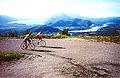
Mountain pass in France  cyklisté na Col du Grand Colombier   | |||||
| Upload media | |||||
| Instance of | |||||
|---|---|---|---|---|---|
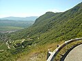
| Location | Ain, Auvergne-Rhône-Alpes, Metropolitan France, France | ||||
| Mountain range | |||||
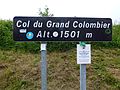
| Elevation above sea level |
| ||||
 | |||||
Media in category "Col du Grand Colombier"
The following 30 files are in this category, out of 30 total.
-
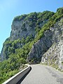 As Grd Colombier- falaises vst Culoz.JPG 1,944 × 2,592; 2.27 MB
-
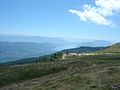
 As-Cy Grand Colombier Est 14.JPG 2,592 × 1,944; 2.24 MB
-
 Col du Grand Colombier.JPG 2,592 × 1,944; 2.07 MB
-
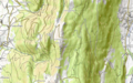 Col du Grand Colombier.png 1,095 × 684; 835 KB
-
 Col Grand Colombier Anglefort 1.jpg 5,184 × 3,456; 9.11 MB
-
 Col Grand Colombier Anglefort 2.jpg 5,184 × 3,456; 8.24 MB
-
 Col Grand Colombier Anglefort 3.jpg 5,184 × 3,456; 7.98 MB
-
 Col Grand Colombier Anglefort 4.jpg 5,184 × 3,456; 8.34 MB
-
 Cyclistes dans l'ascension du Grand Colombier.jpg 429 × 279; 32 KB
-
 Final Grand Colombier Ouest.JPG 2,592 × 1,944; 1.26 MB
-
 Grand Colombier -directissime 19W.JPG 2,592 × 1,944; 2.29 MB
-
 Grand Colombier -directissime 19W2.JPG 2,592 × 1,944; 2.29 MB
-
 Grands Colombier- lacets Culoz.JPG 2,592 × 1,944; 2.3 MB
-
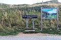
 Inscription Ici Ain Col Grand Colombier Anglefort 01.jpg 4,032 × 3,024; 6.9 MB
-
 Inscription Ici Ain Col Grand Colombier Anglefort 02.jpg 4,032 × 3,024; 6.74 MB
-
 Inscription Ici Ain Col Grand Colombier Anglefort 03.jpg 4,032 × 3,024; 7.39 MB
-
 Inscription Ici Ain Col Grand Colombier Anglefort 04.jpg 4,032 × 3,024; 7.87 MB
-
 Panneau Col Grand Colombier Anglefort 1.jpg 5,184 × 3,456; 8.41 MB
-
 Panneau Col Grand Colombier Anglefort 2.jpg 5,184 × 3,456; 5.9 MB
-
 Panoramique Col du Grand Colombier - étape 4 du Tour de l'Ain 2017.JPG 12,232 × 3,474; 33.21 MB
-
 Tour de l'Ain 2009 - étape 4 - Rein Taaramae.jpg 1,811 × 1,363; 444 KB
-
 Tour de l'Ain 2017 - étape 4 - passage du gpm Col du Grand Colombier - 1.JPG 2,277 × 2,145; 3.22 MB
-
 Tour de l'Ain 2017 - étape 4 - passage du gpm Col du Grand Colombier - 2.JPG 3,526 × 1,831; 4.51 MB
-
 Tour de l'Ain 2017 - étape 4 - passage du gpm Col du Grand Colombier - 3.JPG 2,206 × 1,760; 2.92 MB
-
 Tour de l'Ain 2017 - étape 4 - passage du gpm Col du Grand Colombier - 4.JPG 4,032 × 3,024; 8.93 MB
-
 Tour de l'Ain 2017 - étape 4 - passage du gpm Col du Grand Colombier - 5.JPG 2,855 × 1,947; 4.05 MB
-
 Tour de l'Ain 2017 - étape 4 - passage du gpm Col du Grand Colombier - 6.JPG 2,652 × 2,430; 4.83 MB
-
 Tour de l'Ain 2017 - étape 4 - passage du gpm Col du Grand Colombier - 7.JPG 4,032 × 3,024; 3.53 MB
-
 Žába on the top Grand Colombier in 1501 m - panoramio.jpg 4,320 × 3,240; 5.91 MB
-
 Žába with DIOT CREW (does anybody know what does it mean^^^) - panoramio.jpg 4,320 × 3,240; 5.28 MB


_-_panoramio.jpg)