Category:Colorado State Highway 21
 | number: | (twenty-one) |
|---|---|---|
| State highways in Colorado: | 1 · 2 · 3 · 5 · 7 · 8 · 9 · 10 · 11 · 12 · 13 · 14 · 15 · 16 · 17 · 21 · 22 · 23 · 26 · 30 · 33 · 35 · 36 · 37 · 38 · 39 · 41 |
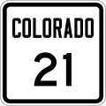
English: Media related to Colorado State Highway 21 (Powers Boulevard), a 20.245-mile (32.581 km) state highway in El Paso County, Colorado, United States, that connects Colorado State Highway 16 in Fountain with Colorado State Highway 83 in Colorado Springs. There is unconnected and yet to be finally completed section that will extend north to connect with Interstate 25/U.S. Route 87 (I-25/US 87), north of Colorado Springs. The completed part of the section (the I-25/US 87 interchange to Voyager Parkway) is unsigned.)
state highway in El Paso County, Colorado, United States   | |||||
| Upload media | |||||
| Instance of | |||||
|---|---|---|---|---|---|
| Location | Colorado | ||||
| Transport network | |||||
| Owned by | |||||
| Maintained by | |||||
| Inception |
| ||||
| Length |
| ||||
| Terminus | |||||
| Partially coincident with | |||||
| |||||
Subcategories
This category has the following 2 subcategories, out of 2 total.
Media in category "Colorado State Highway 21"
The following 13 files are in this category, out of 13 total.
-
 Colorado 21.svg 601 × 601; 5 KB
-
 Colorado 21 (1946).svg 401 × 401; 7 KB
-
 Colorado 21 (1952).svg 401 × 401; 9 KB
-
 Colorado State Highway 21 Map.svg 1,028 × 609; 567 KB
-
 AMR Medic-75, Powers Blvd, Colo Spgs.jpg 1,193 × 869; 263 KB
-
 Future Extension of Powers.jpg 1,073 × 911; 851 KB
-
 US 24 EB exit from CO 21 NB, Colorado Springs.jpg 2,560 × 1,536; 1.07 MB
-
 CO 21 NB, exit 149A, Colorado Springs.jpg 2,560 × 1,536; 1.04 MB
-
 CO 21 NB reassurance sign, Colorado Springs.jpg 2,560 × 1,536; 1.03 MB
-
 End of CO 21, CO 83 N, Colorado Springs.jpg 2,560 × 1,536; 552 KB
-
 CO 21 NB, exit 151, Colorado Springs.jpg 2,560 × 1,536; 1.12 MB
-
 CO 21 NB, approaching Old Ranch Rd, Colorado Springs.jpg 2,560 × 1,536; 1.08 MB
-
 Two Two Men and a Truck trucks.jpg 1,792 × 1,075; 386 KB
.svg)
.svg)


