Category:Combe Hay
English: Combe Hay is a village and civil parish in the English county of Somerset. It falls within the Cotswolds Area of Outstanding Natural Beauty. The parish has a population of 149.
village in the United Kingdom  | |||||
| Upload media | |||||
| Instance of | |||||
|---|---|---|---|---|---|
| Location | Bath and North East Somerset, Somerset, South West England, England | ||||
| Population |
| ||||
 | |||||
Subcategories
This category has the following 6 subcategories, out of 6 total.
C
- Combe Hay Church (5 F)
- Combe Hay Bridge (4 F)
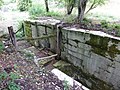
- Combe Hay Locks (8 F)
- Combe Hay Tunnel (2 F)
M
- Combe Hay Manor (4 F)
W
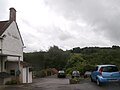
- The Wheatsheaf, Combe Hay (3 F)
Media in category "Combe Hay"
The following 189 files are in this category, out of 189 total.
-
-
 Across the Cam Brook valley - geograph.org.uk - 4847367.jpg 1,920 × 1,208; 798 KB
-
 Bales in fields near Combe Hay - geograph.org.uk - 5030114.jpg 640 × 427; 79 KB
-
 Bridge abutment, Dunkerton - geograph.org.uk - 4899771.jpg 1,920 × 1,280; 954 KB
-
 Bridge over Cam Brook - geograph.org.uk - 4899488.jpg 1,920 × 1,280; 911 KB
-
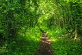
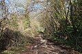
 Bridleway, Combe Hay - geograph.org.uk - 1562677.jpg 640 × 480; 221 KB
-
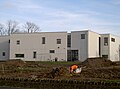
 Building at Fosseway Environment Park - geograph.org.uk - 4848099.jpg 1,920 × 1,294; 875 KB
-
 By Way off Combe Hay Lane - panoramio.jpg 1,728 × 2,304; 1 MB
-
 Byway above Fortnight Farm - geograph.org.uk - 1813556.jpg 2,592 × 1,944; 1.78 MB
-
 Byway along the Fosse - geograph.org.uk - 4848686.jpg 2,048 × 3,072; 1.24 MB
-
 Byway to Fortnight Farm - geograph.org.uk - 4848110.jpg 1,920 × 1,280; 1.1 MB
-
 Calamity in the Cam Brook - geograph.org.uk - 6509781.jpg 2,472 × 3,296; 1.78 MB
-
 Cam Brook - geograph.org.uk - 4899528.jpg 1,920 × 2,880; 2.04 MB
-
 Cemetery near Combe Hay - geograph.org.uk - 798166.jpg 640 × 449; 130 KB
-
 Cleared hillside off Combe Hay Lane - geograph.org.uk - 358406.jpg 480 × 640; 99 KB
-
 Combe Hay - geograph.org.uk - 6544665.jpg 1,200 × 800; 1.15 MB
-
 Combe Hay - geograph.org.uk - 6544672.jpg 1,200 × 800; 1.2 MB
-
 Combe Hay BA2, UK - panoramio (1).jpg 1,600 × 1,062; 572 KB
-
 Combe Hay BA2, UK - panoramio (2).jpg 1,600 × 1,062; 416 KB
-
 Combe Hay BA2, UK - panoramio (3).jpg 1,600 × 1,062; 715 KB
-
 Combe Hay BA2, UK - panoramio.jpg 1,600 × 1,062; 617 KB
-
 Combe Hay Church, altar - geograph.org.uk - 3662075.jpg 640 × 464; 64 KB
-
 Combe Hay Church, external memorial - geograph.org.uk - 3661834.jpg 640 × 480; 103 KB
-
 Combe Hay Church, font - geograph.org.uk - 3662065.jpg 480 × 640; 55 KB
-
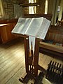 Combe Hay Church, lectern - geograph.org.uk - 3662086.jpg 480 × 640; 66 KB
-
 Combe Hay Church, memorial (1) - geograph.org.uk - 3661790.jpg 640 × 480; 54 KB
-
 Combe Hay Church, memorial (10) - geograph.org.uk - 3662076.jpg 480 × 640; 43 KB
-
 Combe Hay Church, memorial (11) - geograph.org.uk - 3662077.jpg 460 × 640; 54 KB
-
 Combe Hay Church, memorial (12) - geograph.org.uk - 3662078.jpg 465 × 640; 90 KB
-
 Combe Hay Church, memorial (13) - geograph.org.uk - 3662079.jpg 480 × 640; 89 KB
-
 Combe Hay Church, memorial (14) - geograph.org.uk - 3662080.jpg 640 × 471; 35 KB
-
 Combe Hay Church, memorial (15) - geograph.org.uk - 3662083.jpg 640 × 474; 45 KB
-
 Combe Hay Church, memorial (2) - geograph.org.uk - 3662066.jpg 640 × 460; 60 KB
-
 Combe Hay Church, memorial (3) - geograph.org.uk - 3662067.jpg 640 × 461; 39 KB
-
 Combe Hay Church, memorial (4) - geograph.org.uk - 3662068.jpg 640 × 412; 38 KB
-
 Combe Hay Church, memorial (5) - geograph.org.uk - 3662069.jpg 468 × 640; 55 KB
-
 Combe Hay Church, memorial (6) - geograph.org.uk - 3662071.jpg 640 × 480; 57 KB
-
 Combe Hay Church, memorial (7) - geograph.org.uk - 3662072.jpg 640 × 480; 53 KB
-
 Combe Hay Church, memorial (8) - geograph.org.uk - 3662073.jpg 640 × 480; 79 KB
-
 Combe Hay Church, memorial (9) - geograph.org.uk - 3662074.jpg 640 × 480; 69 KB
-
 Combe Hay Church, pulpit - geograph.org.uk - 3662090.jpg 480 × 640; 62 KB
-
 Combe Hay Church, September 2013 - geograph.org.uk - 3659263.jpg 640 × 480; 99 KB
-

-

-

-

-
 Combe Hay Church, war memorial - geograph.org.uk - 3661800.jpg 465 × 640; 48 KB
-
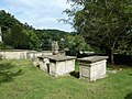
 Combe Hay Churchyard (a) - geograph.org.uk - 3661771.jpg 640 × 480; 129 KB
-
 Combe Hay Churchyard (b) - geograph.org.uk - 3662092.jpg 640 × 480; 111 KB
-
 Combe Hay Churchyard (c) - geograph.org.uk - 3662093.jpg 640 × 480; 121 KB
-
 Combe Hay Lane - geograph.org.uk - 358420.jpg 640 × 480; 62 KB
-
 Combe Hay Lane - geograph.org.uk - 4836641.jpg 1,920 × 2,712; 1.28 MB
-
 Combe Hay Lane - geograph.org.uk - 4836749.jpg 3,068 × 1,860; 1.1 MB
-
 Combe Hay Lane - geograph.org.uk - 4836768.jpg 1,920 × 1,280; 1.1 MB
-
 Combe Hay Lane - geograph.org.uk - 4837677.jpg 1,920 × 2,880; 2.15 MB
-
 Combe Hay Manor - geograph.org.uk - 6544692.jpg 1,200 × 800; 1.1 MB
-
 Combe Hay Manor House.jpg 2,711 × 1,607; 967 KB
-
 Combe Hay parish church - geograph.org.uk - 5339758.jpg 2,592 × 1,790; 1.56 MB
-
 Combe Hay Parish church - geograph.org.uk - 6501943.jpg 681 × 1,024; 289 KB
-
 Combe hay weir.jpg 2,576 × 1,952; 2.83 MB
-
 Combe Hay's Millennium Memorial - geograph.org.uk - 3661808.jpg 640 × 452; 103 KB
-
 Combe Hay, the lower road - geograph.org.uk - 773665.jpg 640 × 444; 123 KB
-
 Combe near Fortnight Farm - geograph.org.uk - 4848074.jpg 1,920 × 1,166; 551 KB
-
 Combe north of Combe Hay - geograph.org.uk - 4848398.jpg 1,920 × 1,280; 703 KB
-
 Culvert under Coombe Hay Aqueduct. - panoramio.jpg 3,648 × 2,736; 3.86 MB
-
 Culvert under the railway embankment - geograph.org.uk - 1813761.jpg 2,592 × 1,944; 1.49 MB
-
 Direction Sign - Signpost at the crossroads in Combe Hay - geograph.org.uk - 6055711.jpg 1,175 × 1,791; 131 KB
-
 Disappearing under the leaves - geograph.org.uk - 5655350.jpg 1,704 × 2,304; 2.09 MB
-
 Diverted footpath, Fosse Farm - geograph.org.uk - 4848703.jpg 3,072 × 2,048; 1.2 MB
-
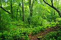
 Edge of woodland below Combe Hay Lane - geograph.org.uk - 4848295.jpg 1,920 × 1,280; 1.19 MB
-
 Exposure, Combe Hay Lane - geograph.org.uk - 4848428.jpg 1,920 × 1,280; 1.25 MB
-
 Field by Rainbow Wood - geograph.org.uk - 4899623.jpg 1,920 × 1,280; 786 KB
-
 Field by the Cam Brook - geograph.org.uk - 4899521.jpg 1,920 × 1,280; 692 KB
-
 Field by the Fosse Way - geograph.org.uk - 4848711.jpg 3,066 × 1,868; 1.14 MB
-
 Field near Combe Hay - geograph.org.uk - 4899581.jpg 1,920 × 1,280; 763 KB
-
 Field near Dunkerton - geograph.org.uk - 4899772.jpg 3,039 × 1,707; 850 KB
-
 Flowers near Combe Hay. - panoramio.jpg 2,816 × 2,112; 4.42 MB
-
 Footpath Combe Hay - panoramio.jpg 1,728 × 2,304; 910 KB
-
 Footpath near Fortnight Farm - geograph.org.uk - 4848241.jpg 1,920 × 1,280; 1.11 MB
-
 Footpath past Fosseway Environment Park - geograph.org.uk - 4848458.jpg 1,920 × 1,280; 1.11 MB
-
 Footpath past Fosseway Environment Park - geograph.org.uk - 4848466.jpg 1,920 × 2,880; 1.8 MB
-
 Footpath past Fosseway Environment Park - geograph.org.uk - 4848532.jpg 1,920 × 1,280; 1.24 MB
-
 Footpath to Combe Hay Lane - geograph.org.uk - 4848245.jpg 1,920 × 1,280; 743 KB
-
 Footpath to Fortnight Farm - geograph.org.uk - 4836800.jpg 1,920 × 2,880; 2 MB
-
 Fortnight Farm - geograph.org.uk - 1813711.jpg 2,592 × 1,944; 1.73 MB
-
 Fosse Way near Crossways Farm - geograph.org.uk - 4848709.jpg 1,920 × 1,280; 1.19 MB
-

-

-
-

-

-
-

-

-
-

-
-

-

-

-

-

-

-

-

-

-

-

-

-

-

-

-
-

-

-

-

-

-

-
 Frost and shadows above Fortnight Farm - geograph.org.uk - 4848042.jpg 1,920 × 1,280; 657 KB
-
 Fuller's Earth Works.JPG 4,384 × 2,466; 3.03 MB
-
 Gate by the Fosse Way - geograph.org.uk - 4848680.jpg 1,920 × 1,280; 946 KB
-
 Gate entrance, Combe Hay - geograph.org.uk - 1562722.jpg 640 × 480; 166 KB
-
 Gate onto Fosse Way - geograph.org.uk - 4848544.jpg 1,920 × 1,280; 1.11 MB
-
 Gateway and byway near Fortnight Farm - geograph.org.uk - 4848180.jpg 1,920 × 1,280; 982 KB
-
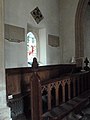
 Inside Combe Hay Church (A) - geograph.org.uk - 3661787.jpg 640 × 480; 69 KB
-
 Inside Combe Hay Church (B) - geograph.org.uk - 3662091.jpg 480 × 640; 54 KB
-
 Junction of Old Fosse Road and A367 - geograph.org.uk - 5533118.jpg 640 × 462; 58 KB
-
 Junction on The Fosseway - geograph.org.uk - 1936249.jpg 2,592 × 1,944; 1.51 MB
-
 Junction, Combe Hay - geograph.org.uk - 4847450.jpg 2,828 × 1,943; 1.51 MB
-
 Lane near Combe Hay - geograph.org.uk - 4899616.jpg 1,920 × 1,348; 835 KB
-
 Lane to Combe Hay - geograph.org.uk - 4899632.jpg 1,920 × 1,280; 784 KB
-
 Lane to Combe Hay - geograph.org.uk - 4899649.jpg 1,920 × 1,280; 760 KB
-
 Lane to Dunkerton - geograph.org.uk - 4899637.jpg 1,920 × 1,280; 599 KB
-
 Lane to Dunkerton - geograph.org.uk - 4899667.jpg 1,920 × 2,733; 2.24 MB
-
 Limestone Link - geograph.org.uk - 6544682.jpg 1,200 × 800; 1.25 MB
-
 Limestone Link footpath - geograph.org.uk - 359493.jpg 480 × 640; 107 KB
-

-
 Little used phone box in Combe Hay - geograph.org.uk - 3659266.jpg 640 × 480; 78 KB
-
 Meadow by Cam Brook - geograph.org.uk - 4899538.jpg 1,920 × 1,280; 688 KB
-
 Minor Road - geograph.org.uk - 6544659.jpg 1,200 × 802; 1.2 MB
-
 Oak above lane, Combe Hay - geograph.org.uk - 4847408.jpg 1,887 × 2,635; 1.67 MB
-
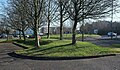 Odd Down roundabout - geograph.org.uk - 4836611.jpg 1,920 × 1,115; 1.04 MB
-
 Odd Down roundabout - geograph.org.uk - 4836627.jpg 1,920 × 1,165; 430 KB
-
 Old Lane to Combe Hay - geograph.org.uk - 1804741.jpg 2,592 × 1,944; 1.75 MB
-
 One stone on top of another - geograph.org.uk - 5654947.jpg 2,304 × 1,704; 1.48 MB
-
 Open access day at the SCC (a) - geograph.org.uk - 3659340.jpg 480 × 640; 116 KB
-
 Open access day at the SCC (b) - geograph.org.uk - 3659351.jpg 640 × 480; 98 KB
-
 Open access day at the SCC (c) - geograph.org.uk - 3659353.jpg 640 × 480; 102 KB
-
 Open access day at the SCC (d) - geograph.org.uk - 3659355.jpg 640 × 480; 126 KB
-
 Open access day at the SCC (e) - geograph.org.uk - 3659361.jpg 640 × 480; 136 KB
-
 Open access day at the SCC (f) - geograph.org.uk - 3659366.jpg 480 × 640; 113 KB
-
 Open access day at the SCC (g) - geograph.org.uk - 3659368.jpg 480 × 640; 101 KB
-
 Open access day at the SCC (h) - geograph.org.uk - 3659372.jpg 640 × 480; 138 KB
-
 Open access day at the SCC (i) - geograph.org.uk - 3659374.jpg 640 × 480; 129 KB
-
 Open access day at the SCC (j) - geograph.org.uk - 3659375.jpg 640 × 480; 96 KB
-
 Path into wood below Combe Hay Lane - geograph.org.uk - 4848256.jpg 1,920 × 1,280; 1.3 MB
-
 Path to the Fosse Way - geograph.org.uk - 4829757.jpg 1,920 × 1,189; 880 KB
-
 Periods of time - geograph.org.uk - 5339751.jpg 1,908 × 2,106; 1.56 MB
-
 Public Footpath-Byway junction - geograph.org.uk - 1813734.jpg 2,592 × 1,944; 1.69 MB
-
 Roundabout at Odd Down park and ride - geograph.org.uk - 5533114.jpg 640 × 377; 60 KB
-
 Rush hour in Combe Hay - geograph.org.uk - 3659271.jpg 640 × 480; 103 KB
-
 Somerset Coal Canal - geograph.org.uk - 3273656.jpg 1,024 × 683; 256 KB
-
 Southstoke, footpath by old canal - geograph.org.uk - 283305.jpg 640 × 427; 323 KB
-

-
-
 Stile on the path down towards the old railway line - geograph.org.uk - 1813745.jpg 2,592 × 1,944; 1.65 MB
-
 Stream Crossing - geograph.org.uk - 1813777.jpg 2,592 × 1,944; 1.76 MB
-
 The Bull's Nose - geograph.org.uk - 3913611.jpg 4,000 × 3,000; 4.97 MB
-
 The Cam Brook - geograph.org.uk - 359496.jpg 480 × 640; 147 KB
-
 The lane to Fortnight Farm above Combe Hay - geograph.org.uk - 1813720.jpg 2,592 × 1,944; 1.76 MB
-
 The Lodge - geograph.org.uk - 6544678.jpg 1,200 × 812; 1.18 MB
-
 The Lodge, Combe Hay (geograph 4899568).jpg 1,920 × 1,280; 742 KB
-
 The Wheatsheaf - geograph.org.uk - 6176724.jpg 1,024 × 771; 95 KB
-
 Towards the Cam Brook - geograph.org.uk - 4847434.jpg 2,649 × 1,487; 1 MB
-
 Track junction near Combe Hay Lane - geograph.org.uk - 4837736.jpg 1,920 × 1,280; 879 KB
-
 Track near Fosseway Environment Park - geograph.org.uk - 4848513.jpg 1,920 × 1,280; 1.08 MB
-
 Track to Combe Hay Lane - geograph.org.uk - 4837709.jpg 1,920 × 1,280; 1.18 MB
-
 Tracks from Combe Hay Lane - geograph.org.uk - 4836797.jpg 1,920 × 1,280; 1.08 MB
-
 Trees above Combe Hay Lane - geograph.org.uk - 4848435.jpg 1,920 × 2,880; 1.77 MB
-
 Week cottage - geograph.org.uk - 803717.jpg 640 × 497; 123 KB
-
 Week Farm - geograph.org.uk - 798174.jpg 640 × 466; 126 KB
-
 Where the Wansdyke and the Fosse Way meet - geograph.org.uk - 5655340.jpg 2,304 × 1,704; 2.27 MB
-
 Woodland near Fosseway Environment Park - geograph.org.uk - 4848524.jpg 1,920 × 1,280; 1.08 MB
-
 Combe Hay Bridge - geograph.org.uk - 359487.jpg 640 × 480; 118 KB
-
 Farmland off Combe Hay Lane - geograph.org.uk - 358378.jpg 640 × 480; 68 KB
-
 Farmland off Combe Hay Lane - geograph.org.uk - 358395.jpg 640 × 480; 81 KB
-
 Footpath off Combe Hay Lane - geograph.org.uk - 358364.jpg 480 × 640; 134 KB
-
 Pink cottage off Combe Hay Lane - geograph.org.uk - 358432.jpg 640 × 480; 80 KB


.jpg)
.jpg)
.jpg)


_-_geograph.org.uk_-_3661790.jpg)
_-_geograph.org.uk_-_3662076.jpg)
_-_geograph.org.uk_-_3662077.jpg)
_-_geograph.org.uk_-_3662078.jpg)
_-_geograph.org.uk_-_3662079.jpg)
_-_geograph.org.uk_-_3662080.jpg)
_-_geograph.org.uk_-_3662083.jpg)
_-_geograph.org.uk_-_3662066.jpg)
_-_geograph.org.uk_-_3662067.jpg)
_-_geograph.org.uk_-_3662068.jpg)
_-_geograph.org.uk_-_3662069.jpg)
_-_geograph.org.uk_-_3662071.jpg)
_-_geograph.org.uk_-_3662072.jpg)
_-_geograph.org.uk_-_3662073.jpg)
_-_geograph.org.uk_-_3662074.jpg)


_-_geograph.org.uk_-_3661779.jpg)
_-_geograph.org.uk_-_3662084.jpg)
_-_geograph.org.uk_-_3662087.jpg)
_-_geograph.org.uk_-_3662088.jpg)

_-_geograph.org.uk_-_3661771.jpg)
_-_geograph.org.uk_-_3662092.jpg)
_-_geograph.org.uk_-_3662093.jpg)


_-_geograph.org.uk_-_3660778.jpg)
_-_geograph.org.uk_-_3660780.jpg)
_-_geograph.org.uk_-_3660782.jpg)
_-_geograph.org.uk_-_3660784.jpg)
_-_geograph.org.uk_-_3660787.jpg)
_-_geograph.org.uk_-_3660788.jpg)
_-_geograph.org.uk_-_3660790.jpg)
_-_geograph.org.uk_-_3660791.jpg)
_-_geograph.org.uk_-_3660794.jpg)
_-_geograph.org.uk_-_3660797.jpg)
_-_geograph.org.uk_-_3661308.jpg)
_-_geograph.org.uk_-_3661309.jpg)
_-_geograph.org.uk_-_3661311.jpg)
_-_geograph.org.uk_-_3661312.jpg)
_-_geograph.org.uk_-_3661315.jpg)
_-_geograph.org.uk_-_3661316.jpg)
_-_geograph.org.uk_-_3661319.jpg)
_-_geograph.org.uk_-_3661321.jpg)
_-_geograph.org.uk_-_3661327.jpg)
_-_geograph.org.uk_-_3661329.jpg)
_-_geograph.org.uk_-_3661333.jpg)
_-_geograph.org.uk_-_3661337.jpg)
_-_geograph.org.uk_-_3661344.jpg)
_-_geograph.org.uk_-_3661354.jpg)
_-_geograph.org.uk_-_3661358.jpg)
_-_geograph.org.uk_-_3661360.jpg)
_-_geograph.org.uk_-_3661364.jpg)
_-_geograph.org.uk_-_3661365.jpg)
_-_geograph.org.uk_-_3661372.jpg)
_-_geograph.org.uk_-_3661376.jpg)
_-_geograph.org.uk_-_3661390.jpg)
_-_geograph.org.uk_-_3661391.jpg)
_-_geograph.org.uk_-_3661407.jpg)


_-_geograph.org.uk_-_3661787.jpg)
_-_geograph.org.uk_-_3662091.jpg)


_-_geograph.org.uk_-_3659340.jpg)
_-_geograph.org.uk_-_3659351.jpg)
_-_geograph.org.uk_-_3659353.jpg)
_-_geograph.org.uk_-_3659355.jpg)
_-_geograph.org.uk_-_3659361.jpg)
_-_geograph.org.uk_-_3659366.jpg)
_-_geograph.org.uk_-_3659368.jpg)
_-_geograph.org.uk_-_3659372.jpg)
_-_geograph.org.uk_-_3659374.jpg)
_-_geograph.org.uk_-_3659375.jpg)


.jpg)


