Category:Commons map adapted by Ulamm
Media in category "Commons map adapted by Ulamm"
The following 175 files are in this category, out of 175 total.
-
 001 Kievan Rus' Kyivan Rus' Ukraine map 1220 1240.jpg 2,301 × 2,856; 4.69 MB
-
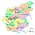
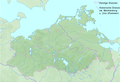
 2018-P02-Friesland.png 2,914 × 2,384; 3.58 MB
-
 2018-P08-Zuid-Holland b2.png 2,660 × 2,195; 4.68 MB
-
 2022 France - régions et départements, noms.png 1,842 × 1,696; 619 KB
-
 ACsEV rot.png 1,567 × 911; 3.62 MB
-
 Africa Ortelius Nil Zambesi Zaire.png 1,672 × 2,334; 9.62 MB
-
 ALBA-Mitgliedsstaaten7.png 627 × 807; 14 KB
-
 Altamira Para vs Maranhao.png 1,344 × 1,184; 29 KB
-
 Altmark Jerichow topo.png 2,608 × 1,626; 3.59 MB
-
 ALTMUEHL.gif 831 × 886; 321 KB
-
 Arktik-Grønland.png 329 × 330; 15 KB
-
 Baltic Marine subdivisions.gif 561 × 547; 33 KB
-
 Baltische Stämme um 1200.png 1,980 × 2,180; 473 KB
-
 Bassin Seine.png 3,500 × 3,007; 6.72 MB
-
 Bavaria relief location map.png 1,695 × 1,672; 4.45 MB
-
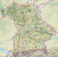 Bayern Relief Grenzen Namen.png 1,695 × 1,672; 4.57 MB
-
 Belgien Backsteingotik mit Ortsnamen 2.png 1,856 × 1,400; 165 KB
-
 Belgien plan ohne Südosten.png 877 × 641; 74 KB
-
 Belgien Relief ohne Südosten.png 2,158 × 1,599; 4.99 MB
-
 Bergen boroughs.png 796 × 963; 15 KB
-
 Bielefeld1908,1930-61,1974.png 926 × 1,190; 1.92 MB
-
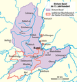 Bistum Basel im 15. Jahrhundert0105a.png 780 × 833; 102 KB
-
 Blaeu 1645 - Pomeraniæ Ducatus tabula.png 2,913 × 2,261; 16.08 MB
-
 Bodensee satellit+text.png 1,394 × 864; 2.79 MB
-
 Bourbonnais 12. Jh.png 557 × 494; 141 KB
-
 Brandenburg-Preussen-1701-1806 ohne Westen.png 1,020 × 831; 80 KB
-
 Bremen Groningen blank.png 843 × 559; 105 KB
-
 Bremen Groningen Friesen.png 843 × 559; 205 KB
-
 BSAG-Bahnen2013+H.png 1,799 × 1,353; 102 KB
-
 Burgund 12. Jh.png 1,792 × 1,471; 1,006 KB
-
 Camargue, Petite Camargue et Parc naturel reg.png 1,436 × 792; 63 KB
-
 Canny-sur-Matz, église Saint-Michel.png 3,270 × 2,598; 1.05 MB
-
 Ceremonial Counties of England.png 459 × 560; 159 KB
-
 CH Kantone.png 2,560 × 1,642; 550 KB
-
 Champagne, Île-de-France, Picardie, Artois, Flandre 1789 et 2022.png 800 × 800; 370 KB
-
 Chevincourt position de l'église.png 3,270 × 2,598; 1.46 MB
-
 DanewerkDetailmap.jpg 383 × 384; 178 KB
-
 Delisle Asie3b.png 874 × 890; 204 KB
-
 Deutscher Orden 1260+Farb.png 1,200 × 1,043; 436 KB
-
 Deutscher Orden 1410+Farb.png 1,200 × 1,043; 370 KB
-
 Deutscher Orden 1466+Farb.png 1,200 × 1,043; 321 KB
-
 DK for localizations+placenames.png 1,650 × 1,650; 155 KB
-
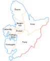
 DK Hovedstaden kommuner.png 606 × 666; 283 KB
-
 DK Midtjyllands kommuner.png 1,870 × 1,368; 135 KB
-
 DK Nordjyllands kommuner.png 1,600 × 1,332; 85 KB
-
 DK Sjælland kommuner.png 1,170 × 1,458; 86 KB
-
 DK survey.png 1,650 × 1,650; 178 KB
-
 DK Syddanmarks kommuner.png 1,591 × 1,255; 125 KB
-
 Donau Einzugsgebiet.png 2,130 × 1,137; 4.04 MB
-
 East Midlands counties 00.png 1,723 × 2,047; 295 KB
-
 East of England Counties.png 1,593 × 1,440; 1.06 MB
-
 England 2012 white.png 1,109 × 1,347; 144 KB
-
 England counties 1851 grey.png 1,459 × 1,769; 86 KB
-
 España relieve M.png 2,356 × 2,778; 10.26 MB
-
 EST + LAT 55.5–59.8, 20.5–28.4 blank.png 2,837 × 2,982; 721 KB
-
 EST + LAT 55.5–59.8, 20.5–28.4 relief.png 2,837 × 2,982; 10.84 MB
-
 Euskara percent.png 570 × 443; 33 KB
-
 Finland 59,5–64N 18,83–30E.png 849 × 692; 592 KB
-
 Finland ≤ 62°N 30°E.png 847 × 384; 339 KB
-
 Flusssystemkarte Mosel(Rhein 03Wwasser).png 763 × 1,188; 2.2 MB
-
 France brique gothique1.png 1,842 × 1,696; 484 KB
-
 Frankish Empire 481 to 814-fr.png 2,087 × 1,476; 559 KB
-
 Frankreich 12. Jh (ohne Süd).png 2,607 × 2,640; 2.41 MB
-
 Gelderland gemeenten.png 2,360 × 1,642; 709 KB
-
 Germany Laender 1947 1990 DDR.png 444 × 612; 16 KB
-
 Groningen gemeenten 2018.png 1,336 × 1,528; 98 KB
-
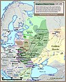
 Großfürstentum Litauen 13.–15. Jh.png 1,379 × 1,533; 517 KB
-
 Gryfino p-gm.png 1,204 × 1,664; 112 KB
-
 HR+HU+SK relief.png 957 × 778; 1.25 MB
-
 Iceland position144.png 1,011 × 856; 55 KB
-
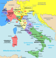 Italien 1843–1870.png 924 × 953; 215 KB
-
 Italien Regionen Metropolitanstädte.png 1,830 × 2,177; 135 KB
-
 Italien Relief.png 2,949 × 3,743; 8.66 MB
-
 Italien, Verwaltungseinheiten mit gotischer Backsteinarchitektur.png 1,830 × 2,177; 159 KB
-
 Jan Reiners Strecke.png 2,048 × 1,663; 24 KB
-
 KaartLesse.jpg 692 × 500; 537 KB
-
 Karte Bodensee V3.png 2,066 × 1,328; 256 KB
-
 Karte Mark Brandenburg 1320b.png 1,200 × 962; 415 KB
-
 Kingdom of Galicia Volhynia Rus' Ukraine 1245 1349.jpg 2,301 × 2,856; 5.18 MB
-
 Krondomäne 12. Jh.png 1,054 × 1,017; 481 KB
-
 Kyivan Rus' 1220-1240.png 2,301 × 2,856; 6.1 MB
-
 Körös basin.png 400 × 300; 169 KB
-
 La France en 1180 (section).png 3,449 × 3,376; 6.88 MB
-
 Lage altmyhl.png 1,066 × 788; 169 KB
-
 Ligne Dorsale+Tournai.png 535 × 413; 16 KB
-
 Lit + Bela relief.png 3,417 × 2,597; 16.23 MB
-
 Lithuania rel 2002.png 995 × 1,085; 2.1 MB
-
 Lyon StÉtienne Andrézieux Roanne1849.png 768 × 612; 1,018 KB
-
 Malopolska Krakowskie sandomierskie lubelskie1.png 1,932 × 1,755; 279 KB
-
 Map-Hispano.png 1,427 × 628; 42 KB
-
 Mappa dello Stato dei Cavalieri Teutonici 1410.jpg 1,654 × 1,449; 1.65 MB
-
 Mazowsze w.png 3,130 × 3,071; 976 KB
-
 Mecklenburg-Vorpommern Relief Kreise Namen Grenze.png 1,744 × 1,197; 1.67 MB
-
 Mecklenburg-Vorpommern relief location map.png 1,744 × 1,197; 1.62 MB
-
 Moray Firth topo.png 926 × 919; 939 KB
-
 Mudéjar architecture in Spain & Portugal.png 1,195 × 1,024; 193 KB
-
 Municipalities of Lithuania.png 623 × 503; 24 KB
-
 Mureș basin.png 600 × 300; 301 KB
-
 Møre og Romsdal kart1.png 1,098 × 802; 37 KB
-
 Møre og Romsdal vest.png 697 × 710; 26 KB
-
 NDS Kreise + Backsteingotik.png 1,686 × 1,423; 329 KB
-
 NDS Kreise.png 1,686 × 1,423; 325 KB
-
 Neuenhagenerinsel2.gif 1,182 × 872; 110 KB
-
 Niedersachsen Relief Friesen.png 1,786 × 1,509; 3.29 MB
-
 Niedersachsen um 1400.jpg 1,948 × 1,644; 487 KB
-
 Niedersachsen um 1400.png 1,948 × 1,644; 3.38 MB
-
 NL Provinzen, Backsteingotik.png 801 × 949; 375 KB
-
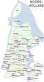 Noord-Holland gemeenten 2017.png 1,174 × 2,186; 178 KB
-
 Nordfjord.png 930 × 513; 42 KB
-
 Noreg-Grønland.png 2,106 × 1,784; 189 KB
-
 Noreg16-3.png 837 × 1,323; 25 KB
-
 North East England counties 2.2.png 842 × 1,100; 70 KB
-
 North West England counties.png 1,341 × 2,685; 306 KB
-
 NorthSeaCurrents.png 1,300 × 1,700; 3.43 MB
-
 NRW cut 5.834–7.678°E, 50.453–52.515°N.png 529 × 792; 301 KB
-
 NRW cut 5.834–7.9546°E, 50.551–52.277°N2.png 598 × 792; 309 KB
-
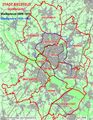
 NRW Regierungsbezirke Kreise.png 4,122 × 4,084; 9.88 MB
-
 NRW relief cut 5.834–7.6046°E, 50.551–52.277°N.png 504 × 792; 281 KB
-
 NRW relief cut 5.834–8.718°E, 50.453–52.515°N.png 808 × 948; 634 KB
-
 Oblast Leningrad relief.png 1,000 × 717; 1.08 MB
-

-
 Ostpreussen Preussen1922-1939.png 700 × 594; 22 KB
-
 Ostseegliederung.png 871 × 1,039; 80 KB
-
 Polen - historische Regionen.png 2,430 × 2,596; 891 KB
-
 Polen - historisches Kujawien, heutige Verwaltungsgrenzen.png 1,551 × 1,432; 1.29 MB
-
 Pontigny1180.png 2,664 × 2,456; 4.11 MB
-
 Positionskarte EE + LV 1260.png 794 × 861; 120 KB
-
 Preussen1410.png 502 × 430; 20 KB
-
 PRVSSIA1576Casparo Henneberg.png 2,973 × 2,289; 4.5 MB
-
 Regione Abruzzo mappa2.png 800 × 738; 222 KB
-
 Regions of England - labelled.png 1,230 × 1,484; 387 KB
-
 Reliefkarte Friaul-Julisch Venetien 2020.png 1,913 × 2,014; 4.93 MB
-
 Reliefkarte Ukraine West.png 1,569 × 1,624; 4.31 MB
-
 Rhein-Karte2.png 1,588 × 2,228; 133 KB
-
 Rheinsystem small DE Main.png 2,133 × 2,885; 9.82 MB
-
 River Forth course.png 1,231 × 436; 12 KB
-
 S+M-Schweden.png 611 × 756; 172 KB
-
 Saarland Kreise Namen.png 1,798 × 1,472; 647 KB
-
 Sachsen Kreis- u Amts-Einteilung 1900–1932.gif 1,706 × 996; 658 KB
-
 Sachsen-Anhalt 1665x2047 Kreise.png 1,665 × 2,047; 4.19 MB
-
 Sachsen-Anhalt 1665x2047.png 1,665 × 2,047; 4.27 MB
-
 Saxony-Anhalt location map.png 1,956 × 2,305; 679 KB
-
 Saxony-Anhalt relief location map.png 1,272 × 1,499; 2.75 MB
-
 Schleswig-Holstein relief loc.png 882 × 775; 1,000 KB
-
 Schlewig-Holstein Kreisgrenzen.png 1,059 × 927; 144 KB
-
 Schweden S(72to74)+M(72to68).png 611 × 970; 201 KB
-
 Schweden S+M, h(M)=72to68.png 611 × 938; 209 KB
-
 Scotland (0 Shetland) council areas.png 2,305 × 2,799; 721 KB
-
 Scotland (core) council areas.png 1,420 × 1,153; 265 KB
-
 SevenSisterStates.png 600 × 558; 171 KB
-
 Someș basin.png 400 × 300; 239 KB
-
 South East England counties.png 2,554 × 2,000; 428 KB
-
 South West England counties.png 1,281 × 936; 258 KB
-
 Spanien-Gliederung.png 1,400 × 1,180; 93 KB
-
 Strasbourg Communauté.jpg 848 × 1,156; 135 KB
-
 Straßenbahn-Netzplan Alexandria 1996.png 2,836 × 1,871; 476 KB
-
 SW England +county names.png 1,912 × 1,496; 508 KB
-
 Sweden län få sjöar S+M.png 611 × 951; 208 KB
-
 Sweden S(72to74)+M(72to65).png 611 × 947; 206 KB
-
 Sweden S(72to77)+M(72to65).png 611 × 977; 212 KB
-
 Tisza Karte.png 838 × 821; 1.2 MB
-
 Toledo-catedral-de.png 794 × 841; 484 KB
-
 Topografischer Hintergrund HU + SK.png 728 × 681; 768 KB
-
 Tornealven.jpg 600 × 572; 419 KB
-
 Tornealven.png 600 × 572; 493 KB
-
 Trk72 Köln Porte Weyer.png 2,398 × 1,584; 8.37 MB
-
 Viroin loc.png 692 × 500; 135 KB
-
 Wales counties.png 1,252 × 1,498; 325 KB
-
 Warszawa-Centralna & al2.png 1,409 × 1,024; 54 KB
-
 Weser Einzugsgebiet+Nr.png 791 × 886; 189 KB
-
 West Midlands counties.png 1,160 × 1,306; 166 KB
-
 Western schism 1378–1417 de.png 2,000 × 1,540; 859 KB
-
 Westphaliae Circulus 17. Jh. Misselwarden + Milsum.png 768 × 558; 851 KB
-
 Zimbabwe monomotapa.gif 642 × 706; 47 KB
-
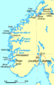
 Åland2topo.png 861 × 494; 148 KB


.png)


.png)


.png)


%2BM(72to68).png)
%3D72to68.png)
_council_areas.png)
_council_areas.png)


%2BM(72to65).png)
%2BM(72to65).png)


