Category:Conisbrough Parks
English: Conisbrough Parks is a civil parish in the Doncaster district, in the county of South Yorkshire, England.
village in United Kingdom | |||||
| Upload media | |||||
| Instance of | |||||
|---|---|---|---|---|---|
| Location | Doncaster, South Yorkshire, Yorkshire and the Humber, England | ||||
 | |||||
Subcategories
This category has the following 2 subcategories, out of 2 total.
C
- Clifton, Doncaster (3 F)
- Conisbrough Viaduct (20 F)
Media in category "Conisbrough Parks"
The following 137 files are in this category, out of 137 total.
-
 A house on Common Lane, Clifton - geograph.org.uk - 4043342.jpg 2,590 × 1,850; 1.95 MB
-
 A630 heading towards Warmsworth - geograph.org.uk - 6124829.jpg 1,024 × 769; 97 KB
-
 A630 Sheffield Road - geograph.org.uk - 6124828.jpg 1,024 × 768; 111 KB
-
 A630 towards Doncaster - geograph.org.uk - 2583276.jpg 1,600 × 1,200; 365 KB
-
 Around the bends on the trail to Conisbrough - geograph.org.uk - 4179812.jpg 1,024 × 768; 287 KB
-
 At Conisbrough Lodge - geograph.org.uk - 4043391.jpg 1,944 × 2,592; 2.45 MB
-
 At Crookhill Park golf course - geograph.org.uk - 5542495.jpg 4,911 × 3,601; 4.42 MB
-
 At Five Lane Ends, Old Edlington - geograph.org.uk - 5542479.jpg 4,899 × 3,631; 5.54 MB
-
 At the viewpoint in Micklebring - geograph.org.uk - 4043094.jpg 2,452 × 1,839; 1.36 MB
-
 Autumn landscape - geograph.org.uk - 2193790.jpg 3,264 × 2,448; 661 KB
-
 B6094 crossing M18 - geograph.org.uk - 5894469.jpg 1,024 × 668; 126 KB
-
 Beacon Hill, Clifton - geograph.org.uk - 1630529.jpg 640 × 480; 93 KB
-
 Beacon Lane corner view - near Clifton - geograph.org.uk - 4043186.jpg 2,558 × 1,827; 2.36 MB
-
 Bridge over the M18 - geograph.org.uk - 2040628.jpg 640 × 480; 44 KB
-
 Bridleway and Conisbrough Lodge Farm - geograph.org.uk - 4867532.jpg 1,024 × 768; 338 KB
-
 Bridleway and Conisbrough Lodge Farm - geograph.org.uk - 4867559.jpg 1,024 × 768; 221 KB
-
 Bridleway through Conisbrough Lodge Farm - geograph.org.uk - 4867543.jpg 1,024 × 768; 183 KB
-
 Bridleway to Park Lane - geograph.org.uk - 4867573.jpg 1,024 × 768; 165 KB
-
 Bridleway to Park Lane - geograph.org.uk - 4867766.jpg 1,024 × 768; 227 KB
-
 Buildings at the Crookhill Park golf club - geograph.org.uk - 4400799.jpg 1,600 × 1,200; 933 KB
-
 Bungalow at the end of Spring Bank Road - geograph.org.uk - 4867702.jpg 1,024 × 768; 153 KB
-
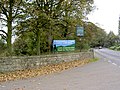
 Carr Lane (B6094) - geograph.org.uk - 2583170.jpg 1,600 × 1,200; 570 KB
-
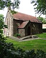
 Clifton Church - geograph.org.uk - 2583128.jpg 1,600 × 1,200; 401 KB
-
 Clifton church. - geograph.org.uk - 2371113.jpg 640 × 480; 88 KB
-
 Clifton Mission Church, Clifton - geograph.org.uk - 4043330.jpg 1,942 × 2,428; 1.91 MB
-
 Clifton Village Church - geograph.org.uk - 4400791.jpg 1,600 × 1,200; 649 KB
-
 Common Lane at Whiteford - geograph.org.uk - 5191876.jpg 4,608 × 3,456; 3.73 MB
-
 Common Lane in Clifton - geograph.org.uk - 5191898.jpg 4,608 × 3,456; 3.59 MB
-
 Common Lane towards Conisbrough - geograph.org.uk - 2583162.jpg 1,600 × 1,200; 544 KB
-
 Common Lane, Clifton - geograph.org.uk - 2583146.jpg 1,600 × 1,200; 592 KB
-
 Common Lane, Clifton - geograph.org.uk - 4043339.jpg 1,834 × 2,445; 2.08 MB
-
 Conisbrough Grange Farm - geograph.org.uk - 5419000.jpg 3,264 × 2,448; 2.85 MB
-
 Conisbrough Lodge Farm - geograph.org.uk - 4867546.jpg 1,024 × 768; 201 KB
-
 Conisbrough Lodge Farm - geograph.org.uk - 4867565.jpg 1,024 × 768; 243 KB
-
 Conisbrough Lodge Farm - geograph.org.uk - 4867568.jpg 1,024 × 768; 161 KB
-
 Conisbrough Lodge Farm - geograph.org.uk - 5002016.jpg 4,608 × 3,456; 3.34 MB
-
 Conisbrough Viaduct - geograph.org.uk - 5839050.jpg 1,024 × 683; 167 KB
-
 Crookhill Park Golf Course - geograph.org.uk - 447742.jpg 640 × 480; 101 KB
-
 Cyclist on Common Lane north of Clifton - geograph.org.uk - 4043359.jpg 2,592 × 1,944; 2.48 MB
-

-
 Derelict buildings at Conisbrough Lodge - geograph.org.uk - 3754278.jpg 1,600 × 1,200; 511 KB
-
 Derelict buildings at Conisbrough Lodge - geograph.org.uk - 3754279.jpg 1,600 × 1,200; 749 KB
-
 Derelict Site near Doncaster Road Bridge - geograph.org.uk - 5424592.jpg 3,264 × 2,448; 2.99 MB
-
 Dismantled railway - geograph.org.uk - 2583274.jpg 1,600 × 1,200; 613 KB
-
 Disused diesel tank - geograph.org.uk - 4867541.jpg 1,024 × 768; 161 KB
-
 Empty dutch barn - geograph.org.uk - 4867556.jpg 1,024 × 768; 147 KB
-
 Entrance to Crookhill Park golf course - geograph.org.uk - 595966.jpg 640 × 480; 145 KB
-
 Entrance to Hilltop Farm - geograph.org.uk - 4867655.jpg 1,024 × 768; 155 KB
-
 Farm advertising - Clifton Hill near Conisbrough - geograph.org.uk - 4043367.jpg 2,552 × 1,823; 1.77 MB
-
 Farm buildings, Conisbrough Lodge - geograph.org.uk - 2583203.jpg 1,600 × 1,200; 500 KB
-
 Farm Track and Public Footpath - geograph.org.uk - 5191958.jpg 4,608 × 3,456; 4.21 MB
-
 Farmhouse ruin at Conisbrough Parks Farm - geograph.org.uk - 4043352.jpg 2,493 × 1,781; 1.58 MB
-
 Farmland and Woodland seen from Common Lane - geograph.org.uk - 5191863.jpg 4,608 × 3,456; 3.79 MB
-
 Farmland at Conisbrough Parks - geograph.org.uk - 5002007.jpg 4,608 × 3,456; 3.99 MB
-
 Farmland off Carr Lane - geograph.org.uk - 2583166.jpg 1,600 × 1,200; 470 KB
-
 Farmland off Firsby Lane - geograph.org.uk - 2583218.jpg 1,600 × 1,200; 451 KB
-
 Farmland off Park Lane - geograph.org.uk - 2583195.jpg 1,600 × 1,200; 478 KB
-
 Farmland off Ruddle Lane - geograph.org.uk - 2573699.jpg 1,600 × 1,200; 555 KB
-
 Farmland off the A630 - geograph.org.uk - 2425579.jpg 1,600 × 1,200; 469 KB
-
 Farmland seen from Drake Head Lane - geograph.org.uk - 5426113.jpg 3,264 × 2,448; 2.88 MB
-
 Farmland, Clifton Common - geograph.org.uk - 2583159.jpg 1,600 × 1,200; 385 KB
-

-
 Field at Butterbusk Green - geograph.org.uk - 2747488.jpg 640 × 480; 73 KB
-
 Field edge near Firsby Hall Farm - geograph.org.uk - 4867592.jpg 1,024 × 768; 203 KB
-
 Firsby Hall Farm - geograph.org.uk - 5912429.jpg 1,600 × 1,064; 663 KB
-
 Firsby Lane - geograph.org.uk - 4867650.jpg 1,024 × 768; 328 KB
-
 Firsby Lane heading south - geograph.org.uk - 2583223.jpg 1,600 × 1,200; 403 KB
-
 Five lane ends. - geograph.org.uk - 2371120.jpg 480 × 640; 76 KB
-
 Footpath and Crop Field near Micklebring - geograph.org.uk - 5002023.jpg 4,608 × 3,456; 4.28 MB
-
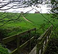
 Footpath from Arbour Lane to Park Lane - geograph.org.uk - 3220567.jpg 640 × 480; 115 KB
-

-
 Gantry north of power lines - geograph.org.uk - 4572892.jpg 640 × 308; 94 KB
-
 Gate to bridleway near Birk Lodge - geograph.org.uk - 806597.jpg 500 × 375; 75 KB
-
 Gorse by the bridleway - geograph.org.uk - 4867763.jpg 1,024 × 768; 292 KB
-
 Hilltop Farm - geograph.org.uk - 4867654.jpg 1,024 × 768; 155 KB
-
 Large house in Clifton - geograph.org.uk - 4043190.jpg 2,358 × 1,685; 1.16 MB
-
-
 Lidgets hill lane. - geograph.org.uk - 2371102.jpg 480 × 640; 61 KB
-
 Lidgets hill lane. - geograph.org.uk - 2371109.jpg 480 × 640; 68 KB
-
 Log cabin under construction at Clifton - geograph.org.uk - 4400790.jpg 1,600 × 1,200; 477 KB
-
 Long Leys Lane approaching Braithwell - geograph.org.uk - 4875799.jpg 1,024 × 682; 167 KB
-
 Long Leys Lane bridge over M18 - geograph.org.uk - 4875806.jpg 1,024 × 682; 190 KB
-
 Looking North on Park Lane - geograph.org.uk - 1072032.jpg 640 × 480; 103 KB
-
 Lots of galvanised steel here - geograph.org.uk - 797130.jpg 480 × 640; 87 KB
-
 M18 north of Micklebring - geograph.org.uk - 6125687.jpg 1,024 × 768; 78 KB
-
 M18 on bend near Micklebring - geograph.org.uk - 4572899.jpg 640 × 328; 95 KB
-
 M18 underpass north of Micklebring - geograph.org.uk - 4043180.jpg 1,727 × 2,417; 1.79 MB
-
 Manor Farm - geograph.org.uk - 4400787.jpg 1,600 × 1,200; 556 KB
-
 Manor Farm north of Clifton Common - geograph.org.uk - 4043362.jpg 2,592 × 1,944; 1.59 MB
-
 Me and my shadow (and the mud^) - geograph.org.uk - 1072029.jpg 476 × 640; 54 KB
-
 Micklebring gorse. - geograph.org.uk - 2917263.jpg 640 × 480; 60 KB
-
 Motorway underpass north of Micklebring - geograph.org.uk - 3754284.jpg 1,600 × 1,200; 741 KB
-
 Muddy bridleway to Firsby Hall - geograph.org.uk - 1341653.jpg 640 × 480; 97 KB
-
 Narrow boat on the navigable River Don - geograph.org.uk - 4179809.jpg 4,896 × 3,672; 852 KB
-
 Narrow boat on the River Don - geograph.org.uk - 3212653.jpg 2,048 × 1,536; 512 KB
-
 On the M18 - geograph.org.uk - 2040618.jpg 640 × 480; 42 KB
-
 Ordnance Survey Cut Mark - geograph.org.uk - 4963284.jpg 640 × 473; 77 KB
-
 Park Lane - geograph.org.uk - 4867760.jpg 1,024 × 768; 155 KB
-
 Park Lane heading south - geograph.org.uk - 2583206.jpg 1,600 × 1,200; 514 KB
-
 Park Lane towards Conisbrough - geograph.org.uk - 3754273.jpg 1,600 × 1,200; 720 KB
-
 Park Lane towards Conisbrough Lodge - geograph.org.uk - 2583196.jpg 1,600 × 1,200; 647 KB
-
 Park Lane towards Conisbrough Parks - geograph.org.uk - 3754275.jpg 1,600 × 1,200; 897 KB
-
 Parks farm cottages. - geograph.org.uk - 2917273.jpg 640 × 599; 127 KB
-
 Path to Conisbrough. - geograph.org.uk - 2917268.jpg 640 × 480; 65 KB
-
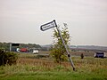
 Pole but no wires - geograph.org.uk - 4867574.jpg 1,024 × 768; 108 KB
-
 Private road - geograph.org.uk - 1072024.jpg 480 × 640; 106 KB
-
 Railway Bridge over River Don - geograph.org.uk - 2388212.jpg 3,264 × 2,448; 2.42 MB
-
 Ruddle Lane - geograph.org.uk - 2573696.jpg 1,600 × 1,200; 691 KB
-
 Ruddle Lane - geograph.org.uk - 2573701.jpg 1,600 × 1,200; 491 KB
-

-
 Shipman Balk - geograph.org.uk - 797148.jpg 640 × 480; 52 KB
-
 Stile and footbridge over the railway at Micklebring Gorse - geograph.org.uk - 3754281.jpg 1,600 × 1,200; 1.08 MB
-
 Stubble Field and Woodland near Manor Farm - geograph.org.uk - 5191852.jpg 4,608 × 3,456; 4.5 MB
-
 The beginning of a footpath to Conisbrough - geograph.org.uk - 4867753.jpg 1,024 × 768; 360 KB
-
 The M18 seen from Long Leys Lane bridge - geograph.org.uk - 5542488.jpg 5,184 × 3,888; 3.93 MB
-
 The navigable River Don - geograph.org.uk - 4179810.jpg 1,024 × 768; 214 KB
-
 The River Don - geograph.org.uk - 2690850.jpg 1,024 × 768; 307 KB
-
 The ruined farmhouse at Conisbrough Lodge - geograph.org.uk - 4043392.jpg 2,592 × 1,944; 1.96 MB
-
 The ruins of Conisbrough Lodge Farm - geograph.org.uk - 4043383.jpg 2,592 × 1,944; 2.41 MB
-
 The start of the trail to Conisbrough - geograph.org.uk - 4179811.jpg 1,024 × 768; 311 KB
-
 Towards Beacon Hill from the motorway underpass - geograph.org.uk - 3754283.jpg 1,600 × 1,200; 547 KB
-
 Track and Bridleway at Lidgets Hill - geograph.org.uk - 5191931.jpg 4,608 × 3,456; 3.9 MB
-
 Track junction at Lidgets Hill, north of Clifton - geograph.org.uk - 4400794.jpg 1,600 × 1,200; 637 KB
-
 Track to Conisbrough Grange Farm - geograph.org.uk - 4234336.jpg 5,184 × 3,888; 5.64 MB
-
 Track to Parks Farm Cottages - geograph.org.uk - 4867720.jpg 1,024 × 768; 146 KB
-
 View across Conisbrough Parks - geograph.org.uk - 4044974.jpg 2,592 × 1,944; 2.01 MB
-
 View across Conisbrough Parks - geograph.org.uk - 4867707.jpg 1,024 × 768; 141 KB
-
 View from the Outskirts of Clifton - geograph.org.uk - 5191919.jpg 4,608 × 3,456; 3.95 MB
-
 View to Parks Farm Cottages - geograph.org.uk - 4043380.jpg 2,592 × 1,944; 1.91 MB
-
 View towards Conisbrough - geograph.org.uk - 4867578.jpg 1,024 × 768; 155 KB
-
 View towards Conisbrough - geograph.org.uk - 4867740.jpg 1,024 × 768; 146 KB
-
 View towards Conisbrough Castle from Clifton - geograph.org.uk - 4043350.jpg 1,850 × 2,590; 1.99 MB
-
 View towards Conisbrough Grange Farm - geograph.org.uk - 4842733.jpg 1,024 × 768; 171 KB
-
 View towards Parks Farm Cottages - geograph.org.uk - 4867749.jpg 1,024 × 768; 145 KB
-
 Warmsworth - foot tunnel under railway - geograph.org.uk - 1845054.jpg 1,600 × 1,200; 681 KB
-
 Warmsworth - kissing gate at Farcliffe Quarry - geograph.org.uk - 1845050.jpg 1,200 × 1,600; 462 KB
-
 Wish I could get a signal here^ - geograph.org.uk - 797138.jpg 549 × 640; 99 KB


_-_geograph.org.uk_-_2583170.jpg)


.jpg)


_-_geograph.org.uk_-_1072029.jpg)


